| Home | City Bus | Maps | Villages | Cities | Rail | Tourist Places | School | College | Pin Codes | Corona Cases Count |
| Distance Calculator Bus Services IFSC Codes Trace Mobile Number Weather Search Place Trace IP Available Cash ATM/Banks Locate Polling Booth Report an Error contact People |
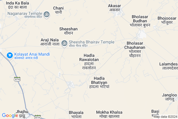
Hadla Rawalotan Map
EDIT Map
Add Your House
 ..
..
Current Corona Virus Infected Patients Count in Bikaner District
| City Name | District Name | Total Covid cases |
|---|---|---|
| Bikaner District | Bikaner | 37 |
Locality Name :
Hadla Rawalotan
( हड़ला रावलोतां )
Tehsil Name : Kolayat
District : Bikaner
State : Rajasthan
Division : Bikaner
Language : Rajasthani and Hindi
Current Time 07:44 PM
Date: Friday , Apr 25,2025 (IST)
Time zone: IST (UTC+5:30)
Elevation / Altitude: 217 meters. Above Seal level
Telephone Code / Std Code: 01533
Assembly constituency : Kolayat assembly constituency
Assembly MLA : Anshuman Singh Bhati
Lok Sabha constituency : Bikaner parliamentary constituency
Parliament MP : ARJUN RAM MEGHWAL
Serpanch Name :
Pin Code : 334302
Post Office Name : Sri Kolayat Ji
Main Village Name : Hadla Rawalotan
Commodities Prices : Bikaner (Grain) Market / Mandi
Hadla Rawalotan Live Weather
Temperature: 36.4 °C
overcast clouds
Humidity: 8%
Wind : 4.38 mt/sec towards SW
StationName : "Deshnoke"
observed on Now
Temperature: 36.4 °C
overcast clouds
Humidity: 8%
Wind : 4.38 mt/sec towards SW
StationName : "Deshnoke"
observed on Now
Hadla Rawalotan Weather Forecast for Next 5 days
26-04-2025
30.2°C to 34.7°C
overcast clouds, broken clouds
30.2°C to 34.7°C
overcast clouds, broken clouds
27-04-2025
28.1°C to 41.2°C
scattered clouds, broken clouds, few clouds, clear sky
28.1°C to 41.2°C
scattered clouds, broken clouds, few clouds, clear sky
28-04-2025
27.8°C to 42.9°C
clear sky
27.8°C to 42.9°C
clear sky
29-04-2025
29.1°C to 44.1°C
clear sky
29.1°C to 44.1°C
clear sky
30-04-2025
29.3°C to 44.4°C
clear sky
29.3°C to 44.4°C
clear sky
National Highways Reachable To Hadla Rawalotan
Nationa High Way :NH754K
Nationa High Way :NH754K
About Hadla Rawalotan
Correct below Info and add more info about Hadla RawalotanHadla Rawalotan is a small Village/hamlet in Kolayat Tehsil in Bikaner District of Rajasthan State, India. It comes under Hadla Rawalotan Panchayath. It belongs to Bikaner Division . It is located 38 KM towards west from District head quarters Bikaner. 17 KM from Kolayat. 338 KM from State capital Jaipur
Hadla Rawalotan Pin code is 334302 and postal head office is Sri Kolayat Ji .
Chani ( 7 KM ) , Lalamdesar ( 11 KM ) , Bajju ( 12 KM ) , Kolayat ( 13 KM ) , Barsingsar ( 15 KM ) are the nearby Villages to Hadla Rawalotan. Hadla Rawalotan is surrounded by Bikaner Tehsil towards East , Nokha Tehsil towards East , Sri Dungargarh Tehsil towards East , Bap Tehsil towards west .
Siana , Bikaner , Nokha , Nagaur are the near by Cities to Hadla Rawalotan.
Hadla Rawalotan 2011 Census Details
Hadla Rawalotan Local Language is Rajasthani. Hadla Rawalotan Village Total population is 755 and number of houses are 116. Female Population is 49.8%. Village literacy rate is 61.9% and the Female Literacy rate is 24.9%.
Population
| Census Parameter | Census Data |
| Total Population | 755 |
| Total No of Houses | 116 |
| Female Population % | 49.8 % ( 376) |
| Total Literacy rate % | 61.9 % ( 467) |
| Female Literacy rate | 24.9 % ( 188) |
| Scheduled Tribes Population % | 0.1 % ( 1) |
| Scheduled Caste Population % | 12.1 % ( 91) |
| Working Population % | 30.1 % |
| Child(0 -6) Population by 2011 | 151 |
| Girl Child(0 -6) Population % by 2011 | 51.7 % ( 78) |
Hadla Rawalotan Census More Deatils.
Politics in Hadla Rawalotan
RSNM , BJP , INC are the major political parties in this area.Polling Stations /Booths near Hadla Rawalotan
1)Gss Gogdiyawala2)Gsss Kesardesar Jatan
3)Gups Gulamwala
4)Gss Right Part Bhluri
5)Gss Left Part Bhluri
HOW TO REACH Hadla Rawalotan
By Rail
There is no railway station near to Hadla Rawalotan in less than 10 km.Colleges near Hadla Rawalotan
Pr College
Address :
M.d.digree College Bajju
Address :
Sanskar College Bajju
Address : Mistri Market Bajju
Schools near Hadla Rawalotan
Shree Narayan Pathshala
Address : girajsar , kolayat , bikaner , Rajasthan . PIN- 334303 , Post - Diyatra
Sharda V.m., School, Bajju
Address : bajju khalsa , kolayat , bikaner , Rajasthan . PIN- 334305 , Post - Bajju
Nav Jyoti Pub.sch., Rd 25 Fulasar
Address : fulasar chhota , kolayat , bikaner , Rajasthan . PIN- 334305 , Post - Bajju
Shiv Shakti S.s., Dasouri
Address : dasouri , kolayat , bikaner , Rajasthan . PIN- 334302 , Post - Sri Kolayat Ji
Govt Health Centers near Hadla Rawalotan
1) Hadla Rawlotan , SHC Hadla Rawlotan , ,2) Hadla Bhatiyan , SHC Hadla , ,
3) Akkasar , PHC Akkasar , ,
Sub Villages in Hadla Rawalotan
Hospitals in Hadla Rawalotan,Kolayat
Nipun Hospital Kolayat
Kolayat - Jhajhu Rd; Kolayat; Rajasthan 334302; India
12.4 KM distance Detail
more ..
Petrol Bunks in Hadla Rawalotan,Kolayat
Indian Oil Corporation Petrol Pump
Techari Phanta; NH 11; Rajasthan 334302; India
14.1 KM distance Detail
more ..
Schools in Hadla Rawalotan,Kolayat
BMP School Budhan
Jajju Road; Bikaner District; Bholasar Budhan; Rajasthan 334001; India
8.5 KM distance Detail
Super Markets in Hadla Rawalotan,Kolayat
Shri BALAJI Mines And Minerals Ball Caly.por.papubhay
Bikaner; Rajasthan 334302; India
6.8 KM distance Detail
About Hadla Rawalotan &
History
How to reach Hadla Rawalotan
Tourist Places Near By Hadla Rawalotan
Schools in Hadla Rawalotan
Colleges in Hadla Rawalotan
Temperature & weather of Hadla Rawalotan
places in Hadla Rawalotan
Hadla Rawalotan photos
More Information
How to reach Hadla Rawalotan
Tourist Places Near By Hadla Rawalotan
Schools in Hadla Rawalotan
Colleges in Hadla Rawalotan
Temperature & weather of Hadla Rawalotan
places in Hadla Rawalotan
Hadla Rawalotan photos
More Information
Village Talk
Post News or Events about this Village
Near Cities
Siana 22 KM near
Bikaner 36 KM near
Nokha 55 KM near
Nagaur 107 KM near
Siana 22 KM near
Bikaner 36 KM near
Nokha 55 KM near
Nagaur 107 KM near
Near By Taluks
Kolayat 17 KM near
Bikaner 36 KM near
Nokha 53 KM near
Sri Dungargarh 95 KM near
Kolayat 17 KM near
Bikaner 36 KM near
Nokha 53 KM near
Sri Dungargarh 95 KM near
Near By Air Ports
Jodhpur Airport 195 KM near
Surat Gujarat Airport 205 KM near
Jaisalmer Airport 265 KM near
Sanganeer Airport 327 KM near
Jodhpur Airport 195 KM near
Surat Gujarat Airport 205 KM near
Jaisalmer Airport 265 KM near
Sanganeer Airport 327 KM near
Near By Tourist Places
Gajner 15 KM near
Bikaner 37 KM near
Khimsar 112 KM near
Osian 138 KM near
Tal Chhapar Sanctuary 150 KM near
Gajner 15 KM near
Bikaner 37 KM near
Khimsar 112 KM near
Osian 138 KM near
Tal Chhapar Sanctuary 150 KM near
Near By Districts
Bikaner 36 KM near
Nagaur 107 KM near
Jodhpur 193 KM near
Churu 216 KM near
Bikaner 36 KM near
Nagaur 107 KM near
Jodhpur 193 KM near
Churu 216 KM near
Near By RailWay Station
Deshnoke Rail Way Station 29 KM near
Bikaner Junction Rail Way Station 35 KM near
Deshnoke Rail Way Station 29 KM near
Bikaner Junction Rail Way Station 35 KM near