| Home | City Bus | Maps | Villages | Cities | Rail | Tourist Places | School | College | Pin Codes | Corona Cases Count |
| Distance Calculator Bus Services IFSC Codes Trace Mobile Number Weather Search Place Trace IP Available Cash ATM/Banks Locate Polling Booth Report an Error contact People |
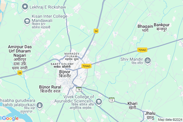
Dida Nagla
Dida Nagla Map
EDIT Map
Add Your House
 ..
..
Current Corona Virus Infected Patients Count in Bijnor District
| City Name | District Name | Total Covid cases |
|---|---|---|
| Bijnor District | Bijnor | 28 |
Locality Name :
Dida Nagla
( दीदा नगला )
Block Name : Mohammedpur Deomal
District : Bijnor
State : Uttar Pradesh
Division : Moradabad
Language : Hindi and Urdu
Current Time 03:28 PM
Date: Tuesday , Apr 29,2025 (IST)
Time zone: IST (UTC+5:30)
Elevation / Altitude: 237 meters. Above Seal level
Telephone Code / Std Code: 01345
Assembly constituency : Bijnor assembly constituency
Assembly MLA : Suchi
Lok Sabha constituency : Bijnor parliamentary constituency
Parliament MP : MALOOK NAGAR
Serpanch Name :
Pin Code : 246701
Post Office Name : Bijnor
Main Village Name : Dida Nagla
Commodities Prices : Bijnaur Market / Mandi
National Highways Reachable To Dida Nagla
Nationa High Way :NH709AG
Nationa High Way :NH709AD
Nationa High Way :NH709AG
Nationa High Way :NH709AD
Rivers Near Dida Nagla
Ramganga
Banganga
Ramganga
Banganga
About Dida Nagla
Correct below Info and add more info about Dida NaglaDida Nagla is a small Village/hamlet in Mohammedpur Deomal Block in Bijnor District of Uttar Pradesh State, India. It comes under Dida Nagla Panchayath. It belongs to Moradabad Division . It is located 4 KM towards East from District head quarters Bijnor. 8 KM from Mohammedpur Deomal. 459 KM from State capital Lucknow
Dida Nagla Pin code is 246701 and postal head office is Bijnor .
Shadmapur Khema ( 1 KM ) , Bharaira ( 2 KM ) , Rampur Bakli ( 2 KM ) , Firozpurmubarak ( 3 KM ) , Fatehpur Noabad ( 3 KM ) are the nearby Villages to Dida Nagla. Dida Nagla is surrounded by Mohammedpur Deomal Block towards North , Haldaur(Khari Jhalu) Block towards South , Kiratpur Block towards North , Nehtaur Block towards East .
Bijnaur , Nehtaur , Nagina , Najibabad are the near by Cities to Dida Nagla.
This Place is in the border of the Bijnor District and Muzaffarnagar District. Muzaffarnagar District Morna is west towards this place .
Dida Nagla 2011 Census Details
Dida Nagla Local Language is Hindi. Dida Nagla Village Total population is 628 and number of houses are 111. Female Population is 47.6%. Village literacy rate is 49.2% and the Female Literacy rate is 19.7%.
Population
| Census Parameter | Census Data |
| Total Population | 628 |
| Total No of Houses | 111 |
| Female Population % | 47.6 % ( 299) |
| Total Literacy rate % | 49.2 % ( 309) |
| Female Literacy rate | 19.7 % ( 124) |
| Scheduled Tribes Population % | 0.0 % ( 0) |
| Scheduled Caste Population % | 14.5 % ( 91) |
| Working Population % | 29.1 % |
| Child(0 -6) Population by 2011 | 124 |
| Girl Child(0 -6) Population % by 2011 | 43.5 % ( 54) |
Dida Nagla Census More Deatils.
Politics in Dida Nagla
BJP , nCP , SP , BSP are the major political parties in this area.Polling Stations /Booths near Dida Nagla
1)P.v.dwarikapuri2)Purv.m.v.faridpur Bhogan Room 2
3)P.v.ramlila Kashiram Collony Bijnor Room 2
4)P.v.rampur Bhakli Room 1
5)P.v.shumalkhadi
HOW TO REACH Dida Nagla
By Rail
Bijnor Rail Way Station , Khari Jhalu Rail Way Station are the very nearby railway stations to Dida Nagla.Colleges near Dida Nagla
Haffiz Mohammad Ibrahim Inter College
Address :
Rajkiya Balika Inter College
Address :
Balram Kunwar Saraswati Vidya Mandir
Address :
Government Inter College
Address :
Syam Narayan Singh Smarak Inter College
Address :
Schools near Dida Nagla
Kisan Inter College Peli Chuki
Address : peli chuki , mohd.pur devmal , bijnor , Uttar Pradesh . PIN- 229506
Kisan J.h.s
Address : mandhawli , mohd.pur devmal , bijnor , Uttar Pradesh . PIN- 229506
Ups Naval Pur
Address : navalpur , mohd.pur devmal , bijnor , Uttar Pradesh . PIN- 246701 , Post - Bijnor
Jhs Badshahpur Tareekam
Address : badshahpur tarikam , mohd.pur devmal , bijnor , Uttar Pradesh . PIN- 246713
Govt Health Centers near Dida Nagla
1) Dhan Saini , Health Sub Center Bulding , Village Dhan Saini ,2) Mandawli , Health Sub Center Bulding , Village & Post Mandawli ,
3) Mandawli , Health Sub Centre Building , , Village Mandawli
Sub Villages in Dida Nagla
Schools in Dida Nagla,Mohammedpur Deomal
Electronic Shops in Dida Nagla,Mohammedpur Deomal
Super Markets in Dida Nagla,Mohammedpur Deomal
Local Parks in Dida Nagla,Mohammedpur Deomal
Police Stations near Dida Nagla,Mohammedpur Deomal
Governement Offices near Dida Nagla,Mohammedpur Deomal
About Dida Nagla &
History
How to reach Dida Nagla
Tourist Places Near By Dida Nagla
Schools in Dida Nagla
Colleges in Dida Nagla
Temperature & weather of Dida Nagla
places in Dida Nagla
Dida Nagla photos
More Information
How to reach Dida Nagla
Tourist Places Near By Dida Nagla
Schools in Dida Nagla
Colleges in Dida Nagla
Temperature & weather of Dida Nagla
places in Dida Nagla
Dida Nagla photos
More Information
Village Talk
Post News or Events about this Village
Near Cities
Bijnaur 4 KM near
Nehtaur 26 KM near
Nagina 29 KM near
Najibabad 33 KM near
Bijnaur 4 KM near
Nehtaur 26 KM near
Nagina 29 KM near
Najibabad 33 KM near
Near By Taluks
Bijnor 3 KM near
Mohammedpur Deomal 7 KM near
Haldaur(Khari Jhalu) 14 KM near
Kiratpur 17 KM near
Bijnor 3 KM near
Mohammedpur Deomal 7 KM near
Haldaur(Khari Jhalu) 14 KM near
Kiratpur 17 KM near
Near By Air Ports
Muzaffarnagar Airport 53 KM near
Dehra Dun Airport 116 KM near
Pantnagar Airport 149 KM near
Indira Gandhi International Airport 155 KM near
Muzaffarnagar Airport 53 KM near
Dehra Dun Airport 116 KM near
Pantnagar Airport 149 KM near
Indira Gandhi International Airport 155 KM near
Near By Tourist Places
Hastinapur 34 KM near
Roorkee 67 KM near
Haridwar 69 KM near
Meerut 70 KM near
Lansdowne 79 KM near
Hastinapur 34 KM near
Roorkee 67 KM near
Haridwar 69 KM near
Meerut 70 KM near
Lansdowne 79 KM near
Near By Districts
Bijnor 4 KM near
Muzaffarnagar 50 KM near
Haridwar 69 KM near
Jyotiba Phule Nagar 69 KM near
Bijnor 4 KM near
Muzaffarnagar 50 KM near
Haridwar 69 KM near
Jyotiba Phule Nagar 69 KM near
Near By RailWay Station
Bijnor Rail Way Station 1.6 KM near
Muazzampur Narayan Junction Rail Way Station 25 KM near
Nagina Rail Way Station 29 KM near
Bijnor Rail Way Station 1.6 KM near
Muazzampur Narayan Junction Rail Way Station 25 KM near
Nagina Rail Way Station 29 KM near