| Home | City Bus | Maps | Villages | Cities | Rail | Tourist Places | School | College | Pin Codes | Corona Cases Count |
| Distance Calculator Bus Services IFSC Codes Trace Mobile Number Weather Search Place Trace IP Available Cash ATM/Banks Locate Polling Booth Report an Error contact People |
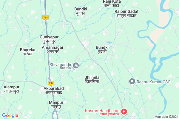
Larpur
Larpur Map
EDIT Map
Add Your House
 ..
..
Current Corona Virus Infected Patients Count in Bijnor District
| City Name | District Name | Total Covid cases |
|---|---|---|
| Bijnor District | Bijnor | 28 |
Locality Name :
Larpur
( लारपुर )
Block Name : Kotwali
District : Bijnor
State : Uttar Pradesh
Division : Moradabad
Language : Hindi and Urdu
Current Time 02:48 PM
Date: Friday , Apr 25,2025 (IST)
Time zone: IST (UTC+5:30)
Elevation / Altitude: 247 meters. Above Seal level
Telephone Code / Std Code: 01341
Assembly constituency : Barhapur assembly constituency
Assembly MLA : Kunwar Sushant Singh
Lok Sabha constituency : Moradabad parliamentary constituency
Parliament MP : Dr. S.T. HASAN
Serpanch Name :
Pin Code : 246763
Post Office Name : Najibabad
Main Village Name : Larpur
Commodities Prices : Nagina Market / Mandi
Larpur Live Weather
Temperature: 40.8 °C
clear sky
Humidity: 4%
Wind : 3.7 mt/sec towards SW
StationName : "Nagīna"
observed on 1 Hours Back
Temperature: 40.8 °C
clear sky
Humidity: 4%
Wind : 3.7 mt/sec towards SW
StationName : "Nagīna"
observed on 1 Hours Back
Larpur Weather Forecast for Next 5 days
26-04-2025
27.9°C to 41.6°C
few clouds, clear sky, overcast clouds
27.9°C to 41.6°C
few clouds, clear sky, overcast clouds
27-04-2025
26.1°C to 42.4°C
overcast clouds, broken clouds
26.1°C to 42.4°C
overcast clouds, broken clouds
28-04-2025
25.8°C to 40.7°C
overcast clouds, scattered clouds, few clouds, clear sky
25.8°C to 40.7°C
overcast clouds, scattered clouds, few clouds, clear sky
29-04-2025
26.1°C to 41.9°C
clear sky, few clouds
26.1°C to 41.9°C
clear sky, few clouds
30-04-2025
26.0°C to 41.3°C
clear sky, scattered clouds, broken clouds, overcast clouds
26.0°C to 41.3°C
clear sky, scattered clouds, broken clouds, overcast clouds
National Highways Reachable To Larpur
Nationa High Way :NH34
Nationa High Way :NH709AD
Nationa High Way :NH34
Nationa High Way :NH709AD
Rivers Near Larpur
Ramganga
Ramganga
Ramganga
Ramganga
About Larpur
Correct below Info and add more info about LarpurLarpur is a small Village/hamlet in Kotwali Block in Bijnor District of Uttar Pradesh State, India. It comes under Larpur Panchayath. It belongs to Moradabad Division . It is located 34 KM towards East from District head quarters Bijnor. 8 KM from Kotwaali. 454 KM from State capital Lucknow
Larpur Pin code is 246763 and postal head office is Najibabad .
Harganpur ( 3 KM ) , Alipura ( 3 KM ) , Sabhachandpur Kesho ( 4 KM ) , Sabha Chandpur Kesho ( 4 KM ) , Samaspurnaseeb ( 4 KM ) are the nearby Villages to Larpur. Larpur is surrounded by Kiratpur Block towards west , Najibabad Block towards North , Nehtaur Block towards South , Dhampur Block towards South .
Nagina , Najibabad , Nehtaur , Sherkot are the near by Cities to Larpur.
Larpur 2011 Census Details
Larpur Local Language is Hindi. Larpur Village Total population is 742 and number of houses are 120. Female Population is 48.9%. Village literacy rate is 52.2% and the Female Literacy rate is 20.8%.
Population
| Census Parameter | Census Data |
| Total Population | 742 |
| Total No of Houses | 120 |
| Female Population % | 48.9 % ( 363) |
| Total Literacy rate % | 52.2 % ( 387) |
| Female Literacy rate | 20.8 % ( 154) |
| Scheduled Tribes Population % | 0.0 % ( 0) |
| Scheduled Caste Population % | 42.2 % ( 313) |
| Working Population % | 29.1 % |
| Child(0 -6) Population by 2011 | 131 |
| Girl Child(0 -6) Population % by 2011 | 51.1 % ( 67) |
Larpur Census More Deatils.
Politics in Larpur
BJP , BSP are the major political parties in this area.Polling Stations /Booths near Larpur
1)Janta .j.h.s Tirlokwala Room No 12)J.g.s Barhapur Room No 2
3)P.v Kunjeta
4)P.v Sahuwala Gosaiwala Room No 2
5)P.v Birla Form Mohammad Alipur Choharh
HOW TO REACH Larpur
By Rail
Bundki Rail Way Station , Murshadpur Rail Way Station are the very nearby railway stations to Larpur.Colleges near Larpur
Haffiz Mohammad Ibrahim Inter College
Address :
Rajkiya Balika Inter College
Address :
Balram Kunwar Saraswati Vidya Mandir
Address :
Government Inter College
Address :
Syam Narayan Singh Smarak Inter College
Address :
Schools near Larpur
Ups Chilkiya
Address : chilkya , kotwali , bijnor , Uttar Pradesh . PIN- 246763 , Post - Najibabad
Ups Kadar Pur Nanu
Address : kadarpur nanu , kotwali , bijnor , Uttar Pradesh . PIN- 252525
Ups Alipur Jet
Address : alipur jat , kotwali , bijnor , Uttar Pradesh . PIN- 246724 , Post - Badhapur
Kgbv Kotwali
Address : kotwali , kotwali , bijnor , Uttar Pradesh . PIN- 246701 , Post - Bijnor
Govt Health Centers near Larpur
1) Sialu Nangla , Health Sub Center Facility Building , Village Sialu Nangla ,2) Sikanderpurwasi , Health Sub Centre Building , Village Sikanderpurwasi ,
3) Shadipur , Health Sub Centre Building , Village Shadipur ,
Sub Villages in Larpur
Schools in Larpur,Kotwali
Electronic Shops in Larpur,Kotwali
Super Markets in Larpur,Kotwali
Local Parks in Larpur,Kotwali
Police Stations near Larpur,Kotwali
Governement Offices near Larpur,Kotwali
About Larpur &
History
How to reach Larpur
Tourist Places Near By Larpur
Schools in Larpur
Colleges in Larpur
Temperature & weather of Larpur
places in Larpur
Larpur photos
More Information
How to reach Larpur
Tourist Places Near By Larpur
Schools in Larpur
Colleges in Larpur
Temperature & weather of Larpur
places in Larpur
Larpur photos
More Information
Village Talk
Post News or Events about this Village
Near Cities
Nagina 9 KM near
Najibabad 13 KM near
Nehtaur 23 KM near
Sherkot 28 KM near
Nagina 9 KM near
Najibabad 13 KM near
Nehtaur 23 KM near
Sherkot 28 KM near
Near By Taluks
Kotwali 7 KM near
Kiratpur 14 KM near
Najibabad 16 KM near
Nehtaur 26 KM near
Kotwali 7 KM near
Kiratpur 14 KM near
Najibabad 16 KM near
Nehtaur 26 KM near
Near By Air Ports
Muzaffarnagar Airport 79 KM near
Dehra Dun Airport 107 KM near
Pantnagar Airport 131 KM near
Indira Gandhi International Airport 183 KM near
Muzaffarnagar Airport 79 KM near
Dehra Dun Airport 107 KM near
Pantnagar Airport 131 KM near
Indira Gandhi International Airport 183 KM near
Near By Tourist Places
Lansdowne 51 KM near
Corbett National Park 59 KM near
Haridwar 59 KM near
Hastinapur 61 KM near
Kashipur 70 KM near
Lansdowne 51 KM near
Corbett National Park 59 KM near
Haridwar 59 KM near
Hastinapur 61 KM near
Kashipur 70 KM near
Near By Districts
Bijnor 33 KM near
Haridwar 59 KM near
Muzaffarnagar 75 KM near
Jyotiba Phule Nagar 76 KM near
Bijnor 33 KM near
Haridwar 59 KM near
Muzaffarnagar 75 KM near
Jyotiba Phule Nagar 76 KM near
Near By RailWay Station
Bundki Rail Way Station 1.7 KM near
Murshadpur Rail Way Station 8.3 KM near
Nagina Rail Way Station 9 KM near
Najibabad Junction Rail Way Station 13 KM near
Bundki Rail Way Station 1.7 KM near
Murshadpur Rail Way Station 8.3 KM near
Nagina Rail Way Station 9 KM near
Najibabad Junction Rail Way Station 13 KM near