| Home | City Bus | Maps | Villages | Cities | Rail | Tourist Places | School | College | Pin Codes | Corona Cases Count |
| Distance Calculator Bus Services IFSC Codes Trace Mobile Number Weather Search Place Trace IP Available Cash ATM/Banks Locate Polling Booth Report an Error contact People |
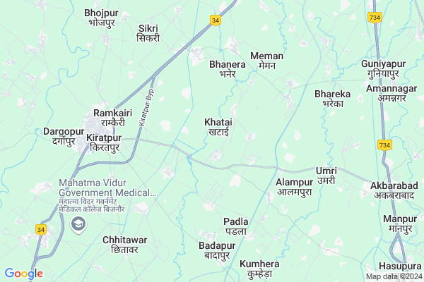
Barhapur
Barhapur Map
EDIT Map
Add Your House
 ..
..
Current Corona Virus Infected Patients Count in Bijnor District
| City Name | District Name | Total Covid cases |
|---|---|---|
| Bijnor District | Bijnor | 28 |
Locality Name :
Barhapur
( बरहपुर )
Block Name : Kiratpur
District : Bijnor
State : Uttar Pradesh
Division : Moradabad
Language : Hindi and Urdu
Current Time 11:25 AM
Date: Monday , Apr 28,2025 (IST)
Time zone: IST (UTC+5:30)
Elevation / Altitude: 253 meters. Above Seal level
Telephone Code / Std Code: 01345
Assembly constituency : Nagina assembly constituency
Assembly MLA : Manoj Kumar Paras
Lok Sabha constituency : Nagina parliamentary constituency
Parliament MP : GIRISH CHANDRA
Serpanch Name :
Pin Code : 246764
Post Office Name : Kotwali (Bijnor)
Main Village Name : Barhapur
Commodities Prices : Kiratpur Market / Mandi
Barhapur Live Weather
Temperature: 35.1 °C
clear sky
Humidity: 19%
Wind : 5.89 mt/sec towards SE
StationName : "KÄ«ratpur"
observed on 1 Hours Back
Temperature: 35.1 °C
clear sky
Humidity: 19%
Wind : 5.89 mt/sec towards SE
StationName : "KÄ«ratpur"
observed on 1 Hours Back
Barhapur Weather Forecast for Next 5 days
29-04-2025
27.2°C to 40.4°C
clear sky, few clouds
27.2°C to 40.4°C
clear sky, few clouds
30-04-2025
26.3°C to 39.5°C
scattered clouds, broken clouds, clear sky, overcast clouds
26.3°C to 39.5°C
scattered clouds, broken clouds, clear sky, overcast clouds
01-05-2025
26.5°C to 40.0°C
overcast clouds, scattered clouds, few clouds, clear sky, broken clouds
26.5°C to 40.0°C
overcast clouds, scattered clouds, few clouds, clear sky, broken clouds
02-05-2025
24.7°C to 39.5°C
overcast clouds, broken clouds, few clouds, light rain
24.7°C to 39.5°C
overcast clouds, broken clouds, few clouds, light rain
03-05-2025
26.0°C to 37.2°C
overcast clouds, light rain
26.0°C to 37.2°C
overcast clouds, light rain
National Highways Reachable To Barhapur
Nationa High Way :NH709AD
Nationa High Way :NH709AG
Nationa High Way :NH709AD
Nationa High Way :NH709AG
Rivers Near Barhapur
Khoh
Malin
Khoh
Malin
About Barhapur
Correct below Info and add more info about BarhapurBarhapur is a small Village/hamlet in Kiratpur Block in Bijnor District of Uttar Pradesh State, India. It comes under Barhapur Panchayath. It belongs to Moradabad Division . It is located 22 KM towards North from District head quarters Bijnor. 462 KM from State capital Lucknow
Barhapur Pin code is 246764 and postal head office is Kotwali (Bijnor).
Barhapur is surrounded by Najibabad Block towards North , Mohammedpur Deomal Block towards west , Kotwali Block towards East , Bijnor Block towards South .
Najibabad , Nagina , Bijnaur , Nehtaur are the near by Cities to Barhapur.
Demographics of Barhapur
Hindi is the Local Language here.Politics in Barhapur
AGP , SP , BSP are the major political parties in this area.Polling Stations /Booths near Barhapur
1)J.h.s.sahabpururf Hindupur2)P.v.begampur Harrey Room No2
3)P.v.saidpurimahichand
4)P.vkiratpur First Room No 3
5)P.v.najibpur Sadat
HOW TO REACH Barhapur
By Rail
Basi Kiratpur Rail Way Station , Muazzampur Narayan Junction Rail Way Station are the very nearby railway stations to Barhapur.Colleges near Barhapur
Haffiz Mohammad Ibrahim Inter College
Address :
Rajkiya Balika Inter College
Address :
Balram Kunwar Saraswati Vidya Mandir
Address :
Government Inter College
Address :
Syam Narayan Singh Smarak Inter College
Address :
Schools near Barhapur
J.s. Chatar Bhojpur Kushal
Address : chatar bhojpur kusal , kiratpur , bijnor , Uttar Pradesh . PIN- 246731 , Post - Kiratpur
Govt. High School
Address : nagar kirat pur , kiratpur , bijnor , Uttar Pradesh . PIN- 246701 , Post - Bijnor
Hindu Inter Collage Kiratpur
Address : nagar kirat pur , kiratpur , bijnor , Uttar Pradesh . PIN- 246701 , Post - Bijnor
Rajkeey Ups Begampur Shadi
Address : begampursadi urf rampur , kiratpur , bijnor , Uttar Pradesh . PIN- 246701 , Post - Bijnor
Govt Health Centers near Barhapur
1) BAGADPUR , , ,2) Bahupura , Health Sub Centre Building , Village Bahupura ,
3) Mohanpur , Health Sub Centre Building , Village Mohanpur ,
Sub Villages in Barhapur
Schools in Barhapur,Kiratpur
Electronic Shops in Barhapur,Kiratpur
Super Markets in Barhapur,Kiratpur
Local Parks in Barhapur,Kiratpur
Police Stations near Barhapur,Kiratpur
Governement Offices near Barhapur,Kiratpur
About Barhapur &
History
How to reach Barhapur
Tourist Places Near By Barhapur
Schools in Barhapur
Colleges in Barhapur
Temperature & weather of Barhapur
places in Barhapur
Barhapur photos
More Information
How to reach Barhapur
Tourist Places Near By Barhapur
Schools in Barhapur
Colleges in Barhapur
Temperature & weather of Barhapur
places in Barhapur
Barhapur photos
More Information
Village Talk
Post News or Events about this Village
Near Cities
Najibabad 16 KM near
Nagina 19 KM near
Bijnaur 21 KM near
Nehtaur 26 KM near
Najibabad 16 KM near
Nagina 19 KM near
Bijnaur 21 KM near
Nehtaur 26 KM near
Near By Taluks
Kiratpur 0 KM near
Najibabad 13 KM near
Mohammedpur Deomal 15 KM near
Kotwali 19 KM near
Kiratpur 0 KM near
Najibabad 13 KM near
Mohammedpur Deomal 15 KM near
Kotwali 19 KM near
Near By Air Ports
Muzaffarnagar Airport 64 KM near
Dehra Dun Airport 104 KM near
Pantnagar Airport 144 KM near
Indira Gandhi International Airport 172 KM near
Muzaffarnagar Airport 64 KM near
Dehra Dun Airport 104 KM near
Pantnagar Airport 144 KM near
Indira Gandhi International Airport 172 KM near
Near By Tourist Places
Hastinapur 51 KM near
Haridwar 56 KM near
Roorkee 61 KM near
Lansdowne 61 KM near
Rishikesh 73 KM near
Hastinapur 51 KM near
Haridwar 56 KM near
Roorkee 61 KM near
Lansdowne 61 KM near
Rishikesh 73 KM near
Near By Districts
Bijnor 21 KM near
Haridwar 56 KM near
Muzaffarnagar 60 KM near
Jyotiba Phule Nagar 77 KM near
Bijnor 21 KM near
Haridwar 56 KM near
Muzaffarnagar 60 KM near
Jyotiba Phule Nagar 77 KM near
Near By RailWay Station
Basi Kiratpur Rail Way Station 5.3 KM near
Muazzampur Narayan Junction Rail Way Station 11 KM near
Najibabad Junction Rail Way Station 15 KM near
Basi Kiratpur Rail Way Station 5.3 KM near
Muazzampur Narayan Junction Rail Way Station 11 KM near
Najibabad Junction Rail Way Station 15 KM near