| Home | City Bus | Maps | Villages | Cities | Rail | Tourist Places | School | College | Pin Codes | Corona Cases Count |
| Distance Calculator Bus Services IFSC Codes Trace Mobile Number Weather Search Place Trace IP Available Cash ATM/Banks Locate Polling Booth Report an Error contact People |
Konjed
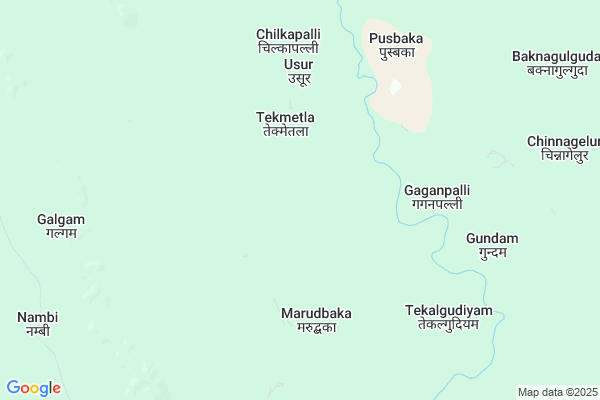
Konjed Map
EDIT Map
Add Your House
 ..
..
Current Corona Virus Infected Patients Count in Bijapur District
| City Name | District Name | Total Covid cases |
|---|
Locality Name :
Konjed
( कॉनजेड )
Tehsil Name : Usoor
District : Bijapur
State : Chattisgarh
Language : Chhattisgarhi and Hindi
Current Time 12:25 PM
Date: Wednesday , Feb 05,2025 (IST)
Time zone: IST (UTC+5:30)
Elevation / Altitude: 631 meters. Above Seal level
Telephone Code / Std Code: 07853
Assembly constituency : Bijapur assembly constituency
Assembly MLA : Vikram Mandavi
Lok Sabha constituency : Bastar parliamentary constituency
Parliament MP : DEEPAK BAIJ
Serpanch Name :
Pin Code : 494447
Post Office Name : Awapalli
Main Village Name : Konjed
Commodities Prices : Bijapur Market / Mandi
Konjed Live Weather
Temperature: 37.1 °C
few clouds
Humidity: 22%
Wind : 0.86 mt/sec towards S
StationName : "Manuguru"
observed on Now
Temperature: 37.1 °C
few clouds
Humidity: 22%
Wind : 0.86 mt/sec towards S
StationName : "Manuguru"
observed on Now
Konjed Weather Forecast for Next 5 days
06-02-2025
20.4°C to 37.8°C
scattered clouds, broken clouds, few clouds, clear sky
20.4°C to 37.8°C
scattered clouds, broken clouds, few clouds, clear sky
07-02-2025
19.3°C to 36.9°C
scattered clouds, few clouds, clear sky
19.3°C to 36.9°C
scattered clouds, few clouds, clear sky
08-02-2025
19.9°C to 36.8°C
clear sky
19.9°C to 36.8°C
clear sky
09-02-2025
19.5°C to 37.4°C
clear sky
19.5°C to 37.4°C
clear sky
10-02-2025
18.3°C to 37.5°C
clear sky
18.3°C to 37.5°C
clear sky
National Highways Reachable To Konjed
Nationa High Way :NH163
Nationa High Way :NH163
Rivers Near Konjed
Godavari :गोदावरी :ಗೋದಾವರಿ :गोदावरी :கோதாவரி :గోదావరి
Taliperu
Godavari :गोदावरी :ಗೋದಾವರಿ :गोदावरी :கோதாவரி :గోదావరి
Taliperu
About Konjed
Correct below Info and add more info about KonjedKonjed is a small Village/hamlet in Usoor Tehsil in Bijapur District of Chattisgarh State, India. It comes under Konjed Panchayath. It is located 45 KM towards South from District head quarters Bijapur. 10 KM from Usoor. 375 KM from State capital Raipur
Konjed Pin code is 494447 and postal head office is Awapalli .
Tarrem ( 9 KM ) , Timmapur ( 10 KM ) , Galgam ( 13 KM ) , Hirapur ( 13 KM ) , Murdanda ( 16 KM ) are the nearby Villages to Konjed. Konjed is surrounded by Venkatapuram Tehsil towards west , Bijapur Tehsil towards North , Wazeed Tehsil towards west , Mangapet Tehsil towards west .
Bade Bacheli , Manuguru , Bhadrachalam , Kothagudem are the near by Cities to Konjed.
Konjed 2011 Census Details
Konjed Local Language is Chhattisgarhi. Konjed Village Total population is 177 and number of houses are 37. Female Population is 52.0%. Village literacy rate is 0.0% and the Female Literacy rate is 0.0%.
Population
| Census Parameter | Census Data |
| Total Population | 177 |
| Total No of Houses | 37 |
| Female Population % | 52.0 % ( 92) |
| Total Literacy rate % | 0.0 % ( 0) |
| Female Literacy rate | 0.0 % ( 0) |
| Scheduled Tribes Population % | 100.0 % ( 177) |
| Scheduled Caste Population % | 0.0 % ( 0) |
| Working Population % | 61.6 % |
| Child(0 -6) Population by 2011 | 26 |
| Girl Child(0 -6) Population % by 2011 | 42.3 % ( 11) |
Konjed Census More Deatils.
Politics in Konjed
Indian National Congress , BJP , INC are the major political parties in this area.Polling Stations /Booths near Konjed
1)Mankeli2)Maroodhbaka -1
3)Bhatwada
4)Puladi
5)Komhu
HOW TO REACH Konjed
By Rail
There is no railway station near to Konjed in less than 10 km.Schools near Konjed
Govt High School Murkinar
Address : halbapara murkinar
Govt Health Centers near Konjed
1) SHC Timmapur , , Sector Basaguda , Basaguda road2) SHC Tarem , , Sector Basaguda ,
3) SHC Basaguda , SHC Basaguda , Sector Basaguda , Behind PHC
Sub Villages in Konjed
Schools in Konjed,Usoor
Electronic Shops in Konjed,Usoor
Super Markets in Konjed,Usoor
Local Parks in Konjed,Usoor
Police Stations near Konjed,Usoor
Governement Offices near Konjed,Usoor
About Konjed &
History
How to reach Konjed
Tourist Places Near By Konjed
Schools in Konjed
Colleges in Konjed
Temperature & weather of Konjed
places in Konjed
Konjed photos
More Information
How to reach Konjed
Tourist Places Near By Konjed
Schools in Konjed
Colleges in Konjed
Temperature & weather of Konjed
places in Konjed
Konjed photos
More Information
Village Talk
Post News or Events about this Village
Near Cities
Bade Bacheli 55 KM near
Manuguru 64 KM near
Bhadrachalam 97 KM near
Kothagudem 115 KM near
Bade Bacheli 55 KM near
Manuguru 64 KM near
Bhadrachalam 97 KM near
Kothagudem 115 KM near
Near By Taluks
Usoor 10 KM near
Venkatapuram 37 KM near
Wazeed 44 KM near
Bijapur 45 KM near
Usoor 10 KM near
Venkatapuram 37 KM near
Wazeed 44 KM near
Bijapur 45 KM near
Near By Air Ports
Rajahmundry Airport 201 KM near
Vijayawada Airport 239 KM near
Vishakhapatnam Airport 293 KM near
Rajiv Gandhi International Airport 326 KM near
Rajahmundry Airport 201 KM near
Vijayawada Airport 239 KM near
Vishakhapatnam Airport 293 KM near
Rajiv Gandhi International Airport 326 KM near
Near By Tourist Places
Medaram 75 KM near
Dantewada 78 KM near
Bhadrachalam 97 KM near
Bhamragarh Wildlife Sanctuary 124 KM near
Papi Kondalu 142 KM near
Medaram 75 KM near
Dantewada 78 KM near
Bhadrachalam 97 KM near
Bhamragarh Wildlife Sanctuary 124 KM near
Papi Kondalu 142 KM near
Near By Districts
Bijapur 44 KM near
Dantewada 80 KM near
Malkangiri 121 KM near
Bastar 156 KM near
Bijapur 44 KM near
Dantewada 80 KM near
Malkangiri 121 KM near
Bastar 156 KM near
Near By RailWay Station
Mahbubabad Rail Way Station 148 KM near
Kesamudram Rail Way Station 149 KM near
Mahbubabad Rail Way Station 148 KM near
Kesamudram Rail Way Station 149 KM near