| Home | City Bus | Maps | Villages | Cities | Rail | Tourist Places | School | College | Pin Codes | Corona Cases Count |
| Distance Calculator Bus Services IFSC Codes Trace Mobile Number Weather Search Place Trace IP Available Cash ATM/Banks Locate Polling Booth Report an Error contact People |
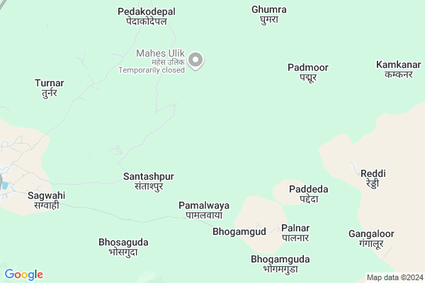
Munaga
Munaga Map
EDIT Map
Add Your House
 ..
..
Current Corona Virus Infected Patients Count in Bijapur District
| City Name | District Name | Total Covid cases |
|---|
Locality Name :
Munaga
( मुनगा )
Tehsil Name : Bijapur
District : Bijapur
State : Chattisgarh
Language : Chhattisgarhi and Hindi
Current Time 10:05 AM
Date: Wednesday , Feb 05,2025 (IST)
Time zone: IST (UTC+5:30)
Elevation / Altitude: 608 meters. Above Seal level
Telephone Code / Std Code: 07853
Assembly constituency : Bijapur assembly constituency
Assembly MLA : Vikram Mandavi
Lok Sabha constituency : Bastar parliamentary constituency
Parliament MP : DEEPAK BAIJ
Serpanch Name :
Main Village Name : Munaga
Alternate Village Name : Munga
Commodities Prices : Bijapur Market / Mandi
Munaga Live Weather
Temperature: 21.1 °C
broken clouds
Humidity: 48%
Wind : 0.92 mt/sec towards E
StationName : "GÄ«dam"
observed on 2 Hours Back
Temperature: 21.1 °C
broken clouds
Humidity: 48%
Wind : 0.92 mt/sec towards E
StationName : "GÄ«dam"
observed on 2 Hours Back
Munaga Weather Forecast for Next 5 days
06-02-2025
19.8°C to 36.0°C
scattered clouds, few clouds, clear sky
19.8°C to 36.0°C
scattered clouds, few clouds, clear sky
07-02-2025
18.1°C to 35.9°C
clear sky
18.1°C to 35.9°C
clear sky
08-02-2025
18.9°C to 37.3°C
clear sky
18.9°C to 37.3°C
clear sky
09-02-2025
17.9°C to 36.7°C
clear sky
17.9°C to 36.7°C
clear sky
10-02-2025
16.7°C to 37.5°C
clear sky
16.7°C to 37.5°C
clear sky
National Highways Reachable To Munaga
Nationa High Way :NH63
Nationa High Way :NH63
Rivers Near Munaga
Dantewada
Sankini
Dantewada
Sankini
About Munaga
Correct below Info and add more info about MunagaMunaga is a small Village/hamlet in Bijapur Tehsil in Bijapur District of Chattisgarh State, India. It comes under Munaga Panchayath. It is located 13 KM towards East from District head quarters Bijapur. 329 KM from State capital Raipur
Munaga is surrounded by Bhairamgarh Tehsil towards North , Usoor Tehsil towards South , Dantewada Tehsil towards East , Kuwakonda Tehsil towards East .
Bade Bacheli , Manuguru , Malkangiri , Kondagaon are the near by Cities to Munaga.
Munga 2011 Census Details
Munaga Local Language is Chhattisgarhi. Munga Village Total population is 352 and number of houses are 80. Female Population is 49.4%. Village literacy rate is 6.5% and the Female Literacy rate is 0.9%.
Population
| Census Parameter | Census Data |
| Total Population | 352 |
| Total No of Houses | 80 |
| Female Population % | 49.4 % ( 174) |
| Total Literacy rate % | 6.5 % ( 23) |
| Female Literacy rate | 0.9 % ( 3) |
| Scheduled Tribes Population % | 100.0 % ( 352) |
| Scheduled Caste Population % | 0.0 % ( 0) |
| Working Population % | 55.4 % |
| Child(0 -6) Population by 2011 | 83 |
| Girl Child(0 -6) Population % by 2011 | 51.8 % ( 43) |
Munga Census More Deatils.
Politics in Munaga
Indian National Congress , BJP , INC are the major political parties in this area.Polling Stations /Booths near Munaga
1)Cheramangi2)Jatloor
3)Kottoor
4)Sankanapalli
5)Cherkanti
HOW TO REACH Munaga
By Rail
There is no railway station near to Munaga in less than 10 km.Pincodes near Munaga
494447 ( Awapalli ) , 494444 ( Bijapur ) , 494553 ( Bacheli )Schools near Munaga
Govt Health Centers near Munaga
1) SHC Cherpal. , SHC Cherpal. , Sector Gangaloor , main road2) SHC Cherpalli , SHC CHERPALLI , Sector madded , Men Road Cherpalli
3) PHC Cherpal , PHC Cherpal , sector cherpal , main road
Sub Villages in Munaga
Schools in Munaga,Bijapur
Electronic Shops in Munaga,Bijapur
Super Markets in Munaga,Bijapur
Local Parks in Munaga,Bijapur
Police Stations near Munaga,Bijapur
Governement Offices near Munaga,Bijapur
About Munaga &
History
How to reach Munaga
Tourist Places Near By Munaga
Schools in Munaga
Colleges in Munaga
Temperature & weather of Munaga
places in Munaga
Munaga photos
More Information
How to reach Munaga
Tourist Places Near By Munaga
Schools in Munaga
Colleges in Munaga
Temperature & weather of Munaga
places in Munaga
Munaga photos
More Information
Village Talk
Post News or Events about this Village
Near Cities
Bade Bacheli 41 KM near
Manuguru 109 KM near
Malkangiri 129 KM near
Kondagaon 132 KM near
Bade Bacheli 41 KM near
Manuguru 109 KM near
Malkangiri 129 KM near
Kondagaon 132 KM near
Near By Taluks
Bijapur 0 KM near
Bhairamgarh 29 KM near
Usoor 36 KM near
Dantewada 49 KM near
Bijapur 0 KM near
Bhairamgarh 29 KM near
Usoor 36 KM near
Dantewada 49 KM near
Near By Air Ports
Rajahmundry Airport 237 KM near
Vijayawada Airport 284 KM near
Vishakhapatnam Airport 304 KM near
Raipur Airport 310 KM near
Rajahmundry Airport 237 KM near
Vijayawada Airport 284 KM near
Vishakhapatnam Airport 304 KM near
Raipur Airport 310 KM near
Near By Tourist Places
Dantewada 51 KM near
Bhamragarh Wildlife Sanctuary 84 KM near
Medaram 100 KM near
Bastar 128 KM near
Jagdalpur 134 KM near
Dantewada 51 KM near
Bhamragarh Wildlife Sanctuary 84 KM near
Medaram 100 KM near
Bastar 128 KM near
Jagdalpur 134 KM near
Near By Districts
Bijapur 12 KM near
Dantewada 54 KM near
Narayanpur 120 KM near
Malkangiri 128 KM near
Bijapur 12 KM near
Dantewada 54 KM near
Narayanpur 120 KM near
Malkangiri 128 KM near
Near By RailWay Station
Bellampalli Rail Way Station 171 KM near
Manchiryal Rail Way Station 173 KM near
Bellampalli Rail Way Station 171 KM near
Manchiryal Rail Way Station 173 KM near