| Home | City Bus | Maps | Villages | Cities | Rail | Tourist Places | School | College | Pin Codes | Corona Cases Count |
| Distance Calculator Bus Services IFSC Codes Trace Mobile Number Weather Search Place Trace IP Available Cash ATM/Banks Locate Polling Booth Report an Error contact People |
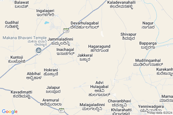
Jakkeral
Jakkeral Map
EDIT Map
Add Your House
 ..
..
Current Corona Virus Infected Patients Count in Bijapur District District
| City Name | District Name | Total Covid cases |
|---|
Locality Name :
Jakkeral
( ಜಕ್ಕೇರಾಲ್ )
Taluk Name : Muddebihal
District : Bijapur District
State : Karnataka
Division : Belgaum
Language : Kannada and English,
Current Time 12:52 PM
Date: Tuesday , Apr 29,2025 (IST)
Time zone: IST (UTC+5:30)
Elevation / Altitude: 535 meters. Above Seal level
Telephone Code / Std Code: 08356
Assembly constituency : Muddebihal assembly constituency
Assembly MLA : Appaji. Aliyas. Channabasavaraj. S/o Shankarao. N
Lok Sabha constituency : Bijapur parliamentary constituency
Parliament MP : JIGAJINAGI RAMESH CHANDAPPA
Serpanch Name :
Pin Code : 586212
Post Office Name : Muddebihal Fort
Main Village Name : Jakkeral
Alternate Village Name : Jekkeral
Commodities Prices : Lingasugur Market / Mandi
National Highways Reachable To Jakkeral
Nationa High Way :NH50
Nationa High Way :NH150A
Nationa High Way :NH50
Nationa High Way :NH150A
Rivers Near Jakkeral
Doni :Doni :ಡೋಣಿ :डॊणि
Krishna :クリシュナ :ಕೃಷ್ಣಾ :कृष्णा
Doni :Doni :ಡೋಣಿ :डॊणि
Krishna :クリシュナ :ಕೃಷ್ಣಾ :कृष्णा
About Jakkeral
Correct below Info and add more info about JakkeralJakkeral is a small Village/hamlet in Muddebihal Taluk in Bijapur District District of Karnataka State, India. It comes under Jakkeral Panchayath. It belongs to Belgaum Division . It is located 87 KM towards East from District head quarters Bijapur. 7 KM from Muddebihal. 473 KM from State capital Bangalore
Jakkeral Pin code is 586212 and postal head office is Muddebihal Fort .
Mukihal ( 9 KM ) , Kuntoji ( 9 KM ) , Hiremural ( 10 KM ) , Kavadimatti ( 10 KM ) , Minajagi ( 13 KM ) are the nearby Villages to Jakkeral. Jakkeral is surrounded by Basavana Bagewadi Taluk towards west , Hungund Taluk towards South , Lingsugur Taluk towards East , Shorapur Taluk towards East .
Muddebihal , Talikota , Lingsugur , Shorapur are the near by Cities to Jakkeral.
Jakkeral 2011 Census Details
Jakkeral Local Language is Kannada. Jakkeral Village Total population is 380 and number of houses are 72. Female Population is 49.2%. Village literacy rate is 51.6% and the Female Literacy rate is 18.7%.
Population
| Census Parameter | Census Data |
| Total Population | 380 |
| Total No of Houses | 72 |
| Female Population % | 49.2 % ( 187) |
| Total Literacy rate % | 51.6 % ( 196) |
| Female Literacy rate | 18.7 % ( 71) |
| Scheduled Tribes Population % | 20.5 % ( 78) |
| Scheduled Caste Population % | 10.5 % ( 40) |
| Working Population % | 61.6 % |
| Child(0 -6) Population by 2011 | 64 |
| Girl Child(0 -6) Population % by 2011 | 45.3 % ( 29) |
Jakkeral Census More Deatils.
Politics in Jakkeral
Bharatiya Janata Party , BJP , Bharatiya Janata Party (BJP) , INC are the major political parties in this area.Polling Stations /Booths near Jakkeral
1)Govt Higher Primarykannada Boysschool Kilaratti2)113- Govt. Higher Primary
3)Village Accountans Revanu Idop Sub Tahasildar Office Naltwad
4)Govt Kannada Higher Primary School Right Wing Nebageri
5)Govt High School New Building East Side Muddebihal
HOW TO REACH Jakkeral
By Road
Muddebihal is the Nearest Town to Jakkeral. Muddebihal is 13 km from Jakkeral. Road connectivity is there from Muddebihal to Jakkeral.By Rail
There is no railway station near to Jakkeral in less than 10 km.Colleges near Jakkeral
Shri Pawad Basaveshwar Govt Pu College Basarkod
Address :
Veereshwara Padavi Purva Mahavidyala College Nalatavad
Address :
S.v.p.u Calleagr
Address :
Schools in Jakkeral
Govt Kbhps Jakkeral
Address : jakkeral , muddebihal , bijapur , Karnataka . PIN- 586122 , Post - Mangoli
Govt Health Centers near Jakkeral
1) Nalatwad CHC , Government Hospital Nalatwad , CHC Nalatwad , Main road Nalatwad2) Kanakal , , Kanakal ,
3) Hunasangi CHC , Hunasangi CHC , ,
Sub Villages in Jakkeral
Petrol Bunks in Jakkeral,Muddebihal
GURADDI PETROLEUMS MUDDEBIHAL
MUDDEBIHAL ON BIJAPUR ROAD; BIJAPUR; Karnataka 586212; India
15.3 KM distance Detail
more ..
Police Stations near Jakkeral,Muddebihal
Muddebihal Police Station
Vijaypura Road; Turakangori Layout; Muddebihal; Karnataka 586212; India
15.4 KM distance Detail
Governement Offices near Jakkeral,Muddebihal
SOTHE DJ Sound System
; Mahantesh Nagar; Muddebihal; Karnataka 586212; India
14.9 KM distance Detail
About Jakkeral &
History
How to reach Jakkeral
Tourist Places Near By Jakkeral
Schools in Jakkeral
Colleges in Jakkeral
Temperature & weather of Jakkeral
places in Jakkeral
Jakkeral photos
More Information
How to reach Jakkeral
Tourist Places Near By Jakkeral
Schools in Jakkeral
Colleges in Jakkeral
Temperature & weather of Jakkeral
places in Jakkeral
Jakkeral photos
More Information
Village Talk
Post News or Events about this Village
Near Cities
Muddebihal 13 KM near
Talikota 16 KM near
Lingsugur 36 KM near
Shorapur 63 KM near
Muddebihal 13 KM near
Talikota 16 KM near
Lingsugur 36 KM near
Shorapur 63 KM near
Near By Taluks
Muddebihal 7 KM near
Basavana Bagewadi 42 KM near
Hungund 44 KM near
Lingsugur 45 KM near
Muddebihal 7 KM near
Basavana Bagewadi 42 KM near
Hungund 44 KM near
Lingsugur 45 KM near
Near By Air Ports
Sholapur Airport 161 KM near
Hubli Airport 187 KM near
Sambre Airport 205 KM near
Kolhapur Airport 231 KM near
Sholapur Airport 161 KM near
Hubli Airport 187 KM near
Sambre Airport 205 KM near
Kolhapur Airport 231 KM near
Near By Tourist Places
Aihole 61 KM near
Pattadakkal 73 KM near
Bijapur 85 KM near
Badami 88 KM near
Hampi 131 KM near
Aihole 61 KM near
Pattadakkal 73 KM near
Bijapur 85 KM near
Badami 88 KM near
Hampi 131 KM near
Near By Districts
Bagalkot 71 KM near
Bijapur District 84 KM near
Yadgir 116 KM near
Koppal 128 KM near
Bagalkot 71 KM near
Bijapur District 84 KM near
Yadgir 116 KM near
Koppal 128 KM near
Near By RailWay Station
Almatti Rail Way Station 41 KM near
Bagalkot Junction Rail Way Station 69 KM near
Almatti Rail Way Station 41 KM near
Bagalkot Junction Rail Way Station 69 KM near