| Home | City Bus | Maps | Villages | Cities | Rail | Tourist Places | School | College | Pin Codes | Corona Cases Count |
| Distance Calculator Bus Services IFSC Codes Trace Mobile Number Weather Search Place Trace IP Available Cash ATM/Banks Locate Polling Booth Report an Error contact People |
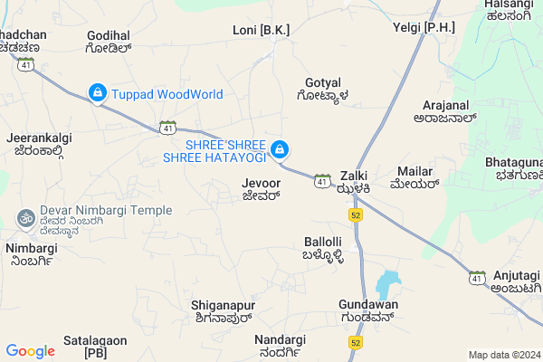
Jevoor
Jevoor Map
EDIT Map
Add Your House
 ..
..
Current Corona Virus Infected Patients Count in Bijapur District District
| City Name | District Name | Total Covid cases |
|---|
Locality Name :
Jevoor
( ಜೇವೂರ )
Taluk Name : Indi
District : Bijapur District
State : Karnataka
Division : Belgaum
Language : Kannada and English,
Current Time 10:10 AM
Date: Thursday , Apr 24,2025 (IST)
Time zone: IST (UTC+5:30)
Elevation / Altitude: 490 meters. Above Seal level
Telephone Code / Std Code: 08359
Assembly constituency : Indi assembly constituency
Assembly MLA : Yashavantaraygoud. Vittalagoud. Patil
Lok Sabha constituency : Bijapur parliamentary constituency
Parliament MP : JIGAJINAGI RAMESH CHANDAPPA
Serpanch Name :
Pin Code : 586204
Post Office Name : Bardol (Bijapur(KAR))
Main Village Name : Jevoor
Alternate Village Name : Jevoor JHC
Commodities Prices : Mangal Wedha Market / Mandi
Jevoor Live Weather
Temperature: 36.5 °C
broken clouds
Humidity: 13%
Wind : 6.43 mt/sec towards N
StationName : "Indi"
observed on 44 Mins Back
Temperature: 36.5 °C
broken clouds
Humidity: 13%
Wind : 6.43 mt/sec towards N
StationName : "Indi"
observed on 44 Mins Back
Jevoor Weather Forecast for Next 5 days
25-04-2025
32.2°C to 41.7°C
broken clouds, few clouds, clear sky
32.2°C to 41.7°C
broken clouds, few clouds, clear sky
26-04-2025
30.6°C to 42.0°C
scattered clouds, clear sky, overcast clouds
30.6°C to 42.0°C
scattered clouds, clear sky, overcast clouds
27-04-2025
30.2°C to 41.2°C
scattered clouds, few clouds, overcast clouds
30.2°C to 41.2°C
scattered clouds, few clouds, overcast clouds
28-04-2025
30.5°C to 39.7°C
few clouds, scattered clouds, clear sky, broken clouds
30.5°C to 39.7°C
few clouds, scattered clouds, clear sky, broken clouds
29-04-2025
27.8°C to 41.4°C
few clouds, clear sky, scattered clouds
27.8°C to 41.4°C
few clouds, clear sky, scattered clouds
National Highways Reachable To Jevoor
Nationa High Way :NH150
Nationa High Way :NH150
Rivers Near Jevoor
Bhima :भीमा :ಭೀಮಾ :भीमा
Bhima :भीमा :ಭೀಮಾ :भीमा
Bhima :भीमा :ಭೀಮಾ :भीमा
Bhima :भीमा :ಭೀಮಾ :भीमा
About Jevoor
Correct below Info and add more info about JevoorJevoor is a small Village/hamlet in Indi Taluk in Bijapur District District of Karnataka State, India. It comes under Jevoor Panchayath. It belongs to Belgaum Division . It is located 55 KM towards North from District head quarters Bijapur. 18 KM from Indi. 602 KM from State capital Bangalore
Jevoor Pin code is 586204 and postal head office is Bardol (Bijapur(KAR)).
Baradol ( 5 KM ) , Nandaragi ( 7 KM ) , Hadalasang ( 11 KM ) , Khyadagi ( 13 KM ) , Anjutagi ( 13 KM ) are the nearby Villages to Jevoor. Jevoor is surrounded by Mangalvedhe Taluk towards west , South Solapur Taluk towards North , Solapur North Taluk towards North , Bijapur Taluk towards South .
Mangalvedhe , Solapur , Bijapur , Sindgi are the near by Cities to Jevoor.
Jevoor 2011 Census Details
Jevoor Local Language is Kannada. Jevoor Village Total population is 3290 and number of houses are 634. Female Population is 48.5%. Village literacy rate is 57.7% and the Female Literacy rate is 23.5%.
Population
| Census Parameter | Census Data |
| Total Population | 3290 |
| Total No of Houses | 634 |
| Female Population % | 48.5 % ( 1595) |
| Total Literacy rate % | 57.7 % ( 1897) |
| Female Literacy rate | 23.5 % ( 774) |
| Scheduled Tribes Population % | 0.0 % ( 1) |
| Scheduled Caste Population % | 36.4 % ( 1196) |
| Working Population % | 43.6 % |
| Child(0 -6) Population by 2011 | 477 |
| Girl Child(0 -6) Population % by 2011 | 49.1 % ( 234) |
Jevoor Census More Deatils.
Politics in Jevoor
Bharatiya Janata Party , BJP , Indian National Congress (INC) , INC are the major political parties in this area.Polling Stations /Booths near Jevoor
1)Govt. Kannada Boys Higher Primary School Ingalagi2)Govt. Kannada Boys Higher Primary School Mailar
3)Govt. Kannada Boys Higher Primary School North Wing West Room Khedagi
4)Govt. Kannada Boys Higher Primary School Room No.1 Arjanal
5)Govt. Kannada Boys School South Wing Room No 2 Gubbewad
HOW TO REACH Jevoor
By Road
Indi is the Nearest Town to Jevoor. Indi is 23 km from Jevoor. Road connectivity is there from Indi to Jevoor.By Rail
There is no railway station near to Jevoor in less than 10 km. How ever there are railway Stations from Near By town Indi. are the railway Stations near to Indi. You can reach from Indi to Jevoor by road after .Colleges near Jevoor
Shri Siddeshwar Pre-university College
Address :
Sri Aurobindo Vidya Vardhaka Sangha Halasangi
Address :
Shee Sangameshwar Degree Collge
Address :
Govt Pu College Golasar
Address :
Bldeas Basaveshwar Arts And Commerce College
Address : Basavan Bagewadi, Bijapur, Karnataka, India.
Schools in Jevoor
Govt Hps Jevoor
Address : jevoor , chadachan , bijapur , Karnataka . PIN- 586204 , Post - Bardol (Bijapur(KAR))
Govt Health Centers near Jevoor
1) Taddewadi , , Taddewadi ,2) Umarani , , Umarani ,
3) Rampur Pa , , Rampur Pa ,
Sub Villages in Jevoor
Petrol Bunks in Jevoor,Indi
Reliance Petroleum
RELIANCE PETRO MARKETING PVT. LTD.;RETAIL OUTLET RS NO 307/2;307/1 & 306/2;NH 13;ZALKI VILLAGE;TALUK & DISTRICT : BIJAPUR 586101 Bijapur Bypass; Karnataka 586122; India
3.9 KM distance Detail
Sri Sai Petroleum Indian Oil Petrol Pump
Bijapur; NH-13; Solapur Mangalore Highway; Zalki; Zalki; Karnataka 586204; India
4.4 KM distance Detail
more ..
Colleges in Jevoor,Indi
Government Polytechnic College
Bijapur; SH-41; Hindi Zabki Road; Zalki; Zalki; Karnataka 586204; India
4.5 KM distance Detail
Government First Grade College
Zalaki; Indi Tq; District; Vijayapura; Karnataka; India
4.7 KM distance Detail
more ..
Schools in Jevoor,Indi
Brilliant Urdu Prathmik School
Bijapur; SH-41; Hindi Zabki Road; Zalki; Zalki; Karnataka 586204; India
3.8 KM distance Detail
Government Primary Shcool; Zalaki
Zalaki; NH52; Zalki; Karnataka 586204; India
3.8 KM distance Detail
Super Markets in Jevoor,Indi
Sinchana Agro Centre
Halasangi - Indi Rd; Bhatagunaki; Karnataka 586207; India
14.5 KM distance Detail
Local Parks in Jevoor,Indi
Governement Offices near Jevoor,Indi
Executive Engineer of Irrigation Office
Bijapur; SH-41; Hindi Zabki Road; Zalki; Zalki; Karnataka 586204; India
4.4 KM distance Detail
About Jevoor &
History
How to reach Jevoor
Tourist Places Near By Jevoor
Schools in Jevoor
Colleges in Jevoor
Temperature & weather of Jevoor
places in Jevoor
Jevoor photos
More Information
How to reach Jevoor
Tourist Places Near By Jevoor
Schools in Jevoor
Colleges in Jevoor
Temperature & weather of Jevoor
places in Jevoor
Jevoor photos
More Information
Village Talk
Post News or Events about this Village
Near Cities
Mangalvedhe 49 KM near
Solapur 52 KM near
Bijapur 57 KM near
Sindgi 69 KM near
Mangalvedhe 49 KM near
Solapur 52 KM near
Bijapur 57 KM near
Sindgi 69 KM near
Near By Taluks
Indi 17 KM near
Mangalvedhe 40 KM near
South Solapur 42 KM near
Solapur North 52 KM near
Indi 17 KM near
Mangalvedhe 40 KM near
South Solapur 42 KM near
Solapur North 52 KM near
Near By Air Ports
Sholapur Airport 50 KM near
Latur Airport 165 KM near
Kolhapur Airport 186 KM near
Sambre Airport 222 KM near
Sholapur Airport 50 KM near
Latur Airport 165 KM near
Kolhapur Airport 186 KM near
Sambre Airport 222 KM near
Near By Tourist Places
Bijapur 54 KM near
Solapur 55 KM near
Pandharpur 73 KM near
Tuljapur 99 KM near
Gulbarga 126 KM near
Bijapur 54 KM near
Solapur 55 KM near
Pandharpur 73 KM near
Tuljapur 99 KM near
Gulbarga 126 KM near
Near By Districts
Solapur 52 KM near
Bijapur District 53 KM near
Osmanabad 121 KM near
Gulbarga 126 KM near
Solapur 52 KM near
Bijapur District 53 KM near
Osmanabad 121 KM near
Gulbarga 126 KM near
Near By RailWay Station
Hotgi Junction Rail Way Station 46 KM near
Solapur Rail Way Station 52 KM near
Hotgi Junction Rail Way Station 46 KM near
Solapur Rail Way Station 52 KM near