| Home | City Bus | Maps | Villages | Cities | Rail | Tourist Places | School | College | Pin Codes | Corona Cases Count |
| Distance Calculator Bus Services IFSC Codes Trace Mobile Number Weather Search Place Trace IP Available Cash ATM/Banks Locate Polling Booth Report an Error contact People |
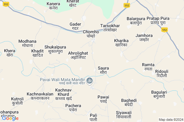
Mora
Mora Map
EDIT Map
Add Your House
 ..
..
Current Corona Virus Infected Patients Count in Bhind District
| City Name | District Name | Total Covid cases |
|---|
Locality Name :
Mora
( मोरा )
Tehsil Name : Ater
District : Bhind
State : Madhya Pradesh
Division : Chambal
Language : Hindi
Current Time 09:15 PM
Date: Wednesday , Feb 05,2025 (IST)
Time zone: IST (UTC+5:30)
Elevation / Altitude: 157 meters. Above Seal level
Telephone Code / Std Code: 07534
Assembly constituency : Ater assembly constituency
Assembly MLA : Hemant Satyadev Katare
Lok Sabha constituency : Bhind parliamentary constituency
Parliament MP : SANDHYA RAY
Serpanch Name :
Pin Code : 477555
Post Office Name : Phoop
Main Village Name : Mora
Commodities Prices : Mehgaon Market / Mandi
National Highways Reachable To Mora
Nationa High Way :NH552
Nationa High Way :NH552
Rivers Near Mora
Kunwari
Yamuna :যমুনা :યમુના :यमुना :ಯಮುನಾ :यमुना :யமுனை :Ямуна :https://1drv.ms/b/s!Ar-WXIFaX7UdgQuO6WpVrTr6YYsQ
Kunwari
Yamuna :যমুনা :યમુના :यमुना :ಯಮುನಾ :यमुना :யமுனை :Ямуна :https://1drv.ms/b/s!Ar-WXIFaX7UdgQuO6WpVrTr6YYsQ
About Mora
Correct below Info and add more info about MoraMora is a small Village/hamlet in Ater Tehsil in Bhind District of Madhya Pradesh State, India. It comes under Mora Panchayath. It belongs to Chambal Division . It is located 22 KM towards west from District head quarters Bhind. 9 KM from Ater. 465 KM from State capital Bhopal
Mora Pin code is 477555 and postal head office is Phoop .
Pawai ( 4 KM ) , Kharika ( 4 KM ) , Tarsokhar ( 5 KM ) , Niwari ( 5 KM ) , Pali ( 5 KM ) are the nearby Villages to Mora. Mora is surrounded by Jaitpur Kalan Tehsil towards North , Mehgaon Tehsil towards South , Bah Tehsil towards North , Porsa Tehsil towards west .
Porsa , Etawah , Sirsaganj , Shikohabad are the near by Cities to Mora.
This Place is in the border of the Bhind District and Agra District. Agra District Bah is North towards this place . It is near to the Uttar Pradesh State Border.
Mora 2011 Census Details
Mora Local Language is Hindi. Mora Village Total population is 1146 and number of houses are 206. Female Population is 43.0%. Village literacy rate is 57.1% and the Female Literacy rate is 19.2%.
Population
| Census Parameter | Census Data |
| Total Population | 1146 |
| Total No of Houses | 206 |
| Female Population % | 43.0 % ( 493) |
| Total Literacy rate % | 57.1 % ( 654) |
| Female Literacy rate | 19.2 % ( 220) |
| Scheduled Tribes Population % | 0.0 % ( 0) |
| Scheduled Caste Population % | 9.7 % ( 111) |
| Working Population % | 40.7 % |
| Child(0 -6) Population by 2011 | 147 |
| Girl Child(0 -6) Population % by 2011 | 38.8 % ( 57) |
Mora Census More Deatils.
Politics in Mora
Bharatiya Janata Party , BJP , INC are the major political parties in this area.Polling Stations /Booths near Mora
1)Soi No 22)Amalahedee
3)Mooratapura
4).chachar No 2
5)Maheva
HOW TO REACH Mora
By Rail
There is no railway station near to Mora in less than 10 km.Colleges near Mora
Mp Bhoj Open Univarsity Khaneta Gohad Bhind
Address :
Mission Rajiv Gandhi Bhoj Mukt College
Address :
Uday Education College
Address :
Sundarnath College
Address :
Dr.radha Raman Swankar College Lahar
Address :
Schools in Mora
M.s. Mora
Address : mora , ater , bhind , Madhya Pradesh . PIN- 477555 , Post - Phoop
Govt Health Centers near Mora
1) SHC Ahroli-Ghat , gram - Ahroli - ghat , gram - Ahroli - ghat , gram - Ahroli - ghat2) SHC Jamora , gram - Jamora , gram - Jamora , gram - Jamora
3) SHC Chomho , gram- Chomho , gram- Chomho , gram- Chomho
Sub Villages in Mora
Hospitals in Mora,Ater
Surpura Hospital
Chhidiyapura;; कुशवाह मोहल्ला; Chhidiyapura; Madhya Pradesh 477555; India
14.6 KM distance Detail
more ..
Petrol Bunks in Mora,Ater
Essar Oil Petrol Pump
Pratap Pura; Bhind; SH-2; Phoop Ater Road; Bhind; Bhind; Madhya Pradesh 477111; India
9.8 KM distance Detail
more ..
Colleges in Mora,Ater
RLD Nursing College
Surpura; SH-2; Ater Road; Bhind; Bhind; Madhya Pradesh 477111; India
13.9 KM distance Detail
Roshanlal Daipuriya College Surpura
Kachhi Ka Pura; Madhya Pradesh 477555; India
14.0 KM distance Detail
Lal Bahadur Shastri Siksha Mahavidyalaya
murlipura; jawasa; ater; bhind; India
14.9 KM distance Detail
more ..
Schools in Mora,Ater
Government Primary School
Kharika; Bhind; SH-2; Bhind; Bhind; Madhya Pradesh 477111; India
4.5 KM distance Detail
Government Primary School
Nawali Har; Bhind; SH-2; Bhind; Bhind; Madhya Pradesh 477111; India
5.2 KM distance Detail
Super Markets in Mora,Ater
Jai Guru Dev general store pratappura ater bhind
Pratap Pura; Madhya Pradesh 477111; India
9.8 KM distance Detail
Governement Offices near Mora,Ater
Tahsil Office
Gormi; Bhind; SH-19; Bhind; Bhind; Madhya Pradesh 477660; India
17.1 KM distance Detail
Sri Giraj Marriage Bureau (HARIOIDH)
Chharenta Village;bhind; Bhind; Madhya Pradesh 477001; India
19.6 KM distance Detail
About Mora &
History
How to reach Mora
Tourist Places Near By Mora
Schools in Mora
Colleges in Mora
Temperature & weather of Mora
places in Mora
Mora photos
More Information
How to reach Mora
Tourist Places Near By Mora
Schools in Mora
Colleges in Mora
Temperature & weather of Mora
places in Mora
Mora photos
More Information
Village Talk
Post News or Events about this Village
Near Cities
Porsa 27 KM near
Etawah 45 KM near
Sirsaganj 47 KM near
Shikohabad 54 KM near
Porsa 27 KM near
Etawah 45 KM near
Sirsaganj 47 KM near
Shikohabad 54 KM near
Near By Taluks
Ater 8 KM near
Jaitpur Kalan 20 KM near
Mehgaon 23 KM near
Bah 27 KM near
Ater 8 KM near
Jaitpur Kalan 20 KM near
Mehgaon 23 KM near
Bah 27 KM near
Near By Air Ports
Gwalior Airport 64 KM near
Kheria Airport 95 KM near
Kanpur Airport 201 KM near
Amausi Airport 251 KM near
Gwalior Airport 64 KM near
Kheria Airport 95 KM near
Kanpur Airport 201 KM near
Amausi Airport 251 KM near
Near By Tourist Places
Gwalior 74 KM near
Agra 93 KM near
Fatehpur Sikri 119 KM near
Sonagir 121 KM near
Datia 125 KM near
Gwalior 74 KM near
Agra 93 KM near
Fatehpur Sikri 119 KM near
Sonagir 121 KM near
Datia 125 KM near
Near By Districts
Bhind 21 KM near
Etawah 44 KM near
Firozabad 65 KM near
Morena 72 KM near
Bhind 21 KM near
Etawah 44 KM near
Firozabad 65 KM near
Morena 72 KM near
Near By RailWay Station
Etawah Junction Rail Way Station 45 KM near
Shikohabad Junction Rail Way Station 52 KM near
Etawah Junction Rail Way Station 45 KM near
Shikohabad Junction Rail Way Station 52 KM near