| Home | City Bus | Maps | Villages | Cities | Rail | Tourist Places | School | College | Pin Codes | Corona Cases Count |
| Distance Calculator Bus Services IFSC Codes Trace Mobile Number Weather Search Place Trace IP Available Cash ATM/Banks Locate Polling Booth Report an Error contact People |
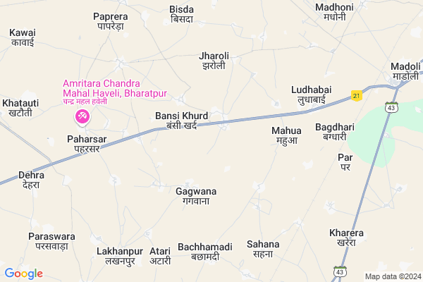
Bansi Kalan Map
EDIT Map
Add Your House
 ..
..
Current Corona Virus Infected Patients Count in Bharatpur District
| City Name | District Name | Total Covid cases |
|---|---|---|
| Bharatpur District | Bharatpur | 110 |
Locality Name :
Bansi Kalan
( बंसी कलां )
Tehsil Name : Sewar
District : Bharatpur
State : Rajasthan
Division : Bharatpur
Language : Hindi and Rajasthani, Bharatpur
Current Time 06:04 AM
Date: Saturday , Apr 26,2025 (IST)
Time zone: IST (UTC+5:30)
Elevation / Altitude: 174 meters. Above Seal level
Telephone Code / Std Code: 05644
Assembly constituency : Nadbai assembly constituency
Assembly MLA : Jagat Singh
Lok Sabha constituency : Bharatpur parliamentary constituency
Parliament MP : RANJEETA KOLI
Serpanch Name :
Pin Code : 321303
Post Office Name : Sewar
Main Village Name : Bansi Kalan
Commodities Prices : Nadwai Market / Mandi
Bansi Kalan Live Weather
Temperature: 29.6 °C
broken clouds
Humidity: 11%
Wind : 2.24 mt/sec towards SW
StationName : "LuhÄ\u0081ru"
observed on 1 Hours Back
Temperature: 29.6 °C
broken clouds
Humidity: 11%
Wind : 2.24 mt/sec towards SW
StationName : "LuhÄ\u0081ru"
observed on 1 Hours Back
Bansi Kalan Weather Forecast for Next 5 days
27-04-2025
29.5°C to 41.6°C
broken clouds, light rain, overcast clouds
29.5°C to 41.6°C
broken clouds, light rain, overcast clouds
28-04-2025
30.0°C to 42.2°C
broken clouds, overcast clouds, scattered clouds, clear sky
30.0°C to 42.2°C
broken clouds, overcast clouds, scattered clouds, clear sky
29-04-2025
29.5°C to 43.6°C
few clouds, clear sky, broken clouds, scattered clouds
29.5°C to 43.6°C
few clouds, clear sky, broken clouds, scattered clouds
30-04-2025
29.9°C to 43.9°C
clear sky
29.9°C to 43.9°C
clear sky
Edit below overview about Bansi Kalan
Edit below overview about Bansi Kalan
OverView of Bansi Kalan
Devendra Rajauriya from bansi kalan he work at Directorate Rapeseed Mustard Research (Sarson Anusandhan kendra) Sewar Bharatpur Raj.Edit below overview about Bansi Kalan
National Highways Reachable To Bansi Kalan
Nationa High Way :NH21
Nationa High Way :NH44
Nationa High Way :NH21
Nationa High Way :NH44
Rivers Near Bansi Kalan
यमुना (Yamuna) :Yamuna :यमुना
यमुना (Yamuna) :Yamuna :यमुना
यमुना (Yamuna) :Yamuna :यमुना
यमुना (Yamuna) :Yamuna :यमुना
About Bansi Kalan
Bansi Kalan is a small Village/hamlet in Sewar Tehsil in Bharatpur District of Rajasthan State, India. It comes under Bansi Kalan Panchayath. It belongs to Bharatpur Division . It is located 18 KM towards west from District head quarters Bharatpur. 20 KM from Sewar. 180 KM from State capital Jaipur
Bansi Kalan Pin code is 321303 and postal head office is Sewar .
Jharoli ( 4 KM ) , Shahpur ( 5 KM ) , Karhi ( 5 KM ) , Paharsar ( 6 KM ) , Bachhamadi ( 6 KM ) are the nearby Villages to Bansi Kalan. Bansi Kalan is surrounded by Kumher Tehsil towards North , Bharatpur Tehsil towards East , Sewar Tehsil towards East , Rupbas Tehsil towards South .
Bharatpur , Nadbai , Fatehpur Sikri , Nagar are the near by Cities to Bansi Kalan.
Bansi Kalan 2011 Census Details
Bansi Kalan Local Language is Hindi. Bansi Kalan Village Total population is 1711 and number of houses are 264. Female Population is 48.7%. Village literacy rate is 60.3% and the Female Literacy rate is 22.2%.
Population
| Census Parameter | Census Data |
| Total Population | 1711 |
| Total No of Houses | 264 |
| Female Population % | 48.7 % ( 834) |
| Total Literacy rate % | 60.3 % ( 1031) |
| Female Literacy rate | 22.2 % ( 379) |
| Scheduled Tribes Population % | 3.4 % ( 58) |
| Scheduled Caste Population % | 51.4 % ( 880) |
| Working Population % | 46.2 % |
| Child(0 -6) Population by 2011 | 263 |
| Girl Child(0 -6) Population % by 2011 | 51.7 % ( 136) |
Bansi Kalan Census More Deatils.
Politics in Bansi Kalan
Bharatiya Janata Party , BJP , BSP , INC are the major political parties in this area.Polling Stations /Booths near Bansi Kalan
1)Govt Hr Sec School Bachamadi(right Side)2)Govt Mortier Satyabir Singh Sr Sec School Gadoli(right Side)
3)Govt Primary School Vamanpura
4)Govt Upper Primary School Sundyana
5)Govt Upper Primery School Medacholi
HOW TO REACH Bansi Kalan
By Rail
Jaicholi Rail Way Station , Sewar Rail Way Station are the very nearby railway stations to Bansi Kalan.Colleges near Bansi Kalan
Govt. Engg. College Bharatpur
Address :
Schools near Bansi Kalan
Gurukuan Vidhyapeeth Komha
Address : koomha , sewar , bharatpur , Rajasthan . PIN- 321303 , Post - Sewar
New Bharathi Pub.school Malah
Address : malah , sewar , bharatpur , Rajasthan . PIN- 321001 , Post - Bharatpur
Lodhirani Avanthi S.s. N.lodha
Address : nagla lodha , sewar , bharatpur , Rajasthan . PIN- 321001 , Post - Bharatpur
Laxmi Vidhya Mandir Bajhera
Address : bajhera(s) , sewar , bharatpur , Rajasthan . PIN- 321001 , Post - Bharatpur
Govt Health Centers near Bansi Kalan
1) Paharsar , , Paharsar ,2) Paharsar , , Paharsar , Rural
3) Fatehpur , Fatehpur , Fatehpur , Fatehpur
Sub Villages in Bansi Kalan
Hospitals in Bansi Kalan,Sewar
Primary Health Center; SUB TEHSIL LAKHANPUR; BHARATPUR
Lakhanpur; Rajasthan 321028; India
7.7 KM distance Detail
Parag Haveli ; Vet.Dr. Y.S Fozzdar
Hasanpur; Rajasthan 321602 ;near bank of; 321602; India
8.1 KM distance Detail
Gov.Ayurvedic Hospital;Gauraksh Fozdar
Devendra Saini Route Hasanpur Rajasthan bard nom 5; 321602; India
8.2 KM distance Detail
more ..
Petrol Bunks in Bansi Kalan,Sewar
HP Petrol Pump
Vill Bansi Khurd Jaipur Agra Road NH 11 Dist Bharatpur; Kota; Rajasthan 321001; India
1.6 KM distance Detail
Nandini Filling Station-Hindustan Petroleum
Sevar; Bharatpur; NH-11; Bharatpur Road; Bharatpur; Bharatpur; Rajasthan 321301; India
1.6 KM distance Detail
HP Petrol Pump - CountryRoad Filling Station
Village Paharsar Jaipur-bharatpur Road; NH-11 TEH Nadbai; Kota; Rajasthan 321602; India
7.5 KM distance Detail
more ..
Electronic Shops in Bansi Kalan,Sewar
chaudhary vans computer & E-Mitra center
Mahnar Main Rd; Jahangirpur Sham; Bihar 321028; India
10.9 KM distance Detail
Super Markets in Bansi Kalan,Sewar
Parag/Dr.Ys RTe
parag fozdar RTE; near; Devendra Saini Rte; Hasanpur; Rajasthan 321602; India
8.3 KM distance Detail
About Bansi Kalan &
History
How to reach Bansi Kalan
Tourist Places Near By Bansi Kalan
Schools in Bansi Kalan
Colleges in Bansi Kalan
Temperature & weather of Bansi Kalan
places in Bansi Kalan
Bansi Kalan photos
More Information
How to reach Bansi Kalan
Tourist Places Near By Bansi Kalan
Schools in Bansi Kalan
Colleges in Bansi Kalan
Temperature & weather of Bansi Kalan
places in Bansi Kalan
Bansi Kalan photos
More Information
Village Talk
Post News or Events about this Village
Near Cities
Bharatpur 16 KM near
Nadbai 18 KM near
Fatehpur Sikri 36 KM near
Nagar 43 KM near
Bharatpur 16 KM near
Nadbai 18 KM near
Fatehpur Sikri 36 KM near
Nagar 43 KM near
Near By Taluks
Nadbai 16 KM near
Kumher 17 KM near
Bharatpur 18 KM near
Sewar 19 KM near
Nadbai 16 KM near
Kumher 17 KM near
Bharatpur 18 KM near
Sewar 19 KM near
Near By Air Ports
Kheria Airport 67 KM near
Gwalior Airport 145 KM near
Indira Gandhi International Airport 176 KM near
Sanganeer Airport 176 KM near
Kheria Airport 67 KM near
Gwalior Airport 145 KM near
Indira Gandhi International Airport 176 KM near
Sanganeer Airport 176 KM near
Near By Tourist Places
Bharatpur 16 KM near
Fatehpur Sikri 35 KM near
Govardhan 43 KM near
Mathura 54 KM near
Vrindavan 64 KM near
Bharatpur 16 KM near
Fatehpur Sikri 35 KM near
Govardhan 43 KM near
Mathura 54 KM near
Vrindavan 64 KM near
Near By Districts
Bharatpur 18 KM near
Mathura 55 KM near
Agra 72 KM near
Mahamaya Nagar 83 KM near
Bharatpur 18 KM near
Mathura 55 KM near
Agra 72 KM near
Mahamaya Nagar 83 KM near
Near By RailWay Station
Jaicholi Rail Way Station 6.7 KM near
Sewar Rail Way Station 9.0 KM near
Nadbai Rail Way Station 17 KM near
Bharatpur Junction Rail Way Station 18 KM near
Jaicholi Rail Way Station 6.7 KM near
Sewar Rail Way Station 9.0 KM near
Nadbai Rail Way Station 17 KM near
Bharatpur Junction Rail Way Station 18 KM near