| Home | City Bus | Maps | Villages | Cities | Rail | Tourist Places | School | College | Pin Codes | Corona Cases Count |
| Distance Calculator Bus Services IFSC Codes Trace Mobile Number Weather Search Place Trace IP Available Cash ATM/Banks Locate Polling Booth Report an Error contact People |
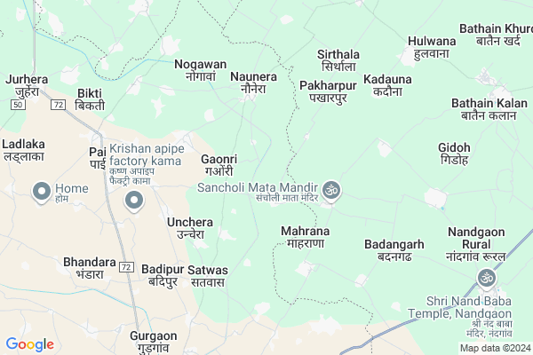
Pathwari Map
EDIT Map
Add Your House
 ..
..
Current Corona Virus Infected Patients Count in Bharatpur District
| City Name | District Name | Total Covid cases |
|---|---|---|
| Bharatpur District | Bharatpur | 110 |
Locality Name :
Pathwari
( पथवारी )
Tehsil Name : Kaman
District : Bharatpur
State : Rajasthan
Division : Bharatpur
Language : Hindi and Rajasthani, Bharatpur
Current Time 11:07 AM
Date: Tuesday , Apr 29,2025 (IST)
Time zone: IST (UTC+5:30)
Elevation / Altitude: 181 meters. Above Seal level
Telephone Code / Std Code: 05640
Assembly constituency : Kaman assembly constituency
Assembly MLA : Nauksham
Lok Sabha constituency : Bharatpur parliamentary constituency
Parliament MP : RANJEETA KOLI
Serpanch Name :
Pin Code : 321023
Post Office Name : Jurhera
Main Village Name : Pathwari
Commodities Prices : Kosikalan Market / Mandi
Pathwari Live Weather
Temperature: 35.5 °C
clear sky
Humidity: 20%
Wind : 5.36 mt/sec towards E
StationName : "KÄ\u0081man"
observed on 43 Mins Back
Temperature: 35.5 °C
clear sky
Humidity: 20%
Wind : 5.36 mt/sec towards E
StationName : "KÄ\u0081man"
observed on 43 Mins Back
Pathwari Weather Forecast for Next 5 days
30-04-2025
29.8°C to 40.2°C
clear sky
29.8°C to 40.2°C
clear sky
01-05-2025
28.2°C to 42.8°C
clear sky
28.2°C to 42.8°C
clear sky
02-05-2025
29.5°C to 43.9°C
clear sky, scattered clouds, few clouds, overcast clouds
29.5°C to 43.9°C
clear sky, scattered clouds, few clouds, overcast clouds
03-05-2025
29.1°C to 42.3°C
overcast clouds, broken clouds, scattered clouds, light rain
29.1°C to 42.3°C
overcast clouds, broken clouds, scattered clouds, light rain
04-05-2025
28.7°C to 41.2°C
light rain, overcast clouds, broken clouds
28.7°C to 41.2°C
light rain, overcast clouds, broken clouds
National Highways Reachable To Pathwari
Nationa High Way :NH248A
Nationa High Way :NH248A
Rivers Near Pathwari
Karwan Nadi
Mathura Escape
Karwan Nadi
Mathura Escape
About Pathwari
Correct below Info and add more info about PathwariPathwari is a small Village/hamlet in Kaman Tehsil in Bharatpur District of Rajasthan State, India. It comes under Pathwari Panchayath. It belongs to Bharatpur Division . It is located 72 KM towards North from District head quarters Bharatpur. 11 KM from Kaman. 202 KM from State capital Jaipur
Pathwari Pin code is 321023 and postal head office is Jurhera .
Pai ( 7 KM ) , Nandera ( 7 KM ) , Bhandara ( 8 KM ) , Dhilabati ( 9 KM ) , Udaka ( 9 KM ) are the nearby Villages to Pathwari. Pathwari is surrounded by Kaman Tehsil towards west , Punahana Tehsil towards North , Chhata Tehsil towards East , Hodal Tehsil towards North .
Hodal , Nagar , Vrindavan , Palwal are the near by Cities to Pathwari.
This Place is in the border of the Bharatpur District and Mathura District. Mathura District Nandgaon is East towards this place . It is near to the Uttar Pradesh State Border.
Pathwari 2011 Census Details
Pathwari Local Language is Hindi. Pathwari Village Total population is 942 and number of houses are 146. Female Population is 46.9%. Village literacy rate is 62.7% and the Female Literacy rate is 22.8%.
Population
| Census Parameter | Census Data |
| Total Population | 942 |
| Total No of Houses | 146 |
| Female Population % | 46.9 % ( 442) |
| Total Literacy rate % | 62.7 % ( 591) |
| Female Literacy rate | 22.8 % ( 215) |
| Scheduled Tribes Population % | 0.0 % ( 0) |
| Scheduled Caste Population % | 8.1 % ( 76) |
| Working Population % | 27.9 % |
| Child(0 -6) Population by 2011 | 152 |
| Girl Child(0 -6) Population % by 2011 | 44.1 % ( 67) |
Pathwari Census More Deatils.
Politics in Pathwari
Bharatiya Janata Party , BJP , INC are the major political parties in this area.Polling Stations /Booths near Pathwari
1)Govt.upper Primary School Netwari2)Govt Primary School Kanwadi
3)Govt Sec. Secondary School Saheda
4)Govt.upper Primary School Kherli Gumani
5)Govt Secondary School Aichwara
HOW TO REACH Pathwari
By Rail
There is no railway station near to Pathwari in less than 10 km.Colleges near Pathwari
Bsm Brij Gorav Collage
Address :
Guru Madhvanand Pratima College
Address :
Kms Iti College
Address :
Shree Bhavarlal Shastri Sanskrit College
Address :
Sanskar College Nadbai
Address :
Schools near Pathwari
Saraswati Vidhya Mandir Kaman
Address : np kaman_ward no , kaman , bharatpur , Rajasthan . PIN- 321022 , Post - Kamanlsg
Genius Pub. School
Address : np kaman_ward no , kaman , bharatpur , Rajasthan . PIN- 321022 , Post - Kamanlsg
Govt Ups Sasnk. S. Gayakund Ka
Address : np kaman_ward no , kaman , bharatpur , Rajasthan . PIN- 321022 , Post - Kamanlsg
Govt. Ups. Sansk. S. Kot Kaman
Address : np kaman_ward no , kaman , bharatpur , Rajasthan . PIN- 321022 , Post - Kamanlsg
Govt Health Centers near Pathwari
1) Ladlaka , , ,2) Udaka , , ,
3) Andhwari , , ,
Sub Villages in Pathwari
Hospitals in Pathwari,Kaman
Akansh Nursing Home
Kosi - Kamar Rd; Kosi Kalan; Uttar Pradesh 281403; India
15.7 KM distance Detail
SG Pathology Center
Bhore ji Market. Bathen Gate; Kosi - Kamar Rd; Kosi Kalan; Uttar Pradesh 281403; India
15.7 KM distance Detail
BPL Nursing Home P Ltd.
BPL Nursing Home; Kosi Kalan; Uttar Pradesh 281403; India
16.0 KM distance Detail
more ..
Petrol Bunks in Pathwari,Kaman
HP PETROL PUMP - NAND AUTO
Kosi Nandgaon Road Vill: Survari; TEH: Chhata Dist:; Agra; Uttar Pradesh 281403; India
13.6 KM distance Detail
JAIN TRANSPORT & GENERAL TRADING CO
KOSI KALAN; MATHURA; Uttar Pradesh 281403; India
16.4 KM distance Detail
more ..
Colleges in Pathwari,Kaman
Bdm iti
mavssal petch kosikakan mathura; Kosi Kalan; Uttar Pradesh 281403; India
12.8 KM distance Detail
Sri Brij Behari Degree College
Nandgaon Road; Kosikalan; Mathura; Uttar Pradesh 281403; India
12.8 KM distance Detail
BRIJ ITI
NH-2; 102 mile stone; Bypass road; Mathura District; Kosi Kalan; Uttar Pradesh 281403; India
16.5 KM distance Detail
Iti College
behind sharma petrol pump NH2; Kosi Kalan; Uttar Pradesh 281403; India
16.9 KM distance Detail
more ..
Electronic Shops in Pathwari,Kaman
Shri ram photo stat
syndicate bank ke samne old g.t.road. kosikalan mathura; Kosi Kalan; Uttar Pradesh 281403; India
12.8 KM distance Detail
Jeet music centers
bhikagari post bharchawali teh chhata mathura up; agra; Uttar Pradesh 281403; India
12.8 KM distance Detail
Super Markets in Pathwari,Kaman
Kapeesh Garg Brijwasi's Town
Old G T Rd; Kosi Kalan; Uttar Pradesh 281403; India
17.0 KM distance Detail
Governement Offices near Pathwari,Kaman
Regional Transport Office
Kosi Border; Mathura; NH-2; Delhi Agra Road; Kosi Kalan; Kosi Kalan; Uttar Pradesh 281403; India
18.0 KM distance Detail
Assistant Commissioner Office Commercial Tax
Kosi Border; Mathura; NH-2; Delhi Agra Road; Kosi Kalan; Kosi Kalan; Uttar Pradesh 281403; India
18.1 KM distance Detail
About Pathwari &
History
How to reach Pathwari
Tourist Places Near By Pathwari
Schools in Pathwari
Colleges in Pathwari
Temperature & weather of Pathwari
places in Pathwari
Pathwari photos
More Information
How to reach Pathwari
Tourist Places Near By Pathwari
Schools in Pathwari
Colleges in Pathwari
Temperature & weather of Pathwari
places in Pathwari
Pathwari photos
More Information
Village Talk
Post News or Events about this Village
Near Cities
Hodal 19 KM near
Nagar 45 KM near
Vrindavan 48 KM near
Palwal 49 KM near
Hodal 19 KM near
Nagar 45 KM near
Vrindavan 48 KM near
Palwal 49 KM near
Near By Taluks
Nandgaon 8 KM near
Kaman 11 KM near
Punahana 19 KM near
Chhata 23 KM near
Nandgaon 8 KM near
Kaman 11 KM near
Punahana 19 KM near
Chhata 23 KM near
Near By Air Ports
Indira Gandhi International Airport 102 KM near
Kheria Airport 103 KM near
Sanganeer Airport 202 KM near
Gwalior Airport 208 KM near
Indira Gandhi International Airport 102 KM near
Kheria Airport 103 KM near
Sanganeer Airport 202 KM near
Gwalior Airport 208 KM near
Near By Tourist Places
Dabchick 20 KM near
Govardhan 35 KM near
Vrindavan 48 KM near
Mathura 52 KM near
Nuh 54 KM near
Dabchick 20 KM near
Govardhan 35 KM near
Vrindavan 48 KM near
Mathura 52 KM near
Nuh 54 KM near
Near By Districts
Palwal 49 KM near
Mathura 52 KM near
Mewat 54 KM near
Bharatpur 69 KM near
Palwal 49 KM near
Mathura 52 KM near
Mewat 54 KM near
Bharatpur 69 KM near
Near By RailWay Station
Kosi Kalan Rail Way Station 16 KM near
Chata Rail Way Station 21 KM near
Kosi Kalan Rail Way Station 16 KM near
Chata Rail Way Station 21 KM near