| Home | City Bus | Maps | Villages | Cities | Rail | Tourist Places | School | College | Pin Codes | Corona Cases Count |
| Distance Calculator Bus Services IFSC Codes Trace Mobile Number Weather Search Place Trace IP Available Cash ATM/Banks Locate Polling Booth Report an Error contact People |
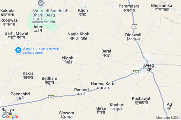
Bandha Khalsa Map
EDIT Map
Add Your House
 ..
..
Current Corona Virus Infected Patients Count in Bharatpur District
| City Name | District Name | Total Covid cases |
|---|---|---|
| Bharatpur District | Bharatpur | 110 |
Locality Name :
Bandha Khalsa
( बंधा खालसा )
Tehsil Name : Deeg
District : Bharatpur
State : Rajasthan
Division : Bharatpur
Language : Hindi and Rajasthani, Bharatpur
Current Time 10:07 PM
Date: Sunday , Apr 27,2025 (IST)
Time zone: IST (UTC+5:30)
Elevation / Altitude: 181 meters. Above Seal level
Telephone Code / Std Code: 05641
Assembly constituency : Nagar assembly constituency
Assembly MLA : Jawaharsingh Bedham
Lok Sabha constituency : Bharatpur parliamentary constituency
Parliament MP : RANJEETA KOLI
Serpanch Name :
Pin Code : 321203
Post Office Name : Deeg
Main Village Name : Bandha Khalsa
Commodities Prices : Nagar Market / Mandi
National Highways Reachable To Bandha Khalsa
Nationa High Way :NH21
Nationa High Way :NH21
Rivers Near Bandha Khalsa
यमुना (Yamuna) :Yamuna :यमुना
यमुना (Yamuna) :Yamuna :यमुना
यमुना (Yamuna) :Yamuna :यमुना
यमुना (Yamuna) :Yamuna :यमुना
About Bandha Khalsa
Correct below Info and add more info about Bandha KhalsaBandha Khalsa is a small Village/hamlet in Deeg Tehsil in Bharatpur District of Rajasthan State, India. It comes under Bandha Khalsa Panchayath. It belongs to Bharatpur Division . It is located 43 KM towards North from District head quarters Bharatpur. 4 KM from Deeg. 181 KM from State capital Jaipur
Bandha Khalsa Pin code is 321203 and postal head office is Deeg .
Panhori ( 3 KM ) , Khohri ( 5 KM ) , Bedham ( 5 KM ) , Didawali ( 6 KM ) , Khoh ( 7 KM ) are the nearby Villages to Bandha Khalsa. Bandha Khalsa is surrounded by Nagar Pahari Tehsil towards west , Govardhan Tehsil towards East , Kumher Tehsil towards South , Kaman Tehsil towards North .
Nagar , Nadbai , Bharatpur , Mathura are the near by Cities to Bandha Khalsa.
This Place is in the border of the Bharatpur District and Mathura District. Mathura District Govardhan is East towards this place . It is near to the Uttar Pradesh State Border.
Bandha Khalsa 2011 Census Details
Bandha Khalsa Local Language is Hindi. Bandha Khalsa Village Total population is 594 and number of houses are 90. Female Population is 47.3%. Village literacy rate is 55.7% and the Female Literacy rate is 21.5%.
Population
| Census Parameter | Census Data |
| Total Population | 594 |
| Total No of Houses | 90 |
| Female Population % | 47.3 % ( 281) |
| Total Literacy rate % | 55.7 % ( 331) |
| Female Literacy rate | 21.5 % ( 128) |
| Scheduled Tribes Population % | 0.0 % ( 0) |
| Scheduled Caste Population % | 28.5 % ( 169) |
| Working Population % | 49.8 % |
| Child(0 -6) Population by 2011 | 128 |
| Girl Child(0 -6) Population % by 2011 | 46.1 % ( 59) |
Bandha Khalsa Census More Deatils.
Politics in Bandha Khalsa
Bharatiya Janata Party , BJP , BSP , INC , NPP are the major political parties in this area.Polling Stations /Booths near Bandha Khalsa
1)Bajaheda2)Narena Katata
3)Nigohi
4)Narena Choth
5)Panhori
HOW TO REACH Bandha Khalsa
By Rail
Bedham Rail Way Station , Deeg Rail Way Station are the very nearby railway stations to Bandha Khalsa.Colleges near Bandha Khalsa
Bsm Brij Gorav Collage
Address :
Guru Madhvanand Pratima College
Address :
Kms Iti College
Address :
Shree Bhavarlal Shastri Sanskrit College
Address :
Sanskar College Nadbai
Address :
Schools in Bandha Khalsa
Govt Ps Bandha Khalsa
Address : bandha khalsa , deeg , bharatpur , Rajasthan . PIN- 321203 , Post - Deeg
Govt Health Centers near Bandha Khalsa
1) NOTIONAL Khoh , , ,2) Aau , hospital , ,
3) Baroli Chouth , , ,
Sub Villages in Bandha Khalsa
Hospitals in Bandha Khalsa,Deeg
Sub Health Center
Nagar - Banainy Dhounkla Rd; Nagar; Rajasthan 321205; India
11.1 KM distance Detail
more ..
Petrol Bunks in Bandha Khalsa,Deeg
Radharani Service Station-Essar Oil Petrol Pump
Ding; Bharatpur; SH-14; Bharatpur Road; Deeg; Deeg; Rajasthan 321203; India
3.7 KM distance Detail
Ghau Filling Station-Bharat Petroleum
Ding; Bharatpur; SH-14; Bharatpur Road; Deeg; Deeg; Rajasthan 321203; India
4.9 KM distance Detail
more ..
Colleges in Bandha Khalsa,Deeg
Government Senior Secondary School Januthar
januthar;deeg;bharatpur;321206; Mawai - Moroli Rd; Janoothar; Rajasthan 321206; India
13.1 KM distance Detail
Dr. BR AMBEDKAR RSCIT CENTER JANUTHAR
Alwar - Bharatpur Rd; Janoothar; Rajasthan 321206; India
13.3 KM distance Detail
Maharaja Surajmal College Januthar
Nadbai Road;Januthar; Janoothar; Rajasthan 321206; India
14.0 KM distance Detail
Shree Chamunda Devi Girls College
Bharatpur; SH-43; Bharatpur Road; Kumher; Rajasthan 321602; India
18.0 KM distance Detail
more ..
Schools in Bandha Khalsa,Deeg
Government High School
Ding; Bharatpur; SH-14; Bharatpur Road; Deeg; Deeg; Rajasthan 321203; India
3.8 KM distance Detail
भागवत रसिक सुप्रसिद्ध रमाकान्त पारासर जी
Bavan Nangla; Rajasthan 321203; India
4.3 KM distance Detail
Electronic Shops in Bandha Khalsa,Deeg
Pandit Rohitash Dj Januthar
Janoothar - Ankholi Rd; Therawar; Rajasthan 321201; India
14.7 KM distance Detail
Super Markets in Bandha Khalsa,Deeg
Jai Hanuman Enterprises Janutar Deeg Bharatpur Rajasthan
Choudhary Charan Singh Marg; Janoothar; Rajasthan 321206; India
12.6 KM distance Detail
Governement Offices near Bandha Khalsa,Deeg
Atal Seva Center
Nagar - Banainy Dhounkla Rd; Nagar; Rajasthan 321205; India
11.0 KM distance Detail
About Bandha Khalsa &
History
How to reach Bandha Khalsa
Tourist Places Near By Bandha Khalsa
Schools in Bandha Khalsa
Colleges in Bandha Khalsa
Temperature & weather of Bandha Khalsa
places in Bandha Khalsa
Bandha Khalsa photos
More Information
How to reach Bandha Khalsa
Tourist Places Near By Bandha Khalsa
Schools in Bandha Khalsa
Colleges in Bandha Khalsa
Temperature & weather of Bandha Khalsa
places in Bandha Khalsa
Bandha Khalsa photos
More Information
Village Talk
Post News or Events about this Village
Near Cities
Nagar 18 KM near
Nadbai 33 KM near
Bharatpur 41 KM near
Mathura 46 KM near
Nagar 18 KM near
Nadbai 33 KM near
Bharatpur 41 KM near
Mathura 46 KM near
Near By Taluks
Deeg 4 KM near
Nagar Pahari 21 KM near
Govardhan 24 KM near
Kumher 24 KM near
Deeg 4 KM near
Nagar Pahari 21 KM near
Govardhan 24 KM near
Kumher 24 KM near
Near By Air Ports
Kheria Airport 87 KM near
Indira Gandhi International Airport 135 KM near
Sanganeer Airport 181 KM near
Gwalior Airport 182 KM near
Kheria Airport 87 KM near
Indira Gandhi International Airport 135 KM near
Sanganeer Airport 181 KM near
Gwalior Airport 182 KM near
Near By Tourist Places
Govardhan 22 KM near
Bharatpur 41 KM near
Mathura 45 KM near
Vrindavan 49 KM near
Dabchick 53 KM near
Govardhan 22 KM near
Bharatpur 41 KM near
Mathura 45 KM near
Vrindavan 49 KM near
Dabchick 53 KM near
Near By Districts
Bharatpur 41 KM near
Mathura 45 KM near
Alwar 73 KM near
Mewat 82 KM near
Bharatpur 41 KM near
Mathura 45 KM near
Alwar 73 KM near
Mewat 82 KM near
Near By RailWay Station
Bedham Rail Way Station 6.8 KM near
Deeg Rail Way Station 7.5 KM near
Nadbai Rail Way Station 33 KM near
Bharatpur Junction Rail Way Station 39 KM near
Bedham Rail Way Station 6.8 KM near
Deeg Rail Way Station 7.5 KM near
Nadbai Rail Way Station 33 KM near
Bharatpur Junction Rail Way Station 39 KM near