| Home | City Bus | Maps | Villages | Cities | Rail | Tourist Places | School | College | Pin Codes | Corona Cases Count |
| Distance Calculator Bus Services IFSC Codes Trace Mobile Number Weather Search Place Trace IP Available Cash ATM/Banks Locate Polling Booth Report an Error contact People |
Bothiya Raiyat
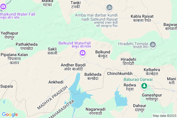
Bothiya Raiyat Map
EDIT Map
Add Your House
 ..
..
Current Corona Virus Infected Patients Count in Betul District
| City Name | District Name | Total Covid cases |
|---|---|---|
| Betul District | Betul | 1 |
Locality Name :
Bothiya Raiyat
( बोथिया रैयत )
Tehsil Name : Athner
District : Betul
State : Madhya Pradesh
Division : Narmadapuram
Language : Hindi
Current Time 11:17 PM
Date: Friday , Apr 25,2025 (IST)
Time zone: IST (UTC+5:30)
Elevation / Altitude: 644 meters. Above Seal level
Telephone Code / Std Code: 07144
Assembly constituency : Bhainsdehi assembly constituency
Assembly MLA : Mahendra Singh Keshar Singh Chouhan
Lok Sabha constituency : Betul parliamentary constituency
Parliament MP : DURGA DAS (D.D.) UIKEY
Serpanch Name :
Pin Code : 460220
Post Office Name : Bhainsdehi
Main Village Name : Bothiya Raiyat
Commodities Prices : Chandur Bazar Market / Mandi
National Highways Reachable To Bothiya Raiyat
Nationa High Way :NH47
Nationa High Way :NH47
Rivers Near Bothiya Raiyat
Tawa
Purna
Tawa
Purna
About Bothiya Raiyat
Correct below Info and add more info about Bothiya RaiyatBothiya Raiyat is a small Village/hamlet in Athner Tehsil in Betul District of Madhya Pradesh State, India. It comes under Bothiya Raiyat Panchayath. It belongs to Narmadapuram Division . It is located 64 KM towards South from District head quarters Betul. 26 KM from Athnair. 243 KM from State capital Bhopal
Bothiya Raiyat Pin code is 460220 and postal head office is Bhainsdehi .
Temni ( 13 KM ) , Kordi ( 13 KM ) , Kothalkund ( 15 KM ) , Dhaba ( 15 KM ) , Bothi ( 15 KM ) are the nearby Villages to Bothiya Raiyat. Bothiya Raiyat is surrounded by Athner Tehsil towards North , Bhainsdehi Tehsil towards North , Morshi Tehsil towards East , Achalpur Tehsil towards west .
Morshi , Achalpur , Warud , Amravati are the near by Cities to Bothiya Raiyat.
Bothiya Raiyat 2011 Census Details
Bothiya Raiyat Local Language is Hindi. Bothiya Raiyat Village Total population is 311 and number of houses are 61. Female Population is 47.9%. Village literacy rate is 59.5% and the Female Literacy rate is 25.7%.
Population
| Census Parameter | Census Data |
| Total Population | 311 |
| Total No of Houses | 61 |
| Female Population % | 47.9 % ( 149) |
| Total Literacy rate % | 59.5 % ( 185) |
| Female Literacy rate | 25.7 % ( 80) |
| Scheduled Tribes Population % | 97.1 % ( 302) |
| Scheduled Caste Population % | 0.6 % ( 2) |
| Working Population % | 55.6 % |
| Child(0 -6) Population by 2011 | 48 |
| Girl Child(0 -6) Population % by 2011 | 45.8 % ( 22) |
Bothiya Raiyat Census More Deatils.
Politics in Bothiya Raiyat
Bharatiya Janata Party , BJP , INC are the major political parties in this area.Polling Stations /Booths near Bothiya Raiyat
1)Bothiya2)Bakka
3)Bakud-1
4)Bakud-2
5)Beldhana
HOW TO REACH Bothiya Raiyat
By Rail
There is no railway station near to Bothiya Raiyat in less than 10 km.Colleges near Bothiya Raiyat
V V M College Betul
Address :
Jayawanti Haxar Government College
Address :
J H College Betul
Address :
Bhimrao Ramrao Ambedkar College Of Education
Address : Bhimrao Ramrao Ambedkar College Of Educationchakka
The Law College
Address : The Law Collegebehind Police Stationbetulmadhya Pr
Schools in Bothiya Raiyat
P.s.bothiya Raiyat
Address : bothiya raiyat , athner , betul , Madhya Pradesh . PIN- 460220 , Post - Bhainsdehi
Govt Health Centers near Bothiya Raiyat
1) SHC Andherbawdi , SHC Andherbawdi , Main road , Near Higher Sec. school2) SHC Belkund , SHC Belkund , On the road , Near Higher Sec. school
3) SHC Satkund , SHC Satkund , Near by Primary School , Near Higher Sec. school
Sub Villages in Bothiya Raiyat
Petrol Bunks in Bothiya Raiyat,Athner
Bpcl Abhijeet Fuel
Shirajgaon kasaba; Shirajgaon Kasba; Maharashtra 444810; India
19.3 KM distance Detail
more ..
Schools in Bothiya Raiyat,Athner
Zila Parishad Urdu Primary School Ghatladki
Ghatladki; Maharashtra 444905; India
10.5 KM distance Detail
Maulana Abul Kalam Azad Urdu High School Ghatladki
Ghatladki Rd; Mamadapur; Maharashtra 444905; India
10.9 KM distance Detail
Local Parks in Bothiya Raiyat,Athner
Police Stations near Bothiya Raiyat,Athner
About Bothiya Raiyat &
History
How to reach Bothiya Raiyat
Tourist Places Near By Bothiya Raiyat
Schools in Bothiya Raiyat
Colleges in Bothiya Raiyat
Temperature & weather of Bothiya Raiyat
places in Bothiya Raiyat
Bothiya Raiyat photos
More Information
How to reach Bothiya Raiyat
Tourist Places Near By Bothiya Raiyat
Schools in Bothiya Raiyat
Colleges in Bothiya Raiyat
Temperature & weather of Bothiya Raiyat
places in Bothiya Raiyat
Bothiya Raiyat photos
More Information
Village Talk
Post News or Events about this Village
Near Cities
Morshi 27 KM near
Achalpur 36 KM near
Warud 56 KM near
Amravati 60 KM near
Morshi 27 KM near
Achalpur 36 KM near
Warud 56 KM near
Amravati 60 KM near
Near By Taluks
Chandur Bz 21 KM near
Athner 25 KM near
Morshi 27 KM near
Bhainsdehi 27 KM near
Chandur Bz 21 KM near
Athner 25 KM near
Morshi 27 KM near
Bhainsdehi 27 KM near
Near By Air Ports
Sonegaon Airport 153 KM near
Bhopal Airport 237 KM near
Indore Airport 279 KM near
Nanded Airport 283 KM near
Sonegaon Airport 153 KM near
Bhopal Airport 237 KM near
Indore Airport 279 KM near
Nanded Airport 283 KM near
Near By Tourist Places
Chikhaldara Wildlife Sanctuary 52 KM near
Amravati 61 KM near
Melghat Tiger Reserve 73 KM near
Sevagram 127 KM near
Itarsi 149 KM near
Chikhaldara Wildlife Sanctuary 52 KM near
Amravati 61 KM near
Melghat Tiger Reserve 73 KM near
Sevagram 127 KM near
Itarsi 149 KM near
Near By Districts
Amravati 62 KM near
Betul 62 KM near
Akola 127 KM near
Wardha 127 KM near
Amravati 62 KM near
Betul 62 KM near
Akola 127 KM near
Wardha 127 KM near
Near By RailWay Station
Betul Rail Way Station 61 KM near
Amravati Rail Way Station 64 KM near
Betul Rail Way Station 61 KM near
Amravati Rail Way Station 64 KM near