| Home | City Bus | Maps | Villages | Cities | Rail | Tourist Places | School | College | Pin Codes | Corona Cases Count |
| Distance Calculator Bus Services IFSC Codes Trace Mobile Number Weather Search Place Trace IP Available Cash ATM/Banks Locate Polling Booth Report an Error contact People |
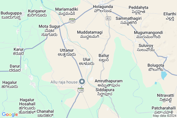
Ulur Map
EDIT Map
Add Your House
 ..
..
Current Corona Virus Infected Patients Count in Bellary District
| City Name | District Name | Total Covid cases |
|---|---|---|
| Hospete | Ballari | 7 |
| Hospet | Ballari | 3 |
| Ballari District | Ballari | 2 |
| Bellary | Ballari | 1 |
Locality Name :
Ulur
( ಉಲೂರ್ )
Taluk Name : Siruguppa
District : Bellary
State : Karnataka
Division : Gulbarga
Language : Kannada and Telugu, Dakhni, Hindi, English
Current Time 05:06 AM
Date: Saturday , Apr 26,2025 (IST)
Time zone: IST (UTC+5:30)
Elevation / Altitude: 480 meters. Above Seal level
Telephone Code / Std Code: 08396
Assembly constituency : Siruguppa assembly constituency
Assembly MLA : B. M. Nagaraja
Lok Sabha constituency : Koppal parliamentary constituency
Parliament MP : KARADI SANGANNA AMARAPPA
Serpanch Name :
Main Village Name : Ulur
Commodities Prices : Alur Market / Mandi
Ulur Live Weather
Temperature: 29.9 °C
broken clouds
Humidity: 53%
Wind : 2.9 mt/sec towards SE
StationName : "Tekkalakote"
observed on Now
Temperature: 29.9 °C
broken clouds
Humidity: 53%
Wind : 2.9 mt/sec towards SE
StationName : "Tekkalakote"
observed on Now
Ulur Weather Forecast for Next 5 days
27-04-2025
30.0°C to 40.6°C
broken clouds, scattered clouds, light rain
30.0°C to 40.6°C
broken clouds, scattered clouds, light rain
28-04-2025
29.1°C to 35.9°C
light rain, overcast clouds, broken clouds
29.1°C to 35.9°C
light rain, overcast clouds, broken clouds
29-04-2025
28.1°C to 39.7°C
scattered clouds, few clouds, clear sky, light rain, broken clouds, overcast clouds
28.1°C to 39.7°C
scattered clouds, few clouds, clear sky, light rain, broken clouds, overcast clouds
30-04-2025
28.1°C to 40.8°C
broken clouds, few clouds, clear sky, scattered clouds
28.1°C to 40.8°C
broken clouds, few clouds, clear sky, scattered clouds
National Highways Reachable To Ulur
Nationa High Way :NH50
Nationa High Way :NH50
Rivers Near Ulur
Uzhavoor River
Kapra
Uzhavoor River
Kapra
About Ulur
Correct below Info and add more info about UlurUlur is a small Village/hamlet in Siruguppa Taluk in Bellary District of Karnataka State, India. It comes under Ulur Panchayath. It belongs to Gulbarga Division . It is located 39 KM towards North from District head quarters Bellary. 24 KM from Siruguppa. 327 KM from State capital Bangalore
Karur ( 10 KM ) , H. Hosahalli ( 10 KM ) , Basarakod ( 11 KM ) , Handihal ( 13 KM ) , Balakundhi ( 16 KM ) are the nearby Villages to Ulur. Ulur is surrounded by Halaharvi Taluk towards East , Siruguppa Taluk towards North , Alur Taluk towards East , Bellary Taluk towards South .
Tekkalakota , Siruguppa , Adoni , Bellary are the near by Cities to Ulur.
Ulur 2011 Census Details
Ulur Local Language is Kannada. Ulur Village Total population is 2260 and number of houses are 409. Female Population is 50.4%. Village literacy rate is 46.0% and the Female Literacy rate is 16.9%.
Population
| Census Parameter | Census Data |
| Total Population | 2260 |
| Total No of Houses | 409 |
| Female Population % | 50.4 % ( 1140) |
| Total Literacy rate % | 46.0 % ( 1040) |
| Female Literacy rate | 16.9 % ( 383) |
| Scheduled Tribes Population % | 6.1 % ( 138) |
| Scheduled Caste Population % | 8.5 % ( 191) |
| Working Population % | 55.9 % |
| Child(0 -6) Population by 2011 | 355 |
| Girl Child(0 -6) Population % by 2011 | 45.6 % ( 162) |
Ulur Census More Deatils.
Politics in Ulur
Bharatiya Janata Party , BJP , Bharatiya Janata Party (BJP) , INC are the major political parties in this area.Polling Stations /Booths near Ulur
1)Government Higher Primary School Old Building Bandral2)Grama Panchayath Office Hagalor Hosahalli
3)Government Higher Primary School(north Wing) Kenchangudda
4)Government Higher Primary
5)Grama Panchayath Office Ravihal
HOW TO REACH Ulur
By Road
Bellary is the Nearest Town to Ulur. Bellary is 32 km from Ulur. Road connectivity is there from Bellary to Ulur.By Rail
There is no railway station near to Ulur in less than 10 km. How ever there are railway Stations from Near By town Bellary. are the railway Stations near to Bellary. You can reach from Bellary to Ulur by road after .Pincodes near Ulur
583120 ( Sirigere (Bellary) ) , 583117 ( Moka ) , 583122 ( Tekkalakota )Colleges near Ulur
Appollo Institute Of Mangement
Address : Siruguppa, Bellary District.
Schools near Ulur
G. Adarsha Vidayala Siruguppa
Address : siruguppa , siruguppa , bellary , Karnataka . PIN- 583121 , Post - Siruguppa Sadashivanagar
Murarji Desai Residency Sgp
Address : siruguppa , siruguppa , bellary , Karnataka . PIN- 583121 , Post - Siruguppa Sadashivanagar
Lps Rajeevgandhi Mem V.s
Address : siruguppa , siruguppa , bellary , Karnataka . PIN- 583121 , Post - Siruguppa Sadashivanagar
Hps Vps Devalapura
Address : siruguppa , siruguppa , bellary , Karnataka . PIN- 583121 , Post - Siruguppa Sadashivanagar
Govt Health Centers near Ulur
1) JALIHALL , jalihal village , m gonal sub center , m gonal phc2) UFWC. M.C.H , k d road , minakshi circle , beside jds office bellary
3) BELLARY DH , opd , medical collage , opd compound
Sub Villages in Ulur
Hospitals in Ulur,Siruguppa
Primary Health Center
Taluru; Bellary; SH-128; Bellary State Highway; Bellary; Bellary; Karnataka 583103; India
4.4 KM distance Detail
more ..
Petrol Bunks in Ulur,Siruguppa
HP PETROL PUMP - DATTA SAI QUALITY FUELS HOLAGUNDA
HPC Dealer S. NO. 514; Bellary Road Holagunda Vill & Mandal; Andhra Pradesh 518134; India
6.9 KM distance Detail
more ..
Colleges in Ulur,Siruguppa
Andhra pradesh social welfare residential school and jr.college
Arikera; Aluru; Kurnool; Andhra Pradesh 518395; India
19.5 KM distance Detail
sri venkateswara degree college
Alur - Bellary Rd; Hathi Belgal; Andhra Pradesh 518395; India
22.9 KM distance Detail
more ..
Local Parks in Ulur,Siruguppa
About Ulur &
History
How to reach Ulur
Tourist Places Near By Ulur
Schools in Ulur
Colleges in Ulur
Temperature & weather of Ulur
places in Ulur
Ulur photos
More Information
How to reach Ulur
Tourist Places Near By Ulur
Schools in Ulur
Colleges in Ulur
Temperature & weather of Ulur
places in Ulur
Ulur photos
More Information
Village Talk
Post News or Events about this Village
Near Cities
Tekkalakota 18 KM near
Siruguppa 29 KM near
Adoni 36 KM near
Bellary 38 KM near
Tekkalakota 18 KM near
Siruguppa 29 KM near
Adoni 36 KM near
Bellary 38 KM near
Near By Taluks
Holagunda 10 KM near
Halaharvi 16 KM near
Siruguppa 22 KM near
Alur 23 KM near
Holagunda 10 KM near
Halaharvi 16 KM near
Siruguppa 22 KM near
Alur 23 KM near
Near By Air Ports
Hubli Airport 233 KM near
Rajiv Gandhi International Airport 280 KM near
Bengaluru International Airport 289 KM near
Sambre Airport 294 KM near
Hubli Airport 233 KM near
Rajiv Gandhi International Airport 280 KM near
Bengaluru International Airport 289 KM near
Sambre Airport 294 KM near
Near By Tourist Places
Hampi 68 KM near
Mantralayam 79 KM near
Hospet 79 KM near
Kurnool 131 KM near
Aihole 155 KM near
Hampi 68 KM near
Mantralayam 79 KM near
Hospet 79 KM near
Kurnool 131 KM near
Aihole 155 KM near
Near By Districts
Bellary 37 KM near
Raichur 103 KM near
Koppal 105 KM near
Anantapur 115 KM near
Bellary 37 KM near
Raichur 103 KM near
Koppal 105 KM near
Anantapur 115 KM near
Near By RailWay Station
Adoni Rail Way Station 37 KM near
Ballari Junction Rail Way Station 37 KM near
Adoni Rail Way Station 37 KM near
Ballari Junction Rail Way Station 37 KM near