| Home | City Bus | Maps | Villages | Cities | Rail | Tourist Places | School | College | Pin Codes | Corona Cases Count |
| Distance Calculator Bus Services IFSC Codes Trace Mobile Number Weather Search Place Trace IP Available Cash ATM/Banks Locate Polling Booth Report an Error contact People |
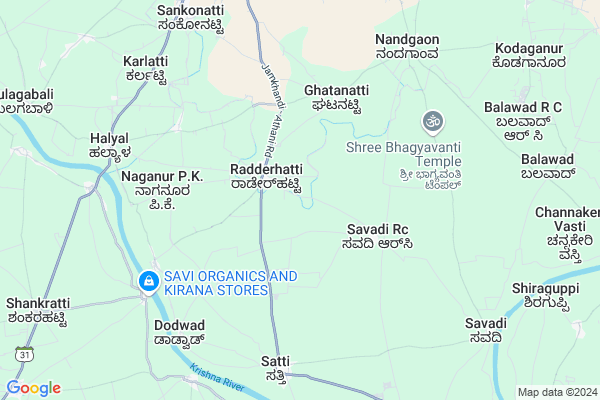
Radderahatti Map
EDIT Map
Add Your House
 ..
..
Current Corona Virus Infected Patients Count in Belgaum District
| City Name | District Name | Total Covid cases |
|---|---|---|
| Belagavi District | Belagavi | 25 |
| Hirebagewadi | Belagavi | 12 |
| Raibagh | Belagavi | 8 |
| Raibag | Belagavi | 3 |
| Raibhag | Belagavi | 2 |
| Bagewadi | Belagavi | 1 |
| Chikkodi | Belagavi | 1 |
Locality Name :
Radderahatti
( ರಡ್ಡೇರಹಟ್ಟಿ )
Taluk Name : Athni
District : Belgaum
State : Karnataka
Division : Belgaum
Language : Kannada and Marathi, English,
Current Time 09:29 AM
Date: Friday , Apr 25,2025 (IST)
Time zone: IST (UTC+5:30)
Elevation / Altitude: 547 meters. Above Seal level
Telephone Code / Std Code: 08289
Assembly constituency : Athani assembly constituency
Assembly MLA : Laxman. Sangappa. Savadi
Lok Sabha constituency : Chikkodi parliamentary constituency
Parliament MP : ANNASAHEB SHANKAR JOLLE
Serpanch Name :
Pin Code : 591240
Post Office Name : Satti
Main Village Name : Radderahatti
Alternate Village Name : Radderhatti
Commodities Prices : Athani Market / Mandi
Edit below overview about Radderahatti
Edit below overview about Radderahatti
OverView of Radderahatti
Radderahati in athani Taluka and Belgavi DistrictNice placeRadderahatti is a small Village/hamlet in Athni Taluk in Belgaum District of Karnataka State, India. It comes under Radderahatti Panchayath. It belongs to Belgaum Division . It is located 124 KM towards North from District head quarters Belgaum. 14 KM from Athni. 570 KM from State capital BangaloreEdit below overview about Radderahatti
National Highways Reachable To Radderahatti
Nationa High Way :NH166
Nationa High Way :NH166
Rivers Near Radderahatti
Krishna :クリシュナ :ಕೃಷ್ಣಾ :कृष्णा
Krishna :クリシュナ :ಕೃಷ್ಣಾ :कृष्णा
Krishna :クリシュナ :ಕೃಷ್ಣಾ :कृष्णा
Krishna :クリシュナ :ಕೃಷ್ಣಾ :कृष्णा
About Radderahatti
Radderahatti is a small Village/hamlet in Athni Taluk in Belgaum District of Karnataka State, India. It comes under Radderahatti Panchayath. It belongs to Belgaum Division . It is located 124 KM towards North from District head quarters Belgaum. 14 KM from Athni. 570 KM from State capital Bangalore
Radderahatti Pin code is 591240 and postal head office is Satti .
Sankonatti ( 8 KM ) , Darur ( 9 KM ) , Naganur P K ( 9 KM ) , Savadi ( 9 KM ) , Nandeshwar ( 10 KM ) are the nearby Villages to Radderahatti. Radderahatti is surrounded by Jamkhandi Taluk towards East , Raybag Taluk towards west , Mudhol Taluk towards South , Kavathemahankal Taluk towards North .
Terdal , Rabkavi Banhatti , Mahalingpur , Mudalgi are the near by Cities to Radderahatti.
Radderahatti 2011 Census Details
Radderahatti Local Language is Kannada. Radderahatti Village Total population is 5134 and number of houses are 1038. Female Population is 49.3%. Village literacy rate is 51.4% and the Female Literacy rate is 21.3%.
Population
| Census Parameter | Census Data |
| Total Population | 5134 |
| Total No of Houses | 1038 |
| Female Population % | 49.3 % ( 2533) |
| Total Literacy rate % | 51.4 % ( 2639) |
| Female Literacy rate | 21.3 % ( 1092) |
| Scheduled Tribes Population % | 29.0 % ( 1491) |
| Scheduled Caste Population % | 8.9 % ( 457) |
| Working Population % | 47.4 % |
| Child(0 -6) Population by 2011 | 737 |
| Girl Child(0 -6) Population % by 2011 | 48.4 % ( 357) |
Radderahatti Census More Deatils.
Politics in Radderahatti
JD(U) , Bharatiya Janata Party , BJP , Indian National Congress (INC) , INC are the major political parties in this area.Polling Stations /Booths near Radderahatti
1)Govt. Higher Primary Kannada School East Side 2nd Room Kodaganur2)Govt. Higher Primary Kannada School North Side New Building Nandagaon
3)Govt. Higher Primary Kannada School North Side Room No.1 Ghatanatti
4)Govt. Higher Primary Kannada School Northern West Room New Building Nandagaon
5)Govt. Higher Primary Kannada School South Side East Room Nandagaon
HOW TO REACH Radderahatti
By Road
Athni is the Nearest Town to Radderahatti. Road connectivity is there from Athni to Radderahatti.By Rail
There is no railway station near to Radderahatti in less than 10 km.Colleges near Radderahatti
Servodaya Pu College Gundewadi
Address :
Composite Pre University College
Address :
Shri Appayya Swami
Address :
M G Pu College Tesang
Address :
Govt First Grade College
Address :
Schools in Radderahatti
Klps Radderhatti
Address : radderhatti , athani , chikkodi , Karnataka . PIN- 591240 , Post - Satti
Govt Health Centers near Radderahatti
1) Alagawadi , Janata Plot Alagwadi , Janata Plot , Near Dattareya Temple2) Malali , Malali , Malali , Malali
3) Harugeri-2 , SC Harugeri , Mugalkhod road , Near Karisiddeshawar Temple
Sub Villages in Radderahatti
Petrol Bunks in Radderahatti,Athni
Asvi Petroleum Indian Oil Petrol Pump
Belgaum; SH-31; Hazarat Tipu Sultan Cir Road; Athani; Athani; Karnataka 591304; India
10.6 KM distance Detail
more ..
Colleges in Radderahatti,Athni
Shri Shivayogi Murughendra Swamiji Arts; Science and Commerce College; Athani
SATTI ROAD; ATHANI; Karnataka 591304; India
11.9 KM distance Detail
more ..
Schools in Radderahatti,Athni
ಸರಕಾರಿ ಹಿರಿಯ ಪ್ರಾಥಮಿಕ ಶಾಲೆ ಹಲ್ಯಾಳ
Halyal Road; Athani; Karnataka 591304; India
8.4 KM distance Detail
Electronic Shops in Radderahatti,Athni
Dawood Electrical Workshop
Water Tank Rd; Satyapramod Nagar; Athani; Karnataka 591304; India
11.9 KM distance Detail
Local Parks in Radderahatti,Athni
SatyaPramod Nagar Park
H B C 2 Gate Road; Satyapramod Nagar; Athani; Karnataka 591304; India
12.2 KM distance Detail
ambedkar garden
Bombay Restaurant Main Road; Athani; Karnataka 591304; India
12.8 KM distance Detail
Police Stations near Radderahatti,Athni
Athani Police Station
Opp. Karnataka Restaurant; Near Tahshildar Office; SH31; Athani; Karnataka 591304; India
13.1 KM distance Detail
Governement Offices near Radderahatti,Athni
Commercial Tax Department
3rd Cross; Shanti Nagar; Athani; Karnataka 591304; India
12.5 KM distance Detail
Athani Municipal Council
Satti road; Haluvalli; Athani; Karnataka 591304; India
12.7 KM distance Detail
About Radderahatti &
History
How to reach Radderahatti
Tourist Places Near By Radderahatti
Schools in Radderahatti
Colleges in Radderahatti
Temperature & weather of Radderahatti
places in Radderahatti
Radderahatti photos
More Information
How to reach Radderahatti
Tourist Places Near By Radderahatti
Schools in Radderahatti
Colleges in Radderahatti
Temperature & weather of Radderahatti
places in Radderahatti
Radderahatti photos
More Information
Village Talk
Post News or Events about this Village
Near Cities
Terdal 16 KM near
Rabkavi Banhatti 20 KM near
Mahalingpur 29 KM near
Mudalgi 40 KM near
Terdal 16 KM near
Rabkavi Banhatti 20 KM near
Mahalingpur 29 KM near
Mudalgi 40 KM near
Near By Taluks
Athni 13 KM near
Jamkhandi 26 KM near
Raybag 35 KM near
Mudhol 49 KM near
Athni 13 KM near
Jamkhandi 26 KM near
Raybag 35 KM near
Mudhol 49 KM near
Near By Air Ports
Kolhapur Airport 90 KM near
Sambre Airport 111 KM near
Hubli Airport 158 KM near
Sholapur Airport 160 KM near
Kolhapur Airport 90 KM near
Sambre Airport 111 KM near
Hubli Airport 158 KM near
Sholapur Airport 160 KM near
Near By Tourist Places
Bijapur 78 KM near
Kolhapur 101 KM near
Badami 113 KM near
Panhala 118 KM near
Pattadakkal 121 KM near
Bijapur 78 KM near
Kolhapur 101 KM near
Badami 113 KM near
Panhala 118 KM near
Pattadakkal 121 KM near
Near By Districts
Sangli 67 KM near
Bijapur District 79 KM near
Bagalkot 90 KM near
Kolhapur 101 KM near
Sangli 67 KM near
Bijapur District 79 KM near
Bagalkot 90 KM near
Kolhapur 101 KM near
Near By RailWay Station
Kudachi Rail Way Station 27 KM near
Raybag Rail Way Station 38 KM near
Kudachi Rail Way Station 27 KM near
Raybag Rail Way Station 38 KM near