| Home | City Bus | Maps | Villages | Cities | Rail | Tourist Places | School | College | Pin Codes | Corona Cases Count |
| Distance Calculator Bus Services IFSC Codes Trace Mobile Number Weather Search Place Trace IP Available Cash ATM/Banks Locate Polling Booth Report an Error contact People |
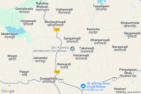
Dolamachiwadi
Dolamachiwadi Map
EDIT Map
Add Your House
 ..
..
Current Corona Virus Infected Patients Count in Beed District
| City Name | District Name | Total Covid cases |
|---|
Locality Name :
Dolamachiwadi
( डोलामाचीवाडी )
Taluka Name : Shirur ( Ka )
District : Beed
State : Maharashtra
Region : Marathwada
Division : Aurangabad
Language : English and Hindi, Marathi
Current Time 04:31 PM
Date: Monday , Apr 28,2025 (IST)
Time zone: IST (UTC+5:30)
Elevation / Altitude: 650 meters. Above Seal level
Telephone Code / Std Code: 02428
Assembly constituency : Beed assembly constituency
Assembly MLA : Sandeep Ravindra Kshirsagar
Lok Sabha constituency : Beed parliamentary constituency
Parliament MP : Pritam Gopinathrao Munde
Serpanch Name :
Pin Code : 414205
Post Office Name : Rajuri Navgan
Main Village Name : Dolamachiwadi
Commodities Prices : Jamkhed Market / Mandi
Dolamachiwadi Live Weather
Temperature: 38.9 °C
clear sky
Humidity: 10%
Wind : 3.43 mt/sec towards N
StationName : "PÄ\u0081thardi"
observed on 32 Mins Back
Temperature: 38.9 °C
clear sky
Humidity: 10%
Wind : 3.43 mt/sec towards N
StationName : "PÄ\u0081thardi"
observed on 32 Mins Back
Dolamachiwadi Weather Forecast for Next 5 days
29-04-2025
30.4°C to 38.7°C
clear sky
30.4°C to 38.7°C
clear sky
30-04-2025
28.9°C to 40.3°C
clear sky, overcast clouds, broken clouds, scattered clouds
28.9°C to 40.3°C
clear sky, overcast clouds, broken clouds, scattered clouds
01-05-2025
28.2°C to 41.4°C
scattered clouds, few clouds, clear sky
28.2°C to 41.4°C
scattered clouds, few clouds, clear sky
02-05-2025
27.7°C to 41.6°C
few clouds, clear sky, scattered clouds, overcast clouds, broken clouds
27.7°C to 41.6°C
few clouds, clear sky, scattered clouds, overcast clouds, broken clouds
03-05-2025
27.9°C to 40.9°C
clear sky, few clouds, scattered clouds, light rain, broken clouds
27.9°C to 40.9°C
clear sky, few clouds, scattered clouds, light rain, broken clouds
Rivers Near Dolamachiwadi
Domri
Bendsura
Domri
Bendsura
About Dolamachiwadi
Correct below Info and add more info about DolamachiwadiDolamachiwadi is a small Village/hamlet in Shirur ( Ka ) Taluka in Beed District of Maharashtra State, India. It comes under Dolamachiwadi Panchayath. It belongs to Marathwada region . It belongs to Aurangabad Division . It is located 35 KM towards west from District head quarters Beed. 8 KM from Shirur ( Ka ). 321 KM from State capital Mumbai
Dolamachiwadi Pin code is 414205 and postal head office is Rajuri Navgan .
Takalwadi ( 3 KM ) , Jatnandur ( 5 KM ) , Raimoha ( 5 KM ) , Hatkarwadi ( 5 KM ) , Wadali ( 7 KM ) are the nearby Villages to Dolamachiwadi. Dolamachiwadi is surrounded by Patoda Taluka towards South , Beed Taluka towards East , Jamkhed Taluka towards South , Ashti Taluka towards west .
Pathardi , Paithan , Ahmednagar , Manjlegaon are the near by Cities to Dolamachiwadi.
Dolamachiwadi 2011 Census Details
Dolamachiwadi Local Language is English. Dolamachiwadi Village Total population is 637 and number of houses are 79. Female Population is 46.0%. Village literacy rate is 64.4% and the Female Literacy rate is 26.7%.
Population
| Census Parameter | Census Data |
| Total Population | 637 |
| Total No of Houses | 79 |
| Female Population % | 46.0 % ( 293) |
| Total Literacy rate % | 64.4 % ( 410) |
| Female Literacy rate | 26.7 % ( 170) |
| Scheduled Tribes Population % | 0.0 % ( 0) |
| Scheduled Caste Population % | 0.0 % ( 0) |
| Working Population % | 60.0 % |
| Child(0 -6) Population by 2011 | 102 |
| Girl Child(0 -6) Population % by 2011 | 39.2 % ( 40) |
Dolamachiwadi Census More Deatils.
Politics in Dolamachiwadi
Bharatiya Janata Party , BJP , NCP , SHS are the major political parties in this area.Polling Stations /Booths near Dolamachiwadi
1)Samanapur2)Laman Tanda(kalegaon H.)
3)Nagaryachivadi
4)Nalvandi
5)Ahirdhanora
HOW TO REACH Dolamachiwadi
By Rail
There is no railway station near to Dolamachiwadi in less than 10 km. are the Rail way stations reachable from near by towns.By Road
Bid are the nearby by towns to Dolamachiwadi having road connectivity to DolamachiwadiColleges near Dolamachiwadi
Janvikas Mahavidyalaya Bansarola
Address :
Kailas Kala Niketan,beed
Address :
Arts, Science And Commerce College Amalner !
Address :
Pt.javaharlal Nehru Jr.collage Ashti
Address :
Sahyadri Iti & Enggering
Address :
Schools near Dolamachiwadi
Bajirao Patil Vid. Jamb
Address : jamb , sirur , bid , Maharashtra . PIN- 414205 , Post - Rajuri Navgan
Mahatma Phule Vid. Dahiwandi
Address : dahiwandi , sirur , bid , Maharashtra . PIN- 413249 , Post - Shirur (Beed)
Arvi High Schoolol Arvi
Address : arvi , sirur , bid , Maharashtra . PIN- 413249 , Post - Shirur (Beed)
Ghatshila Vid Pargaon
Address : ghatshil pargaon , sirur , bid , Maharashtra . PIN- 413249 , Post - Shirur (Beed)
Govt Health Centers near Dolamachiwadi
1) Raimoha , Rular Hospital Raimoha , Rular Hospital Raimoha , Main Road Raimoha2) Loni , sub Centre Loni , ,
3) Rajuri Navgan , Rajuri Navgan , Rajuri Navgan , Rajuri Navgan
Sub Villages in Dolamachiwadi
Petrol Bunks in Dolamachiwadi,Shirur ( Ka )
Indian Oils Petrol Pump
Ahmednagar - Pathardi - Beed Rd; Raimoha; Maharashtra 414205; India
5.3 KM distance Detail
Adarsh Automobiles
Ahmednagar - Pathardi - Beed Rd; Shirur; Maharashtra 413249; India
12.6 KM distance Detail
Bharat Petrolium
Ahmednagar - Pathardi - Beed Rd; Shirur Kasar; Maharashtra 413249; India
14.6 KM distance Detail
more ..
Colleges in Dolamachiwadi,Shirur ( Ka )
Rajiv Gandhi Arts Science And Commerce College;Tagadgaon
Shirur Kasar; Maharashtra 414205; India
6.4 KM distance Detail
Vichardhara Pratishthans Rajiv Gandhi Arts & Science College; Raimoha
Maliwes Subhash Road; Raimoha; Beed; Maharashtra 414205; India
6.7 KM distance Detail
kalika devi junior college
near; Shirur Kasar Police Station; Shirur Kasar; Maharashtra 413249; India
13.5 KM distance Detail
more ..
Schools in Dolamachiwadi,Shirur ( Ka )
जिल्हा परिषद केंद्रीय प्राथमिक शाळा रायमोहा
Raimoha; Maharashtra 414205; India
4.9 KM distance Detail
About Dolamachiwadi &
History
How to reach Dolamachiwadi
Tourist Places Near By Dolamachiwadi
Schools in Dolamachiwadi
Colleges in Dolamachiwadi
Temperature & weather of Dolamachiwadi
places in Dolamachiwadi
Dolamachiwadi photos
More Information
How to reach Dolamachiwadi
Tourist Places Near By Dolamachiwadi
Schools in Dolamachiwadi
Colleges in Dolamachiwadi
Temperature & weather of Dolamachiwadi
places in Dolamachiwadi
Dolamachiwadi photos
More Information
Village Talk
Post News or Events about this Village
Near Cities
Pathardi 42 KM near
Paithan 63 KM near
Ahmednagar 86 KM near
Manjlegaon 92 KM near
Pathardi 42 KM near
Paithan 63 KM near
Ahmednagar 86 KM near
Manjlegaon 92 KM near
Near By Taluks
Shirur ( Ka ) 7 KM near
Patoda 11 KM near
Beed 36 KM near
Jamkhed 41 KM near
Shirur ( Ka ) 7 KM near
Patoda 11 KM near
Beed 36 KM near
Jamkhed 41 KM near
Near By Air Ports
Chikkalthana Airport 111 KM near
Latur Airport 136 KM near
Sholapur Airport 175 KM near
Lohegaon Airport 188 KM near
Chikkalthana Airport 111 KM near
Latur Airport 136 KM near
Sholapur Airport 175 KM near
Lohegaon Airport 188 KM near
Near By Tourist Places
Ahmednagar 88 KM near
Aurangabad 114 KM near
Grishneshwar 136 KM near
Tuljapur 138 KM near
Shirdi 155 KM near
Ahmednagar 88 KM near
Aurangabad 114 KM near
Grishneshwar 136 KM near
Tuljapur 138 KM near
Shirdi 155 KM near
Near By Districts
Beed 33 KM near
Ahmednagar 88 KM near
Aurangabad District 114 KM near
Osmanabad 119 KM near
Beed 33 KM near
Ahmednagar 88 KM near
Aurangabad District 114 KM near
Osmanabad 119 KM near
Near By RailWay Station
Ahmednagar Rail Way Station 89 KM near
Barsi Town Rail Way Station 95 KM near
Ahmednagar Rail Way Station 89 KM near
Barsi Town Rail Way Station 95 KM near