| Home | City Bus | Maps | Villages | Cities | Rail | Tourist Places | School | College | Pin Codes | Corona Cases Count |
| Distance Calculator Bus Services IFSC Codes Trace Mobile Number Weather Search Place Trace IP Available Cash ATM/Banks Locate Polling Booth Report an Error contact People |
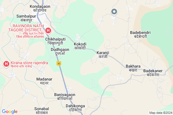
Sitli
Sitli Map
EDIT Map
Add Your House
 ..
..
Current Corona Virus Infected Patients Count in Bastar District
| City Name | District Name | Total Covid cases |
|---|
Locality Name :
Sitli
( सीतलि )
Tehsil Name : Kondagaon
District : Bastar
State : Chattisgarh
Language : Oriya and Hindi
Current Time 04:11 PM
Date: Monday , Apr 28,2025 (IST)
Time zone: IST (UTC+5:30)
Elevation / Altitude: 578 meters. Above Seal level
Telephone Code / Std Code: 07786
Assembly constituency : Kondagaon assembly constituency
Assembly MLA : Lata Usendi
Lok Sabha constituency : Bastar parliamentary constituency
Parliament MP : DEEPAK BAIJ
Serpanch Name :
Pin Code : 494226
Post Office Name : Kondagaon
Main Village Name : Sitli
Commodities Prices : Kondagoan Market / Mandi
Sitli Live Weather
Temperature: 37.2 °C
scattered clouds
Humidity: 19%
Wind : 2.8 mt/sec towards SW
StationName : "Kondagaon"
observed on 2 Hours Back
Temperature: 37.2 °C
scattered clouds
Humidity: 19%
Wind : 2.8 mt/sec towards SW
StationName : "Kondagaon"
observed on 2 Hours Back
Sitli Weather Forecast for Next 5 days
29-04-2025
24.3°C to 36.6°C
broken clouds, few clouds
24.3°C to 36.6°C
broken clouds, few clouds
30-04-2025
23.9°C to 36.6°C
scattered clouds, clear sky, few clouds
23.9°C to 36.6°C
scattered clouds, clear sky, few clouds
01-05-2025
24.8°C to 39.0°C
scattered clouds, clear sky
24.8°C to 39.0°C
scattered clouds, clear sky
02-05-2025
23.8°C to 39.3°C
clear sky, scattered clouds, broken clouds
23.8°C to 39.3°C
clear sky, scattered clouds, broken clouds
03-05-2025
23.3°C to 38.8°C
clear sky, scattered clouds, light rain
23.3°C to 38.8°C
clear sky, scattered clouds, light rain
Rivers Near Sitli
Kosarteda
Boroda
Kosarteda
Boroda
About Sitli
Correct below Info and add more info about SitliSitli is a small Village/hamlet in Kondagaon Tehsil in Bastar District of Chattisgarh State, India. It comes under Sitli Panchayath. It is located 51 KM towards North from District head quarters Jagdalpur. 222 KM from State capital Raipur
Sitli Pin code is 494226 and postal head office is Kondagaon .
Sitli is surrounded by Makdi Tehsil towards North , Pharasgaon Tehsil towards North , Bastar Tehsil towards South , Narayanpur Tehsil towards west .
Kondagaon , Umarkote , Jagdalpur , Kanker are the near by Cities to Sitli.
Sitali 2011 Census Details
Sitli Local Language is Oriya. Sitali Village Total population is 674 and number of houses are 153. Female Population is 50.1%. Village literacy rate is 37.2% and the Female Literacy rate is 14.2%.
Population
| Census Parameter | Census Data |
| Total Population | 674 |
| Total No of Houses | 153 |
| Female Population % | 50.1 % ( 338) |
| Total Literacy rate % | 37.2 % ( 251) |
| Female Literacy rate | 14.2 % ( 96) |
| Scheduled Tribes Population % | 76.1 % ( 513) |
| Scheduled Caste Population % | 0.0 % ( 0) |
| Working Population % | 56.2 % |
| Child(0 -6) Population by 2011 | 146 |
| Girl Child(0 -6) Population % by 2011 | 47.3 % ( 69) |
Sitali Census More Deatils.
Politics in Sitli
Indian National Congress , BJP , INC are the major political parties in this area.Polling Stations /Booths near Sitli
1)Kokodee2)Kokodhi - 1
3)Kamela
4)Bijoli
5)Bagbeda
HOW TO REACH Sitli
By Rail
There is no railway station near to Sitli in less than 10 km.Colleges near Sitli
Govt. College
Address : Kondagaon
Schools in Sitli
Primary School
Address : sitli , kondagaon , baster , Chattisgarh . PIN- 494226 , Post - Kondagaon
Govt Health Centers near Sitli
1) Karanji , SUB HEALTH CENTRE KARANJI , DAHIKONGA ,2) Baniagaon , SUB HEALTH CENTRE BANIAGAON , BANIAGAON ,
3) Bakhra , SUB HEALTH CENTRE BAKHRA , BADEKANERA ,
Sub Villages in Sitli
Hospitals in Sitli,Kondagaon
New Government District Hospital (RNT Ravindra Nath Tagore District Hospital)
Kondagaon; Chhattisgarh 494226; India
6.5 KM distance Detail
more ..
Petrol Bunks in Sitli,Kondagaon
HP PETROL PUMP - JYOTI PETROLEUM CO
HPC Dealer Near BUS Stand; Kondagaon; Dist Bastar (CG); Raipur; Chhattisgarh 494226; India
9.7 KM distance Detail
TIRATHSINGH PRITHIPAL SINGH
MAIN ROAD KONDAGAON; Kondagaon; Chhattisgarh 494226; India
10.0 KM distance Detail
more ..
Schools in Sitli,Kondagaon
District Project Livelihood College; Kondagaon
Raipur - Jagdalpur - Vishakhapatnam road; Kondagaon; Chhattisgarh 494226; India
6.9 KM distance Detail
Electronic Shops in Sitli,Kondagaon
Anoop Pc Game Shop
Raipur - Jagdalpur - Vishakhapatnam road; Kondagaon; Chhattisgarh 494226; India
8.4 KM distance Detail
Super Markets in Sitli,Kondagaon
Prem General Store Vinayak Chowk ; kondagaon chhattisgarh
Kondagaon; Chhattisgarh 494226; India
8.8 KM distance Detail
Police Stations near Sitli,Kondagaon
Office Of Superintendent Of Police
NH30; Kondagaon; Chhattisgarh 494226; India
9.2 KM distance Detail
About Sitli &
History
How to reach Sitli
Tourist Places Near By Sitli
Schools in Sitli
Colleges in Sitli
Temperature & weather of Sitli
places in Sitli
Sitli photos
More Information
How to reach Sitli
Tourist Places Near By Sitli
Schools in Sitli
Colleges in Sitli
Temperature & weather of Sitli
places in Sitli
Sitli photos
More Information
Village Talk
Post News or Events about this Village
Near Cities
Kondagaon 8 KM near
Umarkote 59 KM near
Jagdalpur 68 KM near
Kanker 95 KM near
Kondagaon 8 KM near
Umarkote 59 KM near
Jagdalpur 68 KM near
Kanker 95 KM near
Near By Taluks
Kondagaon 0 KM near
Makdi 33 KM near
Pharasgaon 35 KM near
Bastar 43 KM near
Kondagaon 0 KM near
Makdi 33 KM near
Pharasgaon 35 KM near
Bastar 43 KM near
Near By Air Ports
Raipur Airport 204 KM near
Vishakhapatnam Airport 287 KM near
Rajahmundry Airport 302 KM near
Sonegaon Airport 366 KM near
Raipur Airport 204 KM near
Vishakhapatnam Airport 287 KM near
Rajahmundry Airport 302 KM near
Sonegaon Airport 366 KM near
Near By Tourist Places
Bastar 62 KM near
Jagdalpur 67 KM near
Dantewada 91 KM near
Kanker 94 KM near
Jeypore 129 KM near
Bastar 62 KM near
Jagdalpur 67 KM near
Dantewada 91 KM near
Kanker 94 KM near
Jeypore 129 KM near
Near By Districts
Bastar 48 KM near
Narayanpur 57 KM near
Dantewada 91 KM near
Kanker 95 KM near
Bastar 48 KM near
Narayanpur 57 KM near
Dantewada 91 KM near
Kanker 95 KM near
Near By RailWay Station
Koraput Junction Rail Way Station 149 KM near
Kantabanji Rail Way Station 181 KM near
Koraput Junction Rail Way Station 149 KM near
Kantabanji Rail Way Station 181 KM near