| Home | City Bus | Maps | Villages | Cities | Rail | Tourist Places | School | College | Pin Codes | Corona Cases Count |
| Distance Calculator Bus Services IFSC Codes Trace Mobile Number Weather Search Place Trace IP Available Cash ATM/Banks Locate Polling Booth Report an Error contact People |
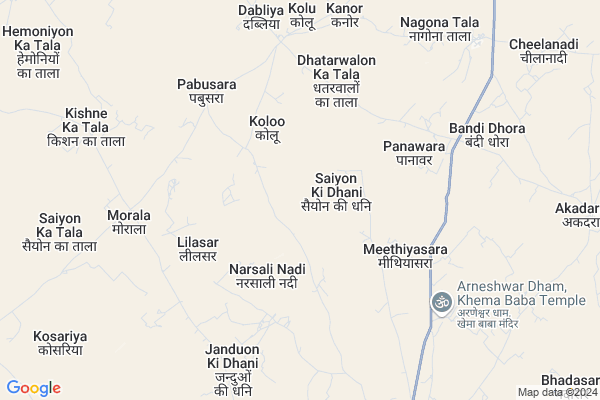
Bhation Ka Der Map
EDIT Map
Add Your House
 ..
..
Current Corona Virus Infected Patients Count in Barmer District
| City Name | District Name | Total Covid cases |
|---|---|---|
| Barmer District | Barmer | 2 |
Locality Name :
Bhation Ka Der
( भातिओं का देर )
Tehsil Name : Baytoo
District : Barmer
State : Rajasthan
Division : Jodhpur
Language : Rajasthani and Hindi ,english
Current Time 01:16 PM
Date: Wednesday , Feb 05,2025 (IST)
Time zone: IST (UTC+5:30)
Elevation / Altitude: 154 meters. Above Seal level
Telephone Code / Std Code: 02986
Assembly constituency : Baytoo assembly constituency
Assembly MLA : Harish Chaudhary
Lok Sabha constituency : Barmer parliamentary constituency
Parliament MP : KAILASH CHOUDHARY
Serpanch Name :
Main Village Name : Bhation Ka Der
Commodities Prices : Barmer Market / Mandi
Bhation Ka Der Live Weather
Temperature: 23.8 °C
clear sky
Humidity: 12%
Wind : 1.64 mt/sec towards NE
StationName : "BÄ\u0081rmer"
observed on 7 Mins Back
Temperature: 23.8 °C
clear sky
Humidity: 12%
Wind : 1.64 mt/sec towards NE
StationName : "BÄ\u0081rmer"
observed on 7 Mins Back
Bhation Ka Der Weather Forecast for Next 5 days
06-02-2025
15.5°C to 24.4°C
clear sky
15.5°C to 24.4°C
clear sky
07-02-2025
13.9°C to 26.3°C
clear sky, overcast clouds
13.9°C to 26.3°C
clear sky, overcast clouds
08-02-2025
13.6°C to 26.4°C
clear sky, broken clouds, scattered clouds, overcast clouds
13.6°C to 26.4°C
clear sky, broken clouds, scattered clouds, overcast clouds
09-02-2025
16.4°C to 28.6°C
overcast clouds, broken clouds, clear sky
16.4°C to 28.6°C
overcast clouds, broken clouds, clear sky
10-02-2025
17.1°C to 30.0°C
clear sky, few clouds, overcast clouds
17.1°C to 30.0°C
clear sky, few clouds, overcast clouds
About Bhation Ka Der
Correct below Info and add more info about Bhation Ka DerBhation Ka Der is a small Village/hamlet in Baytoo Tehsil in Barmer District of Rajasthan State, India. It comes under Bhation Ka Der Panchayath. It belongs to Jodhpur Division . It is located 49 KM towards East from District head quarters Barmer. 492 KM from State capital Jaipur
Bhation Ka Der is surrounded by Sindhari Tehsil towards South , Baltora Tehsil towards East , Sheo Tehsil towards west , Barmer Tehsil towards west .
Barmer , Jalore , Bhinmal , Jaisalmer are the near by Cities to Bhation Ka Der.
Bhation Ka Der 2011 Census Details
Bhation Ka Der Local Language is Rajasthani. Bhation Ka Der Village Total population is 454 and number of houses are 82. Female Population is 44.9%. Village literacy rate is 41.0% and the Female Literacy rate is 15.0%.
Population
| Census Parameter | Census Data |
| Total Population | 454 |
| Total No of Houses | 82 |
| Female Population % | 44.9 % ( 204) |
| Total Literacy rate % | 41.0 % ( 186) |
| Female Literacy rate | 15.0 % ( 68) |
| Scheduled Tribes Population % | 0.0 % ( 0) |
| Scheduled Caste Population % | 9.7 % ( 44) |
| Working Population % | 48.2 % |
| Child(0 -6) Population by 2011 | 84 |
| Girl Child(0 -6) Population % by 2011 | 36.9 % ( 31) |
Bhation Ka Der Census More Deatils.
Politics in Bhation Ka Der
Bharatiya Janata Party , BJP , INC are the major political parties in this area.Polling Stations /Booths near Bhation Ka Der
1)Govt. Upper Primary School Muknaniyon Ki Dhani2)Govt. Upper Primary School Lapundara Tarli
3)Govt. Upper Primary School Richoli West Part
4)Govt. Upper Primary School Jogasar
5)Govt. Secondary School Lapla Tala(south Part)
HOW TO REACH Bhation Ka Der
By Rail
There is no railway station near to Bhation Ka Der in less than 10 km.Pincodes near Bhation Ka Der
344034 ( Baitu ) , 344037 ( Swau Padamsingh ) , 344035 ( Kavas )Colleges near Bhation Ka Der
Mhadev College Baytu
Address :
Mhadev College Baytu
Address :
Schools near Bhation Ka Der
Saraswati Bal Mandir Kawas
Address : nagdesiyan dhuna , baitu , barmer , Rajasthan . PIN- 344035 , Post - Kavas
Kgbv Nambaniyo Ki Dhani
Address : nimbaniyio ki dhan i , baitu , barmer , Rajasthan . PIN- 344035 , Post - Kavas
Marudhar N.a. Kawas
Address : nagdesiyan dhuna , baitu , barmer , Rajasthan . PIN- 344035 , Post - Kavas
Sarsvati Vidha Mandir
Address : swau padam singh , baitu , barmer , Rajasthan . PIN- 344037 , Post - Swau Padamsingh
Govt Health Centers near Bhation Ka Der
1) Kolu , Kolu , Kolu , Kolu2) Panawada , Panawada , Panawada , Panawada
3) Leelala , Leelala , Leelala , Leelala
Sub Villages in Bhation Ka Der
Petrol Bunks in Bhation Ka Der,Baytoo
JAGDAMBA FILLING STATION
BAYTU;JODHPUR -BARMER ROAD; BARMER; Rajasthan 344034; India
12.7 KM distance Detail
Maa Jagdamba Filling Station Bharat Petroleum
Baaptu; Barmer; NH-112; Barmer Road; Barmer; Barmer; Rajasthan 344024; India
12.7 KM distance Detail
MAHAVEER DIESEL BATADU(INDIAN OIL DEALER)
Maylon Ki Dhani; Rajasthan 344035; India
17.5 KM distance Detail
more ..
Colleges in Bhation Ka Der,Baytoo
Govt.College Baytu राजकीय महाविद्यालय बायतु
Government College; Bayatu Chimanji; Rajasthan 344034; India
12.5 KM distance Detail
more ..
Schools in Bhation Ka Der,Baytoo
samir juneja kolu
112;; Dera - Jodhpur Road; Jalam Nagar; Rajasthan 342023; India
3.6 KM distance Detail
Electronic Shops in Bhation Ka Der,Baytoo
Shri Shree Jagdamba Electricals Shree Ram Enterprises Karni Market Shop Number 4 5 Roadways Bus Stand Ke Paas baitu
Baytu; Rajasthan 344034; India
11.8 KM distance Detail
Ramdev Mobile
Khema Baba Mandir Road; main market; Baytu; Rajasthan 344034; India
12.1 KM distance Detail
Super Markets in Bhation Ka Der,Baytoo
Subhash Grocery Store
Khema Baba Mandir Road; Baytu; Rajasthan 344034; India
12.1 KM distance Detail
Local Parks in Bhation Ka Der,Baytoo
Governement Offices near Bhation Ka Der,Baytoo
Karyalaya Adhishashi Abhiyanta
Baaptu; Barmer; NH-112; Barmer Road; Barmer; Barmer; Rajasthan 344024; India
12.1 KM distance Detail
About Bhation Ka Der &
History
How to reach Bhation Ka Der
Tourist Places Near By Bhation Ka Der
Schools in Bhation Ka Der
Colleges in Bhation Ka Der
Temperature & weather of Bhation Ka Der
places in Bhation Ka Der
Bhation Ka Der photos
More Information
How to reach Bhation Ka Der
Tourist Places Near By Bhation Ka Der
Schools in Bhation Ka Der
Colleges in Bhation Ka Der
Temperature & weather of Bhation Ka Der
places in Bhation Ka Der
Bhation Ka Der photos
More Information
Village Talk
Post News or Events about this Village
Near Cities
Barmer 46 KM near
Jalore 128 KM near
Bhinmal 135 KM near
Jaisalmer 149 KM near
Barmer 46 KM near
Jalore 128 KM near
Bhinmal 135 KM near
Jaisalmer 149 KM near
Near By Taluks
Baytoo 0 KM near
Sindhari 50 KM near
Baltora 56 KM near
Sheo 56 KM near
Baytoo 0 KM near
Sindhari 50 KM near
Baltora 56 KM near
Sheo 56 KM near
Near By Air Ports
Jaisalmer Airport 148 KM near
Jodhpur Airport 152 KM near
Dabok Airport 297 KM near
Ahmedabad Airport 377 KM near
Jaisalmer Airport 148 KM near
Jodhpur Airport 152 KM near
Dabok Airport 297 KM near
Ahmedabad Airport 377 KM near
Near By Tourist Places
Barmer 47 KM near
Pokran 122 KM near
Jalore 127 KM near
Jaisalmer 147 KM near
Jodhpur 149 KM near
Barmer 47 KM near
Pokran 122 KM near
Jalore 127 KM near
Jaisalmer 147 KM near
Jodhpur 149 KM near
Near By Districts
Barmer 47 KM near
Jalore 128 KM near
Jaisalmer 146 KM near
Jodhpur 150 KM near
Barmer 47 KM near
Jalore 128 KM near
Jaisalmer 146 KM near
Jodhpur 150 KM near
Near By RailWay Station
Barmer Rail Way Station 46 KM near
Balotra Rail Way Station 62 KM near
Barmer Rail Way Station 46 KM near
Balotra Rail Way Station 62 KM near