| Home | City Bus | Maps | Villages | Cities | Rail | Tourist Places | School | College | Pin Codes | Corona Cases Count |
| Distance Calculator Bus Services IFSC Codes Trace Mobile Number Weather Search Place Trace IP Available Cash ATM/Banks Locate Polling Booth Report an Error contact People |
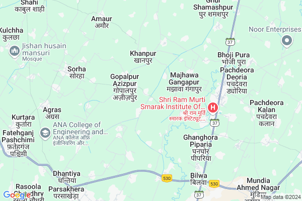
Ramiapur
Ramiapur Map
EDIT Map
Add Your House
 ..
..
Current Corona Virus Infected Patients Count in Bareilly District
| City Name | District Name | Total Covid cases |
|---|---|---|
| Bareilly District | Bareilly | 6 |
Locality Name :
Ramiapur
( रामापुर )
Block Name : Bhojipura
District : Bareilly
State : Uttar Pradesh
Division : Bareilly
Language : Hindi and English, Urdu, Punjabi, And Kumaoni
Current Time 12:09 PM
Date: Wednesday , Apr 30,2025 (IST)
Time zone: IST (UTC+5:30)
Elevation / Altitude: 180 meters. Above Seal level
Telephone Code / Std Code: 0581
Assembly constituency : Bhojipura assembly constituency
Assembly MLA : Shazil Islam Ansari
Lok Sabha constituency : Bareilly parliamentary constituency
Parliament MP : SANTOSH KUMAR GANGWAR
Serpanch Name :
Pin Code : 243202
Post Office Name : Bhojipura
Main Village Name : Ramiapur
Commodities Prices : Bareilly Market / Mandi
Ramiapur Live Weather
Temperature: 34.7 °C
clear sky
Humidity: 25%
Wind : 5.07 mt/sec towards SE
StationName : "ShÄ\u0081hi"
observed on 1 Hours Back
Temperature: 34.7 °C
clear sky
Humidity: 25%
Wind : 5.07 mt/sec towards SE
StationName : "ShÄ\u0081hi"
observed on 1 Hours Back
Ramiapur Weather Forecast for Next 5 days
01-05-2025
27.9°C to 37.9°C
clear sky, scattered clouds, broken clouds
27.9°C to 37.9°C
clear sky, scattered clouds, broken clouds
02-05-2025
27.0°C to 37.2°C
scattered clouds, broken clouds, overcast clouds, clear sky
27.0°C to 37.2°C
scattered clouds, broken clouds, overcast clouds, clear sky
03-05-2025
25.2°C to 39.7°C
light rain, overcast clouds, scattered clouds
25.2°C to 39.7°C
light rain, overcast clouds, scattered clouds
04-05-2025
26.6°C to 39.8°C
overcast clouds, broken clouds, scattered clouds, clear sky
26.6°C to 39.8°C
overcast clouds, broken clouds, scattered clouds, clear sky
05-05-2025
26.0°C to 37.6°C
overcast clouds, broken clouds, scattered clouds
26.0°C to 37.6°C
overcast clouds, broken clouds, scattered clouds
Rivers Near Ramiapur
Nakatia Nadi
Nakatia Nadi
Nakatia Nadi
Nakatia Nadi
About Ramiapur
Correct below Info and add more info about RamiapurRamiapur is a small Village/hamlet in Bhojipura Block in Bareilly District of Uttar Pradesh State, India. It comes under Ramiapur Panchayath. It belongs to Bareilly Division . It is located 15 KM towards North from District head quarters Bareilly. 3 KM from Bhoji Pura. 278 KM from State capital Lucknow
Ramiapur Pin code is 243202 and postal head office is Bhojipura .
Rahpura Karim Bux ( 2 KM ) , Majhawa Gangapur ( 2 KM ) , Gopalpur Azizpur ( 2 KM ) , Beerpur Maqrooqa ( 2 KM ) , Ghanghoua Ghanghori ( 3 KM ) are the nearby Villages to Ramiapur. Ramiapur is surrounded by Fatehganj West Block towards west , Bareilly Block towards South , Bithiri Chainpur Block towards South , Nawabganj Block towards East .
Bareilly , Nawabganj , Shishgarh , Shahabad, Rampur are the near by Cities to Ramiapur.
Ramiapur 2011 Census Details
Ramiapur Local Language is Hindi. Ramiapur Village Total population is 655 and number of houses are 117. Female Population is 45.6%. Village literacy rate is 31.0% and the Female Literacy rate is 12.7%.
Population
| Census Parameter | Census Data |
| Total Population | 655 |
| Total No of Houses | 117 |
| Female Population % | 45.6 % ( 299) |
| Total Literacy rate % | 31.0 % ( 203) |
| Female Literacy rate | 12.7 % ( 83) |
| Scheduled Tribes Population % | 0.0 % ( 0) |
| Scheduled Caste Population % | 51.9 % ( 340) |
| Working Population % | 53.9 % |
| Child(0 -6) Population by 2011 | 115 |
| Girl Child(0 -6) Population % by 2011 | 46.1 % ( 53) |
Ramiapur Census More Deatils.
Politics in Ramiapur
IEMC , BJP , SP , BSP , INC are the major political parties in this area.Polling Stations /Booths near Ramiapur
1)Pra. Pathshala Mawai Room No 012)Pra. School Kalapur Room No. 01
3)Pra. Path Madhopur Mafi Kam. No. 01
4)Patel Inter College Miapur R.n.-1
5)Pra Pathshala Ghunsa Room No 01
HOW TO REACH Ramiapur
By Rail
Bhojipura Junction Rail Way Station , Dohna Rail Way Station are the very nearby railway stations to Ramiapur.Colleges near Ramiapur
Manohar Bhushan Inter College
Address :
Jesus And Mary Inter College
Address :
Invertis University
Address : Invertis Village,
delhi Lucknow Highway Nh-24,
bareilly, Uttar Pradesh
pin - 243 123, India
Mahatma Gandhi Inter College
Address :
Lajpat Roy Inter College
Address :
Schools near Ramiapur
Ups Ghunsa
Address : ghunsa , bhojipura , bareilly , Uttar Pradesh . PIN- 243201 , Post - K.S.W.Tulsi Nagar
Ups Safri
Address : sfari , bhojipura , bareilly , Uttar Pradesh . PIN- 243202 , Post - Bhojipura
Ups Faridapur Ramcharan
Address : faridapur ramcharan , bhojipura , bareilly , Uttar Pradesh . PIN- 243102
Ups Jadaunpur
Address : jadaunpur , bhojipura , bareilly , Uttar Pradesh . PIN- 243202 , Post - Bhojipura
Govt Health Centers near Ramiapur
1) Taiya , Taiya , ,2) larhpur , , ,
3) PHC BHOJIPURA , , ,
Sub Villages in Ramiapur
Petrol Bunks in Ramiapur,Bhojipura
Reliance Petroleum
SH-37; Bareilly Nainital Road; Dohna; Bareilly; Uttar Pradesh 243505; India
6.5 KM distance Detail
Shubham Hindustan Petroleum
Bhojipura; Bareilly; SH-37; Bareilly Nainital Road; Bareilly; Bareilly; Uttar Pradesh 243202; India
6.9 KM distance Detail
more ..
Colleges in Ramiapur,Bhojipura
Shri Ram Murti Smarak School of Nursing
Ram Murti Puram; Village Prahaladpur; Abhaypur Post Bhojipura 13 Km. Bareilly-Nainital Road Bareilly Uttar Pradesh IN 243001; Bareilly - Nainital Rd; India
1.9 KM distance Detail
SRMS College Of Law
ram murti puram nanital highway; Abhaypur Road; Bhoji Pura; Uttar Pradesh 243202; India
4.6 KM distance Detail
LBV HOSTEL;SHRI RAM MURTI SMARAK COLLEGE OF ENGINEERING AND technology
Bareilly; Uttar Pradesh 243202; India
4.6 KM distance Detail
Shri Ram Murti Smarak Institute Of Medical Sciences
Bareilly - Nainital Road; Bhojipura; Bareilly; Uttar Pradesh 243001; India
5.1 KM distance Detail
more ..
Schools in Ramiapur,Bhojipura
R B L PUBLIC SCHOOL GOPALPUR AZIZPUR
Bhoji Pura Road; Gopalpur Azizpur; Uttar Pradesh 243202; India
1.7 KM distance Detail
Sri Harish Kumar Memorial Public School
Ghanghoua Ghanghori; Uttar Pradesh 243202; India
2.7 KM distance Detail
Junior Secondary Girls Govt School
Ghanghori; Ghanghora; Uttar Pradesh 243202; India
2.8 KM distance Detail
RAPV Gopalpur Azizpur B H Bareilly
Gopalpur Azizpur; Uttar Pradesh 243202; India
3.0 KM distance Detail
Electronic Shops in Ramiapur,Bhojipura
urvashi mobile & fasion gallery
Bharat Inter College Bhojipura Bareilly; Pipalsana Chaudhari; Uttar Pradesh; India
5.3 KM distance Detail
Urvashi Mobile And Fasion Galk
Bhoji Pura Road; Pipalsana Chaudhari; Uttar Pradesh 243202; India
5.3 KM distance Detail
Super Markets in Ramiapur,Bhojipura
Rajat Egg Stor
Bhoji Pura Road; Pipalsana Chaudhari; Uttar Pradesh 243202; India
5.3 KM distance Detail
Pradeep Mobile
Bhoji Pura Road; Pipalsana Chaudhari; Uttar Pradesh 243202; India
5.3 KM distance Detail
Police Stations near Ramiapur,Bhojipura
Police Chowki-Parshakedha
NH 24; Parsakhera Industrial Area; Parsakhera; Uttar Pradesh 243502; India
9.8 KM distance Detail
Police Chowki Bariyar No 1 Thana Izzatnagar
SH 37; Bajrng Colony; Izatnagar; Bareilly; Uttar Pradesh 243122; India
9.8 KM distance Detail
Governement Offices near Ramiapur,Bhojipura
Karyalaya Chetra Panchayat Bhojipura
SH 37; Bareilly; Uttar Pradesh 243505; India
5.2 KM distance Detail
Time Office ; Diesel Shed Izatanagar
Izatnagar; Bareilly; Uttar Pradesh 243122; India
10.0 KM distance Detail
About Ramiapur &
History
How to reach Ramiapur
Tourist Places Near By Ramiapur
Schools in Ramiapur
Colleges in Ramiapur
Temperature & weather of Ramiapur
places in Ramiapur
Ramiapur photos
More Information
How to reach Ramiapur
Tourist Places Near By Ramiapur
Schools in Ramiapur
Colleges in Ramiapur
Temperature & weather of Ramiapur
places in Ramiapur
Ramiapur photos
More Information
Village Talk
Post News or Events about this Village
Near Cities
Bareilly 14 KM near
Nawabganj 26 KM near
Shishgarh 29 KM near
Shahabad, Rampur 43 KM near
Bareilly 14 KM near
Nawabganj 26 KM near
Shishgarh 29 KM near
Shahabad, Rampur 43 KM near
Near By Taluks
Bhojipura 3 KM near
Fatehganj West 8 KM near
Bareilly 15 KM near
Bithiri Chainpur 19 KM near
Bhojipura 3 KM near
Fatehganj West 8 KM near
Bareilly 15 KM near
Bithiri Chainpur 19 KM near
Near By Air Ports
Pantnagar Airport 67 KM near
Muzaffarnagar Airport 222 KM near
Kheria Airport 229 KM near
Indira Gandhi International Airport 251 KM near
Pantnagar Airport 67 KM near
Muzaffarnagar Airport 222 KM near
Kheria Airport 229 KM near
Indira Gandhi International Airport 251 KM near
Near By Tourist Places
Moradabad 79 KM near
Khatima 82 KM near
Kathgodam 98 KM near
Kashipur 103 KM near
Bhimtal 107 KM near
Moradabad 79 KM near
Khatima 82 KM near
Kathgodam 98 KM near
Kashipur 103 KM near
Bhimtal 107 KM near
Near By Districts
Bareilly 14 KM near
Pilibhit 47 KM near
Rampur 56 KM near
Udam Singh Nagar 60 KM near
Bareilly 14 KM near
Pilibhit 47 KM near
Rampur 56 KM near
Udam Singh Nagar 60 KM near
Near By RailWay Station
Bhojipura Junction Rail Way Station 5.5 KM near
Dohna Rail Way Station 6.4 KM near
Izzatnagar Rail Way Station 12 KM near
Bareilly City Rail Way Station 16 KM near
Bhojipura Junction Rail Way Station 5.5 KM near
Dohna Rail Way Station 6.4 KM near
Izzatnagar Rail Way Station 12 KM near
Bareilly City Rail Way Station 16 KM near