| Home | City Bus | Maps | Villages | Cities | Rail | Tourist Places | School | College | Pin Codes | Corona Cases Count |
| Distance Calculator Bus Services IFSC Codes Trace Mobile Number Weather Search Place Trace IP Available Cash ATM/Banks Locate Polling Booth Report an Error contact People |
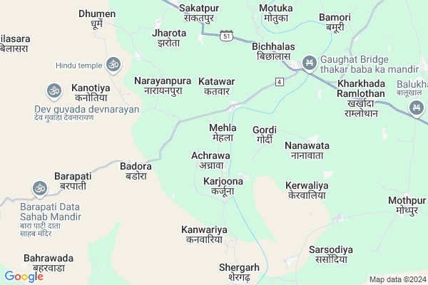
Mehla Map
EDIT Map
Add Your House
 ..
..
Current Corona Virus Infected Patients Count in Baran District
| City Name | District Name | Total Covid cases |
|---|
Locality Name :
Mehla
( मेहला )
Tehsil Name : Atru
District : Baran
State : Rajasthan
Division : Kota
Language : Hindi and Rajasthani
Current Time 10:39 AM
Date: Saturday , Apr 26,2025 (IST)
Time zone: IST (UTC+5:30)
Elevation / Altitude: 289 meters. Above Seal level
Telephone Code / Std Code: 07451
Assembly constituency : Baran-Atru assembly constituency
Assembly MLA : Radheyshyam Bairwa
Lok Sabha constituency : Jhalawar-Baran parliamentary constituency
Parliament MP : DUSHYANT SINGH
Serpanch Name :
Main Village Name : Mehla
Commodities Prices : Khanpur Market / Mandi
Rivers Near Mehla
Ahu
Garni Nadi
Ahu
Garni Nadi
About Mehla
Correct below Info and add more info about MehlaMehla is a small Village/hamlet in Atru Tehsil in Baran District of Rajasthan State, India. It comes under Mehla Panchayath. It belongs to Kota Division . It is located 41 KM towards South from District head quarters Baran. 11 KM from Atru. 291 KM from State capital Jaipur
Badora ( 5 KM ) , Kerwaliya ( 5 KM ) , Sakatpur ( 7 KM ) , Kanotiya ( 7 KM ) , Kharkhada Ramlothan ( 8 KM ) are the nearby Villages to Mehla. Mehla is surrounded by Khanpur Tehsil towards west , Chhipabarod Tehsil towards South , Baran (Full) Tehsil towards North , Sangod Tehsil towards west .
Baran , Jhalawar , Ramganj Mandi , Mangrol are the near by Cities to Mehla.
Mehla 2011 Census Details
Mehla Local Language is Hindi. Mehla Village Total population is 171 and number of houses are 27. Female Population is 52.0%. Village literacy rate is 51.5% and the Female Literacy rate is 23.4%.
Population
| Census Parameter | Census Data |
| Total Population | 171 |
| Total No of Houses | 27 |
| Female Population % | 52.0 % ( 89) |
| Total Literacy rate % | 51.5 % ( 88) |
| Female Literacy rate | 23.4 % ( 40) |
| Scheduled Tribes Population % | 41.5 % ( 71) |
| Scheduled Caste Population % | 5.3 % ( 9) |
| Working Population % | 42.7 % |
| Child(0 -6) Population by 2011 | 23 |
| Girl Child(0 -6) Population % by 2011 | 52.2 % ( 12) |
Mehla Census More Deatils.
Polling Stations /Booths near Mehla
1)Government Secondary School Thoonsara2)Government Senior Secondary School Fatehpur Room No. 1
3)Government Primary School Barkheri
4)Government Upper Primary School Dhumen
5)Government Upper Primary School Bahadurganj
HOW TO REACH Mehla
By Rail
There is no railway station near to Mehla in less than 10 km.Pincodes near Mehla
325223 ( Atone ) , 325219 ( Salpura ) , 325207 ( Bapawar )Colleges near Mehla
Glg College Of Computer Education
Address :
Mahtma Gopal Ram Mahavidhalya
Address :
Svcttr
Address :
Swami Vivekananda College Of Teachers Training & Research
Address : Khandela Road Danta
Government Girls College Of Baran
Address : Hospital Road, Baran - 325205
Schools near Mehla
National Public School Manyagan
Address : manyagan , atru , baran , Rajasthan . PIN- 325223 , Post - Atone
Maa Veshno Devi Vidhya Mandir Aton
Address : aton , atru , baran , Rajasthan . PIN- 325223 , Post - Atone
Krishana Bal Vidhya Mandir Antana
Address : antana , atru , baran , Rajasthan . PIN- 325218 , Post - ATRU
Apex Public School Salpra
Address : kavai , atru , baran , Rajasthan . PIN- 325219 , Post - Salpura
Govt Health Centers near Mehla
1) Kherliganj , ANM House , Khedliganj , Near CHC Atru2) Gordi , Sub Health Centar Gordi , Gordi , Gordi
3) Jalwara , Jalwara , Baran Road Jalwara ,
Sub Villages in Mehla
Petrol Bunks in Mehla,Atru
HP PETROL PUMP - KANHA FILLING STATION
Village Atru Tehsil Atru; NH 12; Kota; Rajasthan 325219; India
21.2 KM distance Detail
HP PETROL PUMP - SRINATH FILLING STATION KAWAI
Khanpur Road Village Kawai Tehsil Atro; Kota; Rajasthan 325219; India
22.4 KM distance Detail
more ..
Colleges in Mehla,Atru
Shree Shyam Pvt ITI
keshav Vihar Colony; Bus Stand Road; Atru; District Baran; Atru; Rajasthan 325218; India
21.6 KM distance Detail
Keshave college
Rajasthan State Highway 37A; Govindpura; Rajasthan 325218; India
22.8 KM distance Detail
more ..
Schools in Mehla,Atru
Rajasthan Gramin Shikshan Sansthan Badora
MDR4; Baisar; Rajasthan 325223; India
4.7 KM distance Detail
Super Markets in Mehla,Atru
Seema Provijan Store Atru
Railway Station; Atru;; Atru; Rajasthan 325218; India
22.0 KM distance Detail
About Mehla &
History
How to reach Mehla
Tourist Places Near By Mehla
Schools in Mehla
Colleges in Mehla
Temperature & weather of Mehla
places in Mehla
Mehla photos
More Information
How to reach Mehla
Tourist Places Near By Mehla
Schools in Mehla
Colleges in Mehla
Temperature & weather of Mehla
places in Mehla
Mehla photos
More Information
Village Talk
Post News or Events about this Village
Near Cities
Baran 40 KM near
Jhalawar 47 KM near
Ramganj Mandi 69 KM near
Mangrol 69 KM near
Baran 40 KM near
Jhalawar 47 KM near
Ramganj Mandi 69 KM near
Mangrol 69 KM near
Near By Taluks
Atru 11 KM near
Khanpur 22 KM near
Chhipabarod 30 KM near
Baran (Full) 39 KM near
Atru 11 KM near
Khanpur 22 KM near
Chhipabarod 30 KM near
Baran (Full) 39 KM near
Near By Air Ports
Bhopal Airport 206 KM near
Indore Airport 267 KM near
Sanganeer Airport 268 KM near
Gwalior Airport 269 KM near
Bhopal Airport 206 KM near
Indore Airport 267 KM near
Sanganeer Airport 268 KM near
Gwalior Airport 269 KM near
Near By Tourist Places
Jhalawar 72 KM near
Guna 89 KM near
Kota 93 KM near
Bundi 130 KM near
Bijolia 143 KM near
Jhalawar 72 KM near
Guna 89 KM near
Kota 93 KM near
Bundi 130 KM near
Bijolia 143 KM near
Near By Districts
Baran 40 KM near
Jhalawar 46 KM near
Guna 89 KM near
Kota 91 KM near
Baran 40 KM near
Jhalawar 46 KM near
Guna 89 KM near
Kota 91 KM near
Near By RailWay Station
Chhabra Gugor Rail Way Station 37 KM near
Baran Rail Way Station 40 KM near
Chhabra Gugor Rail Way Station 37 KM near
Baran Rail Way Station 40 KM near