| Home | City Bus | Maps | Villages | Cities | Rail | Tourist Places | School | College | Pin Codes | Corona Cases Count |
| Distance Calculator Bus Services IFSC Codes Trace Mobile Number Weather Search Place Trace IP Available Cash ATM/Banks Locate Polling Booth Report an Error contact People |
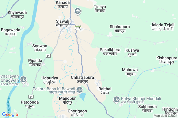
Nawalpura Map
EDIT Map
Add Your House
 ..
..
Current Corona Virus Infected Patients Count in Baran District
| City Name | District Name | Total Covid cases |
|---|
Locality Name :
Nawalpura
( नवलपुरा )
Tehsil Name : Anta
District : Baran
State : Rajasthan
Division : Kota
Language : Hindi and Rajasthani
Current Time 11:33 AM
Date: Tuesday , Apr 29,2025 (IST)
Time zone: IST (UTC+5:30)
Elevation / Altitude: 246 meters. Above Seal level
Telephone Code / Std Code: 07455
Assembly constituency : Anta assembly constituency
Assembly MLA : Kanwarlal
Lok Sabha constituency : Jhalawar-Baran parliamentary constituency
Parliament MP : DUSHYANT SINGH
Serpanch Name :
Pin Code : 325206
Post Office Name : Siswali
Main Village Name : Nawalpura
Commodities Prices : Anta Market / Mandi
National Highways Reachable To Nawalpura
Nationa High Way :NH27
Nationa High Way :NH52
Nationa High Way :NH27
Nationa High Way :NH52
Rivers Near Nawalpura
Banganga
Khari Nadi
Banganga
Khari Nadi
About Nawalpura
Correct below Info and add more info about NawalpuraNawalpura is a small Village/hamlet in Anta Tehsil in Baran District of Rajasthan State, India. It comes under Nawalpura Panchayath. It belongs to Kota Division . It is located 31 KM towards North from District head quarters Baran. 12 KM from Anta. 219 KM from State capital Jaipur
Nawalpura Pin code is 325206 and postal head office is Siswali .
Seeswali ( 6 KM ) , Udpuriya ( 7 KM ) , Patonda ( 9 KM ) , Bargaon ( 10 KM ) , Jaloda Tejaji ( 10 KM ) are the nearby Villages to Nawalpura. Nawalpura is surrounded by Sultanpur Tehsil towards west , Baran (Full) Tehsil towards South , Itawa Tehsil towards North , Kishanganj Tehsil towards East .
Mangrol , Baran , Lakheri , Sheopur are the near by Cities to Nawalpura.
This Place is in the border of the Baran District and Kota District. Kota District Sultanpur is west towards this place .
Nawalpura 2011 Census Details
Nawalpura Local Language is Hindi. Nawalpura Village Total population is 437 and number of houses are 82. Female Population is 48.7%. Village literacy rate is 65.4% and the Female Literacy rate is 24.3%.
Population
| Census Parameter | Census Data |
| Total Population | 437 |
| Total No of Houses | 82 |
| Female Population % | 48.7 % ( 213) |
| Total Literacy rate % | 65.4 % ( 286) |
| Female Literacy rate | 24.3 % ( 106) |
| Scheduled Tribes Population % | 73.0 % ( 319) |
| Scheduled Caste Population % | 14.2 % ( 62) |
| Working Population % | 44.4 % |
| Child(0 -6) Population by 2011 | 59 |
| Girl Child(0 -6) Population % by 2011 | 49.2 % ( 29) |
Nawalpura Census More Deatils.
Politics in Nawalpura
BJP , INC are the major political parties in this area.Polling Stations /Booths near Nawalpura
1)Government Upper Primary School Moondala2)Government Primary School Chainpuria
3)Government Upper Primary School Govindpura
4)Government Primary School Moondiya
5)Government Senior Secondary School Palaytha Right Part
HOW TO REACH Nawalpura
By Rail
There is no railway station near to Nawalpura in less than 10 km.Colleges near Nawalpura
Mahtma Gopal Ram Mahavidhalya
Address :
Schools in Nawalpura
G. P.s. Nawalpura
Address : nawalpura , anta , baran , Rajasthan . PIN- 325206 , Post - Siswali
Govt Health Centers near Nawalpura
1) Kishanpura , Kishanpura , Kishanpura , SC Kishanpura2) Jaloda Khatiyan , subcenter Jaloda Khatiyan , Jaloda Khatiyan , subcenter
3) Barod , Govt. Building Barod , Hat ke chock ke pass barod , Hat ke chock ke pass barod
Sub Villages in Nawalpura
Hospitals in Nawalpura,Anta
Government Community Health Center
Siswali; Baran; MDR-54; Mangrol; Mangrol; Rajasthan 325215; India
5.5 KM distance Detail
more ..
Petrol Bunks in Nawalpura,Anta
HP PETROL PUMP - HAMARA PUMP BAROD
Village: Barod Itawa Road Kota; Kota; Rajasthan 325204; India
13.2 KM distance Detail
more ..
Colleges in Nawalpura,Anta
Mata Bhagwati Devi; Dev Culture Women's Agriculture College
Baran; Rajasthan 325206; India
6.1 KM distance Detail
Aryabhatta Pvt.Indusrial Training Institute
Anta - Siswali Rd; Rajasthan 325202; India
20.5 KM distance Detail
Subodh Pvt. Industrial Training Institute
Anta - Siswali Rd; Rajasthan 325202; India
20.8 KM distance Detail
more ..
Schools in Nawalpura,Anta
Govt.high Primary School Papadli
village- papadli; post-udapuriya; tehsil-mangrol; Rajasthan; India
3.4 KM distance Detail
Police Stations near Nawalpura,Anta
Police Thana;Siswali; Baran;Rajasthan
RJ SH 37A; Kanada; Rajasthan 325206; India
6.7 KM distance Detail
Governement Offices near Nawalpura,Anta
Atal Seva Kendra
Baran; Baran; SH-37A; Mangrol; Mangrol; Rajasthan 325215; India
5.2 KM distance Detail
About Nawalpura &
History
How to reach Nawalpura
Tourist Places Near By Nawalpura
Schools in Nawalpura
Colleges in Nawalpura
Temperature & weather of Nawalpura
places in Nawalpura
Nawalpura photos
More Information
How to reach Nawalpura
Tourist Places Near By Nawalpura
Schools in Nawalpura
Colleges in Nawalpura
Temperature & weather of Nawalpura
places in Nawalpura
Nawalpura photos
More Information
Village Talk
Post News or Events about this Village
Near Cities
Mangrol 15 KM near
Baran 31 KM near
Lakheri 48 KM near
Sheopur 58 KM near
Mangrol 15 KM near
Baran 31 KM near
Lakheri 48 KM near
Sheopur 58 KM near
Near By Taluks
Anta 11 KM near
Sultanpur 25 KM near
Baran (Full) 31 KM near
Itawa 34 KM near
Anta 11 KM near
Sultanpur 25 KM near
Baran (Full) 31 KM near
Itawa 34 KM near
Near By Air Ports
Sanganeer Airport 198 KM near
Gwalior Airport 240 KM near
Bhopal Airport 274 KM near
Kheria Airport 290 KM near
Sanganeer Airport 198 KM near
Gwalior Airport 240 KM near
Bhopal Airport 274 KM near
Kheria Airport 290 KM near
Near By Tourist Places
Kota 63 KM near
Bundi 85 KM near
Sawai Madhopur 88 KM near
Ranthambore 89 KM near
Jhalawar 105 KM near
Kota 63 KM near
Bundi 85 KM near
Sawai Madhopur 88 KM near
Ranthambore 89 KM near
Jhalawar 105 KM near
Near By Districts
Baran 31 KM near
Sheopur 58 KM near
Kota 58 KM near
Bundi 84 KM near
Baran 31 KM near
Sheopur 58 KM near
Kota 58 KM near
Bundi 84 KM near
Near By RailWay Station
Baran Rail Way Station 30 KM near
Lakheri Rail Way Station 46 KM near
Baran Rail Way Station 30 KM near
Lakheri Rail Way Station 46 KM near