| Home | City Bus | Maps | Villages | Cities | Rail | Tourist Places | School | College | Pin Codes | Corona Cases Count |
| Distance Calculator Bus Services IFSC Codes Trace Mobile Number Weather Search Place Trace IP Available Cash ATM/Banks Locate Polling Booth Report an Error contact People |
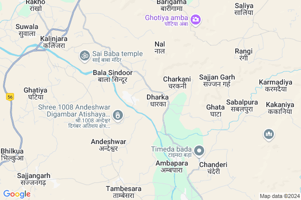
Dharka
Dharka Map
EDIT Map
Add Your House
 ..
..
Current Corona Virus Infected Patients Count in Banswara District
| City Name | District Name | Total Covid cases |
|---|---|---|
| Banswara District | Banswara | 62 |
Locality Name :
Dharka
( द्वारका )
Tehsil Name : Sajjangarh
District : Banswara
State : Rajasthan
Division : Udaipur
Language : Hindi and Rajasthani
Current Time 11:26 AM
Date: Sunday , Apr 27,2025 (IST)
Time zone: IST (UTC+5:30)
Telephone Code / Std Code: 02968
Assembly constituency : Kushalgarh assembly constituency
Assembly MLA : Ramila Khadiya
Lok Sabha constituency : Banswara parliamentary constituency
Parliament MP : KANAKMAL KATARA
Serpanch Name :
Pin Code : 327604
Post Office Name : Barodia
Main Village Name : Dharka
Commodities Prices : Jhalod Market / Mandi
Rivers Near Dharka
Pat
Machhan
Pat
Machhan
About Dharka
Correct below Info and add more info about DharkaDharka is a small Village/hamlet in Sajjangarh Tehsil in Banswara District of Rajasthan State, India. It comes under Dharka Panchayath. It belongs to Udaipur Division . It is located 32 KM towards South from District head quarters Banswara. 13 KM from Sajjangarh. 499 KM from State capital Jaipur
Dharka Pin code is 327604 and postal head office is Barodia .
Sabalpura ( 6 KM ) , Itala ( 7 KM ) , Barigama ( 7 KM ) , Jheekli ( 8 KM ) , Sagwa ( 9 KM ) are the nearby Villages to Dharka. Dharka is surrounded by Kushalgarh Tehsil towards South , Bagidora Tehsil towards west , Banswara Tehsil towards North , Anandpuri Tehsil towards west .
Banswara , Dahod , Sagwara , Jhabua are the near by Cities to Dharka.
Dharka 2011 Census Details
Dharka Local Language is Hindi. Dharka Village Total population is 699 and number of houses are 164. Female Population is 49.6%. Village literacy rate is 48.8% and the Female Literacy rate is 18.9%.
Population
| Census Parameter | Census Data |
| Total Population | 699 |
| Total No of Houses | 164 |
| Female Population % | 49.6 % ( 347) |
| Total Literacy rate % | 48.8 % ( 341) |
| Female Literacy rate | 18.9 % ( 132) |
| Scheduled Tribes Population % | 98.9 % ( 691) |
| Scheduled Caste Population % | 0.4 % ( 3) |
| Working Population % | 70.4 % |
| Child(0 -6) Population by 2011 | 155 |
| Girl Child(0 -6) Population % by 2011 | 47.1 % ( 73) |
Dharka Census More Deatils.
Politics in Dharka
Independent , Bharatiya Janata Party , JD(U) , BJP , INC are the major political parties in this area.Polling Stations /Booths near Dharka
1)Govt.p.s.bulding Darobadiya2)Govt.u.p.s.building(navin) Kushalgarh
3)Govt.u.p.s.building Sabbalpura
4)Govt.u.p.s.building Bor Bhatod
5)Govt.sec.s.building Kotda
HOW TO REACH Dharka
By Rail
There is no railway station near to Dharka in less than 10 km.Colleges near Dharka
Govt. Ekling-nath Acharya Sanskrit Mahavidyalay
Address :
Lbs College Of Arts & Commerce
Address :
Govt Polytecnic Collage Bagidora-naugama
Address :
Veer Aklavya College Jolana
Address :
Excellent College
Address :
Schools in Dharka
Shree Ram V.n.u.p.s. Dharka
Address : dharka , sajjandarh , banswara , Rajasthan . PIN- 327602 , Post - Sajjan Garh
G.p.s. Dharka
Address : dharka , sajjandarh , banswara , Rajasthan . PIN- 327602 , Post - Sajjan Garh
S.k.s.p.s. Dharka
Address : dharka , sajjandarh , banswara , Rajasthan . PIN- 327602 , Post - Sajjan Garh
Govt Health Centers near Dharka
1) Charkani , , Charkani , Timeda Bada2) Biladi , subcentre , biladi ,
3) Nichli Nal , , ,
Sub Villages in Dharka
Petrol Bunks in Dharka,Sajjangarh
ANMOL AUTOMOBILES ; INDIAN OIL ; PETROL PUMP; TYRE DEALER -JK TYRE & APOLLO TYRE
NH-113 ;BHILKUWA;NEAR SAJANGARH; Rajasthan 327602; India
11.1 KM distance Detail
NAVKAR FILLING STATION
National Highway 113; Bhilkua; Rajasthan 327602; India
12.1 KM distance Detail
more ..
Colleges in Dharka,Sajjangarh
Sanskar private ITI Kushalgarh
Behind Govt MBD college; Banswara Road; Kushalgarh; Rajasthan 327801; India
15.1 KM distance Detail
more ..
About Dharka &
History
How to reach Dharka
Tourist Places Near By Dharka
Schools in Dharka
Colleges in Dharka
Temperature & weather of Dharka
places in Dharka
Dharka photos
More Information
How to reach Dharka
Tourist Places Near By Dharka
Schools in Dharka
Colleges in Dharka
Temperature & weather of Dharka
places in Dharka
Dharka photos
More Information
Village Talk
Post News or Events about this Village
Near Cities
Banswara 28 KM near
Dahod 60 KM near
Sagwara 60 KM near
Jhabua 71 KM near
Banswara 28 KM near
Dahod 60 KM near
Sagwara 60 KM near
Jhabua 71 KM near
Near By Taluks
Sajjangarh 13 KM near
Bagidora 17 KM near
Kushalgarh 17 KM near
Banswara 25 KM near
Sajjangarh 13 KM near
Bagidora 17 KM near
Kushalgarh 17 KM near
Banswara 25 KM near
Near By Air Ports
Dabok Airport 171 KM near
Indore Airport 180 KM near
Vadodara Airport 180 KM near
Ahmedabad Airport 202 KM near
Dabok Airport 171 KM near
Indore Airport 180 KM near
Vadodara Airport 180 KM near
Ahmedabad Airport 202 KM near
Near By Tourist Places
Banswara 29 KM near
Dahod 56 KM near
Ratlam 80 KM near
Dungarpur 99 KM near
Champaner 140 KM near
Banswara 29 KM near
Dahod 56 KM near
Ratlam 80 KM near
Dungarpur 99 KM near
Champaner 140 KM near
Near By Districts
Banswara 31 KM near
Dohad 61 KM near
Jhabua 72 KM near
Ratlam 77 KM near
Banswara 31 KM near
Dohad 61 KM near
Jhabua 72 KM near
Ratlam 77 KM near
Near By RailWay Station
Bamnia Rail Way Station 51 KM near
Meghnagar Rail Way Station 53 KM near
Bamnia Rail Way Station 51 KM near
Meghnagar Rail Way Station 53 KM near