| Home | City Bus | Maps | Villages | Cities | Rail | Tourist Places | School | College | Pin Codes | Corona Cases Count |
| Distance Calculator Bus Services IFSC Codes Trace Mobile Number Weather Search Place Trace IP Available Cash ATM/Banks Locate Polling Booth Report an Error contact People |
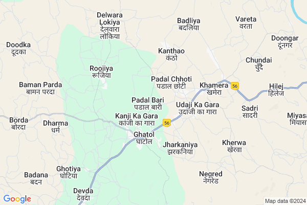
Amarpura Map
EDIT Map
Add Your House
 ..
..
Current Corona Virus Infected Patients Count in Banswara District
| City Name | District Name | Total Covid cases |
|---|---|---|
| Banswara District | Banswara | 62 |
Locality Name :
Amarpura
( अमरपुरा )
Tehsil Name : Ghatol
District : Banswara
State : Rajasthan
Division : Udaipur
Language : Hindi and Rajasthani
Current Time 12:55 PM
Date: Tuesday , Apr 29,2025 (IST)
Time zone: IST (UTC+5:30)
Elevation / Altitude: 509 meters. Above Seal level
Telephone Code / Std Code: 02961
Assembly constituency : Ghatol assembly constituency
Assembly MLA : Nanalal Ninama
Lok Sabha constituency : Banswara parliamentary constituency
Parliament MP : KANAKMAL KATARA
Serpanch Name :
Main Village Name : Amarpura
Commodities Prices : Sailana Market / Mandi
Rivers Near Amarpura
Sau River
Dudiya Khai
Sau River
Dudiya Khai
About Amarpura
Correct below Info and add more info about AmarpuraAmarpura is a small Village/hamlet in Ghatol Tehsil in Banswara District of Rajasthan State, India. It comes under Amarpura Panchayath. It belongs to Udaipur Division . It is located 30 KM towards North from District head quarters Banswara. 439 KM from State capital Jaipur
Amarpura is surrounded by Peepal Khoont Tehsil towards East , Banswara Tehsil towards South , Chhoti Sarwan Tehsil towards South , Garhi Tehsil towards west .
Banswara , Sagwara , Pratapgarh , Ramngarh are the near by Cities to Amarpura.
Amarpura 2011 Census Details
Amarpura Local Language is Hindi. Amarpura Village Total population is 797 and number of houses are 196. Female Population is 48.8%. Village literacy rate is 55.0% and the Female Literacy rate is 19.7%.
Population
| Census Parameter | Census Data |
| Total Population | 797 |
| Total No of Houses | 196 |
| Female Population % | 48.8 % ( 389) |
| Total Literacy rate % | 55.0 % ( 438) |
| Female Literacy rate | 19.7 % ( 157) |
| Scheduled Tribes Population % | 89.0 % ( 709) |
| Scheduled Caste Population % | 0.0 % ( 0) |
| Working Population % | 48.3 % |
| Child(0 -6) Population by 2011 | 157 |
| Girl Child(0 -6) Population % by 2011 | 40.8 % ( 64) |
Amarpura Census More Deatils.
Politics in Amarpura
Bharatiya Janata Party , BJP , INC are the major political parties in this area.Polling Stations /Booths near Amarpura
1)Govt. U.p. School Chiklipada2)Govt. Primary School Building Vilwapada
3)Govt. U.p. School Building Chirola
4)Govt. Secondary School Building Badana (left Side)
5)Govt. Primary School Building Vadeta
HOW TO REACH Amarpura
By Rail
There is no railway station near to Amarpura in less than 10 km.Pincodes near Amarpura
327023 ( Ghatol ) , 327027 ( Khamera ) , 327021 ( Ganoda )Colleges near Amarpura
Govt. Ekling-nath Acharya Sanskrit Mahavidyalay
Address :
Lbs College Of Arts & Commerce
Address :
Excellent College
Address :
Schools in Amarpura
G.p.s.garediyapada
Address : amarpura , ghatol , banswara , Rajasthan . PIN- 327023 , Post - Ghatol
Sks P.s.amarpura
Address : amarpura , ghatol , banswara , Rajasthan . PIN- 327027 , Post - Khamera
Govt Health Centers near Amarpura
1) Rujia , , ,2) Himmat Singh Ka Gada , , ,
3) Charpotiya , Sub Center Building , ,
Sub Villages in Amarpura
Hospitals in Amarpura,Ghatol
Primary Health Center
Savaniya; Banswara; NH-113; Banswara Road; Banswara; Banswara; Rajasthan 327023; India
2.3 KM distance Detail
more ..
Petrol Bunks in Amarpura,Ghatol
Tripura Filling Station-Indian Oil Petrol Pump
Ghatal; Banswara; NH-113; Banswara Road; Banswara; Banswara; Rajasthan 327023; India
1.9 KM distance Detail
RAINY FILLING STATION
Ghatol Mahi Dam Link Rd; Banswara; Rajasthan 327027; India
4.2 KM distance Detail
more ..
Colleges in Amarpura,Ghatol
Nakoda Computers PMKVY
Tehsil Road; Opp. Police Chowki; Ghatol; Rajasthan 327023; India
2.7 KM distance Detail
KALA COMMUNICATION AND STUDY CENTRE
POST OFFICE CHOURAYA ;MAIN ROAD GHATOL GANORA ROAD National Highway 113; Ghatol; Rajasthan 327023; India
3.1 KM distance Detail
more ..
Schools in Amarpura,Ghatol
Ideal Academy Secondary School
Ghatal; Banswara; NH-113; Banswara Road; Banswara; Banswara; Rajasthan 327023; India
2.1 KM distance Detail
Englishbolega.com
POST CHOURAHA; GANODA ROAD; PANCHAL BHAVAN; Ghatol; Rajasthan 327023; India
2.8 KM distance Detail
Super Markets in Amarpura,Ghatol
Mohanlal Vardichand Jain Shop
Motagaon Rd; Motagaon; Rajasthan 327021; India
20.1 KM distance Detail
Local Parks in Amarpura,Ghatol
Governement Offices near Amarpura,Ghatol
Adhishashi Abhiyanta
113; Banswara Rd; Teliwada; Industrial Area; Banswara; Rajasthan 327023; India
2.9 KM distance Detail
Patwari Office
113; Banswara Rd; Industrial Area; Banswara; Rajasthan 327023; India
2.9 KM distance Detail
Atal Seva Center
113; Banswara Rd; Industrial Area; Banswara; Rajasthan 327023; India
3.6 KM distance Detail
About Amarpura &
History
How to reach Amarpura
Tourist Places Near By Amarpura
Schools in Amarpura
Colleges in Amarpura
Temperature & weather of Amarpura
places in Amarpura
Amarpura photos
More Information
How to reach Amarpura
Tourist Places Near By Amarpura
Schools in Amarpura
Colleges in Amarpura
Temperature & weather of Amarpura
places in Amarpura
Amarpura photos
More Information
Village Talk
Post News or Events about this Village
Near Cities
Banswara 32 KM near
Sagwara 47 KM near
Pratapgarh 51 KM near
Ramngarh 56 KM near
Banswara 32 KM near
Sagwara 47 KM near
Pratapgarh 51 KM near
Ramngarh 56 KM near
Near By Taluks
Ghatol 0 KM near
Peepal Khoont 29 KM near
Banswara 34 KM near
Chhoti Sarwan 36 KM near
Ghatol 0 KM near
Peepal Khoont 29 KM near
Banswara 34 KM near
Chhoti Sarwan 36 KM near
Near By Air Ports
Dabok Airport 120 KM near
Indore Airport 205 KM near
Ahmedabad Airport 223 KM near
Vadodara Airport 227 KM near
Dabok Airport 120 KM near
Indore Airport 205 KM near
Ahmedabad Airport 223 KM near
Vadodara Airport 227 KM near
Near By Tourist Places
Banswara 29 KM near
Dungarpur 80 KM near
Ratlam 94 KM near
Neemuch 99 KM near
Dahod 115 KM near
Banswara 29 KM near
Dungarpur 80 KM near
Ratlam 94 KM near
Neemuch 99 KM near
Dahod 115 KM near
Near By Districts
Banswara 29 KM near
Pratapgarh 52 KM near
Dungarpur 80 KM near
Mandsaur 80 KM near
Banswara 29 KM near
Pratapgarh 52 KM near
Dungarpur 80 KM near
Mandsaur 80 KM near
Near By RailWay Station
Jaora Rail Way Station 81 KM near
Mandsor Rail Way Station 83 KM near
Jaora Rail Way Station 81 KM near
Mandsor Rail Way Station 83 KM near