| Home | City Bus | Maps | Villages | Cities | Rail | Tourist Places | School | College | Pin Codes | Corona Cases Count |
| Distance Calculator Bus Services IFSC Codes Trace Mobile Number Weather Search Place Trace IP Available Cash ATM/Banks Locate Polling Booth Report an Error contact People |
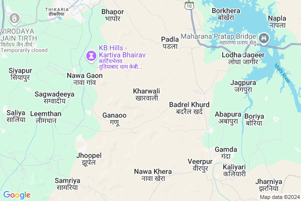
Kharwali Map
EDIT Map
Add Your House
 ..
..
Current Corona Virus Infected Patients Count in Banswara District
| City Name | District Name | Total Covid cases |
|---|---|---|
| Banswara District | Banswara | 62 |
Locality Name :
Kharwali
( खारवाली )
Tehsil Name : Banswara
District : Banswara
State : Rajasthan
Division : Udaipur
Language : Hindi and Rajasthani
Current Time 04:46 PM
Date: Tuesday , Apr 29,2025 (IST)
Time zone: IST (UTC+5:30)
Telephone Code / Std Code: 02962
Assembly constituency : Banswara assembly constituency
Assembly MLA : Arjun Singh Bamaniya
Lok Sabha constituency : Banswara parliamentary constituency
Parliament MP : KANAKMAL KATARA
Serpanch Name :
Pin Code : 327001
Post Office Name : Banswara
Main Village Name : Kharwali
Commodities Prices : Sailana Market / Mandi
Kharwali Live Weather
Temperature: 42.2 °C
clear sky
Humidity: 9%
Wind : 6.43 mt/sec towards W
StationName : "BÄ\u0081nswÄ\u0081ra"
observed on 23 Mins Back
Temperature: 42.2 °C
clear sky
Humidity: 9%
Wind : 6.43 mt/sec towards W
StationName : "BÄ\u0081nswÄ\u0081ra"
observed on 23 Mins Back
Kharwali Weather Forecast for Next 5 days
30-04-2025
29.6°C to 41.7°C
clear sky, scattered clouds
29.6°C to 41.7°C
clear sky, scattered clouds
01-05-2025
27.9°C to 42.4°C
few clouds, clear sky, scattered clouds
27.9°C to 42.4°C
few clouds, clear sky, scattered clouds
02-05-2025
27.7°C to 42.6°C
clear sky, few clouds
27.7°C to 42.6°C
clear sky, few clouds
03-05-2025
27.7°C to 41.9°C
clear sky
27.7°C to 41.9°C
clear sky
04-05-2025
26.6°C to 40.5°C
clear sky
26.6°C to 40.5°C
clear sky
National Highways Reachable To Kharwali
Nationa High Way :NH156
Nationa High Way :NH927A
Nationa High Way :NH156
Nationa High Way :NH927A
Rivers Near Kharwali
Anas
Karan
Anas
Karan
About Kharwali
Correct below Info and add more info about KharwaliKharwali is a small Village/hamlet in Banswara Tehsil in Banswara District of Rajasthan State, India. It comes under Kharwali Panchayath. It belongs to Udaipur Division . It is located 9 KM towards South from District head quarters Banswara. 4 KM from Banswara. 474 KM from State capital Jaipur
Kharwali Pin code is 327001 and postal head office is Banswara .
Ganaoo ( 3 KM ) , Badrel Khurd ( 3 KM ) , Nawa Gaon ( 5 KM ) , Abapura ( 6 KM ) , Jhoopel ( 7 KM ) are the nearby Villages to Kharwali. Kharwali is surrounded by Chhoti Sarwan Tehsil towards East , Kushalgarh Tehsil towards South , Bagidora Tehsil towards west , Bajna Tehsil towards East .
Banswara , Sagwara , Ratlam , Pratapgarh are the near by Cities to Kharwali.
Kharwali 2011 Census Details
Kharwali Local Language is Hindi. Kharwali Village Total population is 552 and number of houses are 131. Female Population is 47.6%. Village literacy rate is 23.9% and the Female Literacy rate is 7.2%.
Population
| Census Parameter | Census Data |
| Total Population | 552 |
| Total No of Houses | 131 |
| Female Population % | 47.6 % ( 263) |
| Total Literacy rate % | 23.9 % ( 132) |
| Female Literacy rate | 7.2 % ( 40) |
| Scheduled Tribes Population % | 99.1 % ( 547) |
| Scheduled Caste Population % | 0.9 % ( 5) |
| Working Population % | 39.3 % |
| Child(0 -6) Population by 2011 | 150 |
| Girl Child(0 -6) Population % by 2011 | 47.3 % ( 71) |
Kharwali Census More Deatils.
Politics in Kharwali
Bharatiya Janata Party , BJP , INC are the major political parties in this area.Polling Stations /Booths near Kharwali
1)Govt. Upper Primary School Nadiya2)Govt. Sec. School Gagrawa
3)Aaganwari Center Kesharpura
4)Rajendra Bal Mandir Sen.sec. School Building Rohini Nagar (room No.5) Banswara
5)Govt. Primary School Bassi Makwana
HOW TO REACH Kharwali
By Rail
There is no railway station near to Kharwali in less than 10 km.Colleges near Kharwali
Govt. Ekling-nath Acharya Sanskrit Mahavidyalay
Address :
Lbs College Of Arts & Commerce
Address :
Govt Polytecnic Collage Bagidora-naugama
Address :
Veer Aklavya College Jolana
Address :
Excellent College
Address :
Schools near Kharwali
Jawahar Navodaya Vidyalaya
Address : np baswara_ward no. 004 , talwara , banswara , Rajasthan . PIN- 327002
S.k.s.u.p.s. Ghada
Address : gadha , talwara , banswara , Rajasthan . PIN- 327001 , Post - Banswara
K.g.b.v. Abapura
Address : abapura , talwara , banswara , Rajasthan . PIN- 327001 , Post - Banswara
G.u.p.s. Sanskrit Talwara
Address : talwara , talwara , banswara , Rajasthan . PIN- 327025 , Post - Talwara
Govt Health Centers near Kharwali
1) Ganau , , ,2) Badrel , Badrel , ,
3) Singpur , , ,
Sub Villages in Kharwali
Hospitals in Kharwali,Banswara
Dariyai Clinic And Medical Store
Banswara; Lal Pahari Masjid Rd; Pratap Nagar; Indra Nagar; Jhunjhunu; Rajasthan 333001; India
9.8 KM distance Detail
Dr Shailendra Jain
2nd floor; Gyayak ShoppingCentre(Maa Beti Chai); 40 Industries Area Dahod Road;; Banswara; Rajasthan 327001; India
10.0 KM distance Detail
more ..
Petrol Bunks in Kharwali,Banswara
Shree Mahaveer Filling Station Bharat Petroleum Bhapor
Industrial Area; Banswara; Rajasthan 327001; India
8.3 KM distance Detail
more ..
Colleges in Kharwali,Banswara
WAGAR INFOTECH SHIKSHA SAMITI; BANSWARA
Chhatrasalpur; Rajasthan 327001; India
7.3 KM distance Detail
Wagar Shree College
Tripoliya Road; Ghantaghar; Banswara; Rajasthan 327001; India
10.5 KM distance Detail
Aravali college
Dahud Road ;Near Aakashvani; Tripura Mandir Lane;Tikariya; Banswara; Rajasthan 327001; India
10.7 KM distance Detail
Haridev Joshi Rajkiya Kanya Mahavidyalaya
Gandi Murti; Banswara; Rajasthan 327001; India
10.8 KM distance Detail
more ..
Schools in Kharwali,Banswara
Govt School Of Chatralpur
Nowa gaon Road; Chhatrasalpur; Rajasthan 327001; India
7.6 KM distance Detail
Super Markets in Kharwali,Banswara
DHAVAL PROVISIONAL STORE
Pragya public school Kalika mata mandir; Banswara; Rajasthan 327001; India
10.2 KM distance Detail
Local Parks in Kharwali,Banswara
Deep Vatika
Ratlam Jaipur Rd Link; Sindhi Colony; Banswara; Rajasthan 327001; India
10.8 KM distance Detail
Governement Offices near Kharwali,Banswara
Nehra Packers and Movers Banswara
Rajtalab Colony; Banswara; Rajasthan 327001; India
10.2 KM distance Detail
Patwari Office
113; Banswara Rd; Industrial Area; Thikaria; Banswara; Rajasthan 327001; India
10.3 KM distance Detail
Lok Seva Samiti
Thikriya; Banswara; NH-113; Banswara Road; Banswara; Banswara; Rajasthan 327001; India
10.3 KM distance Detail
About Kharwali &
History
How to reach Kharwali
Tourist Places Near By Kharwali
Schools in Kharwali
Colleges in Kharwali
Temperature & weather of Kharwali
places in Kharwali
Kharwali photos
More Information
How to reach Kharwali
Tourist Places Near By Kharwali
Schools in Kharwali
Colleges in Kharwali
Temperature & weather of Kharwali
places in Kharwali
Kharwali photos
More Information
Village Talk
Post News or Events about this Village
Near Cities
Banswara 7 KM near
Sagwara 58 KM near
Ratlam 66 KM near
Pratapgarh 78 KM near
Banswara 7 KM near
Sagwara 58 KM near
Ratlam 66 KM near
Pratapgarh 78 KM near
Near By Taluks
Banswara 4 KM near
Chhoti Sarwan 19 KM near
Kushalgarh 32 KM near
Bajna 33 KM near
Banswara 4 KM near
Chhoti Sarwan 19 KM near
Kushalgarh 32 KM near
Bajna 33 KM near
Near By Air Ports
Dabok Airport 157 KM near
Indore Airport 178 KM near
Vadodara Airport 203 KM near
Ahmedabad Airport 218 KM near
Dabok Airport 157 KM near
Indore Airport 178 KM near
Vadodara Airport 203 KM near
Ahmedabad Airport 218 KM near
Near By Tourist Places
Banswara 9 KM near
Ratlam 70 KM near
Dahod 79 KM near
Dungarpur 98 KM near
Neemuch 131 KM near
Banswara 9 KM near
Ratlam 70 KM near
Dahod 79 KM near
Dungarpur 98 KM near
Neemuch 131 KM near
Near By Districts
Banswara 9 KM near
Ratlam 67 KM near
Pratapgarh 78 KM near
Dohad 83 KM near
Banswara 9 KM near
Ratlam 67 KM near
Pratapgarh 78 KM near
Dohad 83 KM near
Near By RailWay Station
Bamnia Rail Way Station 56 KM near
Ratlam Junction Rail Way Station 67 KM near
Bamnia Rail Way Station 56 KM near
Ratlam Junction Rail Way Station 67 KM near