| Home | City Bus | Maps | Villages | Cities | Rail | Tourist Places | School | College | Pin Codes | Corona Cases Count |
| Distance Calculator Bus Services IFSC Codes Trace Mobile Number Weather Search Place Trace IP Available Cash ATM/Banks Locate Polling Booth Report an Error contact People |
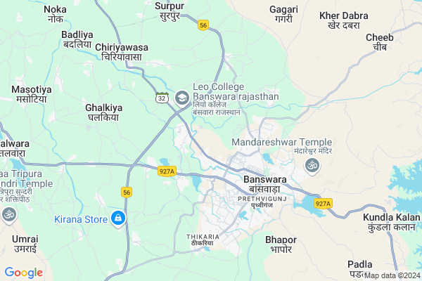
Dhamaniya Map
EDIT Map
Add Your House
 ..
..
Current Corona Virus Infected Patients Count in Banswara District
| City Name | District Name | Total Covid cases |
|---|---|---|
| Banswara District | Banswara | 62 |
Locality Name :
Dhamaniya
( धमनिया )
Tehsil Name : Banswara
District : Banswara
State : Rajasthan
Division : Udaipur
Language : Hindi and Rajasthani
Current Time 04:49 PM
Date: Tuesday , Apr 29,2025 (IST)
Time zone: IST (UTC+5:30)
Telephone Code / Std Code: 02962
Assembly constituency : Banswara assembly constituency
Assembly MLA : Arjun Singh Bamaniya
Lok Sabha constituency : Banswara parliamentary constituency
Parliament MP : KANAKMAL KATARA
Serpanch Name :
Pin Code : 327001
Post Office Name : Banswara
Main Village Name : Dhamaniya
Commodities Prices : Sailana Market / Mandi
Dhamaniya Live Weather
Temperature: 43.4 °C
clear sky
Humidity: 9%
Wind : 6.57 mt/sec towards W
StationName : "BÄ\u0081nswÄ\u0081ra"
observed on 9 Mins Back
Temperature: 43.4 °C
clear sky
Humidity: 9%
Wind : 6.57 mt/sec towards W
StationName : "BÄ\u0081nswÄ\u0081ra"
observed on 9 Mins Back
Dhamaniya Weather Forecast for Next 5 days
30-04-2025
30.7°C to 42.9°C
clear sky, scattered clouds, few clouds
30.7°C to 42.9°C
clear sky, scattered clouds, few clouds
01-05-2025
28.9°C to 43.8°C
clear sky, few clouds, broken clouds, scattered clouds
28.9°C to 43.8°C
clear sky, few clouds, broken clouds, scattered clouds
02-05-2025
28.9°C to 44.0°C
clear sky
28.9°C to 44.0°C
clear sky
03-05-2025
28.9°C to 43.1°C
clear sky
28.9°C to 43.1°C
clear sky
04-05-2025
27.5°C to 41.3°C
clear sky
27.5°C to 41.3°C
clear sky
National Highways Reachable To Dhamaniya
Nationa High Way :NH156
Nationa High Way :NH927A
Nationa High Way :NH156
Nationa High Way :NH927A
Rivers Near Dhamaniya
Anas
Karan
Anas
Karan
About Dhamaniya
Correct below Info and add more info about DhamaniyaDhamaniya is a small Village/hamlet in Banswara Tehsil in Banswara District of Rajasthan State, India. It comes under Dhamaniya Panchayath. It belongs to Udaipur Division . It is located 5 KM towards west from District head quarters Banswara. 9 KM from Banswara. 465 KM from State capital Jaipur
Dhamaniya Pin code is 327001 and postal head office is Banswara .
Sewna ( 1 KM ) , Vidhyut Nagar ( 1 KM ) , Sharda Nagar ( 1 KM ) , Mahi Sarovar Nagar Housing Board Colony ( 2 KM ) , Rati Talai ( 2 KM ) are the nearby Villages to Dhamaniya. Dhamaniya is surrounded by Chhoti Sarwan Tehsil towards East , Ghatol Tehsil towards North , Garhi Tehsil towards west , Bagidora Tehsil towards South .
Banswara , Sagwara , Ramngarh , Pratapgarh are the near by Cities to Dhamaniya.
Dhamaniya 2011 Census Details
Dhamaniya Local Language is Hindi. Dhamaniya Village Total population is 661 and number of houses are 123. Female Population is 49.2%. Village literacy rate is 39.0% and the Female Literacy rate is 11.6%.
Population
| Census Parameter | Census Data |
| Total Population | 661 |
| Total No of Houses | 123 |
| Female Population % | 49.2 % ( 325) |
| Total Literacy rate % | 39.0 % ( 258) |
| Female Literacy rate | 11.6 % ( 77) |
| Scheduled Tribes Population % | 100.0 % ( 661) |
| Scheduled Caste Population % | 0.0 % ( 0) |
| Working Population % | 44.6 % |
| Child(0 -6) Population by 2011 | 150 |
| Girl Child(0 -6) Population % by 2011 | 48.0 % ( 72) |
Dhamaniya Census More Deatils.
Politics in Dhamaniya
Bharatiya Janata Party , BJP , INC are the major political parties in this area.Polling Stations /Booths near Dhamaniya
1)Govt. Sec. School Wagtalab2)Govt. Girls Sr.sec.school Building Theekriya
3)Govt. Sec. School Kheda Badlipada (right Part)
4)Govt Upper Primary School Building (right Part) Jhari Urf Laxmangarh
5)Govt. Primary School Building Saragwara Banswara
HOW TO REACH Dhamaniya
By Rail
There is no railway station near to Dhamaniya in less than 10 km.Colleges near Dhamaniya
Govt. Ekling-nath Acharya Sanskrit Mahavidyalay
Address :
Lbs College Of Arts & Commerce
Address :
Govt Polytecnic Collage Bagidora-naugama
Address :
Veer Aklavya College Jolana
Address :
Excellent College
Address :
Schools near Dhamaniya
Jawahar Navodaya Vidyalaya
Address : np baswara_ward no. 004 , talwara , banswara , Rajasthan . PIN- 327002
S.k.s.u.p.s. Ghada
Address : gadha , talwara , banswara , Rajasthan . PIN- 327001 , Post - Banswara
K.g.b.v. Abapura
Address : abapura , talwara , banswara , Rajasthan . PIN- 327001 , Post - Banswara
G.u.p.s. Sanskrit Talwara
Address : talwara , talwara , banswara , Rajasthan . PIN- 327025 , Post - Talwara
Govt Health Centers near Dhamaniya
1) Pipalwa , , ,2) Sewana , , ,
3) Lodha , , ,
Sub Villages in Dhamaniya
Petrol Bunks in Dhamaniya,Banswara
Royal Filling Station-Bharat Petroleum
Banswara; SH-32; Salumbar Banswara Road; Banswara; Banswara; Rajasthan 327001; India
1.3 KM distance Detail
Manak Filling Station-Essar Oil Petrol Pump
Dangpada; Banswara; SH-32; Salumbar Banswara Road; Banswara; Banswara; Rajasthan 327001; India
1.8 KM distance Detail
more ..
Colleges in Dhamaniya,Banswara
Shree Mahaveer B.Ed College
Udaipur - Banswara Hwy; Bargaon; Rajasthan 327001; India
1.8 KM distance Detail
New Look Girls PG College
Lodha Campus;Dungarpur Road; Banswara; Rajasthan 327001; India
2.2 KM distance Detail
more ..
Schools in Dhamaniya,Banswara
St Matthew's Sec. School; Banswara
Opp CMHO office; Udaipur road; Janawari; Rajasthan 327001; India
0.7 KM distance Detail
St.Thomas School
Near; towards CMHO office; Dhamaniya; Rajasthan 327001; India
0.7 KM distance Detail
Electronic Shops in Dhamaniya,Banswara
Vinayak Electricals And Traders
Banswara; Akshardham; Housing Board; Banswara; Rajasthan 327001; India
1.7 KM distance Detail
Kumar Electronics
'TULSI'; Near Pratap Circle; Shyam Colony; Banswara; Rajasthan 327001; India
2.0 KM distance Detail
Super Markets in Dhamaniya,Banswara
PATANJALI CHIKITSALAY; MANGALAM COMPLEX; BANSWARA
COLLEGE ROAD; Wadiya Colony; Banswara; Rajasthan 327001; India
2.6 KM distance Detail
Tarmal Departmental store
new abadi;gol chouraha;power house road banswara; India
4.0 KM distance Detail
Sulabh Traders
Rajasthan; Yadav Basthi; Gandi Murti; Banswara; Rajasthan 327001; India
4.1 KM distance Detail
Police Stations near Dhamaniya,Banswara
Police Chowki; Housing Board
Mahi Sarower Nagar Block C; Mahi Sarower Nagar; Housing Board; Banswara; Rajasthan 327001; India
2.2 KM distance Detail
SP office banswara
Banswara;; Najmi Bagh; Nai Abadi; Banswara; Rajasthan 327001; India
3.8 KM distance Detail
Governement Offices near Dhamaniya,Banswara
Atal Seva Centre
Lodha; Banswara; NH-927A; Dungarpur Banswara Road; Banswara; Banswara; Rajasthan 327025; India
2.2 KM distance Detail
Mahi Banswara Rajasthan Atomic Power Project (MBRAPP)
Mahi Sarower Nagar Block C; Mahi Sarower Nagar; Housing Board; Banswara; Rajasthan 327001; India
2.2 KM distance Detail
About Dhamaniya &
History
How to reach Dhamaniya
Tourist Places Near By Dhamaniya
Schools in Dhamaniya
Colleges in Dhamaniya
Temperature & weather of Dhamaniya
places in Dhamaniya
Dhamaniya photos
More Information
How to reach Dhamaniya
Tourist Places Near By Dhamaniya
Schools in Dhamaniya
Colleges in Dhamaniya
Temperature & weather of Dhamaniya
places in Dhamaniya
Dhamaniya photos
More Information
Village Talk
Post News or Events about this Village
Near Cities
Banswara 6 KM near
Sagwara 47 KM near
Ramngarh 69 KM near
Pratapgarh 71 KM near
Banswara 6 KM near
Sagwara 47 KM near
Ramngarh 69 KM near
Pratapgarh 71 KM near
Near By Taluks
Banswara 9 KM near
Chhoti Sarwan 23 KM near
Ghatol 26 KM near
Garhi 28 KM near
Banswara 9 KM near
Chhoti Sarwan 23 KM near
Ghatol 26 KM near
Garhi 28 KM near
Near By Air Ports
Dabok Airport 143 KM near
Indore Airport 190 KM near
Vadodara Airport 207 KM near
Ahmedabad Airport 214 KM near
Dabok Airport 143 KM near
Indore Airport 190 KM near
Vadodara Airport 207 KM near
Ahmedabad Airport 214 KM near
Near By Tourist Places
Banswara 4 KM near
Ratlam 81 KM near
Dungarpur 87 KM near
Dahod 89 KM near
Neemuch 122 KM near
Banswara 4 KM near
Ratlam 81 KM near
Dungarpur 87 KM near
Dahod 89 KM near
Neemuch 122 KM near
Near By Districts
Banswara 5 KM near
Pratapgarh 71 KM near
Ratlam 78 KM near
Dungarpur 87 KM near
Banswara 5 KM near
Pratapgarh 71 KM near
Ratlam 78 KM near
Dungarpur 87 KM near
Near By RailWay Station
Bamnia Rail Way Station 70 KM near
Ratlam Junction Rail Way Station 77 KM near
Bamnia Rail Way Station 70 KM near
Ratlam Junction Rail Way Station 77 KM near