| Home | City Bus | Maps | Villages | Cities | Rail | Tourist Places | School | College | Pin Codes | Corona Cases Count |
| Distance Calculator Bus Services IFSC Codes Trace Mobile Number Weather Search Place Trace IP Available Cash ATM/Banks Locate Polling Booth Report an Error contact People |
Chachanmeta
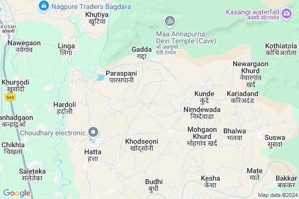
Chachanmeta Map
EDIT Map
Add Your House
 ..
..
Current Corona Virus Infected Patients Count in Balaghat District
| City Name | District Name | Total Covid cases |
|---|
Locality Name :
Chachanmeta
( चचनमता )
Tehsil Name : Balaghat
District : Balaghat
State : Madhya Pradesh
Division : Jabalpur
Language : Hindi and Marathi
Current Time 04:34 PM
Date: Tuesday , Apr 29,2025 (IST)
Time zone: IST (UTC+5:30)
Elevation / Altitude: 309 meters. Above Seal level
Telephone Code / Std Code: 07632
Assembly constituency : Paraswada assembly constituency
Assembly MLA : Madhu Bhau Bhagat
Lok Sabha constituency : Balaghat parliamentary constituency
Parliament MP : DR DHAL SINGH BISEN
Serpanch Name :
Pin Code : 481226
Post Office Name : Hatta (Balaghat)
Main Village Name : Chachanmeta
Commodities Prices : Balaghat Market / Mandi
Chachanmeta Live Weather
Temperature: 41.7 °C
scattered clouds
Humidity: 11%
Wind : 3.45 mt/sec towards W
StationName : "BÄ\u0081lÄ\u0081ghÄ\u0081t"
observed on 57 Mins Back
Temperature: 41.7 °C
scattered clouds
Humidity: 11%
Wind : 3.45 mt/sec towards W
StationName : "BÄ\u0081lÄ\u0081ghÄ\u0081t"
observed on 57 Mins Back
Chachanmeta Weather Forecast for Next 5 days
30-04-2025
27.5°C to 40.8°C
scattered clouds, clear sky, few clouds, overcast clouds
27.5°C to 40.8°C
scattered clouds, clear sky, few clouds, overcast clouds
01-05-2025
26.4°C to 42.4°C
broken clouds, clear sky, few clouds, scattered clouds
26.4°C to 42.4°C
broken clouds, clear sky, few clouds, scattered clouds
02-05-2025
26.3°C to 42.9°C
clear sky, broken clouds, scattered clouds, few clouds
26.3°C to 42.9°C
clear sky, broken clouds, scattered clouds, few clouds
03-05-2025
26.7°C to 42.3°C
scattered clouds, clear sky, broken clouds
26.7°C to 42.3°C
scattered clouds, clear sky, broken clouds
04-05-2025
26.9°C to 43.7°C
broken clouds, clear sky, scattered clouds
26.9°C to 43.7°C
broken clouds, clear sky, scattered clouds
National Highways Reachable To Chachanmeta
Nationa High Way :NH543
Nationa High Way :NH753;NH543
Nationa High Way :NH543
Nationa High Way :NH753;NH543
Rivers Near Chachanmeta
Sasakuran
Chadan
Sasakuran
Chadan
About Chachanmeta
Correct below Info and add more info about ChachanmetaChachanmeta is a small Village/hamlet in Balaghat Tehsil in Balaghat District of Madhya Pradesh State, India. It comes under Chachanmeta Panchayath. It belongs to Jabalpur Division . It is located 17 KM towards East from District head quarters Balaghat. 18 KM from Balaghat. 399 KM from State capital Bhopal
Chachanmeta Pin code is 481226 and postal head office is Hatta (Balaghat).
Khodseoni ( 3 KM ) , Dundaseoni ( 4 KM ) , Nimdewada ( 4 KM ) , Singodi ( 4 KM ) , Kunde ( 4 KM ) are the nearby Villages to Chachanmeta. Chachanmeta is surrounded by Balaghat Tehsil towards North , Waraseoni Tehsil towards west , Gondia Tehsil towards South , Lalbarra Tehsil towards west .
Balaghat , Wara Seoni , Gondiya , Malajkhand are the near by Cities to Chachanmeta.
Demographics of Chachanmeta
Hindi is the Local Language here.Politics in Chachanmeta
Bharatiya Janata Party , BJP , INC are the major political parties in this area.Polling Stations /Booths near Chachanmeta
1)Hatta-42)Hatta-2
3)Hatta-3
4)Hatta-1
5)Hardoli-1
HOW TO REACH Chachanmeta
By Rail
There is no railway station near to Chachanmeta in less than 10 km.Colleges near Chachanmeta
Govt Art And Commerce College Katangi
Address :
Om Politechnic College, Manegaon
Address :
Govt.college Kirnapur
Address :
Mt. Sm Deo Homoeopathic & Biochemic Medical College & Hospital, Balaghat, Madhya Pradesh
Address : Dev Nagarikhursodi, Gondia Road
Schools near Chachanmeta
Kamla Hayar Seco, V,m, Budi
Address : balaghat , balaghat , balaghat , Madhya Pradesh . PIN- 481001 , Post - Balaghat
Kendriya Vidyalya Bharweli
Address : bharweli , balaghat , balaghat , Madhya Pradesh . PIN- 481001 , Post - Balaghat
Gyandeep V,m,prem Nagar
Address : prem nagar ward 26 , balaghat , balaghat , Madhya Pradesh . PIN- 481001 , Post - Balaghat
Mathodi Mis School Balaghat
Address : balaghat , balaghat , balaghat , Madhya Pradesh . PIN- 481001 , Post - Balaghat
Govt Health Centers near Chachanmeta
1) SHC Mohgaonkhurd , Sub Health Centre , , Near Gram Panchayat Building2) SHC Hatta , Sub Health Centre , Hatta , Hatta
3) PHC Hatta , Primary Health Centre Hatta , ,
Sub Villages in Chachanmeta
Hospitals in Chachanmeta,Balaghat
Dr. Dekwar's Ayushman Hospital
Bala Ghat to Lalji Rd; Sarad Sioni; Gunai; Kirnapur; Madhya Pradesh 481226; India
8.0 KM distance Detail
more ..
Petrol Bunks in Chachanmeta,Balaghat
HP PETROL PUMP - AMAR FUELS
HPC Dealer KH NO 6/3;7/3;8/4 Village Navegaon;teh-balaghat; Jabalpur; Madhya Pradesh 481001; India
13.3 KM distance Detail
HP PETROL PUMP - KARAM FUELS
Sarekha Ward Gondia Road Balaghat; Jabalpur; Madhya Pradesh 481001; India
15.1 KM distance Detail
HP PETROL PUMP - GURU NANAK GARAGE
HPC Dealer Gondia Road; Kosmi Balaghat MP; Jabalpur; Madhya Pradesh 481001; India
15.5 KM distance Detail
more ..
Colleges in Chachanmeta,Balaghat
Mahakoshal Private I.T.I. Newargaon
MP SH 11; Newargaon Kalan; Madhya Pradesh 481226; India
14.8 KM distance Detail
more ..
Electronic Shops in Chachanmeta,Balaghat
Ravi Electricals & Agriculture Center
Mohgaon Khurd; Madhya Pradesh 481226; India
5.4 KM distance Detail
Super Markets in Chachanmeta,Balaghat
RupeeGeneral
Saraswati Nagar; Moti Nagar; Balaghat; Madhya Pradesh 481001; India
15.9 KM distance Detail
agrawal butik
Gai Khuri Rd; Gaykhuri; Balaghat; Madhya Pradesh 481001; India
16.1 KM distance Detail
Local Parks in Chachanmeta,Balaghat
Railway Colony Garden
Chitragupt Nagar; Balaghat; Madhya Pradesh 481001; India
15.5 KM distance Detail
Vivekananda Colony Garden
Vivekanand Colony; Chitragupt Nagar; Balaghat; Madhya Pradesh 481001; India
15.5 KM distance Detail
Police Stations near Chachanmeta,Balaghat
Police Station Balaghat (Rural)
Kosmi; Nawegaon; Madhya Pradesh 481001; India
12.9 KM distance Detail
Governement Offices near Chachanmeta,Balaghat
Pawar Mangal Bhawan
Saraswati Nagar; Moti Nagar; Balaghat; Madhya Pradesh 481001; India
15.3 KM distance Detail
About Chachanmeta &
History
How to reach Chachanmeta
Tourist Places Near By Chachanmeta
Schools in Chachanmeta
Colleges in Chachanmeta
Temperature & weather of Chachanmeta
places in Chachanmeta
Chachanmeta photos
More Information
How to reach Chachanmeta
Tourist Places Near By Chachanmeta
Schools in Chachanmeta
Colleges in Chachanmeta
Temperature & weather of Chachanmeta
places in Chachanmeta
Chachanmeta photos
More Information
Village Talk
Post News or Events about this Village
Near Cities
Balaghat 15 KM near
Wara Seoni 30 KM near
Gondiya 37 KM near
Malajkhand 55 KM near
Balaghat 15 KM near
Wara Seoni 30 KM near
Gondiya 37 KM near
Malajkhand 55 KM near
Near By Taluks
Kirnapur 13 KM near
Balaghat 17 KM near
Waraseoni 32 KM near
Lalbarra 36 KM near
Kirnapur 13 KM near
Balaghat 17 KM near
Waraseoni 32 KM near
Lalbarra 36 KM near
Near By Air Ports
Jabalpur Airport 122 KM near
Sonegaon Airport 166 KM near
Raipur Airport 180 KM near
Khajuraho Airport 384 KM near
Jabalpur Airport 122 KM near
Sonegaon Airport 166 KM near
Raipur Airport 180 KM near
Khajuraho Airport 384 KM near
Near By Tourist Places
Kanha National park 75 KM near
Pench National Park 82 KM near
Seoni 97 KM near
Bhandara 105 KM near
Kawardha 112 KM near
Kanha National park 75 KM near
Pench National Park 82 KM near
Seoni 97 KM near
Bhandara 105 KM near
Kawardha 112 KM near
Near By Districts
Balaghat 16 KM near
Gondia 38 KM near
Seoni 97 KM near
Bhandara 103 KM near
Balaghat 16 KM near
Gondia 38 KM near
Seoni 97 KM near
Bhandara 103 KM near
Near By RailWay Station
Gondia Junction Rail Way Station 38 KM near
Amgaon Rail Way Station 48 KM near
Gondia Junction Rail Way Station 38 KM near
Amgaon Rail Way Station 48 KM near