| Home | City Bus | Maps | Villages | Cities | Rail | Tourist Places | School | College | Pin Codes | Corona Cases Count |
| Distance Calculator Bus Services IFSC Codes Trace Mobile Number Weather Search Place Trace IP Available Cash ATM/Banks Locate Polling Booth Report an Error contact People |
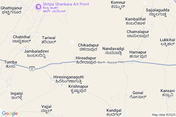
Hireadapur Map
EDIT Map
Add Your House
 ..
..
Current Corona Virus Infected Patients Count in Bagalkot District
| City Name | District Name | Total Covid cases |
|---|---|---|
| Bagalkote District | Bagalkote | 13 |
| Mudhol | Bagalkote | 8 |
| Jamakhandi | Bagalkote | 2 |
| Jamkhandi | Bagalkote | 1 |
Locality Name :
Hireadapur
( ಹಿರೇಅದಾಪುರ್ )
Taluk Name : Hungund
District : Bagalkot
State : Karnataka
Division : Belgaum
Language : Kannada and Konkani, Telugu, English
Current Time 03:08 PM
Date: Tuesday , Apr 29,2025 (IST)
Time zone: IST (UTC+5:30)
Elevation / Altitude: 508 meters. Above Seal level
Telephone Code / Std Code: 08351
Assembly constituency : Hungund assembly constituency
Assembly MLA : Kashappanavara Vijayanand Shivashankrappa
Lok Sabha constituency : Bagalkot parliamentary constituency
Parliament MP : Gaddigoudar Parvatagouda Chandanagouda
Serpanch Name :
Pin Code : 587125
Post Office Name : Ilkal
Main Village Name : Hireadapur
Commodities Prices : Kustagi Market / Mandi
Hireadapur Live Weather
Temperature: 38.5 °C
clear sky
Humidity: 16%
Wind : 2.21 mt/sec towards E
StationName : "Ilkal"
observed on Now
Temperature: 38.5 °C
clear sky
Humidity: 16%
Wind : 2.21 mt/sec towards E
StationName : "Ilkal"
observed on Now
Hireadapur Weather Forecast for Next 5 days
30-04-2025
30.6°C to 38.4°C
clear sky, few clouds, scattered clouds
30.6°C to 38.4°C
clear sky, few clouds, scattered clouds
01-05-2025
26.5°C to 39.4°C
scattered clouds, overcast clouds, broken clouds, clear sky
26.5°C to 39.4°C
scattered clouds, overcast clouds, broken clouds, clear sky
02-05-2025
25.2°C to 40.4°C
broken clouds, clear sky, few clouds
25.2°C to 40.4°C
broken clouds, clear sky, few clouds
03-05-2025
26.5°C to 40.8°C
scattered clouds, clear sky, overcast clouds, broken clouds
26.5°C to 40.8°C
scattered clouds, clear sky, overcast clouds, broken clouds
04-05-2025
27.5°C to 40.2°C
broken clouds, clear sky, overcast clouds, scattered clouds
27.5°C to 40.2°C
broken clouds, clear sky, overcast clouds, scattered clouds
National Highways Reachable To Hireadapur
Nationa High Way :NH50
Nationa High Way :NH367
Nationa High Way :NH50
Nationa High Way :NH367
Rivers Near Hireadapur
Malaprabha :ಮಲಪ್ರಭಾ
Malaprabha :ಮಲಪ್ರಭಾ
Malaprabha :ಮಲಪ್ರಭಾ
Malaprabha :ಮಲಪ್ರಭಾ
About Hireadapur
Correct below Info and add more info about HireadapurHireadapur is a small Village/hamlet in Hungund Taluk in Bagalkot District of Karnataka State, India. It comes under Hireadapur Panchayath. It belongs to Belgaum Division . It is located 71 KM towards East from District head quarters Bagalkot. 21 KM from Hungund. 432 KM from State capital Bangalore
Hireadapur Pin code is 587125 and postal head office is Ilkal .
Gorabal ( 13 KM ) , Binjawadgi ( 14 KM ) are the nearby Villages to Hireadapur. Hireadapur is surrounded by Kushtagi Taluk towards South , Lingsugur Taluk towards East , Muddebihal Taluk towards North , Yelburga Taluk towards South .
Lingsugur , Muddebihal , Talikota , Sindhnur are the near by Cities to Hireadapur.
Hireadapur 2011 Census Details
Hireadapur Local Language is Kannada. Hireadapur Village Total population is 548 and number of houses are 126. Female Population is 49.6%. Village literacy rate is 62.6% and the Female Literacy rate is 23.4%.
Population
| Census Parameter | Census Data |
| Total Population | 548 |
| Total No of Houses | 126 |
| Female Population % | 49.6 % ( 272) |
| Total Literacy rate % | 62.6 % ( 343) |
| Female Literacy rate | 23.4 % ( 128) |
| Scheduled Tribes Population % | 4.9 % ( 27) |
| Scheduled Caste Population % | 14.2 % ( 78) |
| Working Population % | 52.9 % |
| Child(0 -6) Population by 2011 | 60 |
| Girl Child(0 -6) Population % by 2011 | 41.7 % ( 25) |
Hireadapur Census More Deatils.
Politics in Hireadapur
JD(U) , Bharatiya Janata Party , BJP , Bharatiya Janata Party (BJP) , INC are the major political parties in this area.Polling Stations /Booths near Hireadapur
1)Govt Higher Primary School Chikka Aadapur (west Side)2)Govt Higher Primary School Bisaladinni (shouth Side)
3)Kannada Boys School Sankalapur
4)Govt Higer Boys Primary School Ishwar Nagar (balakundi Tanda) Right Wing
5)Govt Higher Primary School Ilal
HOW TO REACH Hireadapur
By Road
Ilkal is the Nearest Town to Hireadapur. Ilkal is 13 km from Hireadapur. Road connectivity is there from Ilkal to Hireadapur.By Rail
There is no railway station near to Hireadapur in less than 10 km.Colleges near Hireadapur
Govt Pu College Hungund
Address :
S C P U College Amingad
Address :
Rudragonda Patil Govt. First Grade College
Address : Dist.:bijapur Karnataka
S.r.kanthi College Of Education
Address : S.r.kanthi College Of Education Ilkal Bagalkot5871
Schools near Hireadapur
Muraraji Desai Res Sch Dhannur
Address : dhannur , hunagund , bagalkot , Karnataka . PIN- 587118 , Post - Hungund
K.g.b.v. School Kudal Sangam
Address : sangam , hunagund , bagalkot , Karnataka . PIN- 587115 , Post - Bevur (Bagalkot)
Govt Kbhps Muganur
Address : muganur , hunagund , bagalkot , Karnataka . PIN- 587120 , Post - Kamatgi
Govt Kbhps Vaddarhosur
Address : balakundi , hunagund , bagalkot , Karnataka . PIN- 587125 , Post - Ilkal
Govt Health Centers near Hireadapur
1) Nalatwad CHC , Government Hospital Nalatwad , CHC Nalatwad , Main road Nalatwad2) Tavargera-A , Sub Centre Tavargera A , Mudagal Road ,
3) FRU Kushtagi Taluka Hospital , , ,
Sub Villages in Hireadapur
Petrol Bunks in Hireadapur,Hungund
Gurunanak Fuels Hindustan Petroleum
Bagalkot; NH-13; Solapur Mangalore Highway; Ilkal; Ilkal; Karnataka 587154; India
16.0 KM distance Detail
HP PETROL PUMP - GURU MAHANT PETROLEUMS
HPC Dealers Taluka Hungund; Ilkal; Belgaum; Karnataka 587125; India
16.0 KM distance Detail
MAHANT PETROLEUM
ILKAL TOWN;ILKAL;BAGALKOT; BAGALKOT; Karnataka 587125; India
16.3 KM distance Detail
Bharath Petrolium
Bagalkot; NH-13; Solapur Mangalore Highway; Ilkal; Ilkal; Karnataka 587125; India
16.3 KM distance Detail
more ..
Colleges in Hireadapur,Hungund
Government PU College
Bagalkot; NH-13; Solapur Mangalore Highway; Ilkal; Ilkal; Karnataka 587154; India
15.5 KM distance Detail
more ..
Electronic Shops in Hireadapur,Hungund
Anjaneykumar Malipatil
Near; NH50; Maruthi Nagar; Ilkal; Karnataka 587125; India
15.1 KM distance Detail
Governement Offices near Hireadapur,Hungund
City Municipal Corporation
Bagalkot District; Ilkal; Karnataka 587125; India
16.5 KM distance Detail
About Hireadapur &
History
How to reach Hireadapur
Tourist Places Near By Hireadapur
Schools in Hireadapur
Colleges in Hireadapur
Temperature & weather of Hireadapur
places in Hireadapur
Hireadapur photos
More Information
How to reach Hireadapur
Tourist Places Near By Hireadapur
Schools in Hireadapur
Colleges in Hireadapur
Temperature & weather of Hireadapur
places in Hireadapur
Hireadapur photos
More Information
Village Talk
Post News or Events about this Village
Near Cities
Lingsugur 32 KM near
Muddebihal 41 KM near
Talikota 58 KM near
Sindhnur 70 KM near
Lingsugur 32 KM near
Muddebihal 41 KM near
Talikota 58 KM near
Sindhnur 70 KM near
Near By Taluks
Hungund 21 KM near
Kushtagi 23 KM near
Lingsugur 36 KM near
Muddebihal 39 KM near
Hungund 21 KM near
Kushtagi 23 KM near
Lingsugur 36 KM near
Muddebihal 39 KM near
Near By Air Ports
Hubli Airport 159 KM near
Sambre Airport 194 KM near
Sholapur Airport 204 KM near
Kolhapur Airport 240 KM near
Hubli Airport 159 KM near
Sambre Airport 194 KM near
Sholapur Airport 204 KM near
Kolhapur Airport 240 KM near
Near By Tourist Places
Aihole 41 KM near
Pattadakkal 50 KM near
Badami 67 KM near
Hampi 90 KM near
Hospet 95 KM near
Aihole 41 KM near
Pattadakkal 50 KM near
Badami 67 KM near
Hampi 90 KM near
Hospet 95 KM near
Near By Districts
Bagalkot 68 KM near
Koppal 85 KM near
Gadag 102 KM near
Bijapur District 117 KM near
Bagalkot 68 KM near
Koppal 85 KM near
Gadag 102 KM near
Bijapur District 117 KM near
Near By RailWay Station
Almatti Rail Way Station 56 KM near
Bagalkot Junction Rail Way Station 66 KM near
Almatti Rail Way Station 56 KM near
Bagalkot Junction Rail Way Station 66 KM near