| Home | City Bus | Maps | Villages | Cities | Rail | Tourist Places | School | College | Pin Codes | Corona Cases Count |
| Distance Calculator Bus Services IFSC Codes Trace Mobile Number Weather Search Place Trace IP Available Cash ATM/Banks Locate Polling Booth Report an Error contact People |
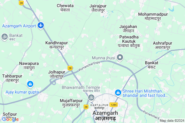
Radhopur
Radhopur Map
EDIT Map
Add Your House
 ..
..
Current Corona Virus Infected Patients Count in Azamgarh District
| City Name | District Name | Total Covid cases |
|---|---|---|
| Azamgarh District | Azamgarh | 8 |
Locality Name :
Radhopur
( राधोपुर )
Block Name : Bilariyaganj
District : Azamgarh
State : Uttar Pradesh
Division : Azamgarh
Language : Hindi and Urdu, Bhojpuri, Bihari
Current Time 11:39 AM
Date: Monday , Apr 28,2025 (IST)
Time zone: IST (UTC+5:30)
Elevation / Altitude: 81 meters. Above Seal level
Telephone Code / Std Code: 05462
Assembly constituency : Gopalpur assembly constituency
Assembly MLA : Nafees Ahmad
Lok Sabha constituency : Azamgarh parliamentary constituency
Parliament MP : Akhilesh Yadav
Serpanch Name :
Pin Code : 276135
Post Office Name : Kandhara Pur
Main Village Name : Radhopur
Commodities Prices : Azamgarh Market / Mandi
Radhopur Live Weather
Temperature: 32.9 °C
broken clouds
Humidity: 31%
Wind : 5.71 mt/sec towards SE
StationName : "Azamgarh"
observed on 2 Hours Back
Temperature: 32.9 °C
broken clouds
Humidity: 31%
Wind : 5.71 mt/sec towards SE
StationName : "Azamgarh"
observed on 2 Hours Back
Radhopur Weather Forecast for Next 5 days
29-04-2025
26.1°C to 38.1°C
broken clouds, overcast clouds
26.1°C to 38.1°C
broken clouds, overcast clouds
30-04-2025
25.1°C to 36.7°C
overcast clouds, broken clouds, clear sky
25.1°C to 36.7°C
overcast clouds, broken clouds, clear sky
01-05-2025
25.5°C to 38.3°C
clear sky, few clouds, broken clouds
25.5°C to 38.3°C
clear sky, few clouds, broken clouds
02-05-2025
27.4°C to 38.1°C
broken clouds, overcast clouds, light rain
27.4°C to 38.1°C
broken clouds, overcast clouds, light rain
03-05-2025
27.2°C to 37.5°C
overcast clouds, broken clouds, scattered clouds, clear sky
27.2°C to 37.5°C
overcast clouds, broken clouds, scattered clouds, clear sky
National Highways Reachable To Radhopur
Nationa High Way :NH19
Nationa High Way :NH27
Nationa High Way :NH19
Nationa High Way :NH27
Rivers Near Radhopur
Varuna
Varuna
Varuna
Varuna
About Radhopur
Correct below Info and add more info about RadhopurRadhopur is a small Village/hamlet in Bilariyaganj Block in Azamgarh District of Uttar Pradesh State, India. It comes under Radhopur Panchayath. It belongs to Azamgarh Division . It is located 9 KM towards North from District head quarters Azamgarh. 8 KM from Bilariya Ganj Dehat. 275 KM from State capital Lucknow
Radhopur Pin code is 276135 and postal head office is Kandhara Pur .
Basti Ugrah Patti ( 2 KM ) , Miriya Reraha ( 2 KM ) , Sahpur Maulani ( 3 KM ) , Bankatiya ( 3 KM ) , Sehda ( 3 KM ) are the nearby Villages to Radhopur. Radhopur is surrounded by Bilariyaganj Block towards North , Palhani Block towards South , Tahbarpur Block towards west , Mahrajganj Block towards North .
Azamgarh , Mau , Adari , Rudrapur are the near by Cities to Radhopur.
Radhopur 2011 Census Details
Radhopur Local Language is Hindi. Radhopur Village Total population is 1109 and number of houses are 158. Female Population is 51.0%. Village literacy rate is 54.8% and the Female Literacy rate is 23.0%.
Population
| Census Parameter | Census Data |
| Total Population | 1109 |
| Total No of Houses | 158 |
| Female Population % | 51.0 % ( 566) |
| Total Literacy rate % | 54.8 % ( 608) |
| Female Literacy rate | 23.0 % ( 255) |
| Scheduled Tribes Population % | 0.0 % ( 0) |
| Scheduled Caste Population % | 13.3 % ( 148) |
| Working Population % | 27.4 % |
| Child(0 -6) Population by 2011 | 179 |
| Girl Child(0 -6) Population % by 2011 | 50.8 % ( 91) |
Radhopur Census More Deatils.
Politics in Radhopur
SP , BSP are the major political parties in this area.Polling Stations /Booths near Radhopur
1)P.v. Barohi Fatepur2)P. V. Khairudeenpur(r.n.1)
3)P. V. Mishrapur (jhotipur)
4)J.h.s. Chewata(r.n.-3)
5)P. V. Narayanpur(r.n.-1)
HOW TO REACH Radhopur
By Rail
There is no railway station near to Radhopur in less than 10 km.Colleges near Radhopur
Sri Girdhari Tilakdhari Enter College
Address :
Amina Girl Inter College
Address :
Schools near Radhopur
U.p.s. Chalakpur
Address : chalakpur , bilariyaganj , azamgarh , Uttar Pradesh . PIN- 276139 , Post - Sardaha
U.p.s. Chhichhori
Address : chhichhori , bilariyaganj , azamgarh , Uttar Pradesh . PIN- 276121 , Post - Bilaria Ganj
U.p.s. Kapsa
Address : kapsa , bilariyaganj , azamgarh , Uttar Pradesh . PIN- 276121 , Post - Bilaria Ganj
U.p.s. Barae Jolhapur
Address : jolhapur , bilariyaganj , azamgarh , Uttar Pradesh . PIN- 276127 , Post - Bazar Gosain
Govt Health Centers near Radhopur
1) UPHC Anatpura , Anantpra Community Center , Anantpura , Hanuman Gadhi2) UPHC Dalsingar , Dalsingar , Dalsingar , Karbala Maidan
3) Manchoba , Manchoba , Manchoba ,
Sub Villages in Radhopur
Petrol Bunks in Radhopur,Bilariyaganj
Sunil Auto Fuels
Azamgarh - Bilariyaganj - Golabazar Rd; कीरतपुर; Azamgarh; Uttar Pradesh 276135; India
3.6 KM distance Detail
Bhawarnath Road Petrol Pump
Rajesultanpur - Azamgarh Rd; Azamgarh; Uttar Pradesh 276001; India
5.3 KM distance Detail
Yash Aluminium Glasses Works
Manchobha Rd; Azamgarh; Uttar Pradesh 276001; India
5.5 KM distance Detail
more ..
Colleges in Radhopur,Bilariyaganj
Shri Durga ji Inter College
NH-233; Azamghar Ambedkar Nagar Road; Sehda; Maharajpur; Azamgarh; Uttar Pradesh 276001; India
3.4 KM distance Detail
M M M Inter College
Kandharapur; Mahatma Gandhi Marg; Jolhapur; Kandhrapur; Uttar Pradesh 276135; India
4.3 KM distance Detail
Swami Sahajanand Polytechnic Institute
Village - Patwadha Katuk; Billariyaganj; Uttar Pradesh 276121; India
5.0 KM distance Detail
more ..
Super Markets in Radhopur,Bilariyaganj
RAI IFFCO Fartilizer
276135; Pipa pul;( Drum bridge) saidpur; Saidpur; Uttar Pradesh 221115; India
3.4 KM distance Detail
Police Stations near Radhopur,Bilariyaganj
Blarampur Police Chowki
Azamgarh - Dohrighat - Gorakhpur Rd; Pura Jodhi; Azamgarh; Uttar Pradesh 276001; India
6.3 KM distance Detail
Governement Offices near Radhopur,Bilariyaganj
Parinaya Vatika Married Haal
Azamgarh - Dohrighat - Gorakhpur Rd; Azamgarh; Uttar Pradesh 276001; India
5.8 KM distance Detail
About Radhopur &
History
How to reach Radhopur
Tourist Places Near By Radhopur
Schools in Radhopur
Colleges in Radhopur
Temperature & weather of Radhopur
places in Radhopur
Radhopur photos
More Information
How to reach Radhopur
Tourist Places Near By Radhopur
Schools in Radhopur
Colleges in Radhopur
Temperature & weather of Radhopur
places in Radhopur
Radhopur photos
More Information
Village Talk
Post News or Events about this Village
Near Cities
Azamgarh 8 KM near
Mau 24 KM near
Adari 52 KM near
Rudrapur 62 KM near
Azamgarh 8 KM near
Mau 24 KM near
Adari 52 KM near
Rudrapur 62 KM near
Near By Taluks
Azamgarh 7 KM near
Bilariyaganj 8 KM near
Palhani 8 KM near
Tahbarpur 12 KM near
Azamgarh 7 KM near
Bilariyaganj 8 KM near
Palhani 8 KM near
Tahbarpur 12 KM near
Near By Air Ports
Gorakhpur Airport 82 KM near
Varanasi Airport 91 KM near
Bamrauli Airport 182 KM near
Patna Airport 225 KM near
Gorakhpur Airport 82 KM near
Varanasi Airport 91 KM near
Bamrauli Airport 182 KM near
Patna Airport 225 KM near
Near By Tourist Places
Jaunpur 74 KM near
Gorakhpur 81 KM near
Sarnath 94 KM near
Basti 96 KM near
Varanasi 103 KM near
Jaunpur 74 KM near
Gorakhpur 81 KM near
Sarnath 94 KM near
Basti 96 KM near
Varanasi 103 KM near
Near By Districts
Azamgarh 8 KM near
Mau 51 KM near
Jaunpur 72 KM near
Ambedkar Nagar 80 KM near
Azamgarh 8 KM near
Mau 51 KM near
Jaunpur 72 KM near
Ambedkar Nagar 80 KM near
Near By RailWay Station
Azamgarh Rail Way Station 11 KM near
Muhammadabad Rail Way Station 26 KM near
Azamgarh Rail Way Station 11 KM near
Muhammadabad Rail Way Station 26 KM near