| Home | City Bus | Maps | Villages | Cities | Rail | Tourist Places | School | College | Pin Codes | Corona Cases Count |
| Distance Calculator Bus Services IFSC Codes Trace Mobile Number Weather Search Place Trace IP Available Cash ATM/Banks Locate Polling Booth Report an Error contact People |
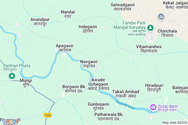
Islampur
Islampur Map
EDIT Map
Add Your House
 ..
..
Current Corona Virus Infected Patients Count in Aurangabad District District
| City Name | District Name | Total Covid cases |
|---|---|---|
| Aurangabad | Aurangabad | 20 |
| Aurangabad District | Aurangabad | 14 |
| Aurangabad Rural | Aurangabad | 3 |
Locality Name :
Islampur
( इस्लामपूर )
Taluka Name : Paithan
District : Aurangabad District
State : Maharashtra
Region : Marathwada
Division : Aurangabad
Language : Hindi and Ahirani, Kandeshi,marathi, Bhili, Andh, Indo-aryan
Current Time 07:05 AM
Date: Saturday , Apr 26,2025 (IST)
Time zone: IST (UTC+5:30)
Elevation / Altitude: 580 meters. Above Seal level
Telephone Code / Std Code: 02431
Assembly constituency : Paithan assembly constituency
Assembly MLA : Bhumare Sandipanrao Asaram
Lok Sabha constituency : Jalna parliamentary constituency
Parliament MP : Danve Raosaheb Dadarao
Serpanch Name :
Pin Code : 431137
Post Office Name : Bihamandwa
Main Village Name : Islampur
Commodities Prices : Paithan Market / Mandi
Islampur Live Weather
Temperature: 31.3 °C
scattered clouds
Humidity: 19%
Wind : 5.71 mt/sec towards NW
StationName : "Paithan"
observed on Now
Temperature: 31.3 °C
scattered clouds
Humidity: 19%
Wind : 5.71 mt/sec towards NW
StationName : "Paithan"
observed on Now
Islampur Weather Forecast for Next 5 days
27-04-2025
32.8°C to 40.8°C
few clouds, clear sky, scattered clouds, broken clouds
32.8°C to 40.8°C
few clouds, clear sky, scattered clouds, broken clouds
28-04-2025
29.7°C to 41.0°C
broken clouds, scattered clouds, few clouds, clear sky
29.7°C to 41.0°C
broken clouds, scattered clouds, few clouds, clear sky
29-04-2025
27.8°C to 40.9°C
clear sky, few clouds
27.8°C to 40.9°C
clear sky, few clouds
30-04-2025
28.8°C to 42.7°C
clear sky, few clouds
28.8°C to 42.7°C
clear sky, few clouds
01-05-2025
27.7°C to 42.8°C
clear sky, scattered clouds, few clouds
27.7°C to 42.8°C
clear sky, scattered clouds, few clouds
National Highways Reachable To Islampur
Nationa High Way :NH753F
Nationa High Way :NH752E
Nationa High Way :NH753F
Nationa High Way :NH752E
Rivers Near Islampur
Shivna
Yirabhadra
Shivna
Yirabhadra
About Islampur
Correct below Info and add more info about IslampurIslampur is a small Village/hamlet in Paithan Taluka in Aurangabad District District of Maharashtra State, India. It comes under Islampur Panchayath. It belongs to Marathwada region . It belongs to Aurangabad Division . It is located 63 KM towards South from District head quarters Aurangabad. 23 KM from Paithan Kheda. 331 KM from State capital Mumbai
Islampur Pin code is 431137 and postal head office is Bihamandwa .
Takali Ambad ( 5 KM ) , Bramhagaon ( 7 KM ) , Vihamandwa ( 7 KM ) , Nandar ( 8 KM ) , Hiradpuri ( 8 KM ) are the nearby Villages to Islampur. Islampur is surrounded by Shevgaon Taluka towards west , Ambad Taluka towards East , Georai Taluka towards East , Shirur ( Ka ) Taluka towards South .
Paithan , Pathardi , Aurangabad , Jalna are the near by Cities to Islampur.
Islampur 2011 Census Details
Islampur Local Language is Hindi. Islampur Village Total population is and number of houses are . Female Population is -1.0%. Village literacy rate is -1.0% and the Female Literacy rate is -1.0%.
Population
| Census Parameter | Census Data |
| Total Population | |
| Total No of Houses | |
| Female Population % | -1.0 % ( ) |
| Total Literacy rate % | -1.0 % ( ) |
| Female Literacy rate | -1.0 % ( ) |
| Scheduled Tribes Population % | -1.0 % ( ) |
| Scheduled Caste Population % | -1.0 % ( ) |
| Working Population % | -1.0 % |
| Child(0 -6) Population by 2011 | |
| Girl Child(0 -6) Population % by 2011 | -1.0 % ( ) |
Islampur Census More Deatils.
Politics in Islampur
Bharatiya Janata Party , BJP , NCP , INC , SHS are the major political parties in this area.Polling Stations /Booths near Islampur
1)Narayangaon2)Navgaon
3)Navgaon
4)Rajapur
5)Tulapur
HOW TO REACH Islampur
By Rail
There is no railway station near to Islampur in less than 10 km. are the Rail way stations reachable from near by towns.By Road
Paithan are the nearby by towns to Islampur having road connectivity to IslampurColleges near Islampur
New High School
Address :
Higher Secondary Collage Nandar Ta.paithan .dist .aurangabad
Address :
Mahatma Phule Junior College,bidkin
Address : Nilajgaon Road
bidkin
Schools in Islampur
Ps Islampur
Address : islampur , paithan , aurangabad (maharashtra) , Maharashtra . PIN- 431108
Govt Health Centers near Islampur
1) Kambi , SUBCENTER KAMBI , GAVTHAN , NEAR HANUMAN MANDIR2) Mungi , SUBCENTER MUNGI , ,
3) Hatgaon , PHC HATGAON , GAVTHAN ,
Sub Villages in Islampur
Hospitals in Islampur,Paithan
Metropolis Healthcare Ltd
Opp. Bus Stand ;Near Parimal Cooldrinks; Sakri; Dhule; Maharashtra 424304; India
2.4 KM distance Detail
Metropolis Healthcare Ltd
C/O Dhanwantari Hospital;H.No.2/393; Dhanwantari Medical Punarwasan Dhokiroad; Kalamb; Maharashtra 413507; India
6.6 KM distance Detail
Metropolis Healthcare Ltd
Old Bus Stand; Bhaji Mandai Javal Akluj; Solapur; Maharashtra 413101; India
7.8 KM distance Detail
more ..
Petrol Bunks in Islampur,Paithan
Prajval petroleum
Bodhegaon; Maharashtra State Highway 44;; Bodhegoan; Maharashtra; India
16.5 KM distance Detail
Indian Oil Petrol Pump
Madhava Nagar Road; Krishna Bansode; Saraf Nagar; Paithan; Maharashtra 431107; India
16.9 KM distance Detail
more ..
Colleges in Islampur,Paithan
Institute Of Professional Skills Development
Survey No-276/1/2; Behind Crystal Honda Showroom( Mantri Alpine); Opposite Lalani Quantum; Inside Baandal Estate; Bawadhan(Budruk); India
16.8 KM distance Detail
more ..
Local Parks in Islampur,Paithan
Sant Dnyaneshwar Garden
Court Road; Sant Dynaneshwar Udyaan; Paithan; Maharashtra 431107; India
18.7 KM distance Detail
Police Stations near Islampur,Paithan
Ichhawar Police Station
District Tihore; Icchawar; Maharashtra 464001; India
11.2 KM distance Detail
Governement Offices near Islampur,Paithan
Nagar Parishad Paithan
Paithan; Jama Masjid ward; Johri; Paithan; Maharashtra 431107; India
17.4 KM distance Detail
Rahul Enterprises - Government electrical contractor
tribak das nager ; new kavsan; Paithan; Maharashtra 431107; India
17.7 KM distance Detail
About Islampur &
History
How to reach Islampur
Tourist Places Near By Islampur
Schools in Islampur
Colleges in Islampur
Temperature & weather of Islampur
places in Islampur
Islampur photos
More Information
How to reach Islampur
Tourist Places Near By Islampur
Schools in Islampur
Colleges in Islampur
Temperature & weather of Islampur
places in Islampur
Islampur photos
More Information
Village Talk
Post News or Events about this Village
Near Cities
Paithan 15 KM near
Pathardi 51 KM near
Aurangabad 61 KM near
Jalna 66 KM near
Paithan 15 KM near
Pathardi 51 KM near
Aurangabad 61 KM near
Jalna 66 KM near
Near By Taluks
Paithan 21 KM near
Shevgaon 27 KM near
Ambad 30 KM near
Georai 37 KM near
Paithan 21 KM near
Shevgaon 27 KM near
Ambad 30 KM near
Georai 37 KM near
Near By Air Ports
Chikkalthana Airport 56 KM near
Latur Airport 169 KM near
Gandhinagar Airport 211 KM near
Nanded Airport 213 KM near
Chikkalthana Airport 56 KM near
Latur Airport 169 KM near
Gandhinagar Airport 211 KM near
Nanded Airport 213 KM near
Near By Tourist Places
Aurangabad 60 KM near
Grishneshwar 84 KM near
Ahmednagar 102 KM near
Shirdi 131 KM near
Ozar 185 KM near
Aurangabad 60 KM near
Grishneshwar 84 KM near
Ahmednagar 102 KM near
Shirdi 131 KM near
Ozar 185 KM near
Near By Districts
Aurangabad District 60 KM near
Beed 61 KM near
Jalna 66 KM near
Ahmednagar 100 KM near
Aurangabad District 60 KM near
Beed 61 KM near
Jalna 66 KM near
Ahmednagar 100 KM near
Near By RailWay Station
Aurangabad Rail Way Station 58 KM near
Jalna Rail Way Station 66 KM near
Aurangabad Rail Way Station 58 KM near
Jalna Rail Way Station 66 KM near