| Home | City Bus | Maps | Villages | Cities | Rail | Tourist Places | School | College | Pin Codes | Corona Cases Count |
| Distance Calculator Bus Services IFSC Codes Trace Mobile Number Weather Search Place Trace IP Available Cash ATM/Banks Locate Polling Booth Report an Error contact People |
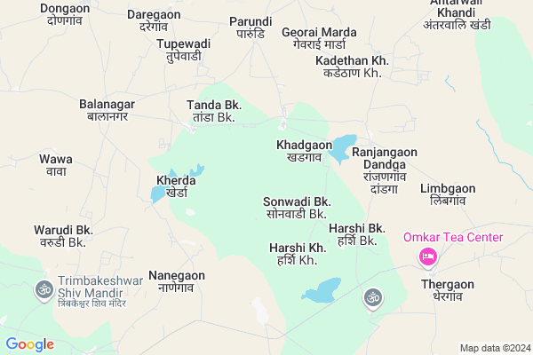
Inayatpur
Inayatpur Map
EDIT Map
Add Your House
 ..
..
Current Corona Virus Infected Patients Count in Aurangabad District District
| City Name | District Name | Total Covid cases |
|---|---|---|
| Aurangabad | Aurangabad | 20 |
| Aurangabad District | Aurangabad | 14 |
| Aurangabad Rural | Aurangabad | 3 |
Locality Name :
Inayatpur
( इनायातपूर )
Taluka Name : Paithan
District : Aurangabad District
State : Maharashtra
Region : Marathwada
Division : Aurangabad
Language : Hindi and Ahirani, Kandeshi,marathi, Bhili, Andh, Indo-aryan
Current Time 05:40 PM
Date: Tuesday , Apr 29,2025 (IST)
Time zone: IST (UTC+5:30)
Elevation / Altitude: 580 meters. Above Seal level
Telephone Code / Std Code: 02431
Assembly constituency : Paithan assembly constituency
Assembly MLA : Bhumare Sandipanrao Asaram
Lok Sabha constituency : Jalna parliamentary constituency
Parliament MP : Danve Raosaheb Dadarao
Serpanch Name :
Pin Code : 431107
Post Office Name : Paithan
Main Village Name : Inayatpur
Commodities Prices : Paithan Market / Mandi
Inayatpur Live Weather
Temperature: 40.2 °C
clear sky
Humidity: 9%
Wind : 7.24 mt/sec towards N
StationName : "Paithan"
observed on Now
Temperature: 40.2 °C
clear sky
Humidity: 9%
Wind : 7.24 mt/sec towards N
StationName : "Paithan"
observed on Now
Inayatpur Weather Forecast for Next 5 days
30-04-2025
30.7°C to 39.2°C
clear sky
30.7°C to 39.2°C
clear sky
01-05-2025
28.1°C to 41.7°C
clear sky, few clouds
28.1°C to 41.7°C
clear sky, few clouds
02-05-2025
28.9°C to 42.1°C
clear sky
28.9°C to 42.1°C
clear sky
03-05-2025
29.6°C to 41.7°C
clear sky
29.6°C to 41.7°C
clear sky
04-05-2025
27.2°C to 41.3°C
clear sky, broken clouds, scattered clouds, few clouds
27.2°C to 41.3°C
clear sky, broken clouds, scattered clouds, few clouds
National Highways Reachable To Inayatpur
Nationa High Way :NH753F
Nationa High Way :NH752E
Nationa High Way :NH753F
Nationa High Way :NH752E
Rivers Near Inayatpur
Shivna
Yirabhadra
Shivna
Yirabhadra
About Inayatpur
Correct below Info and add more info about InayatpurInayatpur is a small Village/hamlet in Paithan Taluka in Aurangabad District District of Maharashtra State, India. It comes under Inayatpur Panchayath. It belongs to Marathwada region . It belongs to Aurangabad Division . It is located 43 KM towards South from District head quarters Aurangabad. 12 KM from Paithan Kheda. 334 KM from State capital Mumbai
Inayatpur Pin code is 431107 and postal head office is Paithan .
Kherda ( 4 KM ) , Harshi Bk. ( 4 KM ) , Parundi ( 6 KM ) , Dadegaon Bk. ( 7 KM ) , Balangar ( 8 KM ) are the nearby Villages to Inayatpur. Inayatpur is surrounded by Ambad Taluka towards East , Shevgaon Taluka towards South , Aurangabad Taluka towards North , Badnapur Taluka towards North .
Paithan , Aurangabad , Jalna , Pathardi are the near by Cities to Inayatpur.
Inayatpur 2011 Census Details
Inayatpur Local Language is Hindi. Inayatpur Village Total population is 242 and number of houses are 48. Female Population is 46.3%. Village literacy rate is 58.3% and the Female Literacy rate is 25.2%.
Population
| Census Parameter | Census Data |
| Total Population | 242 |
| Total No of Houses | 48 |
| Female Population % | 46.3 % ( 112) |
| Total Literacy rate % | 58.3 % ( 141) |
| Female Literacy rate | 25.2 % ( 61) |
| Scheduled Tribes Population % | 3.7 % ( 9) |
| Scheduled Caste Population % | 0.0 % ( 0) |
| Working Population % | 57.9 % |
| Child(0 -6) Population by 2011 | 42 |
| Girl Child(0 -6) Population % by 2011 | 31.0 % ( 13) |
Inayatpur Census More Deatils.
Politics in Inayatpur
Bharatiya Janata Party , BJP , NCP , SHS , INC are the major political parties in this area.Polling Stations /Booths near Inayatpur
1)Kesapuri2)Khadgaon
3)Sonpuri
4)Sonwadi Kh.
5)Harshi Bk.
HOW TO REACH Inayatpur
By Rail
There is no railway station near to Inayatpur in less than 10 km. are the Rail way stations reachable from near by towns.By Road
Paithan are the nearby by towns to Inayatpur having road connectivity to InayatpurColleges near Inayatpur
New High School
Address :
Higher Secondary Collage Nandar Ta.paithan .dist .aurangabad
Address :
Mahatma Phule Junior College,bidkin
Address : Nilajgaon Road
bidkin
Schools in Inayatpur
Ps Inayatpur
Address : inayatpur , paithan , aurangabad (maharashtra) , Maharashtra . PIN- 431107 , Post - Paithan
Govt Health Centers near Inayatpur
1) Bakshichiwadi , Sub Center Bakshichiwadi , At Post Bakshichiwadi ,2) Jamkhed , Primary Health Center Jamkhed , At Post Jamkhed, , Tq. Ambad, Dist Jalna
3) Jamkhed , Primary Health Center Jamkhed , At Post Jamkhed , PHC Jamkhed
Sub Villages in Inayatpur
Hospitals in Inayatpur,Paithan
Metropolis Healthcare Ltd
Shantai Dia Centre;Virendra Reddy Comp;Shop No.5; Phodgaon Road; Ahmedpur; Maharashtra 413515; India
5.6 KM distance Detail
Metropolis Healthcare Ltd
C/O Om Sai Lab;Opp Sharma Medical Store; Near Phc Road; Amgaon; Maharashtra 441902; India
10.0 KM distance Detail
more ..
Petrol Bunks in Inayatpur,Paithan
HP Isarwadi Highway Center
40 Kms Stone 431148; Aurangabad; Maharashtra; India
16.8 KM distance Detail
HP PETROL PUMP - HP ISARWADI HIGHWAY CENTRE
AT PO Isarwadi TQ; Paithan Rd; Maharashtra 431148; India
16.9 KM distance Detail
more ..
Colleges in Inayatpur,Paithan
Nath Polytechnic; Paithan
Plot No.B-1; MIDC; Aurangabad Road; Paithan; Maharashtra 431128; India
17.0 KM distance Detail
more ..
Super Markets in Inayatpur,Paithan
Amar kirana and sim card shop
At.Akhatwada Post.Rahatgaon Tq 拜滕; Akhatwada; Maharashtra 431107; India
14.3 KM distance Detail
Police Stations near Inayatpur,Paithan
Ichhawar Police Station
District Tihore; Icchawar; Maharashtra 464001; India
13.1 KM distance Detail
Police Station MIDC; Mudhalwadi; Paithan; Maharashtra
Mudhalwadi; Maharashtra 431148; India
17.3 KM distance Detail
Governement Offices near Inayatpur,Paithan
Rahul Enterprises - Government electrical contractor
tribak das nager ; new kavsan; Paithan; Maharashtra 431107; India
21.2 KM distance Detail
About Inayatpur &
History
How to reach Inayatpur
Tourist Places Near By Inayatpur
Schools in Inayatpur
Colleges in Inayatpur
Temperature & weather of Inayatpur
places in Inayatpur
Inayatpur photos
More Information
How to reach Inayatpur
Tourist Places Near By Inayatpur
Schools in Inayatpur
Colleges in Inayatpur
Temperature & weather of Inayatpur
places in Inayatpur
Inayatpur photos
More Information
Village Talk
Post News or Events about this Village
Near Cities
Paithan 18 KM near
Aurangabad 43 KM near
Jalna 53 KM near
Pathardi 64 KM near
Paithan 18 KM near
Aurangabad 43 KM near
Jalna 53 KM near
Pathardi 64 KM near
Near By Taluks
Paithan 11 KM near
Ambad 27 KM near
Shevgaon 38 KM near
Aurangabad 40 KM near
Paithan 11 KM near
Ambad 27 KM near
Shevgaon 38 KM near
Aurangabad 40 KM near
Near By Air Ports
Chikkalthana Airport 36 KM near
Latur Airport 185 KM near
Gandhinagar Airport 204 KM near
Nanded Airport 218 KM near
Chikkalthana Airport 36 KM near
Latur Airport 185 KM near
Gandhinagar Airport 204 KM near
Nanded Airport 218 KM near
Near By Tourist Places
Aurangabad 42 KM near
Grishneshwar 67 KM near
Ahmednagar 111 KM near
Shirdi 124 KM near
Dhule 184 KM near
Aurangabad 42 KM near
Grishneshwar 67 KM near
Ahmednagar 111 KM near
Shirdi 124 KM near
Dhule 184 KM near
Near By Districts
Aurangabad District 41 KM near
Jalna 53 KM near
Beed 80 KM near
Ahmednagar 108 KM near
Aurangabad District 41 KM near
Jalna 53 KM near
Beed 80 KM near
Ahmednagar 108 KM near
Near By RailWay Station
Aurangabad Rail Way Station 40 KM near
Jalna Rail Way Station 53 KM near
Aurangabad Rail Way Station 40 KM near
Jalna Rail Way Station 53 KM near