| Home | City Bus | Maps | Villages | Cities | Rail | Tourist Places | School | College | Pin Codes | Corona Cases Count |
| Distance Calculator Bus Services IFSC Codes Trace Mobile Number Weather Search Place Trace IP Available Cash ATM/Banks Locate Polling Booth Report an Error contact People |
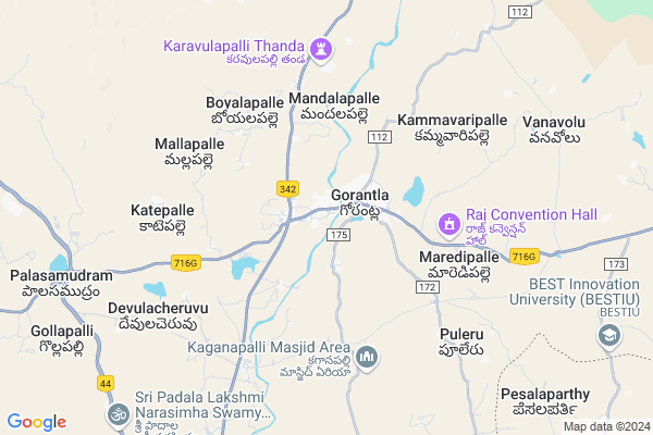
Obulapuram
Obulapuram Map
EDIT Map
Add Your House
 ..
..
Current Corona Virus Infected Patients Count in Anantapur District
| City Name | District Name | Total Covid cases |
|---|---|---|
| Anantapur District | Anantapur | 36 |
| Anantapur | Anantapur | 5 |
| Hindupur | Anantapur | 3 |
| R K Function Hall Backside | Anantapur | 2 |
| Lepakshi | Anantapur | 2 |
| Aravinda Nagar | Anantapur | 1 |
| Kalyana Durgam | Anantapur | 1 |
| Hindupur Mandal | Anantapur | 1 |
| Naik Nagar | Anantapur | 1 |
| Kothacheruvu | Anantapur | 1 |
Locality Name :
Obulapuram
( ఓబుళాపురం )
Mandal Name : Gorantla
District : Anantapur
State : Andhra Pradesh
Region : Rayalaseema
Language : Telugu and Urdu
Current Time 12:45 PM
Date: Thursday , Apr 24,2025 (IST)
Time zone: IST (UTC+5:30)
Elevation / Altitude: 477 meters. Above Seal level
Telephone Code / Std Code: 08557
Assembly constituency : assembly constituency
Assembly MLA : MALAGUNDLA SANKARANARAYANA
Lok Sabha constituency : parliamentary constituency
Parliament MP : KURUVA GORANTLA MADHAV
Serpanch Name :
Pin Code : 515241
Post Office Name : Budili
Main Village Name : Obulapuram
Commodities Prices : Gowribidanoor Market / Mandi
Obulapuram Live Weather
Temperature: 35.4 °C
scattered clouds
Humidity: 21%
Wind : 1.26 mt/sec towards N
StationName : "Puttaparthi"
observed on 1 Hours Back
Temperature: 35.4 °C
scattered clouds
Humidity: 21%
Wind : 1.26 mt/sec towards N
StationName : "Puttaparthi"
observed on 1 Hours Back
Obulapuram Weather Forecast for Next 5 days
25-04-2025
28.9°C to 39.2°C
scattered clouds, broken clouds
28.9°C to 39.2°C
scattered clouds, broken clouds
26-04-2025
27.2°C to 38.3°C
broken clouds, light rain, few clouds, scattered clouds, overcast clouds
27.2°C to 38.3°C
broken clouds, light rain, few clouds, scattered clouds, overcast clouds
27-04-2025
28.3°C to 37.0°C
broken clouds, clear sky, overcast clouds, light rain
28.3°C to 37.0°C
broken clouds, clear sky, overcast clouds, light rain
28-04-2025
27.4°C to 38.4°C
clear sky, few clouds, scattered clouds, broken clouds, light rain, overcast clouds
27.4°C to 38.4°C
clear sky, few clouds, scattered clouds, broken clouds, light rain, overcast clouds
29-04-2025
27.1°C to 36.3°C
overcast clouds, broken clouds, light rain
27.1°C to 36.3°C
overcast clouds, broken clouds, light rain
National Highways Reachable To Obulapuram
Nationa High Way :NH42
Nationa High Way :NH342
Nationa High Way :NH42
Nationa High Way :NH342
Rivers Near Obulapuram
Chitravati :ಚಿತ್ರಾವತಿ :చిత్రావతి
Papagni :ಪಾಪಾಗ್ನಿ :పాపాగ్ని
Chitravati :ಚಿತ್ರಾವತಿ :చిత్రావతి
Papagni :ಪಾಪಾಗ್ನಿ :పాపాగ్ని
About Obulapuram
Correct below Info and add more info about ObulapuramObulapuram is a small Village/hamlet in Gorantla Mandal in Anantapur District of Andhra Pradesh State, India. It comes under Obulapuram Panchayath. It belongs to Rayalaseema region . It is located 93 KM towards South from District head quarters Anantapur. 451 KM from State capital Hyderabad
Obulapuram Pin code is 515241 and postal head office is Budili .
Obulapuram is surrounded by Chilamathur Mandal towards South , Puttaparthi Mandal towards North , Somandepalle Mandal towards west , Penukonda Mandal towards west .
Hindupur , Kadiri , Dharmavaram , Pavagada are the near by Cities to Obulapuram.
Obulapuram 2011 Census Details
Obulapuram Local Language is Telugu. Obulapuram Village Total population is and number of houses are . Female Population is -1.0%. Village literacy rate is -1.0% and the Female Literacy rate is -1.0%.
Population
| Census Parameter | Census Data |
| Total Population | |
| Total No of Houses | |
| Female Population % | -1.0 % ( ) |
| Total Literacy rate % | -1.0 % ( ) |
| Female Literacy rate | -1.0 % ( ) |
| Scheduled Tribes Population % | -1.0 % ( ) |
| Scheduled Caste Population % | -1.0 % ( ) |
| Working Population % | -1.0 % |
| Child(0 -6) Population by 2011 | |
| Girl Child(0 -6) Population % by 2011 | -1.0 % ( ) |
Obulapuram Census More Deatils.
HOW TO REACH Obulapuram
By Rail
There is no railway station near to Obulapuram in less than 10 km. Hindupur Rail Way Station (near to Hindupur) , Kadiri Rail Way Station (near to Kadiri) , Malugur Rail Way Station (near to Hindupur) are the Rail way stations reachable from near by towns.By Road
Hindupur , Kadiri are the nearby by towns to Obulapuram having road connectivity to ObulapuramBy Bus
Gorantla APSRTC Bus Station , Pedapalli APSRTC Bus Station , Palasamudram APSRTC Bus Station are the nearby by Bus Stations to Obulapuram .APSRTC runs Number of busses from major cities to here.Colleges near Obulapuram
Shirdi Sai Jr College (girls), Gorantla
Address : Gorantla
Sri Venkateswara Jr College, Gorantla
Address : Gorantla
S A P S Junior College Gorantla
Address : S A P S Junior College Gorantla
Sri Peddarasu Veeraiah Memorial (spvm) Degree College
Address : Gorantla, Anantapur Dist. - 515231
Schools near Obulapuram
Great Way Em Hs
Address : palasamudram , gorantla , anantapur , Andhra Pradesh . PIN- 515231 , Post - Gorantla
Zphs Mandalapalli
Address : gorantla , gorantla , anantapur , Andhra Pradesh . PIN- 515231 , Post - Gorantla
Zphs(u) Vi Ward
Address : gorantla , gorantla , anantapur , Andhra Pradesh . PIN- 515231 , Post - Gorantla
K.g.b.vidyalaya(res)a.p.17
Address : gorantla , gorantla , anantapur , Andhra Pradesh . PIN- 515231 , Post - Gorantla
Govt Health Centers near Obulapuram
1) Gorantla , NEW CONSTRUCTION , MAIN ROAD , BSNL OFFICE2) Gorantla , , MAIN ROAD ,
3) Sc Gummaiahgaripalli , , main road , main road
Sub Villages in Obulapuram
Hospitals in Obulapuram,Gorantla
Sree Teja Health Care
near ayyappa swamy temple; Gorantla; Andhra Pradesh 515231; India
0.8 KM distance Detail
Sri Sai Dhanvantari Clinic
Hindupur - Kadiri Hwy; Reddicheruvupalli; Palagalapalli; Gorantla; Andhra Pradesh 515231; India
1.6 KM distance Detail
more ..
Petrol Bunks in Obulapuram,Gorantla
HP Petrol Pump Sree Sahasra Fuels Station
Survey NO.275-2; Hindupur - Kadiri Highway; Gorantla; Andhra Pradesh 515231; India
0.7 KM distance Detail
Gopu Filling Station-hpcl Petrol Pump
Gummayyagaripalli; Anantapur; SH-87; Anantapur; Anantapur; Andhra Pradesh 515231; India
1.1 KM distance Detail
Gorantla Petrol Bunk
Hindupur - Kadiri Hwy; Gummayyagaripalle; Andhra Pradesh 515231; India
1.1 KM distance Detail
more ..
Colleges in Obulapuram,Gorantla
s.p.v.m degree college
Hindupur - Kadiri Hwy; Gorantla; Andhra Pradesh 515231; India
0.6 KM distance Detail
Mahesh IT software
budilivandala palli; Gorantla; Andhra Pradesh 515231; India
1.6 KM distance Detail
more ..
Schools in Obulapuram,Gorantla
z.p.boys high school
Hindupur - Kadiri Hwy; Gorantla; Andhra Pradesh 515231; India
0.6 KM distance Detail
Electronic Shops in Obulapuram,Gorantla
BABA D.T.H SERVICE GORANTLA
Cheruvu Rd; Palagalapalli; Gorantla; Andhra Pradesh 515231; India
1.0 KM distance Detail
As Auto Elctiracl Works
Gorantla- Hindupur - Banglore Rd; Andhra Pradesh 515231; India
1.2 KM distance Detail
Super Markets in Obulapuram,Gorantla
Ramu Egg Centre
RTC Bus Stand Rd; Palagalapalli; Gorantla; Andhra Pradesh 515231; India
0.9 KM distance Detail
Althaf rice corner
SH 87; Reddicheruvupalli; Palagalapalli; Gorantla; Andhra Pradesh 515231; India
1.6 KM distance Detail
Local Parks in Obulapuram,Gorantla
Sri madhavaraya swamy temple park
Hindupur - Kadiri Hwy; Gorantla; Andhra Pradesh 515231; India
1.0 KM distance Detail
Police Stations near Obulapuram,Gorantla
Gorantla Police Station
Hindupur-Kadiri Highway Gorantla 515231 Andhra Pradesh India; Hindupur - Kadiri Hwy; Gorantla; Andhra Pradesh 515231; India
1.7 KM distance Detail
Chilamathur Police Station
Lepakshi Road; Chilamathur; Andhra Pradesh 515341; India
19.5 KM distance Detail
Governement Offices near Obulapuram,Gorantla
MeeSeva Center
Near MRO Office; Mandal Office Rd; Gorantla; Andhra Pradesh 515231; India
0.9 KM distance Detail
MeeSeva Center
Mandalapalli Gorantla Ananthapur.; 4/38; Andhra Pradesh 515231; India
5.4 KM distance Detail
About Obulapuram &
History
How to reach Obulapuram
Tourist Places Near By Obulapuram
Schools in Obulapuram
Colleges in Obulapuram
Temperature & weather of Obulapuram
places in Obulapuram
Obulapuram photos
More Information
How to reach Obulapuram
Tourist Places Near By Obulapuram
Schools in Obulapuram
Colleges in Obulapuram
Temperature & weather of Obulapuram
places in Obulapuram
Obulapuram photos
More Information
Village Talk
Post News or Events about this Village
Near Cities
Hindupur 36 KM near
Kadiri 51 KM near
Dharmavaram 53 KM near
Pavagada 58 KM near
Hindupur 36 KM near
Kadiri 51 KM near
Dharmavaram 53 KM near
Pavagada 58 KM near
Near By Taluks
Gorantla 0 KM near
Chilamathur 16 KM near
Puttaparthi 16 KM near
Somandepalle 19 KM near
Gorantla 0 KM near
Chilamathur 16 KM near
Puttaparthi 16 KM near
Somandepalle 19 KM near
Near By Air Ports
Bengaluru International Airport 97 KM near
Tirupati Airport 219 KM near
Mysore Airport 248 KM near
Salem Airport 294 KM near
Bengaluru International Airport 97 KM near
Tirupati Airport 219 KM near
Mysore Airport 248 KM near
Salem Airport 294 KM near
Near By Tourist Places
Puttaparthi 23 KM near
Lepakshi 28 KM near
Nandi Hills 77 KM near
Horsley Hills 87 KM near
Shivagange 118 KM near
Puttaparthi 23 KM near
Lepakshi 28 KM near
Nandi Hills 77 KM near
Horsley Hills 87 KM near
Shivagange 118 KM near
Near By Districts
Chikballapur 69 KM near
Anantapur 89 KM near
Bangalore Rural 91 KM near
Tumkur 113 KM near
Chikballapur 69 KM near
Anantapur 89 KM near
Bangalore Rural 91 KM near
Tumkur 113 KM near
Near By RailWay Station
Sri Sathya Sai Prashanthi Nilayam Rail Way Station 22 KM near
Penukonda Junction Rail Way Station 24 KM near
Sri Sathya Sai Prashanthi Nilayam Rail Way Station 22 KM near
Penukonda Junction Rail Way Station 24 KM near