| Home | City Bus | Maps | Villages | Cities | Rail | Tourist Places | School | College | Pin Codes | Corona Cases Count |
| Distance Calculator Bus Services IFSC Codes Trace Mobile Number Weather Search Place Trace IP Available Cash ATM/Banks Locate Polling Booth Report an Error contact People |
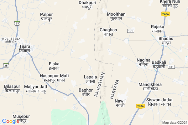
Rahmatnagar Map
EDIT Map
Add Your House
 ..
..
Current Corona Virus Infected Patients Count in Alwar District
| City Name | District Name | Total Covid cases |
|---|---|---|
| Alwar District | Alwar | 7 |
Locality Name :
Rahmatnagar
( रहमतनगर )
Tehsil Name : Tijara
District : Alwar
State : Rajasthan
Division : Jaipur
Language : Rajasthani
Current Time 12:16 PM
Date: Wednesday , Apr 30,2025 (IST)
Time zone: IST (UTC+5:30)
Elevation / Altitude: 286 meters. Above Seal level
Telephone Code / Std Code: 01493
Assembly constituency : Tijara assembly constituency
Assembly MLA : Mahant Balak Nath
Lok Sabha constituency : Alwar parliamentary constituency
Parliament MP : Balak Nath
Serpanch Name :
Main Village Name : Rahmatnagar
Commodities Prices : Khairthal Market / Mandi
Rahmatnagar Live Weather
Temperature: 32.5 °C
clear sky
Humidity: 27%
Wind : 4.55 mt/sec towards SE
StationName : "TijÄ\u0081ra"
observed on 2 Hours Back
Temperature: 32.5 °C
clear sky
Humidity: 27%
Wind : 4.55 mt/sec towards SE
StationName : "TijÄ\u0081ra"
observed on 2 Hours Back
Rahmatnagar Weather Forecast for Next 5 days
01-05-2025
29.7°C to 37.9°C
clear sky
29.7°C to 37.9°C
clear sky
02-05-2025
27.9°C to 41.6°C
few clouds, clear sky, light rain, broken clouds
27.9°C to 41.6°C
few clouds, clear sky, light rain, broken clouds
03-05-2025
29.2°C to 41.7°C
broken clouds, few clouds, light rain
29.2°C to 41.7°C
broken clouds, few clouds, light rain
04-05-2025
27.8°C to 40.6°C
light rain, overcast clouds, broken clouds, scattered clouds
27.8°C to 40.6°C
light rain, overcast clouds, broken clouds, scattered clouds
05-05-2025
25.9°C to 40.2°C
broken clouds, scattered clouds
25.9°C to 40.2°C
broken clouds, scattered clouds
National Highways Reachable To Rahmatnagar
Nationa High Way :NH48
Nationa High Way :NH24
Nationa High Way :NH48
Nationa High Way :NH24
About Rahmatnagar
Correct below Info and add more info about RahmatnagarRahmatnagar is a small Village/hamlet in Tijara Tehsil in Alwar District of Rajasthan State, India. It comes under Rahmatnagar Panchayath. It belongs to Jaipur Division . It is located 58 KM towards North from District head quarters Alwar. 15 KM from Tijara. 182 KM from State capital Jaipur
Hasanpurmaffi ( 5 KM ) , Tijara ( 8 KM ) , Palpur ( 8 KM ) , Hamiraka ( 9 KM ) , Luhadera ( 12 KM ) are the nearby Villages to Rahmatnagar. Rahmatnagar is surrounded by Tijara Tehsil towards North , Ferozepur Jhirka Tehsil towards South , Mewat Tehsil towards North , Kotkasim Tehsil towards west .
Bawal , Sohna , Rewari , Hodal are the near by Cities to Rahmatnagar.
This Place is in the border of the Alwar District and Mewat District. Mewat District Nagina is East towards this place . It is near to the Haryana State Border.
Rahmatnagar 2011 Census Details
Rahmatnagar Local Language is Rajasthani. Rahmatnagar Village Total population is 1037 and number of houses are 165. Female Population is 47.4%. Village literacy rate is 42.9% and the Female Literacy rate is 15.1%.
Population
| Census Parameter | Census Data |
| Total Population | 1037 |
| Total No of Houses | 165 |
| Female Population % | 47.4 % ( 492) |
| Total Literacy rate % | 42.9 % ( 445) |
| Female Literacy rate | 15.1 % ( 157) |
| Scheduled Tribes Population % | 0.0 % ( 0) |
| Scheduled Caste Population % | 22.2 % ( 230) |
| Working Population % | 48.6 % |
| Child(0 -6) Population by 2011 | 269 |
| Girl Child(0 -6) Population % by 2011 | 44.2 % ( 119) |
Rahmatnagar Census More Deatils.
Politics in Rahmatnagar
Bharatiya Janata Party , BJP , BSP , INC are the major political parties in this area.Polling Stations /Booths near Rahmatnagar
1)Govt. Primary School Shed Wali Dhani Gwalda2)Govt. Primary School Pathredi
3)Govt. Primary School Piplana
4)Govt. Upper Primary School Muradbas Room No. 1
5)Govt. Upper Primary School Mirchuni
HOW TO REACH Rahmatnagar
By Rail
There is no railway station near to Rahmatnagar in less than 10 km.Pincodes near Rahmatnagar
301411 ( Tizara ) , 301405 ( Kishan Garh Bass ) , 301702 ( Kotkassim )Colleges near Rahmatnagar
Anibesaint Girls College
Address :
Rajasthan Degree Girls College Tapukra
Address :
Modern Institute Of Tecnology & Reserch Institute
Address : Sirmoli Road,6 Th Mile Stone, Delhi - Tijara High
Schools near Rahmatnagar
Desert Sec.sch. Bhindusi
Address : bhindusi , tizara , alwar , Rajasthan . PIN- 301405 , Post - Kishan Garh Bass
Bhanu Shss Jhiwana
Address : jhiwana , tizara , alwar , Rajasthan . PIN- 301707 , Post - Tapukara
Govt. Ups,maseet
Address : maseet , tizara , alwar , Rajasthan . PIN- 301707 , Post - Tapukara
Lord Krishna Sec. Raikheda
Address : rai kheda , tizara , alwar , Rajasthan . PIN- 301411 , Post - Tizara
Govt Health Centers near Rahmatnagar
1) Teouwas , teouwas , jodiya , kotkasim2) Jodiya , jodiya , jodiya , kotkasim
3) Deegli , Deengli , pur , kotkasim
Sub Villages in Rahmatnagar
Hospitals in Rahmatnagar,Tijara
Dr Wazid Khan ghaghas
122108; RD Complex; U-3; Sector 3; Avas Vikas Colony; Sikandra; Agra; Rajasthan 282004; India
5.2 KM distance Detail
more ..
Petrol Bunks in Rahmatnagar,Tijara
Indian Oil Petrol Pump
Mandi Khera; Mewat; SH-13; Sohna Alwar Road; Mewat; Mewat; Haryana 122104; India
8.0 KM distance Detail
more ..
Governement Offices near Rahmatnagar,Tijara
ZMQ District Office Mewat
Near A.K Gas Agency Nagina Road; Nagina; Haryana 122108; India
6.3 KM distance Detail
AE Online Service
Shop N.2 ; Nagina Road; Tahsil mode; Nuh; Haryana 122108; India
7.3 KM distance Detail
About Rahmatnagar &
History
How to reach Rahmatnagar
Tourist Places Near By Rahmatnagar
Schools in Rahmatnagar
Colleges in Rahmatnagar
Temperature & weather of Rahmatnagar
places in Rahmatnagar
Rahmatnagar photos
More Information
How to reach Rahmatnagar
Tourist Places Near By Rahmatnagar
Schools in Rahmatnagar
Colleges in Rahmatnagar
Temperature & weather of Rahmatnagar
places in Rahmatnagar
Rahmatnagar photos
More Information
Village Talk
Post News or Events about this Village
Near Cities
Bawal 43 KM near
Sohna 43 KM near
Rewari 48 KM near
Hodal 49 KM near
Bawal 43 KM near
Sohna 43 KM near
Rewari 48 KM near
Hodal 49 KM near
Near By Taluks
Nagina 11 KM near
Tijara 15 KM near
Ferozepur Jhirka 17 KM near
Mewat 23 KM near
Nagina 11 KM near
Tijara 15 KM near
Ferozepur Jhirka 17 KM near
Mewat 23 KM near
Near By Air Ports
Indira Gandhi International Airport 81 KM near
Kheria Airport 148 KM near
Sanganeer Airport 185 KM near
Muzaffarnagar Airport 204 KM near
Indira Gandhi International Airport 81 KM near
Kheria Airport 148 KM near
Sanganeer Airport 185 KM near
Muzaffarnagar Airport 204 KM near
Near By Tourist Places
Nuh 24 KM near
Sohna 43 KM near
Dabchick 48 KM near
Manesar 54 KM near
Alwar 56 KM near
Nuh 24 KM near
Sohna 43 KM near
Dabchick 48 KM near
Manesar 54 KM near
Alwar 56 KM near
Near By Districts
Mewat 23 KM near
Rewari 49 KM near
Palwal 50 KM near
Alwar 56 KM near
Mewat 23 KM near
Rewari 49 KM near
Palwal 50 KM near
Alwar 56 KM near
Near By RailWay Station
Khairthal Rail Way Station 35 KM near
Rewari Junction Rail Way Station 49 KM near
Khairthal Rail Way Station 35 KM near
Rewari Junction Rail Way Station 49 KM near