| Home | City Bus | Maps | Villages | Cities | Rail | Tourist Places | School | College | Pin Codes | Corona Cases Count |
| Distance Calculator Bus Services IFSC Codes Trace Mobile Number Weather Search Place Trace IP Available Cash ATM/Banks Locate Polling Booth Report an Error contact People |
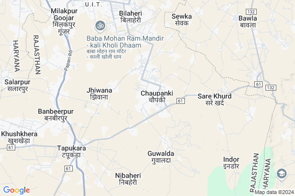
Pathredi Map
EDIT Map
Add Your House
 ..
..
Current Corona Virus Infected Patients Count in Alwar District
| City Name | District Name | Total Covid cases |
|---|---|---|
| Alwar District | Alwar | 7 |
Locality Name :
Pathredi
( पाथरेड़ी )
Tehsil Name : Tijara
District : Alwar
State : Rajasthan
Division : Jaipur
Language : Rajasthani
Current Time 08:01 AM
Date: Thursday , Apr 24,2025 (IST)
Time zone: IST (UTC+5:30)
Elevation / Altitude: 286 meters. Above Seal level
Telephone Code / Std Code: 01493
Assembly constituency : Tijara assembly constituency
Assembly MLA : Mahant Balak Nath
Lok Sabha constituency : Alwar parliamentary constituency
Parliament MP : Balak Nath
Serpanch Name :
Pin Code : 301707
Post Office Name : Tapukara
Main Village Name : Pathredi
Commodities Prices : Rewari Market / Mandi
Pathredi Live Weather
Temperature: 24.8 °C
clear sky
Humidity: 8%
Wind : 2.76 mt/sec towards W
StationName : "NÅ«h"
observed on 1 Hours Back
Temperature: 24.8 °C
clear sky
Humidity: 8%
Wind : 2.76 mt/sec towards W
StationName : "NÅ«h"
observed on 1 Hours Back
Pathredi Weather Forecast for Next 5 days
25-04-2025
28.0°C to 41.2°C
clear sky
28.0°C to 41.2°C
clear sky
26-04-2025
27.1°C to 42.6°C
clear sky, few clouds, overcast clouds, broken clouds
27.1°C to 42.6°C
clear sky, few clouds, overcast clouds, broken clouds
27-04-2025
28.0°C to 40.1°C
broken clouds, overcast clouds, scattered clouds
28.0°C to 40.1°C
broken clouds, overcast clouds, scattered clouds
28-04-2025
27.9°C to 41.7°C
broken clouds, overcast clouds, clear sky, few clouds
27.9°C to 41.7°C
broken clouds, overcast clouds, clear sky, few clouds
29-04-2025
26.5°C to 42.3°C
clear sky
26.5°C to 42.3°C
clear sky
National Highways Reachable To Pathredi
Nationa High Way :NH48
Nationa High Way :NH24
Nationa High Way :NH48
Nationa High Way :NH24
About Pathredi
Correct below Info and add more info about PathrediPathredi is a small Village/hamlet in Tijara Tehsil in Alwar District of Rajasthan State, India. It comes under Pathredi Panchayath. It belongs to Jaipur Division . It is located 80 KM towards North from District head quarters Alwar. 15 KM from Tijara. 200 KM from State capital Jaipur
Pathredi Pin code is 301707 and postal head office is Tapukara .
Mayapur ( 4 KM ) , Tapookara ( 6 KM ) , Santhalka ( 6 KM ) , Seethal ( 9 KM ) , Bhiwadi ( 9 KM ) are the nearby Villages to Pathredi. Pathredi is surrounded by Mewat Tehsil towards East , Tijara Tehsil towards South , Nuh Tehsil towards East , Pataudi Tehsil towards North .
Sohna , Rewari , Bawal , Gurgaon are the near by Cities to Pathredi.
This Place is in the border of the Alwar District and Mewat District. Mewat District Nagina is South towards this place . It is near to the Haryana State Border.
Pathredi 2011 Census Details
Pathredi Local Language is Rajasthani. Pathredi Village Total population is 1704 and number of houses are 293. Female Population is 44.2%. Village literacy rate is 48.8% and the Female Literacy rate is 14.4%.
Population
| Census Parameter | Census Data |
| Total Population | 1704 |
| Total No of Houses | 293 |
| Female Population % | 44.2 % ( 754) |
| Total Literacy rate % | 48.8 % ( 831) |
| Female Literacy rate | 14.4 % ( 246) |
| Scheduled Tribes Population % | 0.0 % ( 0) |
| Scheduled Caste Population % | 11.4 % ( 195) |
| Working Population % | 35.1 % |
| Child(0 -6) Population by 2011 | 408 |
| Girl Child(0 -6) Population % by 2011 | 43.9 % ( 179) |
Pathredi Census More Deatils.
Politics in Pathredi
Bharatiya Janata Party , BJP , BSP , INC are the major political parties in this area.Polling Stations /Booths near Pathredi
1)Govt. Upper Primary School Thada East Side Room No. 42)Govt. Upper Primary School Tatarpur South Side Room No. 6
3)Govt. Upper Primary School South Side Room No. 2 Nimli
4)Govt. Secondary School East Side Room No. 4 Milakpur Gurjar
5)Govt. Upper Primary School Palasali
HOW TO REACH Pathredi
By Rail
There is no railway station near to Pathredi in less than 10 km.Colleges near Pathredi
Anibesaint Girls College
Address :
Rajasthan Degree Girls College Tapukra
Address :
Modern Institute Of Tecnology & Reserch Institute
Address : Sirmoli Road,6 Th Mile Stone, Delhi - Tijara High
Schools in Pathredi
Govt. Pri Sch,pathredi
Address : pathredi , tizara , alwar , Rajasthan . PIN- 301707 , Post - Tapukara
Govt Health Centers near Pathredi
1) Budhibawal , budhibawal , jodiya , kotkasim2) Nasopur , nasopur , jodiya , kotkasim
3) Katopur , katopur , jodiya , kotkasim
Sub Villages in Pathredi
Hospitals in Pathredi,Tijara
Jeevan Rekha Clinic Chopanki
varun bevegas chopanki near by master market; Rajasthan 301018; India
1.2 KM distance Detail
more ..
Petrol Bunks in Pathredi,Tijara
Essar Petrol Pump
Main Road Bhiwadi - Chopanki; Industrial Area Kehrani; Alwar district; Gadpur; Rajasthan 301019; India
4.5 KM distance Detail
GOYAL AUTO SERVICE (Indian Oil)
Teacher Colony; Tapukara; Rajasthan 301707; India
7.0 KM distance Detail
HP PETROL PUMP - NURPUR FILLING STATION
Village Nurpur Charoda-nurpur Road Tehsil Tauru; Gurgaon; Haryana 122105; India
7.9 KM distance Detail
more ..
Colleges in Pathredi,Tijara
Paramedical Institute of Harish Hospital
Life Line Hospital; Alwar; Rajasthan; India
1.7 KM distance Detail
Baba Mohan Ram Kisaan PG College
Baba Mohan Ram Temple Road; Bhiwadi; Rajasthan; India
7.3 KM distance Detail
Being Gentle With Guru
5/288 UIT Bhiwadi Alwar Rajasthan; Bhiwadi; Rajasthan 301019; India
9.0 KM distance Detail
more ..
Schools in Pathredi,Tijara
M D S Public Secondary School Pathredi
Kotputli; Pathredi; Rajasthan 303107; India
0.3 KM distance Detail
Ups Choupanki
Bhiwadi - Chopanki Rd; RIICO Industrial Area; Bhiwadi; Rajasthan 301019; India
1.1 KM distance Detail
JAMIA MADINATUL ULOOM MADARSA JHIWANA
CHOPANKI ROAD; Jhiwana; Rajasthan; India
2.2 KM distance Detail
govt senior secondary school joriya rajasthan
Joriya; Rajasthan 301018; India
2.5 KM distance Detail
Super Markets in Pathredi,Tijara
Khan Kirana Store Chopanki
Bhiwadi - Chopanki Rd; RIICO Industrial Area; Bhiwadi; Rajasthan 301019; India
1.2 KM distance Detail
About Pathredi &
History
How to reach Pathredi
Tourist Places Near By Pathredi
Schools in Pathredi
Colleges in Pathredi
Temperature & weather of Pathredi
places in Pathredi
Pathredi photos
More Information
How to reach Pathredi
Tourist Places Near By Pathredi
Schools in Pathredi
Colleges in Pathredi
Temperature & weather of Pathredi
places in Pathredi
Pathredi photos
More Information
Village Talk
Post News or Events about this Village
Near Cities
Sohna 24 KM near
Rewari 28 KM near
Bawal 33 KM near
Gurgaon 41 KM near
Sohna 24 KM near
Rewari 28 KM near
Bawal 33 KM near
Gurgaon 41 KM near
Near By Taluks
Taoru 13 KM near
Mewat 14 KM near
Tijara 15 KM near
Nuh 22 KM near
Taoru 13 KM near
Mewat 14 KM near
Tijara 15 KM near
Nuh 22 KM near
Near By Air Ports
Indira Gandhi International Airport 57 KM near
Kheria Airport 170 KM near
Muzaffarnagar Airport 182 KM near
Sanganeer Airport 202 KM near
Indira Gandhi International Airport 57 KM near
Kheria Airport 170 KM near
Muzaffarnagar Airport 182 KM near
Sanganeer Airport 202 KM near
Near By Tourist Places
Nuh 14 KM near
Sohna 24 KM near
Manesar 27 KM near
Gurgaon 44 KM near
Faridabad 58 KM near
Nuh 14 KM near
Sohna 24 KM near
Manesar 27 KM near
Gurgaon 44 KM near
Faridabad 58 KM near
Near By Districts
Mewat 14 KM near
Rewari 30 KM near
Gurgaon 42 KM near
Palwal 47 KM near
Mewat 14 KM near
Rewari 30 KM near
Gurgaon 42 KM near
Palwal 47 KM near
Near By RailWay Station
Pataudi Road Rail Way Station 29 KM near
Rewari Junction Rail Way Station 30 KM near
Pataudi Road Rail Way Station 29 KM near
Rewari Junction Rail Way Station 30 KM near