| Home | City Bus | Maps | Villages | Cities | Rail | Tourist Places | School | College | Pin Codes | Corona Cases Count |
| Distance Calculator Bus Services IFSC Codes Trace Mobile Number Weather Search Place Trace IP Available Cash ATM/Banks Locate Polling Booth Report an Error contact People |
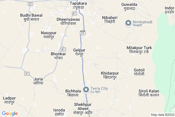
Bhamraka Map
EDIT Map
Add Your House
 ..
..
Current Corona Virus Infected Patients Count in Alwar District
| City Name | District Name | Total Covid cases |
|---|---|---|
| Alwar District | Alwar | 7 |
Locality Name :
Bhamraka
( भामरका )
Tehsil Name : Tijara
District : Alwar
State : Rajasthan
Division : Jaipur
Language : Rajasthani
Current Time 12:07 PM
Date: Wednesday , Apr 30,2025 (IST)
Time zone: IST (UTC+5:30)
Elevation / Altitude: 286 meters. Above Seal level
Telephone Code / Std Code: 01493
Assembly constituency : Tijara assembly constituency
Assembly MLA : Mahant Balak Nath
Lok Sabha constituency : Alwar parliamentary constituency
Parliament MP : Balak Nath
Serpanch Name :
Pin Code : 301411
Post Office Name : Tizara
Main Village Name : Bhamraka
Commodities Prices : Rewari Market / Mandi
Bhamraka Live Weather
Temperature: 32.7 °C
clear sky
Humidity: 27%
Wind : 4.76 mt/sec towards SE
StationName : "TijÄ\u0081ra"
observed on 2 Hours Back
Temperature: 32.7 °C
clear sky
Humidity: 27%
Wind : 4.76 mt/sec towards SE
StationName : "TijÄ\u0081ra"
observed on 2 Hours Back
Bhamraka Weather Forecast for Next 5 days
01-05-2025
30.5°C to 38.6°C
clear sky
30.5°C to 38.6°C
clear sky
02-05-2025
29.0°C to 42.7°C
clear sky, light rain, broken clouds, scattered clouds
29.0°C to 42.7°C
clear sky, light rain, broken clouds, scattered clouds
03-05-2025
29.2°C to 42.4°C
scattered clouds, overcast clouds, broken clouds, clear sky, light rain
29.2°C to 42.4°C
scattered clouds, overcast clouds, broken clouds, clear sky, light rain
04-05-2025
28.6°C to 41.2°C
light rain, broken clouds, scattered clouds
28.6°C to 41.2°C
light rain, broken clouds, scattered clouds
05-05-2025
26.4°C to 41.0°C
broken clouds, scattered clouds
26.4°C to 41.0°C
broken clouds, scattered clouds
National Highways Reachable To Bhamraka
Nationa High Way :NH48
Nationa High Way :NH24
Nationa High Way :NH48
Nationa High Way :NH24
About Bhamraka
Correct below Info and add more info about BhamrakaBhamraka is a small Village/hamlet in Tijara Tehsil in Alwar District of Rajasthan State, India. It comes under Bhamraka Panchayath. It belongs to Jaipur Division . It is located 67 KM towards North from District head quarters Alwar. 3 KM from Tijara. 188 KM from State capital Jaipur
Bhamraka Pin code is 301411 and postal head office is Tizara .
Bhonkar ( 4 KM ) , Maseet ( 4 KM ) , Ishroda ( 7 KM ) , Tapookara ( 8 KM ) , Katopur ( 8 KM ) are the nearby Villages to Bhamraka. Bhamraka is surrounded by Kotkasim Tehsil towards west , Mewat Tehsil towards East , Nagina Tehsil towards East , Taoru Tehsil towards North .
Bawal , Rewari , Sohna , Palwal are the near by Cities to Bhamraka.
This Place is in the border of the Alwar District and Mewat District. Mewat District Nagina is East towards this place . It is near to the Haryana State Border.
Bhamraka 2011 Census Details
Bhamraka Local Language is Rajasthani. Bhamraka Village Total population is 1727 and number of houses are 289. Female Population is 47.5%. Village literacy rate is 59.9% and the Female Literacy rate is 23.7%.
Population
| Census Parameter | Census Data |
| Total Population | 1727 |
| Total No of Houses | 289 |
| Female Population % | 47.5 % ( 821) |
| Total Literacy rate % | 59.9 % ( 1035) |
| Female Literacy rate | 23.7 % ( 410) |
| Scheduled Tribes Population % | 0.0 % ( 0) |
| Scheduled Caste Population % | 11.6 % ( 200) |
| Working Population % | 45.9 % |
| Child(0 -6) Population by 2011 | 321 |
| Girl Child(0 -6) Population % by 2011 | 45.2 % ( 145) |
Bhamraka Census More Deatils.
Politics in Bhamraka
Bharatiya Janata Party , BJP , BSP , INC are the major political parties in this area.Polling Stations /Booths near Bhamraka
1)Govt. Upper Primary School Dhakpuri2)Govt. Secondary School Majri Gurjer
3)Govt. Upper Primary School Kalaka
4)Govt. Girls Senior Secondary School South Side Tijara
5)Govt. Upper Primary School Middle Side Ghatal Room No. 7
HOW TO REACH Bhamraka
By Rail
There is no railway station near to Bhamraka in less than 10 km.Colleges near Bhamraka
Anibesaint Girls College
Address :
Rajasthan Degree Girls College Tapukra
Address :
Modern Institute Of Tecnology & Reserch Institute
Address : Sirmoli Road,6 Th Mile Stone, Delhi - Tijara High
Schools near Bhamraka
Desert Sec.sch. Bhindusi
Address : bhindusi , tizara , alwar , Rajasthan . PIN- 301405 , Post - Kishan Garh Bass
Bhanu Shss Jhiwana
Address : jhiwana , tizara , alwar , Rajasthan . PIN- 301707 , Post - Tapukara
Govt. Ups,maseet
Address : maseet , tizara , alwar , Rajasthan . PIN- 301707 , Post - Tapukara
Lord Krishna Sec. Raikheda
Address : rai kheda , tizara , alwar , Rajasthan . PIN- 301411 , Post - Tizara
Govt Health Centers near Bhamraka
1) Nasopur , nasopur , jodiya , kotkasim2) Teouwas , teouwas , jodiya , kotkasim
3) Jodiya , jodiya , jodiya , kotkasim
Sub Villages in Bhamraka
Petrol Bunks in Bhamraka,Tijara
GOYAL AUTO SERVICE (Indian Oil)
Teacher Colony; Tapukara; Rajasthan 301707; India
7.5 KM distance Detail
iocl petrol pump
Tijara Rd; Ward 2; Ibrahimpur at Virampur; Rajasthan 301411; India
13.4 KM distance Detail
more ..
Colleges in Bhamraka,Tijara
Paramedical Institute of Harish Hospital
Life Line Hospital; Alwar; Rajasthan; India
11.0 KM distance Detail
Chandra Prubhu Digmer Jain College Tijara
301411; RD Complex; U-3; Unnamed Rd; Sector 3; Avas Vikas Colony; Sikandra; Agra; Rajasthan 282004; India
14.2 KM distance Detail
more ..
Schools in Bhamraka,Tijara
B V M PUBLIC SCHOOL
Post Gotoli; Tijara; Jagmal Heri; Alwar; Rajasthan 301411; India
0.7 KM distance Detail
Prime Rose School Gailpur- Tapukara
Village:- Gailpur (Tapukara); Near Kajaria Tiles Comp; Alwar - Bhiwadi Rd; Tapukara; Rajasthan 301707; India
1.2 KM distance Detail
Bachpan Play School Gailpur; Tapukara
Village:- Gailpur (Tapukara); Near Kajaria Tiles Comp; Alwar - Bhiwadi Rd; Tapukara; Rajasthan 301707; India
1.2 KM distance Detail
Super Markets in Bhamraka,Tijara
palak communation vodafone distrubuter
Khiderpur Road; Khidarpur; Rajasthan 301707; India
0.7 KM distance Detail
Governement Offices near Bhamraka,Tijara
RAJASTHAN BOOK AND E MITRA CENTRE
Alwar Bhiwadi Road; Gelpur; Rajasthan 301707; India
1.6 KM distance Detail
About Bhamraka &
History
How to reach Bhamraka
Tourist Places Near By Bhamraka
Schools in Bhamraka
Colleges in Bhamraka
Temperature & weather of Bhamraka
places in Bhamraka
Bhamraka photos
More Information
How to reach Bhamraka
Tourist Places Near By Bhamraka
Schools in Bhamraka
Colleges in Bhamraka
Temperature & weather of Bhamraka
places in Bhamraka
Bhamraka photos
More Information
Village Talk
Post News or Events about this Village
Near Cities
Bawal 28 KM near
Rewari 29 KM near
Sohna 34 KM near
Palwal 53 KM near
Bawal 28 KM near
Rewari 29 KM near
Sohna 34 KM near
Palwal 53 KM near
Near By Taluks
Tijara 3 KM near
Kotkasim 17 KM near
Mewat 18 KM near
Nagina 25 KM near
Tijara 3 KM near
Kotkasim 17 KM near
Mewat 18 KM near
Nagina 25 KM near
Near By Air Ports
Indira Gandhi International Airport 69 KM near
Kheria Airport 166 KM near
Sanganeer Airport 191 KM near
Muzaffarnagar Airport 194 KM near
Indira Gandhi International Airport 69 KM near
Kheria Airport 166 KM near
Sanganeer Airport 191 KM near
Muzaffarnagar Airport 194 KM near
Near By Tourist Places
Nuh 19 KM near
Sohna 35 KM near
Manesar 39 KM near
Gurgaon 56 KM near
Dabchick 61 KM near
Nuh 19 KM near
Sohna 35 KM near
Manesar 39 KM near
Gurgaon 56 KM near
Dabchick 61 KM near
Near By Districts
Mewat 19 KM near
Rewari 31 KM near
Palwal 53 KM near
Gurgaon 54 KM near
Mewat 19 KM near
Rewari 31 KM near
Palwal 53 KM near
Gurgaon 54 KM near
Near By RailWay Station
Rewari Junction Rail Way Station 31 KM near
Khairthal Rail Way Station 38 KM near
Rewari Junction Rail Way Station 31 KM near
Khairthal Rail Way Station 38 KM near