| Home | City Bus | Maps | Villages | Cities | Rail | Tourist Places | School | College | Pin Codes | Corona Cases Count |
| Distance Calculator Bus Services IFSC Codes Trace Mobile Number Weather Search Place Trace IP Available Cash ATM/Banks Locate Polling Booth Report an Error contact People |
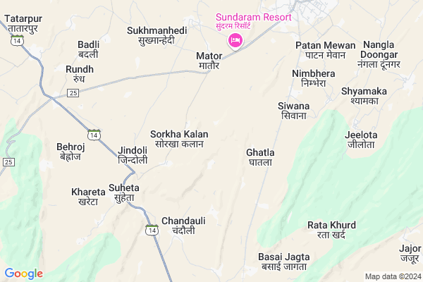
Chakoliya Map
EDIT Map
Add Your House
 ..
..
Current Corona Virus Infected Patients Count in Alwar District
| City Name | District Name | Total Covid cases |
|---|---|---|
| Alwar District | Alwar | 7 |
Locality Name :
Chakoliya
( चकोलिया )
Tehsil Name : Mandawar
District : Alwar
State : Rajasthan
Division : Jaipur
Language : Rajasthani
Current Time 04:36 AM
Date: Saturday , Apr 26,2025 (IST)
Time zone: IST (UTC+5:30)
Elevation / Altitude: 284 meters. Above Seal level
Telephone Code / Std Code: 01495
Assembly constituency : Alwar Rural assembly constituency
Assembly MLA : Tikaram Jully
Lok Sabha constituency : Bharatpur parliamentary constituency
Parliament MP : RANJEETA KOLI
Serpanch Name :
Pin Code : 301404
Post Office Name : Khairthal
Main Village Name : Chakoliya
Commodities Prices : Khairthal Market / Mandi
Chakoliya Live Weather
Temperature: 30.7 °C
scattered clouds
Humidity: 8%
Wind : 1.52 mt/sec towards W
StationName : "Alwar"
observed on 2 Hours Back
Temperature: 30.7 °C
scattered clouds
Humidity: 8%
Wind : 1.52 mt/sec towards W
StationName : "Alwar"
observed on 2 Hours Back
Chakoliya Weather Forecast for Next 5 days
26-04-2025
30.0°C to 30.0°C
scattered clouds
30.0°C to 30.0°C
scattered clouds
27-04-2025
29.0°C to 40.2°C
scattered clouds, broken clouds, few clouds, overcast clouds
29.0°C to 40.2°C
scattered clouds, broken clouds, few clouds, overcast clouds
28-04-2025
27.7°C to 41.4°C
overcast clouds, clear sky, few clouds, broken clouds, scattered clouds
27.7°C to 41.4°C
overcast clouds, clear sky, few clouds, broken clouds, scattered clouds
29-04-2025
28.4°C to 42.8°C
clear sky, scattered clouds, few clouds
28.4°C to 42.8°C
clear sky, scattered clouds, few clouds
30-04-2025
29.5°C to 42.8°C
clear sky, few clouds
29.5°C to 42.8°C
clear sky, few clouds
National Highways Reachable To Chakoliya
Nationa High Way :NH148B
Nationa High Way :NH48
Nationa High Way :NH148B
Nationa High Way :NH48
Rivers Near Chakoliya
Sahibi
Chalak Nala
Sahibi
Chalak Nala
About Chakoliya
Correct below Info and add more info about ChakoliyaChakoliya is a small Village/hamlet in Mandawar Tehsil in Alwar District of Rajasthan State, India. It comes under Chakoliya Panchayath. It belongs to Jaipur Division . It is located 21 KM towards North from District head quarters Alwar. 22 KM from Mundawar. 140 KM from State capital Jaipur
Chakoliya Pin code is 301404 and postal head office is Khairthal .
Mator ( 4 KM ) , Jindoli ( 4 KM ) , Patan Mewan ( 7 KM ) , Rata Khurd ( 8 KM ) , Bhand Wara ( 8 KM ) are the nearby Villages to Chakoliya. Chakoliya is surrounded by Mandawar Tehsil towards North , Alwar Tehsil towards South , Bansur Tehsil towards west , Ramgarh Tehsil towards East .
Alwar , Bawal , Narnaul , Rewari are the near by Cities to Chakoliya.
This Place is in the border of the Alwar District and Rewari District. Rewari District Bawal is North towards this place . It is near to the Haryana State Border.
Chakoliya 2011 Census Details
Chakoliya Local Language is Rajasthani. Chakoliya Village Total population is 418 and number of houses are 73. Female Population is 45.7%. Village literacy rate is 62.2% and the Female Literacy rate is 21.1%.
Population
| Census Parameter | Census Data |
| Total Population | 418 |
| Total No of Houses | 73 |
| Female Population % | 45.7 % ( 191) |
| Total Literacy rate % | 62.2 % ( 260) |
| Female Literacy rate | 21.1 % ( 88) |
| Scheduled Tribes Population % | 0.0 % ( 0) |
| Scheduled Caste Population % | 14.4 % ( 60) |
| Working Population % | 49.8 % |
| Child(0 -6) Population by 2011 | 65 |
| Girl Child(0 -6) Population % by 2011 | 41.5 % ( 27) |
Chakoliya Census More Deatils.
Politics in Chakoliya
Bharatiya Janata Party , BJP , INC are the major political parties in this area.Polling Stations /Booths near Chakoliya
1)Govt. Upper Primary School West Side Malakehra2)Govt. Secondary School East Side Jatiyana
3)Govt. Upper Primary School Room No. 9 Soteka
4)Govt.upper Primary School East Side Norangabad
5)Govt. Senior Secondary School North Side Burja
HOW TO REACH Chakoliya
By Rail
Ghatla Rail Way Station , Parisal Rail Way Station are the very nearby railway stations to Chakoliya.Colleges near Chakoliya
Karam Vidhya Mandir Mundawar
Address :
Rat Mahila Mahavidyalaya, Mundawar
Address : Rat Mahila Mahavidyalaya, Mundawar, Alwar
Ratandeep Mahila Mahavidyalaya, Kokawas Sodaws
Address : Ratandeep Mahila Mahavidyalaya, Kokawas Sodaws, Mu
Schools in Chakoliya
Govt. Ps Chakolia
Address : chakoliya , mundawar , alwar , Rajasthan . PIN- 301404 , Post - Khairthal
Govt Health Centers near Chakoliya
1) Sourakha Kalan , , ,2) Jindoli , , Jindoli ,
3) Khareta , khareta , khareta ,
Sub Villages in Chakoliya
Hospitals in Chakoliya,Mandawar
Mukesh Ayurvedic Store
Rajasthan; Mator Rd; Purani Mandi; Khairthal; Rajasthan 301404; India
8.9 KM distance Detail
more ..
Colleges in Chakoliya,Mandawar
Sarvodaya ITI College
sewaram mukhija nagar ismilpur road; Khairthal; Rajasthan 301404; India
9.9 KM distance Detail
more ..
Electronic Shops in Chakoliya,Mandawar
Devansh Enterprises
Krishan Vatika; Mator Rd; Khairthal; Rajasthan 301404; India
7.9 KM distance Detail
Super Markets in Chakoliya,Mandawar
pawan Genral Store
261; Siwan Rd; Adarsh Nagar; Khairthal; Rajasthan 301404; India
8.4 KM distance Detail
Vishwa General Store
Mator Rd; Old Anaj Mandi; Khairthal; Rajasthan 301404; India
9.0 KM distance Detail
Local Parks in Chakoliya,Mandawar
Lala Jai Narayan Park2
Old Ajanj Mandi Ring Rd; Old Anaj Mandi; Khairthal; Rajasthan 301404; India
8.9 KM distance Detail
Governement Offices near Chakoliya,Mandawar
Krishi Upaj Mandi;Khairthal Office
New Anaj Mandi; Khairthal; Alwar; Rajasthan 301404; India
8.9 KM distance Detail
About Chakoliya &
History
How to reach Chakoliya
Tourist Places Near By Chakoliya
Schools in Chakoliya
Colleges in Chakoliya
Temperature & weather of Chakoliya
places in Chakoliya
Chakoliya photos
More Information
How to reach Chakoliya
Tourist Places Near By Chakoliya
Schools in Chakoliya
Colleges in Chakoliya
Temperature & weather of Chakoliya
places in Chakoliya
Chakoliya photos
More Information
Village Talk
Post News or Events about this Village
Near Cities
Alwar 21 KM near
Bawal 42 KM near
Narnaul 56 KM near
Rewari 57 KM near
Alwar 21 KM near
Bawal 42 KM near
Narnaul 56 KM near
Rewari 57 KM near
Near By Taluks
Kishangarh Bas 15 KM near
Mandawar 21 KM near
Alwar 22 KM near
Bansur 28 KM near
Kishangarh Bas 15 KM near
Mandawar 21 KM near
Alwar 22 KM near
Bansur 28 KM near
Near By Air Ports
Indira Gandhi International Airport 115 KM near
Sanganeer Airport 144 KM near
Kheria Airport 167 KM near
Muzaffarnagar Airport 240 KM near
Indira Gandhi International Airport 115 KM near
Sanganeer Airport 144 KM near
Kheria Airport 167 KM near
Muzaffarnagar Airport 240 KM near
Near By Tourist Places
Alwar 22 KM near
Sariska 49 KM near
Nuh 63 KM near
Narnaul 65 KM near
Sohna 81 KM near
Alwar 22 KM near
Sariska 49 KM near
Nuh 63 KM near
Narnaul 65 KM near
Sohna 81 KM near
Near By Districts
Alwar 21 KM near
Rewari 57 KM near
Mewat 63 KM near
Mahendragarh 65 KM near
Alwar 21 KM near
Rewari 57 KM near
Mewat 63 KM near
Mahendragarh 65 KM near
Near By RailWay Station
Ghatla Rail Way Station 3.6 KM near
Parisal Rail Way Station 7.8 KM near
Khairthal Rail Way Station 9.1 KM near
Alwar Junction Rail Way Station 22 KM near
Ghatla Rail Way Station 3.6 KM near
Parisal Rail Way Station 7.8 KM near
Khairthal Rail Way Station 9.1 KM near
Alwar Junction Rail Way Station 22 KM near