| Home | City Bus | Maps | Villages | Cities | Rail | Tourist Places | School | College | Pin Codes | Corona Cases Count |
| Distance Calculator Bus Services IFSC Codes Trace Mobile Number Weather Search Place Trace IP Available Cash ATM/Banks Locate Polling Booth Report an Error contact People |
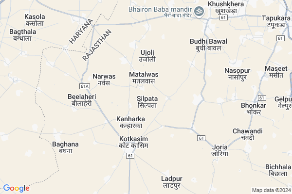
Silpata Map
EDIT Map
Add Your House
 ..
..
Current Corona Virus Infected Patients Count in Alwar District
| City Name | District Name | Total Covid cases |
|---|---|---|
| Alwar District | Alwar | 7 |
Locality Name :
Silpata
( सिलपता )
Tehsil Name : Kotkasim
District : Alwar
State : Rajasthan
Division : Jaipur
Language : Rajasthani
Current Time 06:39 AM
Date: Saturday , Apr 26,2025 (IST)
Time zone: IST (UTC+5:30)
Elevation / Altitude: 273 meters. Above Seal level
Telephone Code / Std Code: 01493
Assembly constituency : Kishangarh Bas assembly constituency
Assembly MLA : Deepchand Khairiya
Lok Sabha constituency : Alwar parliamentary constituency
Parliament MP : Balak Nath
Serpanch Name :
Pin Code : 301702
Post Office Name : Kotkassim
Main Village Name : Silpata
Commodities Prices : Rewari Market / Mandi
Silpata Live Weather
Temperature: 29.1 °C
few clouds
Humidity: 8%
Wind : 1.22 mt/sec towards S
StationName : "BakÄ\u0081pur"
observed on 2 Hours Back
Temperature: 29.1 °C
few clouds
Humidity: 8%
Wind : 1.22 mt/sec towards S
StationName : "BakÄ\u0081pur"
observed on 2 Hours Back
Silpata Weather Forecast for Next 5 days
27-04-2025
27.8°C to 41.3°C
few clouds, scattered clouds, broken clouds, overcast clouds
27.8°C to 41.3°C
few clouds, scattered clouds, broken clouds, overcast clouds
28-04-2025
28.0°C to 42.1°C
broken clouds, few clouds, clear sky, scattered clouds
28.0°C to 42.1°C
broken clouds, few clouds, clear sky, scattered clouds
29-04-2025
28.7°C to 43.5°C
clear sky, few clouds
28.7°C to 43.5°C
clear sky, few clouds
30-04-2025
29.6°C to 43.5°C
clear sky, few clouds
29.6°C to 43.5°C
clear sky, few clouds
Edit below overview about Silpata
Edit below overview about Silpata
OverView of Silpata
Haryanvi Ahirwati language is spoken in Silpata village and this village is adjacent to Rewari district, Rewari and Bhiwadi are the nearest towns 15km away and Gurgaon is the nearest city 55km mainly. This village is dominated by Rao Sahab Yadav and this village falls in Ahirwal region, the culture here is also of Ahirwal region, there is Santoriya clan here, the most famous person of this village is Dr. Jaswant Yadav who has been a minister in the Rajasthan government and is an MLA from Behror, the people of this village also came from Behror and settled here. Two Yadav brothers Hemsingh Rao and Pamesingh Rao came here around 1900 and settled this village, who were descendants of Rao Mitrasen Santoriya who was a great warrior and also the ruler of Rewari throne.Edit below overview about Silpata
National Highways Reachable To Silpata
Nationa High Way :NH48
Nationa High Way :NH148B
Nationa High Way :NH48
Nationa High Way :NH148B
Rivers Near Silpata
Chalak Nala
Sota
Chalak Nala
Sota
About Silpata
Silpata is a small Village/hamlet in Kotkasim Tehsil in Alwar District of Rajasthan State, India. It comes under Silpata Panchayath. It belongs to Jaipur Division . It is located 64 KM towards North from District head quarters Alwar. 10 KM from Kotkasim. 181 KM from State capital Jaipur
Silpata Pin code is 301702 and postal head office is Kotkassim .
Kotkasim ( 3 KM ) , Katopur ( 4 KM ) , Bilaheri ( 5 KM ) , Ladpur ( 6 KM ) , Gheekaka ( 7 KM ) are the nearby Villages to Silpata. Silpata is surrounded by Tijara Tehsil towards East , Bawal Tehsil towards west , Rewari Tehsil towards North , Mewat Tehsil towards East .
Bawal , Rewari , Sohna , Gurgaon are the near by Cities to Silpata.
This Place is in the border of the Alwar District and Rewari District. Rewari District Bawal is west towards this place . It is near to the Haryana State Border.
Silpata 2011 Census Details
Silpata Local Language is Rajasthani. Silpata Village Total population is 949 and number of houses are 194. Female Population is 47.0%. Village literacy rate is 69.8% and the Female Literacy rate is 27.7%.
Population
| Census Parameter | Census Data |
| Total Population | 949 |
| Total No of Houses | 194 |
| Female Population % | 47.0 % ( 446) |
| Total Literacy rate % | 69.8 % ( 662) |
| Female Literacy rate | 27.7 % ( 263) |
| Scheduled Tribes Population % | 17.3 % ( 164) |
| Scheduled Caste Population % | 31.4 % ( 298) |
| Working Population % | 59.1 % |
| Child(0 -6) Population by 2011 | 131 |
| Girl Child(0 -6) Population % by 2011 | 42.7 % ( 56) |
Silpata Census More Deatils.
Politics in Silpata
Bharatiya Janata Party , BJP , BSP , INC are the major political parties in this area.Polling Stations /Booths near Silpata
1)Govt. Primary School Chaundawata2)Govt. Senior Secondary School Mancha Right Side Of North Side
3)Govt. Upper Primary School Shahpur Room No 2 North Side
4)Govt. Senior Secondary School Baghana South Part
5)Govt. Senior Secondary School Kotkasim Room No 11
HOW TO REACH Silpata
By Rail
There is no railway station near to Silpata in less than 10 km.Colleges near Silpata
Bhagat Singh Mahila College Kotkasim
Address :
Govt Bibirani College, Bibirani, Kotkasim
Address :
Rao Prakash Private Iti College
Address : Patan Ahir,harsoli Road Near Kadiya , Alwar(raj.)
Sharama Morden B.ed Collage
Address : Harsoli Road,patan Aheer
Govt. Sanskrit Coollege
Address : Near Ramleela Ground
Schools in Silpata
Govt. Ps Silpata
Address : silpata , kotkasim , alwar , Rajasthan . PIN- 301702 , Post - Kotkassim
Govt Health Centers near Silpata
1) Kanhadka , kanhadka , kotkasim , kotkasim2) Kotkasim , CHC KOTKASIM , SDM COURT KE PASS , rajasthan
3) Jatuwas , jatuwas , makdawa matalwas road jatuwas , kotkasim
Sub Villages in Silpata
Hospitals in Silpata,Kotkasim
Dr Manoj Chauhan clinic(Pediatrician)
Kumharwara Mohalla; Kotkasim; Rajasthan 301702; India
4.1 KM distance Detail
more ..
Colleges in Silpata,Kotkasim
Yashika Medical Store
OPP-GOVT.CHC; Kumharwara Mohalla; Kotkasim; Rajasthan 301702; India
4.1 KM distance Detail
New Tagore Iti Bhudi Bawal
Near shri shyam mandir budhi bawal; Burhi Bawal - Dharuhera Rd; Budhi Bawal; Rajasthan 301707; India
7.8 KM distance Detail
Shri Shyam TT College; Shahpur; Tijara
Lane from Papari Road; Near Tatarpur; India
13.7 KM distance Detail
more ..
Schools in Silpata,Kotkasim
Govt. School Aanaka
301702; RD Complex; U-3; Unnamed Rd; Sector 3; Avas Vikas Colony; Sikandra; Agra; Rajasthan 282004; India
1.6 KM distance Detail
Super Markets in Silpata,Kotkasim
Surendra Agarwal Ultratech Ciment
Hign School Road; Major District Road 61A; Kumharwara Mohalla; Kotkasim; Rajasthan 301702; India
4.0 KM distance Detail
Manoj Agarwal Lays;Pepsi;Kurkure & More Brand Distributer
Hign School Road; MDR61A; Kumharwara Mohalla; Kotkasim; Rajasthan 301702; India
4.1 KM distance Detail
Vijay Agarwal Bsnl Distributer
Kanugoyan Mohalla; Kotkasim; Rajasthan 301702; India
4.6 KM distance Detail
Governement Offices near Silpata,Kotkasim
saini e-mitra
New Market Rd; Kumharwara Mohalla; Teacher Colony; Tapukara; Rajasthan 301707; India
4.3 KM distance Detail
About Silpata &
History
How to reach Silpata
Tourist Places Near By Silpata
Schools in Silpata
Colleges in Silpata
Temperature & weather of Silpata
places in Silpata
Silpata photos
More Information
How to reach Silpata
Tourist Places Near By Silpata
Schools in Silpata
Colleges in Silpata
Temperature & weather of Silpata
places in Silpata
Silpata photos
More Information
Village Talk
Post News or Events about this Village
Near Cities
Bawal 16 KM near
Rewari 20 KM near
Sohna 43 KM near
Gurgaon 59 KM near
Bawal 16 KM near
Rewari 20 KM near
Sohna 43 KM near
Gurgaon 59 KM near
Near By Taluks
Kotkasim 10 KM near
Tijara 14 KM near
Bawal 16 KM near
Rewari 20 KM near
Kotkasim 10 KM near
Tijara 14 KM near
Bawal 16 KM near
Rewari 20 KM near
Near By Air Ports
Indira Gandhi International Airport 74 KM near
Kheria Airport 176 KM near
Sanganeer Airport 185 KM near
Muzaffarnagar Airport 199 KM near
Indira Gandhi International Airport 74 KM near
Kheria Airport 176 KM near
Sanganeer Airport 185 KM near
Muzaffarnagar Airport 199 KM near
Near By Tourist Places
Nuh 30 KM near
Manesar 43 KM near
Sohna 44 KM near
Gurgaon 60 KM near
Bhindawas Lake 62 KM near
Nuh 30 KM near
Manesar 43 KM near
Sohna 44 KM near
Gurgaon 60 KM near
Bhindawas Lake 62 KM near
Near By Districts
Rewari 21 KM near
Mewat 30 KM near
Gurgaon 59 KM near
Alwar 62 KM near
Rewari 21 KM near
Mewat 30 KM near
Gurgaon 59 KM near
Alwar 62 KM near
Near By RailWay Station
Rewari Junction Rail Way Station 22 KM near
Khairthal Rail Way Station 33 KM near
Rewari Junction Rail Way Station 22 KM near
Khairthal Rail Way Station 33 KM near