| Home | City Bus | Maps | Villages | Cities | Rail | Tourist Places | School | College | Pin Codes | Corona Cases Count |
| Distance Calculator Bus Services IFSC Codes Trace Mobile Number Weather Search Place Trace IP Available Cash ATM/Banks Locate Polling Booth Report an Error contact People |
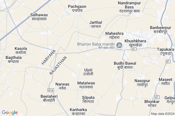
Lalpur Map
EDIT Map
Add Your House
 ..
..
Current Corona Virus Infected Patients Count in Alwar District
| City Name | District Name | Total Covid cases |
|---|---|---|
| Alwar District | Alwar | 7 |
Locality Name :
Lalpur
( लालपुर )
Tehsil Name : Kotkasim
District : Alwar
State : Rajasthan
Division : Jaipur
Language : Rajasthani
Current Time 01:25 PM
Date: Wednesday , Feb 05,2025 (IST)
Time zone: IST (UTC+5:30)
Elevation / Altitude: 273 meters. Above Seal level
Telephone Code / Std Code: 01493
Assembly constituency : Kishangarh Bas assembly constituency
Assembly MLA : Deepchand Khairiya
Lok Sabha constituency : Alwar parliamentary constituency
Parliament MP : Balak Nath
Serpanch Name :
Pin Code : 301702
Post Office Name : Kotkassim
Main Village Name : Lalpur
Commodities Prices : Rewari Market / Mandi
Lalpur Live Weather
Temperature: 19.7 °C
clear sky
Humidity: 31%
Wind : 4.15 mt/sec towards NW
StationName : "BakÄ\u0081pur"
observed on 2 Hours Back
Temperature: 19.7 °C
clear sky
Humidity: 31%
Wind : 4.15 mt/sec towards NW
StationName : "BakÄ\u0081pur"
observed on 2 Hours Back
Lalpur Weather Forecast for Next 5 days
06-02-2025
11.2°C to 21.8°C
clear sky
11.2°C to 21.8°C
clear sky
07-02-2025
10.0°C to 22.7°C
clear sky
10.0°C to 22.7°C
clear sky
08-02-2025
8.9°C to 22.7°C
few clouds, clear sky, broken clouds
8.9°C to 22.7°C
few clouds, clear sky, broken clouds
09-02-2025
10.7°C to 24.4°C
scattered clouds, broken clouds, clear sky, few clouds
10.7°C to 24.4°C
scattered clouds, broken clouds, clear sky, few clouds
10-02-2025
13.2°C to 26.6°C
few clouds, clear sky, broken clouds, overcast clouds
13.2°C to 26.6°C
few clouds, clear sky, broken clouds, overcast clouds
Edit below overview about Lalpur
Edit below overview about Lalpur
OverView of Lalpur
Lapur is smal village having the population of 300 houses. Main job of people is Agriculture.Post office -UJOLY, Grampanchayat UjolyTehsil-KOTKASIMVillage is Connected by Road to Garhi Bolani(Haryana-Rewari)and BUDHI Bawal,and Ujoly. Rewari is 18Km and Alwar is 75Km. Bhiwari is 20Km.People live in veryhealthy atmoshphere/in cordialrelation.one problem which may trouble in future isexcess use of waterfor domestic use because every house has its own submersible pumpwhich leads to misuse.There is no hospital in the village.Govt. school is up to 8th.Edit below overview about Lalpur
National Highways Reachable To Lalpur
Nationa High Way :NH48
Nationa High Way :NH148B
Nationa High Way :NH48
Nationa High Way :NH148B
Rivers Near Lalpur
Chalak Nala
Sota
Chalak Nala
Sota
About Lalpur
Lalpur is a small Village/hamlet in Kotkasim Tehsil in Alwar District of Rajasthan State, India. It comes under Lalpur Panchayath. It belongs to Jaipur Division . It is located 70 KM towards North from District head quarters Alwar. 16 KM from Kotkasim. 186 KM from State capital Jaipur
Lalpur Pin code is 301702 and postal head office is Kotkassim .
Mahesara ( 5 KM ) , Katopur ( 6 KM ) , Kanharka ( 7 KM ) , Karoli ( 7 KM ) , Bilaheri ( 7 KM ) are the nearby Villages to Lalpur. Lalpur is surrounded by Rewari Tehsil towards North , Bawal Tehsil towards west , Tijara Tehsil towards East , Pataudi Tehsil towards North .
Bawal , Rewari , Sohna , Gurgaon are the near by Cities to Lalpur.
This Place is in the border of the Alwar District and Rewari District. Rewari District Bawal is west towards this place . It is near to the Haryana State Border.
Lalpur 2011 Census Details
Lalpur Local Language is Rajasthani. Lalpur Village Total population is 1101 and number of houses are 202. Female Population is 48.6%. Village literacy rate is 69.4% and the Female Literacy rate is 29.6%.
Population
| Census Parameter | Census Data |
| Total Population | 1101 |
| Total No of Houses | 202 |
| Female Population % | 48.6 % ( 535) |
| Total Literacy rate % | 69.4 % ( 764) |
| Female Literacy rate | 29.6 % ( 326) |
| Scheduled Tribes Population % | 0.0 % ( 0) |
| Scheduled Caste Population % | 20.2 % ( 222) |
| Working Population % | 56.8 % |
| Child(0 -6) Population by 2011 | 154 |
| Girl Child(0 -6) Population % by 2011 | 43.5 % ( 67) |
Lalpur Census More Deatils.
Politics in Lalpur
Bharatiya Janata Party , BJP , BSP , INC are the major political parties in this area.Polling Stations /Booths near Lalpur
1)Sahid Rajendra Prasad Govt Upper Primary School Gurguchka2)Govt. Primary School Silpata
3)Shahid Balwant Singh Govt. Secondary School Ujoli Room No 1 East Side
4)Govt.upper Primary School Hanspur Kalan
5)Govt. Primary School Bhamuvas
HOW TO REACH Lalpur
By Rail
There is no railway station near to Lalpur in less than 10 km.Colleges near Lalpur
Bhagat Singh Mahila College Kotkasim
Address :
Govt Bibirani College, Bibirani, Kotkasim
Address :
Rao Prakash Private Iti College
Address : Patan Ahir,harsoli Road Near Kadiya , Alwar(raj.)
Sharama Morden B.ed Collage
Address : Harsoli Road,patan Aheer
Govt. Sanskrit Coollege
Address : Near Ramleela Ground
Schools in Lalpur
Saraswati Pub.school
Address : lalpur , kotkasim , alwar , Rajasthan . PIN- 301702 , Post - Kotkassim
Govt. Ups Lalpur
Address : lalpur , kotkasim , alwar , Rajasthan . PIN- 301702 , Post - Kotkassim
Govt Health Centers near Lalpur
1) Jatuwas , jatuwas , makdawa matalwas road jatuwas , kotkasim2) Makdava , Sub centre makdawa , kotkasim , kotkasim
3) Bilahedi , bilahedi , baghana , kotkasim
Sub Villages in Lalpur
Hospitals in Lalpur,Kotkasim
Saksham Hospital & Diagnostic Center
Alwar-Bhiwadi Rd; RIICO Industrial Area; Karmsiwas; Rajasthan 301707; India
5.3 KM distance Detail
more ..
Petrol Bunks in Lalpur,Kotkasim
HP PETROL PUMP - BIRJU SINGH FILLING STATION
HPC Petrol Pump Vill. Jarthal Post Office- Raliawas; Gurgaon; Haryana 123106; India
6.6 KM distance Detail
more ..
Colleges in Lalpur,Kotkasim
New Tagore Iti Bhudi Bawal
Near shri shyam mandir budhi bawal; Burhi Bawal - Dharuhera Rd; Budhi Bawal; Rajasthan 301707; India
4.9 KM distance Detail
Yashika Medical Store
OPP-GOVT.CHC; Kumharwara Mohalla; Kotkasim; Rajasthan 301702; India
9.2 KM distance Detail
Shri Shyam TT College; Shahpur; Tijara
Lane from Papari Road; Near Tatarpur; India
9.8 KM distance Detail
more ..
Electronic Shops in Lalpur,Kotkasim
Jyoti Photo Studio
Burhi Bawal - Dharuhera Rd; Karmsiwas; Rajasthan 301707; India
4.9 KM distance Detail
Governement Offices near Lalpur,Kotkasim
Ishika Transport Company
khuskhera near; balaji kanta; Khushkhera; Rajasthan; India
7.3 KM distance Detail
About Lalpur &
History
How to reach Lalpur
Tourist Places Near By Lalpur
Schools in Lalpur
Colleges in Lalpur
Temperature & weather of Lalpur
places in Lalpur
Lalpur photos
More Information
How to reach Lalpur
Tourist Places Near By Lalpur
Schools in Lalpur
Colleges in Lalpur
Temperature & weather of Lalpur
places in Lalpur
Lalpur photos
More Information
Village Talk
Post News or Events about this Village
Near Cities
Bawal 16 KM near
Rewari 16 KM near
Sohna 41 KM near
Gurgaon 55 KM near
Bawal 16 KM near
Rewari 16 KM near
Sohna 41 KM near
Gurgaon 55 KM near
Near By Taluks
Kotkasim 14 KM near
Bawal 15 KM near
Rewari 15 KM near
Tijara 16 KM near
Kotkasim 14 KM near
Bawal 15 KM near
Rewari 15 KM near
Tijara 16 KM near
Near By Air Ports
Indira Gandhi International Airport 69 KM near
Kheria Airport 179 KM near
Sanganeer Airport 189 KM near
Muzaffarnagar Airport 194 KM near
Indira Gandhi International Airport 69 KM near
Kheria Airport 179 KM near
Sanganeer Airport 189 KM near
Muzaffarnagar Airport 194 KM near
Near By Tourist Places
Nuh 30 KM near
Manesar 39 KM near
Sohna 41 KM near
Gurgaon 56 KM near
Bhindawas Lake 57 KM near
Nuh 30 KM near
Manesar 39 KM near
Sohna 41 KM near
Gurgaon 56 KM near
Bhindawas Lake 57 KM near
Near By Districts
Rewari 18 KM near
Mewat 30 KM near
Gurgaon 55 KM near
Palwal 64 KM near
Rewari 18 KM near
Mewat 30 KM near
Gurgaon 55 KM near
Palwal 64 KM near
Near By RailWay Station
Rewari Junction Rail Way Station 18 KM near
Pataudi Road Rail Way Station 30 KM near
Rewari Junction Rail Way Station 18 KM near
Pataudi Road Rail Way Station 30 KM near