| Home | City Bus | Maps | Villages | Cities | Rail | Tourist Places | School | College | Pin Codes | Corona Cases Count |
| Distance Calculator Bus Services IFSC Codes Trace Mobile Number Weather Search Place Trace IP Available Cash ATM/Banks Locate Polling Booth Report an Error contact People |
Ranman
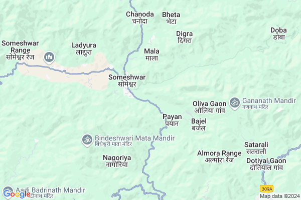
Ranman Map
EDIT Map
Add Your House
 ..
..
Current Corona Virus Infected Patients Count in Almora District
| City Name | District Name | Total Covid cases |
|---|---|---|
| Almora District | Almora | 1 |
Locality Name :
Ranman
( रणमण )
Block Name : Takula
District : Almora
State : Uttarakhand
Language : Hindi and Urdu
Current Time 12:57 PM
Date: Friday , Apr 25,2025 (IST)
Time zone: IST (UTC+5:30)
Elevation / Altitude: 520 meters. Above Seal level
Telephone Code / Std Code: 05962
Assembly constituency : Someshwar assembly constituency
Assembly MLA : Rekha Arya
Lok Sabha constituency : Almora parliamentary constituency
Parliament MP : Ajay Tamta
Serpanch Name :
Pin Code : 263637
Post Office Name :
Main Village Name : Ranman
Commodities Prices : Haldwani Market / Mandi
Ranman Live Weather
Temperature: 27.2 °C
clear sky
Humidity: 8%
Wind : 3.02 mt/sec towards SW
StationName : "DwÄ\u0081rÄ\u0081hÄ\u0081t"
observed on Now
Temperature: 27.2 °C
clear sky
Humidity: 8%
Wind : 3.02 mt/sec towards SW
StationName : "DwÄ\u0081rÄ\u0081hÄ\u0081t"
observed on Now
Ranman Weather Forecast for Next 5 days
26-04-2025
16.2°C to 31.2°C
clear sky, few clouds, broken clouds, overcast clouds
16.2°C to 31.2°C
clear sky, few clouds, broken clouds, overcast clouds
27-04-2025
15.6°C to 32.3°C
overcast clouds, broken clouds
15.6°C to 32.3°C
overcast clouds, broken clouds
28-04-2025
16.3°C to 30.7°C
overcast clouds, scattered clouds, broken clouds, clear sky
16.3°C to 30.7°C
overcast clouds, scattered clouds, broken clouds, clear sky
29-04-2025
15.4°C to 32.7°C
scattered clouds, few clouds, clear sky, light rain, broken clouds
15.4°C to 32.7°C
scattered clouds, few clouds, clear sky, light rain, broken clouds
30-04-2025
14.1°C to 33.0°C
clear sky, scattered clouds, broken clouds, moderate rain, light rain, overcast clouds
14.1°C to 33.0°C
clear sky, scattered clouds, broken clouds, moderate rain, light rain, overcast clouds
National Highways Reachable To Ranman
Nationa High Way :NH309A
Nationa High Way :NH309A
Rivers Near Ranman
Maheshwari Nadi
Kathron Nadi
Maheshwari Nadi
Kathron Nadi
About Ranman
Correct below Info and add more info about RanmanRanman is a small Village/hamlet in Takula Block in Almora District of Uttarakhand State, India. It comes under Ranman Panchayath. It is located 22 KM towards North from District head quarters Almora. 0 KM from Takula. 192 KM from State capital Dehradun
Ranman Pin code is 263637 and postal head office is .
Payan ( 2 KM ) , Rasyara Gaon ( 2 KM ) , Mala ( 2 KM ) , Rait ( 3 KM ) , Banaura ( 4 KM ) are the nearby Villages to Ranman. Ranman is surrounded by Hawalbag Block towards South , Garur Block towards North , Dwarahat Block towards west , Almora Block towards South .
Almora , Nainital , Haldwani , Pithoragarh are the near by Cities to Ranman.
Ranman 2011 Census Details
Ranman Local Language is Hindi. Ranman Village Total population is 78 and number of houses are 16. Female Population is 51.3%. Village literacy rate is 84.6% and the Female Literacy rate is 39.7%.
Population
| Census Parameter | Census Data |
| Total Population | 78 |
| Total No of Houses | 16 |
| Female Population % | 51.3 % ( 40) |
| Total Literacy rate % | 84.6 % ( 66) |
| Female Literacy rate | 39.7 % ( 31) |
| Scheduled Tribes Population % | 0.0 % ( 0) |
| Scheduled Caste Population % | 0.0 % ( 0) |
| Working Population % | 41.0 % |
| Child(0 -6) Population by 2011 | 5 |
| Girl Child(0 -6) Population % by 2011 | 40.0 % ( 2) |
Ranman Census More Deatils.
Politics in Ranman
BJP , BJP , INC are the major political parties in this area.Polling Stations /Booths near Ranman
1)Tana2)Someshwar
3)Someshwar
4)Sutargaon
5)Someshwar
HOW TO REACH Ranman
By Rail
There is no railway station near to Ranman in less than 10 km.Colleges near Ranman
Govt. Inter College Manila
Address :
Rajkiya Mahavidyalaya, Bhikisain
Address :
P G College Manila
Address :
Government Inter College, Bhanoli
Address :
Govt. Inter College Masi
Address :
Schools in Ranman
S.s.m Ranman
Address : ranman , takula , almora , Uttarakhand . PIN- 263638 , Post - Manan
Govt Health Centers near Ranman
1) Bamsera SC , Bamsera ANM Center , Ayartoli Road ,2) Gairar SC , Gairad ANM CENTER , Kanda Road , Near Primary School
3) Ghingartola SC , Ghingartola , Kanda Road , Near BSNL tower ANM Center
Sub Villages in Ranman
Hospitals in Ranman,Takula
Government hospital Someshwar
Kausani Rd; Falya Arjunrath; Uttarakhand 263637; India
1.4 KM distance Detail
more ..
Petrol Bunks in Ranman,Takula
HP PETROL PUMP - RANA FILLING STATION
Village Palyuda Someshwar; Kausani Rd; Dehradun; 263630; India
2.4 KM distance Detail
Hindustan Petroleum
Jal Dhaular; Almora; SH-11; Dwarahat Almora Kausani Road; Somaswer; Somaswer; Uttarakhand 263637; India
2.9 KM distance Detail
more ..
Colleges in Ranman,Takula
Industrial Training Institute Someshwar
Dhamuk Pinath Gunth; Uttarakhand 263629; India
4.0 KM distance Detail
more ..
Schools in Ranman,Takula
Anand Valley School
Someshwar; Almora; SH-11; Bageswar Road; Somaswer; Somaswer; Uttarakhand 263637; India
3.2 KM distance Detail
Government Primary School
Adhuriya; Dwarahat - Almora - Kausani Rd; Uttarakhand 263629; India
3.9 KM distance Detail
Electronic Shops in Ranman,Takula
Bajrang Electricals
Almora-Bageshwar Rd; Basoli band Market; Basholi; Uttarakhand 263628; India
12.5 KM distance Detail
Pragya Computers
Dwarahat - Almora - Kausani Rd; Lohari Talli; Uttarakhand 263639; India
16.2 KM distance Detail
Super Markets in Ranman,Takula
Vishal Mega Mart
LR Shah Road; Jagannath Talkies; Almora; Uttarakhand 263601; India
22.5 KM distance Detail
Dalakoti gen store
Almora - Barechhina Rd; New Colony; Dugalkhola; Almora; Uttarakhand 263601; India
22.6 KM distance Detail
Local Parks in Ranman,Takula
The Pine Valley
Near Mahindra Holidays Binsar Valley; Basoli; Uttarakhand 263684; India
12.6 KM distance Detail
Police Stations near Ranman,Takula
Police Station Baijnath
Karanprayag Gwaldam Bageshwar Almora Nainital Rd; Syalde; Uttarakhand 263641; India
17.6 KM distance Detail
Police Station
Bhauli; Bageshwar; SH-11; Bageshwar Road; Bageshwar; Bageshwar; Uttarakhand 263669; India
19.0 KM distance Detail
Governement Offices near Ranman,Takula
Sub Treasury Takula
Takula - Gananath Marg; Sub Treasury; Satarali; Uttarakhand 263628; India
10.2 KM distance Detail
District Magistrate Office
Bajnath; Bageshwar; SH-11; Bageshwar Road; Bageshwar; Bageshwar; Uttarakhand 263669; India
17.6 KM distance Detail
About Ranman &
History
How to reach Ranman
Tourist Places Near By Ranman
Schools in Ranman
Colleges in Ranman
Temperature & weather of Ranman
places in Ranman
Ranman photos
More Information
How to reach Ranman
Tourist Places Near By Ranman
Schools in Ranman
Colleges in Ranman
Temperature & weather of Ranman
places in Ranman
Ranman photos
More Information
Village Talk
Post News or Events about this Village
Near Cities
Almora 21 KM near
Nainital 51 KM near
Haldwani 67 KM near
Pithoragarh 68 KM near
Almora 21 KM near
Nainital 51 KM near
Haldwani 67 KM near
Pithoragarh 68 KM near
Near By Taluks
Takula 1 KM near
Hawalbag 14 KM near
Garur 18 KM near
Dwarahat 21 KM near
Takula 1 KM near
Hawalbag 14 KM near
Garur 18 KM near
Dwarahat 21 KM near
Near By Air Ports
Pantnagar Airport 93 KM near
Dehra Dun Airport 184 KM near
Muzaffarnagar Airport 215 KM near
Indira Gandhi International Airport 312 KM near
Pantnagar Airport 93 KM near
Dehra Dun Airport 184 KM near
Muzaffarnagar Airport 215 KM near
Indira Gandhi International Airport 312 KM near
Near By Tourist Places
Kasauni 9 KM near
Binsar 13 KM near
Jageshwar 15 KM near
Bageshwar 18 KM near
Dwarahat 20 KM near
Kasauni 9 KM near
Binsar 13 KM near
Jageshwar 15 KM near
Bageshwar 18 KM near
Dwarahat 20 KM near
Near By Districts
Bageshwar 18 KM near
Almora 21 KM near
Nainital 51 KM near
Pithoragarh 68 KM near
Bageshwar 18 KM near
Almora 21 KM near
Nainital 51 KM near
Pithoragarh 68 KM near
Near By RailWay Station
Kathgodam Rail Way Station 63 KM near
Haldwani Rail Way Station 69 KM near
Kathgodam Rail Way Station 63 KM near
Haldwani Rail Way Station 69 KM near