| Home | City Bus | Maps | Villages | Cities | Rail | Tourist Places | School | College | Pin Codes | Corona Cases Count |
| Distance Calculator Bus Services IFSC Codes Trace Mobile Number Weather Search Place Trace IP Available Cash ATM/Banks Locate Polling Booth Report an Error contact People |
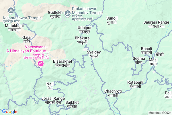
Gwali
Gwali Map
EDIT Map
Add Your House
 ..
..
Current Corona Virus Infected Patients Count in Almora District
| City Name | District Name | Total Covid cases |
|---|---|---|
| Almora District | Almora | 1 |
Locality Name :
Gwali
( गवली )
Block Name : Syaldey
District : Almora
State : Uttarakhand
Language : Hindi and Urdu
Current Time 10:25 PM
Date: Thursday , Mar 13,2025 (IST)
Time zone: IST (UTC+5:30)
Elevation / Altitude: 345 meters. Above Seal level
Telephone Code / Std Code: 05966
Assembly constituency : Salt assembly constituency
Assembly MLA : Mahesh Jeena
Lok Sabha constituency : Almora parliamentary constituency
Parliament MP : Ajay Tamta
Serpanch Name :
Main Village Name : Gwali
Commodities Prices : Ramnagar Market / Mandi
Gwali Live Weather
Temperature: 13.3 °C
broken clouds
Humidity: 73%
Wind : 1.93 mt/sec towards NE
StationName : "DwÄ\u0081rÄ\u0081hÄ\u0081t"
observed on 1 Hours Back
Temperature: 13.3 °C
broken clouds
Humidity: 73%
Wind : 1.93 mt/sec towards NE
StationName : "DwÄ\u0081rÄ\u0081hÄ\u0081t"
observed on 1 Hours Back
Gwali Weather Forecast for Next 5 days
14-03-2025
12.1°C to 13.3°C
broken clouds, scattered clouds
12.1°C to 13.3°C
broken clouds, scattered clouds
15-03-2025
11.2°C to 24.3°C
clear sky, broken clouds, scattered clouds, overcast clouds, light rain
11.2°C to 24.3°C
clear sky, broken clouds, scattered clouds, overcast clouds, light rain
16-03-2025
12.1°C to 24.8°C
scattered clouds, broken clouds, light rain, overcast clouds
12.1°C to 24.8°C
scattered clouds, broken clouds, light rain, overcast clouds
17-03-2025
12.1°C to 25.7°C
light rain, scattered clouds, broken clouds
12.1°C to 25.7°C
light rain, scattered clouds, broken clouds
18-03-2025
12.1°C to 23.3°C
scattered clouds, clear sky, broken clouds, few clouds
12.1°C to 23.3°C
scattered clouds, clear sky, broken clouds, few clouds
National Highways Reachable To Gwali
Nationa High Way :NH309A
Nationa High Way :NH534
Nationa High Way :NH309A
Nationa High Way :NH534
Rivers Near Gwali
Khoh
Ramganga
Khoh
Ramganga
About Gwali
Correct below Info and add more info about GwaliGwali is a small Village/hamlet in Syaldey Block in Almora District of Uttarakhand State, India. It comes under Gwali Panchayath. It is located 58 KM towards west from District head quarters Almora. 3 KM from Syaldey. 147 KM from State capital Dehradun
Jaspur ( 1 KM ) , Bhakura Talla ( 1 KM ) , Chani ( 1 KM ) , Bhakura Malla ( 2 KM ) , Kalyan Pur ( 3 KM ) are the nearby Villages to Gwali. Gwali is surrounded by Chaukhutiya Block towards East , Bhikiyasain Block towards South , Bironkhal Block towards west , Sult Block towards South .
Ramnagar , Almora , Pauri , Nainital are the near by Cities to Gwali.
Gwali 2011 Census Details
Gwali Local Language is Hindi. Gwali Village Total population is 352 and number of houses are 83. Female Population is 60.2%. Village literacy rate is 67.9% and the Female Literacy rate is 38.4%.
Population
| Census Parameter | Census Data |
| Total Population | 352 |
| Total No of Houses | 83 |
| Female Population % | 60.2 % ( 212) |
| Total Literacy rate % | 67.9 % ( 239) |
| Female Literacy rate | 38.4 % ( 135) |
| Scheduled Tribes Population % | 0.0 % ( 0) |
| Scheduled Caste Population % | 19.0 % ( 67) |
| Working Population % | 77.3 % |
| Child(0 -6) Population by 2011 | 40 |
| Girl Child(0 -6) Population % by 2011 | 35.0 % ( 14) |
Gwali Census More Deatils.
Politics in Gwali
BJP , BJP , INC are the major political parties in this area.Polling Stations /Booths near Gwali
1)Sunoli2)Syalde
3)Syalde
4)Katariya
5)Bhairangkhal
HOW TO REACH Gwali
By Rail
There is no railway station near to Gwali in less than 10 km.Pincodes near Gwali
263661 ( Syalde ) , 263665 ( Matela ) , 263658 ( Masi )Colleges near Gwali
G.i.c Chintoli
Address : Main Bajar Nagchulakhal Chintoli
Schools near Gwali
U.p.s. Pattharkhola
Address : pattharkhola , syaldey , almora , Uttarakhand . PIN- 263661 , Post - Syalde
G.i.c. Agaspur
Address : masod , syaldey , almora , Uttarakhand . PIN- 263661 , Post - Syalde
U.p.s. Titari Gurna
Address : titari , syaldey , almora , Uttarakhand . PIN- 263659 , Post - Deghat
H.s. Chitrakut
Address : rudoli , syaldey , almora , Uttarakhand . PIN- 263661 , Post - Syalde
Govt Health Centers near Gwali
1) Kingodikhal SC , , Kingodikhal , Kingodikhal2) Digolikhal SC , , Ddigolikhal , Digolikhal
3) Choptakhal SC , , Village Choptakhal , Choptakhal
Sub Villages in Gwali
Hospitals in Gwali,Syaldey
प्राथमिक स्वास्थ्य केंद्र मंगरू
Jainal Dotiyal Road; Jorasi Range; Uttarakhand 263676; India
8.9 KM distance Detail
more ..
Petrol Bunks in Gwali,Syaldey
HP PETROL PUMP - JAI JIYA FILLING STATION
Karn Prayag Road Chaukhutia Dist- UA; Dehradun; 263656; India
20.3 KM distance Detail
more ..
Colleges in Gwali,Syaldey
Janta Inter College
Gumati; Dotiyal Nail Deghat Road; Dudhauri Birkhal; Uttarakhand 263665; India
3.9 KM distance Detail
Government Higher Secondary School; Chachroti
Deghat Road; Faniya; Uttarakhand 263661; India
4.2 KM distance Detail
more ..
Super Markets in Gwali,Syaldey
Governement Offices near Gwali,Syaldey
Tehsil Chaukhutia
Agneri Mandir Road;; Chaukhutiya; Uttarakhand 263656; India
19.3 KM distance Detail
About Gwali &
History
How to reach Gwali
Tourist Places Near By Gwali
Schools in Gwali
Colleges in Gwali
Temperature & weather of Gwali
places in Gwali
Gwali photos
More Information
How to reach Gwali
Tourist Places Near By Gwali
Schools in Gwali
Colleges in Gwali
Temperature & weather of Gwali
places in Gwali
Gwali photos
More Information
Village Talk
Post News or Events about this Village
Near Cities
Ramnagar 53 KM near
Almora 56 KM near
Pauri 61 KM near
Nainital 62 KM near
Ramnagar 53 KM near
Almora 56 KM near
Pauri 61 KM near
Nainital 62 KM near
Near By Taluks
Syaldey 4 KM near
Chaukhutiya 15 KM near
Bhikiyasain 17 KM near
Bironkhal 17 KM near
Syaldey 4 KM near
Chaukhutiya 15 KM near
Bhikiyasain 17 KM near
Bironkhal 17 KM near
Near By Air Ports
Pantnagar Airport 102 KM near
Dehra Dun Airport 140 KM near
Muzaffarnagar Airport 172 KM near
Simla Airport 272 KM near
Pantnagar Airport 102 KM near
Dehra Dun Airport 140 KM near
Muzaffarnagar Airport 172 KM near
Simla Airport 272 KM near
Near By Tourist Places
Dwarahat 25 KM near
Gairsain 32 KM near
Ranikhet 33 KM near
Kasauni 43 KM near
Corbett National Park 45 KM near
Dwarahat 25 KM near
Gairsain 32 KM near
Ranikhet 33 KM near
Kasauni 43 KM near
Corbett National Park 45 KM near
Near By Districts
Almora 56 KM near
Pauri Garhwal 61 KM near
Nainital 62 KM near
Bageshwar 62 KM near
Almora 56 KM near
Pauri Garhwal 61 KM near
Nainital 62 KM near
Bageshwar 62 KM near
Near By RailWay Station
Ramnagar Rail Way Station 54 KM near
Kathgodam Rail Way Station 78 KM near
Ramnagar Rail Way Station 54 KM near
Kathgodam Rail Way Station 78 KM near