| Home | City Bus | Maps | Villages | Cities | Rail | Tourist Places | School | College | Pin Codes | Corona Cases Count |
| Distance Calculator Bus Services IFSC Codes Trace Mobile Number Weather Search Place Trace IP Available Cash ATM/Banks Locate Polling Booth Report an Error contact People |
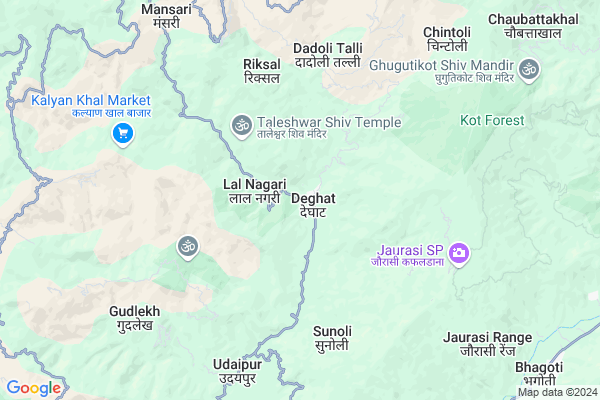
Bairsal
Bairsal Map
EDIT Map
Add Your House
 ..
..
Current Corona Virus Infected Patients Count in Almora District
| City Name | District Name | Total Covid cases |
|---|---|---|
| Almora District | Almora | 1 |
Locality Name :
Bairsal
( बैरसल )
Block Name : Syaldey
District : Almora
State : Uttarakhand
Language : Hindi and Urdu
Current Time 10:34 PM
Date: Thursday , Mar 13,2025 (IST)
Time zone: IST (UTC+5:30)
Elevation / Altitude: 345 meters. Above Seal level
Telephone Code / Std Code: 05966
Assembly constituency : Salt assembly constituency
Assembly MLA : Mahesh Jeena
Lok Sabha constituency : Almora parliamentary constituency
Parliament MP : Ajay Tamta
Serpanch Name :
Pin Code : 263659
Post Office Name : Deghat
Main Village Name : Bairsal
Commodities Prices : Ramnagar Market / Mandi
Bairsal Live Weather
Temperature: 13.5 °C
broken clouds
Humidity: 70%
Wind : 2.92 mt/sec towards N
StationName : "DwÄ\u0081rÄ\u0081hÄ\u0081t"
observed on 1 Hours Back
Temperature: 13.5 °C
broken clouds
Humidity: 70%
Wind : 2.92 mt/sec towards N
StationName : "DwÄ\u0081rÄ\u0081hÄ\u0081t"
observed on 1 Hours Back
Bairsal Weather Forecast for Next 5 days
14-03-2025
9.3°C to 10.3°C
broken clouds, scattered clouds
9.3°C to 10.3°C
broken clouds, scattered clouds
15-03-2025
8.4°C to 20.2°C
clear sky, scattered clouds, overcast clouds, light rain
8.4°C to 20.2°C
clear sky, scattered clouds, overcast clouds, light rain
16-03-2025
9.1°C to 20.6°C
light rain, broken clouds, overcast clouds
9.1°C to 20.6°C
light rain, broken clouds, overcast clouds
17-03-2025
9.0°C to 20.8°C
light rain, broken clouds, overcast clouds, scattered clouds
9.0°C to 20.8°C
light rain, broken clouds, overcast clouds, scattered clouds
18-03-2025
8.5°C to 18.6°C
scattered clouds, clear sky, overcast clouds, few clouds
8.5°C to 18.6°C
scattered clouds, clear sky, overcast clouds, few clouds
National Highways Reachable To Bairsal
Nationa High Way :NH309A
Nationa High Way :NH534
Nationa High Way :NH309A
Nationa High Way :NH534
Rivers Near Bairsal
Khoh
Ramganga
Khoh
Ramganga
About Bairsal
Correct below Info and add more info about BairsalBairsal is a small Village/hamlet in Syaldey Block in Almora District of Uttarakhand State, India. It comes under Bairsal Panchayath. It is located 62 KM towards west from District head quarters Almora. 6 KM from Syaldey. 144 KM from State capital Dehradun
Bairsal Pin code is 263659 and postal head office is Deghat .
Bharsoli ( 1 KM ) , Bheliwar ( 2 KM ) , Palpur ( 4 KM ) , Patal Gaon ( 4 KM ) , Masmoli ( 4 KM ) are the nearby Villages to Bairsal. Bairsal is surrounded by Chaukhutiya Block towards East , Gairsain Block towards North , Bironkhal Block towards west , Bhikiyasain Block towards South .
Pauri , Almora , Ramnagar , Nainital are the near by Cities to Bairsal.
Bairsal 2011 Census Details
Bairsal Local Language is Hindi. Bairsal Village Total population is 61 and number of houses are 10. Female Population is 47.5%. Village literacy rate is 80.3% and the Female Literacy rate is 36.1%.
Population
| Census Parameter | Census Data |
| Total Population | 61 |
| Total No of Houses | 10 |
| Female Population % | 47.5 % ( 29) |
| Total Literacy rate % | 80.3 % ( 49) |
| Female Literacy rate | 36.1 % ( 22) |
| Scheduled Tribes Population % | 0.0 % ( 0) |
| Scheduled Caste Population % | 0.0 % ( 0) |
| Working Population % | 86.9 % |
| Child(0 -6) Population by 2011 | 6 |
| Girl Child(0 -6) Population % by 2011 | 16.7 % ( 1) |
Bairsal Census More Deatils.
Politics in Bairsal
BJP , BJP , INC are the major political parties in this area.Polling Stations /Booths near Bairsal
1)Dak Karakoti2)Deghat
3)Basai
4)Giwaipani
5)Chakkargaon
HOW TO REACH Bairsal
By Rail
There is no railway station near to Bairsal in less than 10 km.Colleges near Bairsal
G.i.c Chintoli
Address : Main Bajar Nagchulakhal Chintoli
Schools near Bairsal
U.p.s. Pattharkhola
Address : pattharkhola , syaldey , almora , Uttarakhand . PIN- 263661 , Post - Syalde
G.i.c. Agaspur
Address : masod , syaldey , almora , Uttarakhand . PIN- 263661 , Post - Syalde
U.p.s. Titari Gurna
Address : titari , syaldey , almora , Uttarakhand . PIN- 263659 , Post - Deghat
H.s. Chitrakut
Address : rudoli , syaldey , almora , Uttarakhand . PIN- 263661 , Post - Syalde
Govt Health Centers near Bairsal
1) Boongidhar SC , Subcentre Boongidhar , Boongidhar , PWD gest House2) Health Sub Center Sunimalli , SC Sunimalli , ,
3) Choptakhal SC , , Village Choptakhal , Choptakhal
Sub Villages in Bairsal
Hospitals in Bairsal,Syaldey
Rajkiya Aurwaidik Hospital Kunigad Chamoli
Bhandari Khor; Uttarakhand 246431; India
13.1 KM distance Detail
more ..
Petrol Bunks in Bairsal,Syaldey
HP PETROL PUMP - JAI JIYA FILLING STATION
Karn Prayag Road Chaukhutia Dist- UA; Dehradun; 263656; India
15.4 KM distance Detail
more ..
Colleges in Bairsal,Syaldey
Government Higher Secondary School; Chachroti
Deghat Road; Faniya; Uttarakhand 263661; India
13.8 KM distance Detail
more ..
Schools in Bairsal,Syaldey
Chaukot Public School
Deghat Road; Deghat Market; Deghat; Uttarakhand 263659; India
0.6 KM distance Detail
Electronic Shops in Bairsal,Syaldey
YUVI MOBILE REPAIRING CENTER DEGHAT
Deghat Market; Deghat; Uttarakhand 263659; India
0.6 KM distance Detail
Super Markets in Bairsal,Syaldey
Governement Offices near Bairsal,Syaldey
Tehsil Chaukhutia
Agneri Mandir Road;; Chaukhutiya; Uttarakhand 263656; India
14.7 KM distance Detail
About Bairsal &
History
How to reach Bairsal
Tourist Places Near By Bairsal
Schools in Bairsal
Colleges in Bairsal
Temperature & weather of Bairsal
places in Bairsal
Bairsal photos
More Information
How to reach Bairsal
Tourist Places Near By Bairsal
Schools in Bairsal
Colleges in Bairsal
Temperature & weather of Bairsal
places in Bairsal
Bairsal photos
More Information
Village Talk
Post News or Events about this Village
Near Cities
Pauri 56 KM near
Almora 59 KM near
Ramnagar 63 KM near
Nainital 70 KM near
Pauri 56 KM near
Almora 59 KM near
Ramnagar 63 KM near
Nainital 70 KM near
Near By Taluks
Syaldey 6 KM near
Chaukhutiya 13 KM near
Gairsain 18 KM near
Bironkhal 18 KM near
Syaldey 6 KM near
Chaukhutiya 13 KM near
Gairsain 18 KM near
Bironkhal 18 KM near
Near By Air Ports
Pantnagar Airport 111 KM near
Dehra Dun Airport 137 KM near
Muzaffarnagar Airport 177 KM near
Simla Airport 268 KM near
Pantnagar Airport 111 KM near
Dehra Dun Airport 137 KM near
Muzaffarnagar Airport 177 KM near
Simla Airport 268 KM near
Near By Tourist Places
Gairsain 22 KM near
Dwarahat 27 KM near
Ranikhet 39 KM near
Kasauni 42 KM near
Gauchar 48 KM near
Gairsain 22 KM near
Dwarahat 27 KM near
Ranikhet 39 KM near
Kasauni 42 KM near
Gauchar 48 KM near
Near By Districts
Rudra Prayag 54 KM near
Pauri Garhwal 56 KM near
Almora 60 KM near
Bageshwar 60 KM near
Rudra Prayag 54 KM near
Pauri Garhwal 56 KM near
Almora 60 KM near
Bageshwar 60 KM near
Near By RailWay Station
Ramnagar Rail Way Station 64 KM near
Kathgodam Rail Way Station 86 KM near
Ramnagar Rail Way Station 64 KM near
Kathgodam Rail Way Station 86 KM near