| Home | City Bus | Maps | Villages | Cities | Rail | Tourist Places | School | College | Pin Codes | Corona Cases Count |
| Distance Calculator Bus Services IFSC Codes Trace Mobile Number Weather Search Place Trace IP Available Cash ATM/Banks Locate Polling Booth Report an Error contact People |
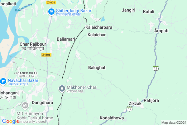
Balughat
Balughat Map
EDIT Map
Add Your House
 ..
..
Current Corona Virus Infected Patients Count in West Garo Hills District
| City Name | District Name | Total Covid cases |
|---|
Locality Name :
Balughat
( बालूघाट )
Block Name : Zikzak
District : West Garo Hills
State : Meghalaya
Language : English and Khasi, Garo, A Tong
Current Time 12:35 PM
Date: Monday , Apr 28,2025 (IST)
Time zone: IST (UTC+5:30)
Telephone Code / Std Code: 03651
Assembly constituency : Mahendraganj assembly constituency
Assembly MLA : dikkanchi d. shira
Lok Sabha constituency : Tura parliamentary constituency
Parliament MP : AGATHA K. SANGMA
Serpanch Name :
Pin Code : 794115
Post Office Name : Ampati
Commodities Prices : Ampati Market / Mandi
Balughat Live Weather
Temperature: 34.2 °C
scattered clouds
Humidity: 37%
Wind : 3.41 mt/sec towards NE
StationName : "MankÄ\u0081char"
observed on Now
Temperature: 34.2 °C
scattered clouds
Humidity: 37%
Wind : 3.41 mt/sec towards NE
StationName : "MankÄ\u0081char"
observed on Now
Balughat Weather Forecast for Next 5 days
29-04-2025
21.6°C to 31.3°C
moderate rain, heavy intensity rain, light rain
21.6°C to 31.3°C
moderate rain, heavy intensity rain, light rain
30-04-2025
21.2°C to 31.1°C
light rain, scattered clouds, broken clouds, overcast clouds
21.2°C to 31.1°C
light rain, scattered clouds, broken clouds, overcast clouds
01-05-2025
21.6°C to 31.4°C
overcast clouds, broken clouds, light rain
21.6°C to 31.4°C
overcast clouds, broken clouds, light rain
02-05-2025
22.4°C to 32.3°C
overcast clouds, light rain, broken clouds, scattered clouds
22.4°C to 32.3°C
overcast clouds, light rain, broken clouds, scattered clouds
03-05-2025
23.1°C to 32.5°C
overcast clouds, light rain
23.1°C to 32.5°C
overcast clouds, light rain
Rivers Near Balughat
Jinjiram River
Brahmaputra
Jinjiram River
Brahmaputra
About Balughat
Correct below Info and add more info about BalughatBalughat is a Village in Zikzak Block in West Garo Hills District of Meghalaya State, India. It is located 42 KM towards west from District head quarters Tura. 10 KM from Zikzak. 237 KM from State capital Shillong
Balughat Pin code is 794115 and postal head office is Ampati .
Kalaicharpara ( 5 KM ) , Gangikona ( 6 KM ) , Baghana ( 6 KM ) , Kodaldhowa ( 6 KM ) , Zikzak ( 7 KM ) are the nearby Villages to Balughat. Balughat is surrounded by Mankachar Block towards North , Betasing Block towards East , Fekamari Block towards North , Dalu Block towards East .
Mankachar , Tura , Dhubri , Gauripur are the near by Cities to Balughat.
This Place is in the border of the West Garo Hills District and Dhubri District. Dhubri District Mankachar is North towards this place . It is near to the Assam State Border.
Balughat 2011 Census Details
Balughat Local Language is English. Balughat Village Total population is 378 and number of houses are 60. Female Population is 45.0%. Village literacy rate is 67.7% and the Female Literacy rate is 26.7%.
Population
| Census Parameter | Census Data |
| Total Population | 378 |
| Total No of Houses | 60 |
| Female Population % | 45.0 % ( 170) |
| Total Literacy rate % | 67.7 % ( 256) |
| Female Literacy rate | 26.7 % ( 101) |
| Scheduled Tribes Population % | 89.9 % ( 340) |
| Scheduled Caste Population % | 0.3 % ( 1) |
| Working Population % | 45.2 % |
| Child(0 -6) Population by 2011 | 62 |
| Girl Child(0 -6) Population % by 2011 | 54.8 % ( 34) |
Balughat Census More Deatils.
Politics in Balughat
UDP , National People's Party , NCP , NPP , INC are the major political parties in this area.Polling Stations /Booths near Balughat
1)Paulpara2)Kalaichar
3)Kalaigaon Marahalipara
4)Beluarchar
5)Boldamgre
HOW TO REACH Balughat
By Rail
There is no railway station near to Balughat in less than 10 km.Colleges near Balughat
Phulbari Govt. College
Address :
Schools in Balughat
Balughat Sec. School
Address : balughat , zikzak , west garo hills , Meghalaya . PIN- 794106 , Post - Mahendraganj (West Garo Hills)
Balughat Ups
Address : balughat , zikzak , west garo hills , Meghalaya . PIN- 794106 , Post - Mahendraganj (West Garo Hills)
Govt Health Centers near Balughat
1) Kalaichar PHC , Kalaichar PHC , PWD Street , Near SBI2) Gilajuri SC , Gilajuri SC , PWD Street , Near Paddy Field
3) Zikzak PHC , Zikzak PHC , PWD Street , Near SBI
Petrol Bunks in Balughat,Zikzak
HP PETROL PUMP - MANKACHAR SERVICE STATION
Mankachar DT Assam; Gauhati; Assam 783131; India
13.4 KM distance Detail
more ..
Schools in Balughat,Zikzak
Good Shepherd Sec. School; Chapahati-Nogorpara
West Garo Hills; Meghalaya 794106; India
11.5 KM distance Detail
School of Livelihood & Rural Development
Thakuranbari; Meghalaya 783131; India
13.0 KM distance Detail
Super Markets in Balughat,Zikzak
Police Stations near Balughat,Zikzak
Mankachar Police Station
Near J.M High Secondary school; Mankachar; Assam 783131; India
13.8 KM distance Detail
About Balughat &
History
How to reach Balughat
Tourist Places Near By Balughat
Schools in Balughat
Colleges in Balughat
Temperature & weather of Balughat
places in Balughat
Balughat photos
More Information
How to reach Balughat
Tourist Places Near By Balughat
Schools in Balughat
Colleges in Balughat
Temperature & weather of Balughat
places in Balughat
Balughat photos
More Information
Village Talk
Post News or Events about this Village
Near Cities
Mankachar 12 KM near
Tura 43 KM near
Dhubri 75 KM near
Gauripur 83 KM near
Mankachar 12 KM near
Tura 43 KM near
Dhubri 75 KM near
Gauripur 83 KM near
Near By Taluks
Zikzak 10 KM near
Mankachar 15 KM near
Betasing 21 KM near
Fekamari 33 KM near
Zikzak 10 KM near
Mankachar 15 KM near
Betasing 21 KM near
Fekamari 33 KM near
Near By Air Ports
Rupsi Airport 89 KM near
Borjhar Airport 211 KM near
Shillong Airport 228 KM near
Bagdogra Airport 232 KM near
Rupsi Airport 89 KM near
Borjhar Airport 211 KM near
Shillong Airport 228 KM near
Bagdogra Airport 232 KM near
Near By Tourist Places
Tura 42 KM near
Williamnagar 85 KM near
Baghmara 92 KM near
Goalpara 119 KM near
Cooch-Behar 120 KM near
Tura 42 KM near
Williamnagar 85 KM near
Baghmara 92 KM near
Goalpara 119 KM near
Cooch-Behar 120 KM near
Near By Districts
West Garo Hills 40 KM near
Dhubri 73 KM near
South Garo Hills 91 KM near
Coochbehar 120 KM near
West Garo Hills 40 KM near
Dhubri 73 KM near
South Garo Hills 91 KM near
Coochbehar 120 KM near
Near By RailWay Station
Goalpara Town Rail Way Station 121 KM near
Fakiragram Junction Rail Way Station 122 KM near
Goalpara Town Rail Way Station 121 KM near
Fakiragram Junction Rail Way Station 122 KM near