| Home | City Bus | Maps | Villages | Cities | Rail | Tourist Places | School | College | Pin Codes | Corona Cases Count |
| Distance Calculator Bus Services IFSC Codes Trace Mobile Number Weather Search Place Trace IP Available Cash ATM/Banks Locate Polling Booth Report an Error contact People |
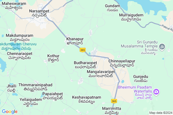
Manubothulagaddathanda Map
EDIT Map
Add Your House
 ..
..
Current Corona Virus Infected Patients Count in Warangal District
| City Name | District Name | Total Covid cases |
|---|---|---|
| Warangal Urban District | Warangal Urban | 23 |
| Mulugu District | Mulugu | 2 |
| Mahabubabad District | Mahabubabad | 1 |
Locality Name :
Manubothulagaddathanda
( మనుబోతులగడ్డతండా )
Mandal Name : Khanapur
District : Warangal
State : Telangana
Region : Telangana
Language : Telugu and Urdu
Current Time 08:08 PM
Date: Tuesday , Apr 29,2025 (IST)
Time zone: IST (UTC+5:30)
Elevation / Altitude: 236 meters. Above Seal level
Telephone Code / Std Code: 08718
Assembly constituency : Narsampet assembly constituency
Assembly MLA : Donthi Madhava Reddy
Lok Sabha constituency : Mahabubabad parliamentary constituency
Parliament MP : Kavitha Malothu
Serpanch Name :
Pin Code : 506132
Post Office Name : Narsampet
Alternate Village Name : Manubotulagadda
Commodities Prices : Narsampet Market / Mandi
Manubothulagaddathanda Live Weather
Temperature: 37.7 °C
scattered clouds
Humidity: 21%
Wind : 2.88 mt/sec towards S
StationName : "MahbÅ«bÄ\u0081bÄ\u0081d"
observed on 2 Hours Back
Temperature: 37.7 °C
scattered clouds
Humidity: 21%
Wind : 2.88 mt/sec towards S
StationName : "MahbÅ«bÄ\u0081bÄ\u0081d"
observed on 2 Hours Back
Manubothulagaddathanda Weather Forecast for Next 5 days
30-04-2025
27.8°C to 37.7°C
scattered clouds, clear sky
27.8°C to 37.7°C
scattered clouds, clear sky
01-05-2025
26.5°C to 40.9°C
clear sky, broken clouds, few clouds, scattered clouds
26.5°C to 40.9°C
clear sky, broken clouds, few clouds, scattered clouds
02-05-2025
26.9°C to 41.9°C
clear sky, few clouds, scattered clouds
26.9°C to 41.9°C
clear sky, few clouds, scattered clouds
03-05-2025
27.5°C to 42.2°C
few clouds, broken clouds, scattered clouds, clear sky
27.5°C to 42.2°C
few clouds, broken clouds, scattered clouds, clear sky
04-05-2025
27.4°C to 43.3°C
few clouds, clear sky, scattered clouds
27.4°C to 43.3°C
few clouds, clear sky, scattered clouds
National Highways Reachable To Manubothulagaddathanda
Nationa High Way :NH163
Nationa High Way :NH563
Nationa High Way :NH163
Nationa High Way :NH563
Rivers Near Manubothulagaddathanda
Sali Vagu
Munneru River
Sali Vagu
Munneru River
About Manubothulagaddathanda
Correct below Info and add more info about ManubothulagaddathandaManubothulagaddathanda is a Village in Khanapur Mandal in Warangal District of Telangana State, India. It belongs to Telangana region . It is located 47 KM towards East from District head quarters Warangal.
Manubothulagaddathanda Pin code is 506132 and postal head office is Narsampet .
Manubothulagaddathanda is surrounded by Narsampet Mandal towards North , Chennaraopet Mandal towards west , Gudur Mandal towards South , Kothagudem Mandal towards East .
Warangal , Yellandu , Khammam , Palwancha are the near by Cities to Manubothulagaddathanda.
Demographics of Manubothulagaddathanda
Telugu is the Local Language here.Politics in Manubothulagaddathanda
TDP , TRS , INC are the major political parties in this area.Polling Stations /Booths near Manubothulagaddathanda
1)Budha Rao Pet2)Buchireddy Palli H/o Kannarao Pet
3)Budarao Pet
4)Budraopeta
5)Chennaraopettah
HOW TO REACH Manubothulagaddathanda
By Rail
There is no railway station near to Manubothulagaddathanda in less than 10 km. Warangal Rail Way Station (near to Warangal) , Kazipet Town Rail Way Station (near to Warangal) are the Rail way stations reachable from near by towns.By Road
Warangal are the nearby by towns to Manubothulagaddathanda having road connectivity to ManubothulagaddathandaColleges near Manubothulagaddathanda
A P R Jr College(st)boys Ashoknagar
Address : A P R Jr College(st)boys Ashoknagar
Schools near Manubothulagaddathanda
Zphs Kothur
Address : kothur , khanapur , warangal , Andhra Pradesh . PIN- 506132 , Post - Narsampet
Puahs Srividyanilayam
Address : khanapur , khanapur , warangal , Andhra Pradesh . PIN- 506132 , Post - Narsampet
Zphs Mangalavaripet
Address : mangalavaripet , khanapur , warangal , Andhra Pradesh . PIN- 506134 , Post - Gudur (Warangal)
Zphs Dharmarao Pet
Address : dharmaraopeta , khanapur , warangal , Andhra Pradesh . PIN- 506134 , Post - Gudur (Warangal)
Govt Health Centers near Manubothulagaddathanda
1) SubCentre Budaraopet , 3- 9 2 , BUDARAOPET , near gp office2) SubCentre Mangala Varipet , 1-1 9 , MANGALAVARIPET , near bustand
3) SubCentre Dharma rao pet , 1-104 , DHARMARAOPET , near bustand
Hospitals in Manubothulagaddathanda,Khanapur
Sandhya Ayurveda Health center
Mahbubabad - Warangal Rd; Khanapur; Telangana 506332; India
3.4 KM distance Detail
Sammaiya Davakana Sanathana Ayurveda Vidyashala
Khanapur; Telangana 506132; India
3.4 KM distance Detail
more ..
Petrol Bunks in Manubothulagaddathanda,Khanapur
HP Petrol Pump
Survey NO 203/2 Sarvapuram Village Narsam PET; Warangal; 506132; India
7.7 KM distance Detail
Janakiram Filling Station-Hindustan Petroleum
Sarvapuram; Warangal; NH-365; Narasampet Kothagudem Road; Narsampet; Narsampet; Telangana 506132; India
7.7 KM distance Detail
more ..
Colleges in Manubothulagaddathanda,Khanapur
Rudramadevi Women's Degree College
Mahbubabad - Warangal Rd; Budharaopet; Telangana 506332; India
1.2 KM distance Detail
Vijetha ITI College
Mahbubabad - Warangal Rd; Pocharam; Telangana 506132; India
1.2 KM distance Detail
more ..
Schools in Manubothulagaddathanda,Khanapur
MPP School
Budharaopet; Warangal; Narasampet Kothagudem Road; Khanapur; Khanapur; Telangana 506134; India
1.0 KM distance Detail
Central Primary School
Budharaopet; Warangal; Narasampet Kothagudem Road; Khanapur; Khanapur; Telangana 506134; India
1.0 KM distance Detail
Electronic Shops in Manubothulagaddathanda,Khanapur
sri sai electronics..nagaraju
Mahbubabad - Warangal Rd; Pocharam; Telangana 506332; India
1.2 KM distance Detail
AMJAD Mobile Ship
Mahbubabad - Warangal Rd; Pocharam; Telangana 506332; India
2.6 KM distance Detail
Super Markets in Manubothulagaddathanda,Khanapur
Rambabu Chillara Dhukanam
Narsampet Rd; Girmajipet; Warangal; Telangana 506002; India
8.1 KM distance Detail
Padmasri Kirana & General Store(Solthi Venkat Rajkumar)
Pakhal Rd; Narsampet; Telangana 506132; India
9.2 KM distance Detail
Police Stations near Manubothulagaddathanda,Khanapur
Police Station-Narsampet
NH-365; Narasampet Kothagudem Road; Narsampet; Telangana 506132; India
9.3 KM distance Detail
About Manubothulagaddathanda &
History
How to reach Manubothulagaddathanda
Tourist Places Near By Manubothulagaddathanda
Schools in Manubothulagaddathanda
Colleges in Manubothulagaddathanda
Temperature & weather of Manubothulagaddathanda
places in Manubothulagaddathanda
Manubothulagaddathanda photos
More Information
How to reach Manubothulagaddathanda
Tourist Places Near By Manubothulagaddathanda
Schools in Manubothulagaddathanda
Colleges in Manubothulagaddathanda
Temperature & weather of Manubothulagaddathanda
places in Manubothulagaddathanda
Manubothulagaddathanda photos
More Information
Village Talk
Post News or Events about this Village
Near Cities
Warangal 44 KM near
Yellandu 56 KM near
Khammam 81 KM near
Palwancha 85 KM near
Warangal 44 KM near
Yellandu 56 KM near
Khammam 81 KM near
Palwancha 85 KM near
Near By Taluks
Khanapur 0 KM near
Gudur 10 KM near
Narsampet 10 KM near
Chennaraopet 10 KM near
Khanapur 0 KM near
Gudur 10 KM near
Narsampet 10 KM near
Chennaraopet 10 KM near
Near By Air Ports
Vijayawada Airport 196 KM near
Rajiv Gandhi International Airport 197 KM near
Rajahmundry Airport 242 KM near
Nanded Airport 350 KM near
Vijayawada Airport 196 KM near
Rajiv Gandhi International Airport 197 KM near
Rajahmundry Airport 242 KM near
Nanded Airport 350 KM near
Near By Tourist Places
Warangal 42 KM near
Medaram 64 KM near
Khammam 81 KM near
Bhadrachalam 114 KM near
Nagarjunakonda 144 KM near
Warangal 42 KM near
Medaram 64 KM near
Khammam 81 KM near
Bhadrachalam 114 KM near
Nagarjunakonda 144 KM near
Near By Districts
Warangal 45 KM near
Khammam 81 KM near
Karimnagar 118 KM near
Nalgonda 132 KM near
Warangal 45 KM near
Khammam 81 KM near
Karimnagar 118 KM near
Nalgonda 132 KM near
Near By RailWay Station
Nekonda Rail Way Station 20 KM near
Kesamudram Rail Way Station 24 KM near
Nekonda Rail Way Station 20 KM near
Kesamudram Rail Way Station 24 KM near