| Home | City Bus | Maps | Villages | Cities | Rail | Tourist Places | School | College | Pin Codes | Corona Cases Count |
| Distance Calculator Bus Services IFSC Codes Trace Mobile Number Weather Search Place Trace IP Available Cash ATM/Banks Locate Polling Booth Report an Error contact People |
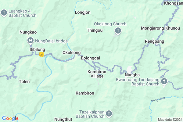
Bolongdai
Bolongdai Map
EDIT Map
Add Your House
 ..
..
Current Corona Virus Infected Patients Count in Tamenglong District
| City Name | District Name | Total Covid cases |
|---|
Locality Name :
Bolongdai
( बोलोंगड़ाई )
Tehsil Name : Nungba
District : Tamenglong
State : Manipur
Language : Meiteilon (manipuri)
Current Time 11:58 AM
Date: Friday , Mar 14,2025 (IST)
Time zone: IST (UTC+5:30)
Elevation / Altitude: 41 meters. Above Seal level
Telephone Code / Std Code: 03877
Assembly constituency : Nungba assembly constituency
Assembly MLA : Dinganglung Gangmei
Lok Sabha constituency : Outer Manipur parliamentary constituency
Parliament MP : Lorho S. Pfoze
Serpanch Name :
Pin Code : 795147
Post Office Name : Nungba
Commodities Prices : Bishenpur Market / Mandi
Bolongdai Live Weather
Temperature: 32.8 °C
clear sky
Humidity: 28%
Wind : 2.75 mt/sec towards W
StationName : "Lakhipur"
observed on 14 Mins Back
Temperature: 32.8 °C
clear sky
Humidity: 28%
Wind : 2.75 mt/sec towards W
StationName : "Lakhipur"
observed on 14 Mins Back
Bolongdai Weather Forecast for Next 5 days
15-03-2025
17.0°C to 32.0°C
few clouds, light rain, clear sky
17.0°C to 32.0°C
few clouds, light rain, clear sky
16-03-2025
16.4°C to 33.7°C
light rain, clear sky, scattered clouds
16.4°C to 33.7°C
light rain, clear sky, scattered clouds
17-03-2025
18.3°C to 33.8°C
clear sky, few clouds, light rain
18.3°C to 33.8°C
clear sky, few clouds, light rain
18-03-2025
18.2°C to 34.4°C
clear sky, scattered clouds, light rain, few clouds
18.2°C to 34.4°C
clear sky, scattered clouds, light rain, few clouds
19-03-2025
17.9°C to 33.4°C
clear sky, light rain, broken clouds
17.9°C to 33.4°C
clear sky, light rain, broken clouds
National Highways Reachable To Bolongdai
Nationa High Way :NH2
Nationa High Way :NH306
Nationa High Way :NH2
Nationa High Way :NH306
Rivers Near Bolongdai
Barak River :Barak River
Bali Chara
Barak River :Barak River
Bali Chara
About Bolongdai
Correct below Info and add more info about BolongdaiBolongdai is a Village in Nungba Tehsil in Tamenglong District of Manipur State, India. It is located 32 KM towards South from District head quarters Tamenglong. 15 KM from Nungba. 67 KM from State capital Imphal
Bolongdai Pin code is 795147 and postal head office is Nungba .
Thingou ( 3 KM ) , Kambiron ( 4 KM ) , Nungba ( 5 KM ) , Kekru-naga ( 8 KM ) , Nungthut ( 8 KM ) are the nearby Villages to Bolongdai. Bolongdai is surrounded by Khoupum Tehsil towards East , Rajabazar Tehsil towards west , Tamenglong Tehsil towards North , Jiribam Tehsil towards west .
Mayang Imphal , Imphal , Lilong , Haflong are the near by Cities to Bolongdai.
Bolongdai 2011 Census Details
Bolongdai Local Language is Meiteilon (manipuri). Bolongdai Village Total population is 872 and number of houses are 143. Female Population is 49.3%. Village literacy rate is 64.2% and the Female Literacy rate is 29.0%.
Population
| Census Parameter | Census Data |
| Total Population | 872 |
| Total No of Houses | 143 |
| Female Population % | 49.3 % ( 430) |
| Total Literacy rate % | 64.2 % ( 560) |
| Female Literacy rate | 29.0 % ( 253) |
| Scheduled Tribes Population % | 99.8 % ( 870) |
| Scheduled Caste Population % | 0.0 % ( 0) |
| Working Population % | 36.4 % |
| Child(0 -6) Population by 2011 | 175 |
| Girl Child(0 -6) Population % by 2011 | 51.4 % ( 90) |
Bolongdai Census More Deatils.
Politics in Bolongdai
NPF , Naga Peoples Front , BJP , NCP , PDA , INC are the major political parties in this area.Polling Stations /Booths near Bolongdai
1)Joujangtek2)Nungba-a
3)Nungadang
4)Bolongdai
5)Tupul
HOW TO REACH Bolongdai
By Rail
There is no railway station near to Bolongdai in less than 10 km.Schools near Bolongdai
Khangshillung Govt. Hr Sec. Sc
Address : gaidimjang pt- 1&2 , nungba , tamenglong , Manipur . PIN- 795147 , Post - Nungba
Tengkonjang Hr. Sec. School
Address : noney pt-1 , nungba , tamenglong , Manipur . PIN- 795159 , Post - None
Nampatrei Memorial High School
Address : gaidimjang pt- 1&2 , nungba , tamenglong , Manipur . PIN- 795145 , Post - Litan
Children Training School
Address : noney pt-1 , nungba , tamenglong , Manipur . PIN- 795159 , Post - None
Govt Health Centers near Bolongdai
1) CHC Nungba , , , Near Nungba Bazar Shed2) PHSC Kadangban , , , Near Bridge
3) Khumbong PHC , , , Opposite to Vetenary Office
Electronic Shops in Bolongdai,Nungba
Super Markets in Bolongdai,Nungba
Local Parks in Bolongdai,Nungba
Governement Offices near Bolongdai,Nungba
About Bolongdai &
History
How to reach Bolongdai
Tourist Places Near By Bolongdai
Schools in Bolongdai
Colleges in Bolongdai
Temperature & weather of Bolongdai
places in Bolongdai
Bolongdai photos
More Information
How to reach Bolongdai
Tourist Places Near By Bolongdai
Schools in Bolongdai
Colleges in Bolongdai
Temperature & weather of Bolongdai
places in Bolongdai
Bolongdai photos
More Information
Village Talk
Post News or Events about this Village
Near Cities
Mayang Imphal 62 KM near
Imphal 64 KM near
Lilong 64 KM near
Haflong 65 KM near
Mayang Imphal 62 KM near
Imphal 64 KM near
Lilong 64 KM near
Haflong 65 KM near
Near By Taluks
Nungba 14 KM near
Khoupum 24 KM near
Rajabazar 25 KM near
Tamenglong 26 KM near
Nungba 14 KM near
Khoupum 24 KM near
Rajabazar 25 KM near
Tamenglong 26 KM near
Near By Air Ports
Kumbhirgram Airport 49 KM near
Imphal Municipal Airport 58 KM near
Aizawl Airport 143 KM near
Dimapur Airport 146 KM near
Kumbhirgram Airport 49 KM near
Imphal Municipal Airport 58 KM near
Aizawl Airport 143 KM near
Dimapur Airport 146 KM near
Near By Tourist Places
Tamenglong 31 KM near
Imphal 64 KM near
Silchar 66 KM near
Thoubal 71 KM near
Chandel 87 KM near
Tamenglong 31 KM near
Imphal 64 KM near
Silchar 66 KM near
Thoubal 71 KM near
Chandel 87 KM near
Near By Districts
Tamenglong 31 KM near
Bishnupur 44 KM near
Imphal West 53 KM near
Churachandpur 62 KM near
Tamenglong 31 KM near
Bishnupur 44 KM near
Imphal West 53 KM near
Churachandpur 62 KM near
Near By RailWay Station
Silchar Rail Way Station 67 KM near
Badarpur Junction Rail Way Station 93 KM near
Silchar Rail Way Station 67 KM near
Badarpur Junction Rail Way Station 93 KM near