| Home | City Bus | Maps | Villages | Cities | Rail | Tourist Places | School | College | Pin Codes | Corona Cases Count |
| Distance Calculator Bus Services IFSC Codes Trace Mobile Number Weather Search Place Trace IP Available Cash ATM/Banks Locate Polling Booth Report an Error contact People |
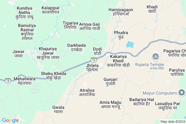
Jhilela
Jhilela Map
EDIT Map
Add Your House
 ..
..
Current Corona Virus Infected Patients Count in Sehore District
| City Name | District Name | Total Covid cases |
|---|
Locality Name :
Jhilela
( झिलेला )
Tehsil Name : Ashta
District : Sehore
State : Madhya Pradesh
Division : Bhopal
Language : Hindi
Current Time 07:17 AM
Date: Saturday , Apr 26,2025 (IST)
Time zone: IST (UTC+5:30)
Elevation / Altitude: 487 meters. Above Seal level
Telephone Code / Std Code: 07560
Assembly constituency : Ashta assembly constituency
Assembly MLA : Gopal Singh Engineer
Lok Sabha constituency : Dewas parliamentary constituency
Parliament MP : MAHENDRA SINGH SOLANKY
Serpanch Name :
Pin Code : 466116
Post Office Name : Ashta
Commodities Prices : Jawar Market / Mandi
Jhilela Live Weather
Temperature: 28.1 °C
few clouds
Humidity: 25%
Wind : 3.95 mt/sec towards NW
StationName : "IÄ\u0081war"
observed on 2 Hours Back
Temperature: 28.1 °C
few clouds
Humidity: 25%
Wind : 3.95 mt/sec towards NW
StationName : "IÄ\u0081war"
observed on 2 Hours Back
Jhilela Weather Forecast for Next 5 days
27-04-2025
28.9°C to 37.8°C
few clouds, light rain, broken clouds, scattered clouds, clear sky
28.9°C to 37.8°C
few clouds, light rain, broken clouds, scattered clouds, clear sky
28-04-2025
26.9°C to 40.0°C
clear sky, broken clouds, scattered clouds, few clouds
26.9°C to 40.0°C
clear sky, broken clouds, scattered clouds, few clouds
29-04-2025
27.9°C to 41.7°C
clear sky, few clouds, scattered clouds, broken clouds
27.9°C to 41.7°C
clear sky, few clouds, scattered clouds, broken clouds
30-04-2025
28.8°C to 42.2°C
broken clouds, scattered clouds
28.8°C to 42.2°C
broken clouds, scattered clouds
National Highways Reachable To Jhilela
Nationa High Way :NH52
Nationa High Way :NH47
Nationa High Way :NH52
Nationa High Way :NH47
Rivers Near Jhilela
Londri Nadi
Kasarni Nadi
Londri Nadi
Kasarni Nadi
About Jhilela
Correct below Info and add more info about JhilelaJhilela is a Village in Ashta Tehsil in Sehore District of Madhya Pradesh State, India. It belongs to Bhopal Division . It is located 61 KM towards west from District head quarters Sehore. 14 KM from Aroliya Ashta. 106 KM from State capital Bhopal
Jhilela Pin code is 466116 and postal head office is Ashta .
Darkheda ( 2 KM ) , Arniya Gaji ( 4 KM ) , Phudra ( 5 KM ) , Sheku Kheda ( 5 KM ) , Tigariya ( 5 KM ) are the nearby Villages to Jhilela. Jhilela is surrounded by Sonkatch Tehsil towards west , Tonk Khurd Tehsil towards west , Bagli Tehsil towards South , Shujalpur Tehsil towards North .
Shujalpur , Pachore , Sehore , Shajapur are the near by Cities to Jhilela.
Jhilela 2011 Census Details
Jhilela Local Language is Hindi. Jhilela Village Total population is 2087 and number of houses are 393. Female Population is 49.1%. Village literacy rate is 42.4% and the Female Literacy rate is 16.0%.
Population
| Census Parameter | Census Data |
| Total Population | 2087 |
| Total No of Houses | 393 |
| Female Population % | 49.1 % ( 1024) |
| Total Literacy rate % | 42.4 % ( 884) |
| Female Literacy rate | 16.0 % ( 334) |
| Scheduled Tribes Population % | 0.3 % ( 6) |
| Scheduled Caste Population % | 21.5 % ( 448) |
| Working Population % | 53.8 % |
| Child(0 -6) Population by 2011 | 355 |
| Girl Child(0 -6) Population % by 2011 | 50.4 % ( 179) |
Jhilela Census More Deatils.
Politics in Jhilela
Bharatiya Janata Party , BJP , INC are the major political parties in this area.Polling Stations /Booths near Jhilela
1)Mundala Mahobba2)Jhikadi
3)Bhatouni
4)Dabri
5)Kanarakhedi
HOW TO REACH Jhilela
By Rail
There is no railway station near to Jhilela in less than 10 km.Colleges near Jhilela
Sahid Bhagat Singh College Ashta
Address :
Schools in Jhilela
Gms Jhilela
Address : jhilela , ashta , sehore , Madhya Pradesh . PIN- 466116 , Post - Ashta
Govt Health Centers near Jhilela
1) SHC Darkheda , SHC Darkheda , Jawar , School ke pass2) CHC Jawar , CHC Jawar , Jawar , School ke pass
3) SHC Metwada , SHC Metwada , Mehatwada , AGANWADI KE PASS
Hospitals in Jhilela,Ashta
Shyam Kirana Setor And Servis Sentar
bejnath; Khamkhed; Madhya Pradesh; India
16.7 KM distance Detail
Dr.manzoor Lala
old indore road; Alipur; Ashta; Madhya Pradesh 466116; India
17.6 KM distance Detail
more ..
Petrol Bunks in Jhilela,Ashta
Raghvendra Filing Station (Essar Oil)
MP SH 18; Jhilela; Madhya Pradesh 466118; India
0.4 KM distance Detail
Essar Petrol Pump
Survey no 87/3; Jhilela; Jawar; Sehore; Madhya Pradesh; India
1.0 KM distance Detail
more ..
Colleges in Jhilela,Ashta
Kalawati College Of Professional Studies
Ashta; Madhya Pradesh 466116; India
18.1 KM distance Detail
more ..
Schools in Jhilela,Ashta
Saraswati Shishu Mandir Darkheda (Balwan Singh)
Darkheda; Madhya Pradesh 466221; India
2.3 KM distance Detail
रिया जनरल स्टोर एवं स्टेशनरी डोडी
dodi NH86A; Kakariya Khedi; Madhya Pradesh 466116; India
2.5 KM distance Detail
About Jhilela &
History
How to reach Jhilela
Tourist Places Near By Jhilela
Schools in Jhilela
Colleges in Jhilela
Temperature & weather of Jhilela
places in Jhilela
Jhilela photos
More Information
How to reach Jhilela
Tourist Places Near By Jhilela
Schools in Jhilela
Colleges in Jhilela
Temperature & weather of Jhilela
places in Jhilela
Jhilela photos
More Information
Village Talk
Post News or Events about this Village
Near Cities
Shujalpur 54 KM near
Pachore 54 KM near
Sehore 59 KM near
Shajapur 62 KM near
Shujalpur 54 KM near
Pachore 54 KM near
Sehore 59 KM near
Shajapur 62 KM near
Near By Taluks
Ashta 13 KM near
Sonkatch 24 KM near
Tonk Khurd 44 KM near
Bagli 46 KM near
Ashta 13 KM near
Sonkatch 24 KM near
Tonk Khurd 44 KM near
Bagli 46 KM near
Near By Air Ports
Indore Airport 93 KM near
Bhopal Airport 95 KM near
Dabok Airport 365 KM near
Sonegaon Airport 372 KM near
Indore Airport 93 KM near
Bhopal Airport 95 KM near
Dabok Airport 365 KM near
Sonegaon Airport 372 KM near
Near By Tourist Places
Indore 88 KM near
Ujjain 92 KM near
Bhopal 101 KM near
Omkareshwar 105 KM near
Bhimbetka 116 KM near
Indore 88 KM near
Ujjain 92 KM near
Bhopal 101 KM near
Omkareshwar 105 KM near
Bhimbetka 116 KM near
Near By Districts
Sehore 58 KM near
Dewas 59 KM near
Shajapur 62 KM near
Indore 87 KM near
Sehore 58 KM near
Dewas 59 KM near
Shajapur 62 KM near
Indore 87 KM near
Near By RailWay Station
Berchha Rail Way Station 44 KM near
Kali Sindh Rail Way Station 45 KM near
Berchha Rail Way Station 44 KM near
Kali Sindh Rail Way Station 45 KM near