| Home | City Bus | Maps | Villages | Cities | Rail | Tourist Places | School | College | Pin Codes | Corona Cases Count |
| Distance Calculator Bus Services IFSC Codes Trace Mobile Number Weather Search Place Trace IP Available Cash ATM/Banks Locate Polling Booth Report an Error contact People |
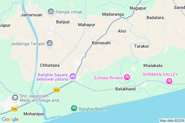
Dopada Map
EDIT Map
Add Your House
 ..
..
Current Corona Virus Infected Patients Count in Puri District
| City Name | District Name | Total Covid cases |
|---|---|---|
| Puri District | Puri | 1 |
Locality Name :
Dopada
( ଡପଡା )
Tehsil Name : Gop
District : Puri
State : Odisha
Language : Oriya and Hindi
Current Time 01:34 PM
Date: Wednesday , Apr 30,2025 (IST)
Time zone: IST (UTC+5:30)
Elevation / Altitude: 10 meters. Above Seal level
Telephone Code / Std Code: 06758
Assembly constituency : Nimapara assembly constituency
Assembly MLA :
Lok Sabha constituency : Jagatsinghpur parliamentary constituency
Parliament MP :
Serpanch Name :
Pin Code : 752002
Post Office Name : Puri Station Road
Commodities Prices : Dumal Market / Mandi
Dopada Live Weather
Temperature: 31.5 °C
clear sky
Humidity: 63%
Wind : 5.51 mt/sec towards S
StationName : "Konark"
observed on 2 Hours Back
Temperature: 31.5 °C
clear sky
Humidity: 63%
Wind : 5.51 mt/sec towards S
StationName : "Konark"
observed on 2 Hours Back
Dopada Weather Forecast for Next 5 days
01-05-2025
26.7°C to 32.3°C
clear sky, light rain, moderate rain, broken clouds
26.7°C to 32.3°C
clear sky, light rain, moderate rain, broken clouds
02-05-2025
21.5°C to 31.4°C
clear sky, light rain, scattered clouds, moderate rain
21.5°C to 31.4°C
clear sky, light rain, scattered clouds, moderate rain
03-05-2025
25.9°C to 32.2°C
few clouds, clear sky, light rain, broken clouds
25.9°C to 32.2°C
few clouds, clear sky, light rain, broken clouds
04-05-2025
27.2°C to 32.2°C
scattered clouds, clear sky, light rain, broken clouds
27.2°C to 32.2°C
scattered clouds, clear sky, light rain, broken clouds
05-05-2025
28.3°C to 33.2°C
broken clouds, scattered clouds, few clouds, clear sky
28.3°C to 33.2°C
broken clouds, scattered clouds, few clouds, clear sky
National Highways Reachable To Dopada
Nationa High Way :NH316
Nationa High Way :NH16
Nationa High Way :NH316
Nationa High Way :NH16
Rivers Near Dopada
Devi River
Devi River
About Dopada
Correct below Info and add more info about DopadaDopada is a small Village/hamlet in Gop Tehsil in Puri District of Odisha State, India. It is located 18 KM towards East from District head quarters Puri. 13 KM from Gop. 52 KM from State capital Bhubaneswar
Dopada Pin code is 752002 and postal head office is Puri Station Road .
Gadabhingura ( 5 KM ) , Chhaitana ( 5 KM ) , Tarakor ( 7 KM ) , Kuanpada ( 7 KM ) , Sutan ( 8 KM ) are the nearby Villages to Dopada. Dopada is surrounded by Puri Tehsil towards west , Sadar Tehsil towards west , Satyabadi Tehsil towards west , Nimapada Tehsil towards North .
Puri , Jatani , Bhubaneswar , Jagatsinghapur are the near by Cities to Dopada.
This Place is in the border of the Puri District and Jagatsinghapur District. Jagatsinghapur District Naugaon is North towards this place . Also it is in the Border of other district Khordha . It is near to bay of bengal. There is a chance of humidity in the weather.
Dopada 2011 Census Details
Dopada Local Language is Oriya. Dopada Village Total population is 187 and number of houses are 35. Female Population is 55.1%. Village literacy rate is 71.7% and the Female Literacy rate is 38.5%.
Population
| Census Parameter | Census Data |
| Total Population | 187 |
| Total No of Houses | 35 |
| Female Population % | 55.1 % ( 103) |
| Total Literacy rate % | 71.7 % ( 134) |
| Female Literacy rate | 38.5 % ( 72) |
| Scheduled Tribes Population % | 0.0 % ( 0) |
| Scheduled Caste Population % | 0.0 % ( 0) |
| Working Population % | 23.0 % |
| Child(0 -6) Population by 2011 | 22 |
| Girl Child(0 -6) Population % by 2011 | 59.1 % ( 13) |
Dopada Census More Deatils.
Politics in Dopada
BJP , BJD are the major political parties in this area.Polling Stations /Booths near Dopada
1)Charchika Nodal Up School Sholapur-22)Bayabar Project U.p. School
3)Bedapur Pry. School -1
4)Resinga U.g.u.p. School
5)Helari Jamara Pry. School
HOW TO REACH Dopada
By Rail
There is no railway station near to Dopada in less than 10 km.Colleges near Dopada
Nayahat Mahavidyalaya
Address :
Schools in Dopada
Bira Pratappur Ps
Address : dopada , gop , puri , Sikkim . PIN- 752002 , Post - Puri Station Road
Govt Health Centers near Dopada
1) I.D.H,Puri , Puri , Puri , Puri2) Municipality Hospital Swargadwar , UHC , Achia Sahi,Swargadwar ,
3) Basantamala , BASANTAMALA SC , RAJAS , RAJAS
Petrol Bunks in Dopada,Gop
Pujapanda Petrol Station
Puri-Konark Marine Dr; Purussottam Nagar; Puri; Odisha 752002; India
14.0 KM distance Detail
more ..
Colleges in Dopada,Gop
College of Pharmaceutical Sciences
Puri-Konark Marine Drive Road; Puri-2; Odisha 752002; India
13.3 KM distance Detail
more ..
Schools in Dopada,Gop
H.C.M High School;Chhaitana
H.C.M; Police High School; Hospital Rd; Puri; Odisha 752002; India
1.9 KM distance Detail
Chandi Brahmapur Primary School
Rusipur; Puri; SH-60; Konark Cuttack Road; Puri; Puri; Odisha 752002; India
2.7 KM distance Detail
Local Parks in Dopada,Gop
Srikhetra colony Park
Srikhetra Colony; New Railway Colony; Puri; Odisha 752002; India
16.9 KM distance Detail
Governement Offices near Dopada,Gop
Block Development Office
Gop- Sanakundura- Kuruma- Banakhandi- Junei- Ranihatsahi- Konark Road; Bayakuda Alias Purusottampur; Odisha 752110; India
14.7 KM distance Detail
About Dopada &
History
How to reach Dopada
Tourist Places Near By Dopada
Schools in Dopada
Colleges in Dopada
Temperature & weather of Dopada
places in Dopada
Dopada photos
More Information
How to reach Dopada
Tourist Places Near By Dopada
Schools in Dopada
Colleges in Dopada
Temperature & weather of Dopada
places in Dopada
Dopada photos
More Information
Village Talk
Post News or Events about this Village
Near Cities
Puri 17 KM near
Jatani 47 KM near
Bhubaneswar 53 KM near
Jagatsinghapur 54 KM near
Puri 17 KM near
Jatani 47 KM near
Bhubaneswar 53 KM near
Jagatsinghapur 54 KM near
Near By Taluks
Gop 12 KM near
Puri 15 KM near
Sadar 17 KM near
Satyabadi 18 KM near
Gop 12 KM near
Puri 15 KM near
Sadar 17 KM near
Satyabadi 18 KM near
Near By Air Ports
Bhubaneswar Airport 49 KM near
Vishakhapatnam Airport 419 KM near
Ranchi Airport 434 KM near
Netaji Subhas Chandra Bose Airport 448 KM near
Bhubaneswar Airport 49 KM near
Vishakhapatnam Airport 419 KM near
Ranchi Airport 434 KM near
Netaji Subhas Chandra Bose Airport 448 KM near
Near By Tourist Places
Konark 15 KM near
Puri 17 KM near
Bhubaneswar 54 KM near
Nandan Kanan National Park 66 KM near
Cuttack 73 KM near
Konark 15 KM near
Puri 17 KM near
Bhubaneswar 54 KM near
Nandan Kanan National Park 66 KM near
Cuttack 73 KM near
Near By Districts
Puri 18 KM near
Jagatsinghapur 53 KM near
Khordha 53 KM near
Cuttack 74 KM near
Puri 18 KM near
Jagatsinghapur 53 KM near
Khordha 53 KM near
Cuttack 74 KM near
Near By RailWay Station
Puri Rail Way Station 16 KM near
Sakhi Gopal Rail Way Station 18 KM near
Puri Rail Way Station 16 KM near
Sakhi Gopal Rail Way Station 18 KM near