| Home | City Bus | Maps | Villages | Cities | Rail | Tourist Places | School | College | Pin Codes | Corona Cases Count |
| Distance Calculator Bus Services IFSC Codes Trace Mobile Number Weather Search Place Trace IP Available Cash ATM/Banks Locate Polling Booth Report an Error contact People |
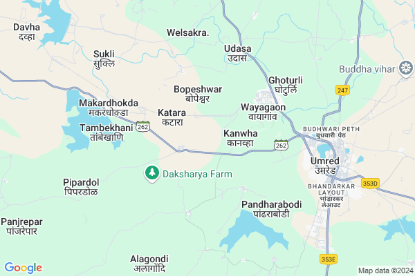
Shirpur
Shirpur Map
EDIT Map
Add Your House
 ..
..
Current Corona Virus Infected Patients Count in Nagpur District
| City Name | District Name | Total Covid cases |
|---|---|---|
| Nagpur | Nagpur | 51 |
| Nagpur District | Nagpur | 36 |
| Nagpur Rural | Nagpur | 6 |
Locality Name :
Shirpur
( शिरपूर )
Taluka Name : Umred
District : Nagpur
State : Maharashtra
Region : Vidarbh
Division : Nagpur
Language : Marathi and Hindi, English
Current Time 07:12 PM
Date: Tuesday , Apr 29,2025 (IST)
Time zone: IST (UTC+5:30)
Elevation / Altitude: 292 meters. Above Seal level
Telephone Code / Std Code: 07116
Assembly constituency : Umred assembly constituency
Assembly MLA : Raju Devnath Parwe
Lok Sabha constituency : Ramtek parliamentary constituency
Parliament MP : Krupal Balaji Tumane
Serpanch Name :
Commodities Prices : Umared Market / Mandi
Shirpur Live Weather
Temperature: 39.0 °C
few clouds
Humidity: 12%
Wind : 2.99 mt/sec towards SW
StationName : "Umred"
observed on 19 Mins Back
Temperature: 39.0 °C
few clouds
Humidity: 12%
Wind : 2.99 mt/sec towards SW
StationName : "Umred"
observed on 19 Mins Back
Shirpur Weather Forecast for Next 5 days
30-04-2025
31.1°C to 39.3°C
few clouds, scattered clouds, overcast clouds
31.1°C to 39.3°C
few clouds, scattered clouds, overcast clouds
01-05-2025
29.7°C to 43.7°C
broken clouds, clear sky, few clouds
29.7°C to 43.7°C
broken clouds, clear sky, few clouds
02-05-2025
28.0°C to 42.2°C
scattered clouds, few clouds, clear sky
28.0°C to 42.2°C
scattered clouds, few clouds, clear sky
03-05-2025
29.9°C to 42.3°C
scattered clouds, clear sky, overcast clouds
29.9°C to 42.3°C
scattered clouds, clear sky, overcast clouds
04-05-2025
29.1°C to 43.5°C
broken clouds, clear sky, scattered clouds, overcast clouds, light rain
29.1°C to 43.5°C
broken clouds, clear sky, scattered clouds, overcast clouds, light rain
National Highways Reachable To Shirpur
Nationa High Way :NH353D
Nationa High Way :NH353D
Rivers Near Shirpur
Bor River
Bor
Bor River
Bor
About Shirpur
Correct below Info and add more info about ShirpurShirpur is a Village in Umred Taluka in Nagpur District of Maharashtra State, India. It belongs to Vidarbh region . It belongs to Nagpur Division . It is located 42 KM towards South from District head quarters Nagpur. 6 KM from Umred. 818 KM from State capital Mumbai
Gangapur ( 6 KM ) , Godhani ( 7 KM ) , Aaptur ( 8 KM ) , Virli ( 8 KM ) , Thombra ( 8 KM ) are the nearby Villages to Shirpur. Shirpur is surrounded by Bhivapur Taluka towards East , Kuhi Taluka towards East , Nagpur Taluka towards North , Kamptee Taluka towards North .
Umred , Pauni , Nagpur , Kamthi are the near by Cities to Shirpur.
Shirpur 2011 Census Details
Shirpur Local Language is Marathi. Shirpur Village Total population is 1172 and number of houses are 274. Female Population is 50.7%. Village literacy rate is 77.9% and the Female Literacy rate is 36.2%.
Population
| Census Parameter | Census Data |
| Total Population | 1172 |
| Total No of Houses | 274 |
| Female Population % | 50.7 % ( 594) |
| Total Literacy rate % | 77.9 % ( 913) |
| Female Literacy rate | 36.2 % ( 424) |
| Scheduled Tribes Population % | 2.9 % ( 34) |
| Scheduled Caste Population % | 27.0 % ( 317) |
| Working Population % | 52.1 % |
| Child(0 -6) Population by 2011 | 109 |
| Girl Child(0 -6) Population % by 2011 | 51.4 % ( 56) |
Shirpur Census More Deatils.
Politics in Shirpur
BJP , Shivsena , BSP , SHS , INC are the major political parties in this area.Polling Stations /Booths near Shirpur
1)Shedeshwar2)Khursapar
3)Lanjala
4)Hardoli Raja
5)Hewati
HOW TO REACH Shirpur
By Rail
Umred Rail Way Station is the very nearby railway stations to Shirpur. Umred Rail Way Station (near to Umred) , Nagpur Junction Rail Way Station (near to Nagpur) , Ajni Rail Way Station (near to Nagpur) , Bamhni Rail Way Station (near to Umred) are the Rail way stations reachable from near by towns.By Road
Umred , Nagpur are the nearby by towns to Shirpur having road connectivity to ShirpurPincodes near Shirpur
441203 ( Umred ) , 441204 ( Umred Project ) , 441108 ( Bori (Nagpur) )Colleges near Shirpur
Vasantrao Naik Krishi Vidyalaya, Sirsi
Address :
Randhirsingh Bhadoriya Mahavidyalaya, Umred
Address :
Schools in Shirpur
Upper Primary School
Address : shirpur , umred , nagpur , Maharashtra . PIN- 441203 , Post - Umred
Govt Health Centers near Shirpur
1) Bramhani , Subcenter Bamhani , Bamhani , On Umerd Mandhal Road2) Besur , MCH subcenter Besur , SC BESUR , SC BESUR
3) Silli , Subcenter Silli , Silli , Near ZP School
Hospitals in Shirpur,Umred
Aanandam Multispeciality Hospital And Research Centre
Teachers Colony; Umred; Maharashtra 441203; India
7.6 KM distance Detail
Dr K C Gillurkar
Plot No 20 Reshimbagh; Umred Road; Umred Road; Nagpur; Maharashtra 440009; India
7.6 KM distance Detail
more ..
Colleges in Shirpur,Umred
Umrer College Of Engineering
State Highway No.9; Opp. WCL; Dist. Nagpur; Umrer; Maharashtra 441204; India
4.9 KM distance Detail
more ..
Super Markets in Shirpur,Umred
Juna Bail Bazar New Chicken Market
;; Teachers Colony; Umred; Maharashtra 441203; India
7.4 KM distance Detail
Police Stations near Shirpur,Umred
Police Station Umred
Tilak Putla; Nagpur-Umred Highway; Umred; Maharashtra 441203; India
8.2 KM distance Detail
Governement Offices near Shirpur,Umred
Eco Village Development Committee
Kurkheda - Wadsa - Bramhapuri - Nagpur Hwy; Manora; Maharashtra 441203; India
19.6 KM distance Detail
About Shirpur &
History
How to reach Shirpur
Tourist Places Near By Shirpur
Schools in Shirpur
Colleges in Shirpur
Temperature & weather of Shirpur
places in Shirpur
Shirpur photos
More Information
How to reach Shirpur
Tourist Places Near By Shirpur
Schools in Shirpur
Colleges in Shirpur
Temperature & weather of Shirpur
places in Shirpur
Shirpur photos
More Information
Village Talk
Post News or Events about this Village
Near Cities
Umred 9 KM near
Pauni 43 KM near
Nagpur 43 KM near
Kamthi 47 KM near
Umred 9 KM near
Pauni 43 KM near
Nagpur 43 KM near
Kamthi 47 KM near
Near By Taluks
Umred 6 KM near
Bhivapur 24 KM near
Kuhi 27 KM near
Nagpur 38 KM near
Umred 6 KM near
Bhivapur 24 KM near
Kuhi 27 KM near
Nagpur 38 KM near
Near By Air Ports
Sonegaon Airport 37 KM near
Jabalpur Airport 237 KM near
Raipur Airport 291 KM near
Nanded Airport 308 KM near
Sonegaon Airport 37 KM near
Jabalpur Airport 237 KM near
Raipur Airport 291 KM near
Nanded Airport 308 KM near
Near By Tourist Places
Nagpur 42 KM near
Bhandara 59 KM near
Sevagram 78 KM near
Tadoba 78 KM near
Chandrapur 113 KM near
Nagpur 42 KM near
Bhandara 59 KM near
Sevagram 78 KM near
Tadoba 78 KM near
Chandrapur 113 KM near
Near By Districts
Nagpur 40 KM near
Bhandara 60 KM near
Wardha 77 KM near
Chandrapur 112 KM near
Nagpur 40 KM near
Bhandara 60 KM near
Wardha 77 KM near
Chandrapur 112 KM near
Near By RailWay Station
Umred Rail Way Station 8.7 KM near
Ajni Rail Way Station 39 KM near
Itwari Junction Rail Way Station 40 KM near
Umred Rail Way Station 8.7 KM near
Ajni Rail Way Station 39 KM near
Itwari Junction Rail Way Station 40 KM near