| Home | City Bus | Maps | Villages | Cities | Rail | Tourist Places | School | College | Pin Codes | Corona Cases Count |
| Distance Calculator Bus Services IFSC Codes Trace Mobile Number Weather Search Place Trace IP Available Cash ATM/Banks Locate Polling Booth Report an Error contact People |
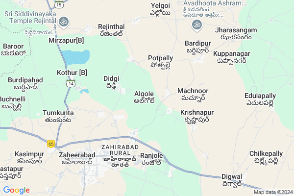
Algole Map
EDIT Map
Add Your House
 ..
..
Current Corona Virus Infected Patients Count in Medak District
| City Name | District Name | Total Covid cases |
|---|---|---|
| Sangareddy District | Sangareddy | 7 |
| Medak District | Medak | 5 |
Locality Name :
Algole
( అల్గోలే )
Mandal Name : Zahirabad
District : Medak
State : Telangana
Region : Telangana
Language : Telugu
Current Time 02:16 PM
Date: Monday , Apr 28,2025 (IST)
Time zone: IST (UTC+5:30)
Elevation / Altitude: 635 meters. Above Seal level
Telephone Code / Std Code: 08451
Assembly constituency : Zahirabad assembly constituency
Assembly MLA : Koninty Manik Rao
Lok Sabha constituency : Zahirabad parliamentary constituency
Parliament MP : B.B.PATIL
Serpanch Name :
Pin Code : 502318
Post Office Name : Ranjhole
Commodities Prices : Zaheerabad Market / Mandi
National Highways Reachable To Algole
Nationa High Way :NH65
Nationa High Way :Old NH9
Nationa High Way :NH65
Nationa High Way :Old NH9
Rivers Near Algole
Saranala :ಸರನಾಲಾ
Saranala :ಸರನಾಲಾ
About Algole
Correct below Info and add more info about AlgoleAlgole is a Village in Zahirabad Mandal in Medak District of Telangana State, India. It belongs to Telangana region . As part Telangana Districts re-organisation , Algole Village Zahirabad Mandal re organised from Medak District to Sangareddy district. It is located 55 KM towards west from District head quarters Sangareddi. 10 KM from Zahirabad N.P.
Algole Pin code is 502318 and postal head office is Ranjhole .
Potpalle ( 3 KM ) , Machnoor ( 4 KM ) , Ranjole ( 4 KM ) , Krishnapur ( 4 KM ) , Allipur ( 5 KM ) are the nearby Villages to Algole. Algole is surrounded by Zahirabad Mandal towards west , Nyalkal Mandal towards North , Kohir Mandal towards South , Raikode Mandal towards North .
Zahirabad , Bidar , Sadasivpet , Sangareddy are the near by Cities to Algole.
Algole 2011 Census Details
Algole Local Language is Telugu. Algole Village Total population is 2784 and number of houses are 626. Female Population is 51.3%. Village literacy rate is 53.3% and the Female Literacy rate is 22.7%.
Population
| Census Parameter | Census Data |
| Total Population | 2784 |
| Total No of Houses | 626 |
| Female Population % | 51.3 % ( 1428) |
| Total Literacy rate % | 53.3 % ( 1485) |
| Female Literacy rate | 22.7 % ( 633) |
| Scheduled Tribes Population % | 2.0 % ( 56) |
| Scheduled Caste Population % | 37.3 % ( 1039) |
| Working Population % | 52.8 % |
| Child(0 -6) Population by 2011 | 304 |
| Girl Child(0 -6) Population % by 2011 | 51.0 % ( 155) |
Algole Census More Deatils.
Politics in Algole
TDP , TRS , INC are the major political parties in this area.Polling Stations /Booths near Algole
1)Machireddypally2)Kothur (patti Kohir)
3)Algole
4)Zahirabad
5)Pastapur
HOW TO REACH Algole
By Road
Zahirabad is the Nearest Town to Algole. Zahirabad is 7 km from Algole. Road connectivity is there from Zahirabad to Algole.By Rail
Zahirabad Rail Way Station is the very nearby railway stations to Algole. Also you can consider railway Stations from Near By town Zahirabad. Zahirabad Rail Way Station are the railway Stations near to Zahirabad. You can reach from Zahirabad to Algole by road after .Colleges near Algole
Tara Govt Degree And Pg College
Address :
J N T U, Sultanpur
Address :
Governament Junior College Hadnoor
Address :
Govt.junior College,siddipet
Address :
Government Polytechnic College
Address :
Schools in Algole
Zphs School
Address : algole , zaheerabad , medak , Andhra Pradesh . PIN- 502318 , Post - Ranjhole
Govt Health Centers near Algole
1) SubCentre Yelgoi , , BC Colony , Near GP2) SubCentre, Ranjole , Jun-43 , GP Road , GP Area
3) SubCentre Shanthinagar , 5- 3 -277 , Shanthinagar , Shanthinagar
Hospitals in Algole,Zahirabad
Nani
50; Mumbai Hwy; Royal Colony; Mumbai Hwy; Royal Colony; Vema Reddy colony; Shantinagar; Zahirabad Rural; Zaheerabad; Telangana 502318; India
5.4 KM distance Detail
Medical
50; Mumbai Hwy; Royal Colony; Mumbai Hwy; Royal Colony; Vema Reddy colony; Shantinagar; Zahirabad Rural; Zaheerabad; Telangana 502318; India
5.5 KM distance Detail
Ayush Care; Homoeopathy; Ayurvedic & Unani Clinic; Zaheerabad
Plot # 103; Chinna Reddy Nagar Colony; Near Shah Masjid; District Medak; Zaheerabad; Telangana 502220; India
6.2 KM distance Detail
more ..
Petrol Bunks in Algole,Zahirabad
AEGIS Auto Gas
Ranjhole; Medak; NH-9; Mumbai Highway; Zaheerabad; Zaheerabad; Telangana 502220; India
5.2 KM distance Detail
Shree channamalleswara Service station
50; Mumbai Hwy; Royal Colony; Zahirabad Rural; Zaheerabad; Telangana 502318; India
5.3 KM distance Detail
more ..
Colleges in Algole,Zahirabad
SRI SANGAMESHWARA GOVERNMENT POLYTECHNIC; ZAHEERABAD
Ranjole; Zaheerabad; Telangana 502318; India
6.1 KM distance Detail
more ..
Schools in Algole,Zahirabad
Dr. RLR School
Pastapur Road; Zaheerabad; Medak Dist; Telangana 502318; India
4.6 KM distance Detail
Electronic Shops in Algole,Zahirabad
Pooja electronics services
Plot no:57 Sai RAM nagar COLONY; Nearby Sangamithra High School; Zaheerabad; Telangana 502318; India
5.3 KM distance Detail
SRIHAANCOLOURS
shop no 2 Datta Giri Colony; Zaheerabad; Telangana 502220; India
6.0 KM distance Detail
Super Markets in Algole,Zahirabad
Kethaki Sai Super Bazar
50; Mumbai Highway; Mainroad; shetkar complex; Zahirabad Rural; Opposite Victor shopping mall.; Zaheerabad; Telangana 502318; India
6.2 KM distance Detail
APNA BAZAR
Baswa Nagar Colony; Dattagiri Colony; Shantinagar; Zaheerabad; Telangana 502228; India
6.4 KM distance Detail
Local Parks in Algole,Zahirabad
Uttam Gardens
Algole Road; Pastapur National Highway 9;; Zaheerabad; Telangana 502228; India
4.8 KM distance Detail
Police Stations near Algole,Zahirabad
Zaheerabad Rural Police Station
Pastapur; Medak; Zaheerabad; Telangana 502220; India
4.2 KM distance Detail
Governement Offices near Algole,Zahirabad
MeeSeva Center
eSeva; Muncipal Office Complex;; Zaheerabad; Telangana 502228; India
6.2 KM distance Detail
About Algole &
History
How to reach Algole
Tourist Places Near By Algole
Schools in Algole
Colleges in Algole
Temperature & weather of Algole
places in Algole
Algole photos
More Information
How to reach Algole
Tourist Places Near By Algole
Schools in Algole
Colleges in Algole
Temperature & weather of Algole
places in Algole
Algole photos
More Information
Village Talk
Post News or Events about this Village
Near Cities
Zahirabad 5 KM near
Bidar 28 KM near
Sadasivpet 38 KM near
Sangareddy 56 KM near
Zahirabad 5 KM near
Bidar 28 KM near
Sadasivpet 38 KM near
Sangareddy 56 KM near
Near By Taluks
Jharasangam 8 KM near
Zahirabad 10 KM near
Nyalkal 13 KM near
Kohir 14 KM near
Jharasangam 8 KM near
Zahirabad 10 KM near
Nyalkal 13 KM near
Kohir 14 KM near
Near By Air Ports
Rajiv Gandhi International Airport 110 KM near
Latur Airport 164 KM near
Nanded Airport 186 KM near
Sholapur Airport 203 KM near
Rajiv Gandhi International Airport 110 KM near
Latur Airport 164 KM near
Nanded Airport 186 KM near
Sholapur Airport 203 KM near
Near By Tourist Places
Bidar 25 KM near
Medak 83 KM near
Hyderabad 107 KM near
Gulbarga 108 KM near
Tuljapur 191 KM near
Bidar 25 KM near
Medak 83 KM near
Hyderabad 107 KM near
Gulbarga 108 KM near
Tuljapur 191 KM near
Near By Districts
Bidar 28 KM near
Medak 53 KM near
Rangareddi 76 KM near
Hyderabad 103 KM near
Bidar 28 KM near
Medak 53 KM near
Rangareddi 76 KM near
Hyderabad 103 KM near
Near By RailWay Station
Zahirabad Rail Way Station 7.5 KM near
Bidar Rail Way Station 28 KM near
Zahirabad Rail Way Station 7.5 KM near
Bidar Rail Way Station 28 KM near