| Home | City Bus | Maps | Villages | Cities | Rail | Tourist Places | School | College | Pin Codes | Corona Cases Count |
| Distance Calculator Bus Services IFSC Codes Trace Mobile Number Weather Search Place Trace IP Available Cash ATM/Banks Locate Polling Booth Report an Error contact People |
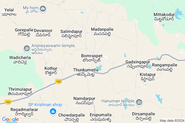
Bomraspeta
Bomraspeta Map
EDIT Map
Add Your House
 ..
..
Current Corona Virus Infected Patients Count in Mahbubnagar District
| City Name | District Name | Total Covid cases |
|---|---|---|
| Jogulamba Gadwal District | Jogulamba Gadwal | 40 |
| Mahabubnagar District | Mahabubnagar | 11 |
Locality Name :
Bomraspeta
( బొంరాసుపేట )
Mandal Name : Bomraspeta
District : Mahbubnagar
State : Telangana
Region : Telangana
Language : Telugu and Hindi, Urdu
Current Time 12:19 PM
Date: Wednesday , Apr 30,2025 (IST)
Time zone: IST (UTC+5:30)
Elevation / Altitude: 465 meters. Above Seal level
Telephone Code / Std Code: 08505
Assembly constituency : Kodangal assembly constituency
Assembly MLA : Anumula Revanth Reddy
Lok Sabha constituency : Mahabubnagar parliamentary constituency
Parliament MP : MANNE SRINIVAS REDDY
Serpanch Name :
Pin Code : 509338
Post Office Name : Kodangal
Alternate Village Name : Bomraspet
Commodities Prices : Kosgi Market / Mandi
Bomraspeta Live Weather
Temperature: 39.8 °C
few clouds
Humidity: 14%
Wind : 4.62 mt/sec towards NW
StationName : "Tandur"
observed on 17 Mins Back
Temperature: 39.8 °C
few clouds
Humidity: 14%
Wind : 4.62 mt/sec towards NW
StationName : "Tandur"
observed on 17 Mins Back
Bomraspeta Weather Forecast for Next 5 days
01-05-2025
30.8°C to 41.0°C
scattered clouds, broken clouds
30.8°C to 41.0°C
scattered clouds, broken clouds
02-05-2025
28.9°C to 41.2°C
scattered clouds, clear sky, few clouds, broken clouds
28.9°C to 41.2°C
scattered clouds, clear sky, few clouds, broken clouds
03-05-2025
29.5°C to 41.3°C
broken clouds, clear sky, few clouds, scattered clouds
29.5°C to 41.3°C
broken clouds, clear sky, few clouds, scattered clouds
04-05-2025
28.9°C to 41.9°C
scattered clouds, clear sky, few clouds, light rain, broken clouds
28.9°C to 41.9°C
scattered clouds, clear sky, few clouds, light rain, broken clouds
05-05-2025
29.1°C to 38.7°C
broken clouds, clear sky, light rain
29.1°C to 38.7°C
broken clouds, clear sky, light rain
National Highways Reachable To Bomraspeta
Nationa High Way :NH163
Nationa High Way :Old NH7
Nationa High Way :NH163
Nationa High Way :Old NH7
Rivers Near Bomraspeta
Kagina :ಕಾಗಿನಾ
Kamalavati :ಕಮಲಾವತಿ
Kagina :ಕಾಗಿನಾ
Kamalavati :ಕಮಲಾವತಿ
About Bomraspeta
Correct below Info and add more info about BomraspetaBomraspeta is a Town in Bomraspeta Mandal in Mahbubnagar District of Telangana State, India. It belongs to Telangana region . It is located 62 KM towards North from District head quarters Mahabubnagar. It is a Mandal head quarter.
Bomraspeta Pin code is 509338 and postal head office is Kodangal .
Burhanpur ( 2 KM ) , Metlakunta ( 2 KM ) , Salimdapur ( 4 KM ) , Kothur ( 5 KM ) , Erpumalla ( 6 KM ) are the nearby Villages to Bomraspeta. Bomraspeta is surrounded by Doma Mandal towards East , Yalal Mandal towards west , Pargi Mandal towards East , Dharur Mandal towards North .
Tandur , Vicarabad , Sedam , Farooqnagar are the nearby Cities to Bomraspeta.
This Place is in the border of the Mahbubnagar District and Rangareddi District. Rangareddi District Yalal is west towards this place .
Bomraspet 2011 Census Details
Bomraspeta Local Language is Telugu. Bomraspet town Total population is 5538 and number of houses are 1084. Female Population is 50.4%. town literacy rate is 45.8% and the Female Literacy rate is 19.4%.
Population
| Census Parameter | Census Data |
| Total Population | 5538 |
| Total No of Houses | 1084 |
| Female Population % | 50.4 % ( 2789) |
| Total Literacy rate % | 45.8 % ( 2539) |
| Female Literacy rate | 19.4 % ( 1076) |
| Scheduled Tribes Population % | 9.7 % ( 535) |
| Scheduled Caste Population % | 10.8 % ( 598) |
| Working Population % | 50.5 % |
| Child(0 -6) Population by 2011 | 681 |
| Girl Child(0 -6) Population % by 2011 | 48.2 % ( 328) |
Bomraspet Census More Deatils.
Demographics of Bomraspeta
Telugu is the Local Language here. Total population of Bomraspeta is 5270 .Males are 2555 and Females are 2,715 living in 929 Houses. Total area of Bomraspeta is 1634 hectares.Politics in Bomraspeta
TDP , TRS , INC are the major political parties in this area.Polling Stations /Booths near Bomraspeta
1)Bolwanipally2)Bomraspet
3)Bomraspet
4)Bomraspet
5)Maddur
HOW TO REACH Bomraspeta
By Road
Mahbubnagar is the Nearest Town to Bomraspeta. Mahbubnagar is 74 km from Bomraspeta. Road connectivity is there from Mahbubnagar to Bomraspeta.By Rail
There is no railway station near to Bomraspeta in less than 10 km. How ever There are railway stations from Near By town Mahbubnagar. Mahbubnagar Town Halt Rail Way Station , Mahbubnagar Rail Way Station are the railway stations near to Mahbubnagar. You can reach from Mahbubnagar to Bomraspeta by road after .Govt Health Centers near Bomraspeta
1) Primary Health Centre, Bomraspet , , Main road , G.P2) SubCentre, Chinnimailwar , , Main road , G.P
3) SubCentre Gadisingapur , Jan-46 , Hanuman Tempal , High School
Sub Villages in Bomraspeta
Petrol Bunks in Bomraspeta,Bomraspeta
Sangameshwara Filling Station Indian Oil Petrol Pump
Mahbubnagar; SH-23; Tandur Mahabubnagar Road; Kodangal; Kodangal; Telangana 509338; India
15.9 KM distance Detail
more ..
Colleges in Bomraspeta,Bomraspeta
Sri Venkateshwara Educational Society
Kodangal Rd; Pargi; Telangana 501501; India
15.7 KM distance Detail
more ..
Super Markets in Bomraspeta,Bomraspeta
Ramesh Kirana & General Stores
Mohan Nagar; kodangal; Vikarabad; Telangana 509338; India
15.5 KM distance Detail
Local Parks in Bomraspeta,Bomraspeta
Shanthi Nagar Colony Park
1-22; Bijapur Rd; Kodangal; Telangana 509338; India
16.4 KM distance Detail
About Bomraspeta &
History
How to reach Bomraspeta
Tourist Places Near By Bomraspeta
Schools in Bomraspeta
Colleges in Bomraspeta
Temperature & weather of Bomraspeta
places in Bomraspeta
Bomraspeta photos
More Information
How to reach Bomraspeta
Tourist Places Near By Bomraspeta
Schools in Bomraspeta
Colleges in Bomraspeta
Temperature & weather of Bomraspeta
places in Bomraspeta
Bomraspeta photos
More Information
Town Talk
Post News or Events about this Town
Near Cities
Tandur 21 KM near
Vicarabad 28 KM near
Sedam 53 KM near
Farooqnagar 55 KM near
Tandur 21 KM near
Vicarabad 28 KM near
Sedam 53 KM near
Farooqnagar 55 KM near
Near By Taluks
Bomraspeta 5 KM near
Doma 12 KM near
Yalal 13 KM near
Pargi 16 KM near
Bomraspeta 5 KM near
Doma 12 KM near
Yalal 13 KM near
Pargi 16 KM near
Near By Air Ports
Rajiv Gandhi International Airport 82 KM near
Latur Airport 216 KM near
Sholapur Airport 222 KM near
Nanded Airport 256 KM near
Rajiv Gandhi International Airport 82 KM near
Latur Airport 216 KM near
Sholapur Airport 222 KM near
Nanded Airport 256 KM near
Near By Tourist Places
Hyderabad 93 KM near
Bidar 94 KM near
Gulbarga 109 KM near
Medak 127 KM near
Mantralayam 156 KM near
Hyderabad 93 KM near
Bidar 94 KM near
Gulbarga 109 KM near
Medak 127 KM near
Mantralayam 156 KM near
Near By Districts
Rangareddi 45 KM near
Mahbubnagar 59 KM near
Medak 70 KM near
Yadgir 87 KM near
Rangareddi 45 KM near
Mahbubnagar 59 KM near
Medak 70 KM near
Yadgir 87 KM near
Near By RailWay Station
Tandur Rail Way Station 21 KM near
Vikarabad Junction Rail Way Station 30 KM near
Tandur Rail Way Station 21 KM near
Vikarabad Junction Rail Way Station 30 KM near