| Home | City Bus | Maps | Villages | Cities | Rail | Tourist Places | School | College | Pin Codes | Corona Cases Count |
| Distance Calculator Bus Services IFSC Codes Trace Mobile Number Weather Search Place Trace IP Available Cash ATM/Banks Locate Polling Booth Report an Error contact People |
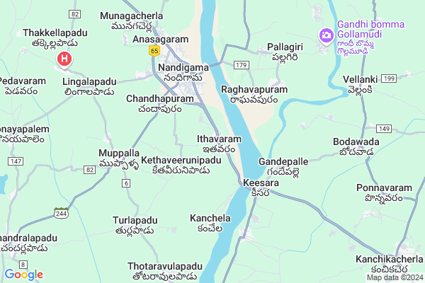
Ithavaram
Ithavaram Map
EDIT Map
Add Your House
 ..
..
Current Corona Virus Infected Patients Count in Krishna District
| City Name | District Name | Total Covid cases |
|---|---|---|
| Krishna District | Krishna | 159 |
| Vijayawada | Krishna | 18 |
| Machilipatnam | Krishna | 1 |
| Ranihari Thotta | Krishna | 1 |
| Payakapuram | Krishna | 1 |
Locality Name :
Ithavaram
( ఐతవరం )
Mandal Name : Nandigama
District : Krishna
State : Andhra Pradesh
Region : Andhra
Language : Telugu
Current Time 12:08 PM
Date: Thursday , Apr 24,2025 (IST)
Time zone: IST (UTC+5:30)
Elevation / Altitude: 73 meters. Above Seal level
Telephone Code / Std Code: 08678
Assembly constituency : assembly constituency
Assembly MLA :
Lok Sabha constituency : parliamentary constituency
Parliament MP : KESINENI SRINIVAS (NANI)
Serpanch Name :
Pin Code : 521185
Post Office Name : Nandigama
Commodities Prices : Kodad Market / Mandi
Ithavaram Live Weather
Temperature: 35.3 °C
broken clouds
Humidity: 40%
Wind : 4.42 mt/sec towards S
StationName : "NandigÄ\u0081ma"
observed on 2 Hours Back
Temperature: 35.3 °C
broken clouds
Humidity: 40%
Wind : 4.42 mt/sec towards S
StationName : "NandigÄ\u0081ma"
observed on 2 Hours Back
Ithavaram Weather Forecast for Next 5 days
25-04-2025
28.3°C to 42.0°C
broken clouds, scattered clouds, few clouds
28.3°C to 42.0°C
broken clouds, scattered clouds, few clouds
26-04-2025
27.6°C to 41.2°C
scattered clouds, broken clouds, clear sky
27.6°C to 41.2°C
scattered clouds, broken clouds, clear sky
27-04-2025
27.5°C to 41.6°C
few clouds, overcast clouds, broken clouds, clear sky
27.5°C to 41.6°C
few clouds, overcast clouds, broken clouds, clear sky
28-04-2025
27.5°C to 42.0°C
scattered clouds, few clouds, clear sky, light rain
27.5°C to 42.0°C
scattered clouds, few clouds, clear sky, light rain
29-04-2025
28.0°C to 41.2°C
broken clouds, scattered clouds, few clouds
28.0°C to 41.2°C
broken clouds, scattered clouds, few clouds
National Highways Reachable To Ithavaram
Nationa High Way :NH365BG
Nationa High Way :NH65
Nationa High Way :NH365BG
Nationa High Way :NH65
Rivers Near Ithavaram
Tammileru
Tammileru
About Ithavaram
Correct below Info and add more info about IthavaramIthavaram is a Village in Nandigama Mandal in Krishna District of Andhra Pradesh State, India. It belongs to Andhra region . It is located 125 KM towards west from District head quarters Machilipatnam. 4 KM from Nandigama. 241 KM from State capital Hyderabad
Ithavaram Pin code is 521185 and postal head office is Nandigama .
Kethaveerunipadu ( 2 KM ) , Chandapuram ( 3 KM ) , Gandepalli ( 3 KM ) , Kanchela ( 4 KM ) , Kammavaripalem ( 5 KM ) are the nearby Villages to Ithavaram. Ithavaram is surrounded by Kanchikacherla Mandal towards South , Chandarlapadu Mandal towards west , Veerullapadu Mandal towards East , Penuganchiprolu Mandal towards North .
Jaggaiahpet , Sattenapalle , Mangalagiri , Kodad are the near by Cities to Ithavaram.
This Place is in the border of the Krishna District and Khammam District. Khammam District Madhira is North towards this place . It is near to the Telangana State Border.
Demographics of Ithavaram
Telugu is the Local Language here. Total population of Ithavaram is 2157 .Males are 1122 and Females are 1,035 living in 524 Houses. Total area of Ithavaram is 518 hectares.HOW TO REACH Ithavaram
By Road
Jaggaiahpet is the Nearest Town to Ithavaram. Jaggaiahpet is 52 km from Ithavaram. Road connectivity is there from Jaggaiahpet to Ithavaram.By Rail
There is no railway station near to Ithavaram in less than 10 km.By Bus
Nandigum APSRTC Bus Station , Nandigama APSRTC Bus Station , Kanchikacherla APSRTC Bus Station are the nearby by Bus Stations to Ithavaram .APSRTC runs Number of busses from major cities to here.Colleges near Ithavaram
Teja Dvr Junior & Degree College Nandigama College Code-202
Address : Near Dvr Govt Hospital
Chaitanya College
Address :
Sri Venkata Siddhardha Jr College
Address :
Gurindapalli Devananda Mary Memorial (gdmm) College Of Engineering & Technology For Women
Address : Nandigama (v&m), Krishna Dist - 521185
Kakani Venkat Ratnam College
Address :
Schools in Ithavaram
Zphs Ithavaram
Address : ithavaram , nandigama , krishna , Andhra Pradesh . PIN- 521185 , Post - Nandigama
Kakatiya Pubs Ithavaram
Address : ithavaram , nandigama , krishna , Andhra Pradesh . PIN- 521185 , Post - Nandigama
Govt Health Centers near Ithavaram
1) Kanchela , 18-Jan , Near mpps , Near Panchayath offi2) Nandigama-4 , Feb-52 , Vijaya Talkies Road , Nethaji Nagar
3) Nandigama-3 , 12/6/1993 , Opp Mayuri Theatre , CheruvuBazar
Sub Villages in Ithavaram
Hospitals in Ithavaram,Nandigama
Lingalapadu Hospital
Thakkellapadu Road;Lingalapadu; Andhra Pradesh 521185; India
9.9 KM distance Detail
more ..
Petrol Bunks in Ithavaram,Nandigama
SRI SURYA ARAVIND FILLING STATION
CHANDRALAPADU; KRISHNA; Andhra Pradesh 521182; India
2.5 KM distance Detail
Raghavendhra Filling Station
Oposite Z.P.H School; Chandarlapadu Rd; Muppalla; Andhra Pradesh 521183; India
4.7 KM distance Detail
HP
Kanchikacherla VIJ HYD RD.;; NH65; Vijayawada; Andhra Pradesh 521130; India
10.9 KM distance Detail
more ..
Colleges in Ithavaram,Nandigama
GDMM College of Engineering & Technology
Nandigama; Andhra Pradesh 521185; India
5.4 KM distance Detail
Sri Sai Siddhrda Jr College
10-53; Gottumukkala Rd; Vasantha Colony; Gottumukkala Rd; Vasntha Colony; Vasantha Colony; Kanchikacherla; Andhra Pradesh 521180; India
13.2 KM distance Detail
more ..
Schools in Ithavaram,Nandigama
M P P School
Ambarupeta; Krishna; NH-9; Vijayawada Hyderabad Road; Nandigama; Nandigama; Andhra Pradesh 522185; India
0.5 KM distance Detail
Z P High School
Ithavaram; Krishna; NH-9; Vijayawada Hyderabad Road; Kanchikacharla; Kanchikacharla; Andhra Pradesh 522185; India
1.0 KM distance Detail
Electronic Shops in Ithavaram,Nandigama
Kokila digital studio
Kanchikacharla;near bus stand; Vijayawada; Andhra Pradesh 521180; India
11.2 KM distance Detail
Super Markets in Ithavaram,Nandigama
Sai Bhavani Kirana Stores
7/139;old police station road;; Kanchikacherla; Andhra Pradesh 521180; India
13.2 KM distance Detail
Police Stations near Ithavaram,Nandigama
Highway Clicks
Hyderabad - Vijayawada Hwy; Kanchela; Andhra Pradesh 521180; India
4.0 KM distance Detail
Chandarlapadu Police Station
Chandarlapadu Rd; Chandralapadu; Andhra Pradesh 521182; India
13.0 KM distance Detail
Police Station
11-86/4; NH65; Hanumanpet; Vasantha Colony; Kanchikacherla; Andhra Pradesh 521180; India
13.3 KM distance Detail
Governement Offices near Ithavaram,Nandigama
MeeSeva Center
J.Saideswararao;DNO:-1-126-1;Kesara(v);(p);Kanchikacharla(md);; NH65; Andhra Pradesh 521180; India
4.3 KM distance Detail
About Ithavaram &
History
How to reach Ithavaram
Tourist Places Near By Ithavaram
Schools in Ithavaram
Colleges in Ithavaram
Temperature & weather of Ithavaram
places in Ithavaram
Ithavaram photos
More Information
How to reach Ithavaram
Tourist Places Near By Ithavaram
Schools in Ithavaram
Colleges in Ithavaram
Temperature & weather of Ithavaram
places in Ithavaram
Ithavaram photos
More Information
Village Talk
Post News or Events about this Village
Near Cities
Jaggaiahpet 30 KM near
Sattenapalle 46 KM near
Mangalagiri 49 KM near
Kodad 52 KM near
Jaggaiahpet 30 KM near
Sattenapalle 46 KM near
Mangalagiri 49 KM near
Kodad 52 KM near
Near By Taluks
Nandigama 3 KM near
Chandarlapadu 11 KM near
Kanchikacherla 12 KM near
Veerullapadu 14 KM near
Nandigama 3 KM near
Chandarlapadu 11 KM near
Kanchikacherla 12 KM near
Veerullapadu 14 KM near
Near By Air Ports
Vijayawada Airport 64 KM near
Rajahmundry Airport 186 KM near
Rajiv Gandhi International Airport 231 KM near
Vishakhapatnam Airport 369 KM near
Vijayawada Airport 64 KM near
Rajahmundry Airport 186 KM near
Rajiv Gandhi International Airport 231 KM near
Vishakhapatnam Airport 369 KM near
Near By Tourist Places
Amaravathi 23 KM near
Vijayawada 48 KM near
Nagarjunakonda 51 KM near
Guntur 56 KM near
Khammam 66 KM near
Amaravathi 23 KM near
Vijayawada 48 KM near
Nagarjunakonda 51 KM near
Guntur 56 KM near
Khammam 66 KM near
Near By Districts
Guntur 57 KM near
Khammam 66 KM near
West Godavari 96 KM near
Krishna 120 KM near
Guntur 57 KM near
Khammam 66 KM near
West Godavari 96 KM near
Krishna 120 KM near
Near By RailWay Station
Madhira Rail Way Station 23 KM near
Sattenapalle Rail Way Station 45 KM near
Madhira Rail Way Station 23 KM near
Sattenapalle Rail Way Station 45 KM near