| Home | City Bus | Maps | Villages | Cities | Rail | Tourist Places | School | College | Pin Codes | Corona Cases Count |
| Distance Calculator Bus Services IFSC Codes Trace Mobile Number Weather Search Place Trace IP Available Cash ATM/Banks Locate Polling Booth Report an Error contact People |
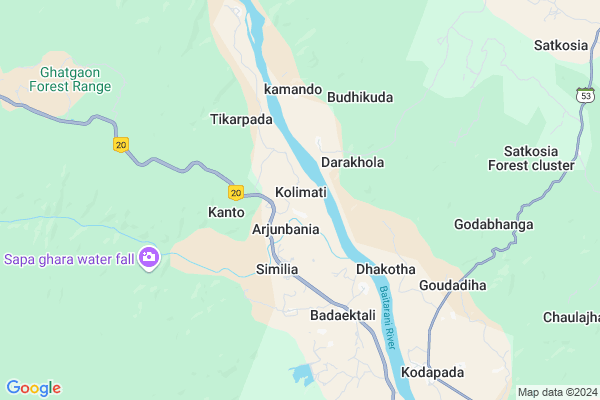
Kolimati Map
EDIT Map
Add Your House
 ..
..
Current Corona Virus Infected Patients Count in Kendujhar District
| City Name | District Name | Total Covid cases |
|---|
Locality Name :
Kolimati
( କୋଳିମାଟି )
Tehsil Name : Anandapur
District : Kendujhar
State : Odisha
Language : Oriya and Hindi
Current Time 06:51 AM
Date: Monday , Apr 28,2025 (IST)
Time zone: IST (UTC+5:30)
Elevation / Altitude: 92 meters. Above Seal level
Telephone Code / Std Code: 06731
Assembly constituency : Ghasipura assembly constituency
Assembly MLA : badri narayan patra
Lok Sabha constituency : Keonjhar parliamentary constituency
Parliament MP : Chandrani Murmu
Serpanch Name :
Pin Code : 758015
Post Office Name : Ghasipura
Commodities Prices : Anandapur Market / Mandi
Kolimati Live Weather
Temperature: 27.1 °C
broken clouds
Humidity: 75%
Wind : 2.44 mt/sec towards SE
StationName : "Daitari"
observed on 1 Hours Back
Temperature: 27.1 °C
broken clouds
Humidity: 75%
Wind : 2.44 mt/sec towards SE
StationName : "Daitari"
observed on 1 Hours Back
Kolimati Weather Forecast for Next 5 days
29-04-2025
22.9°C to 38.2°C
broken clouds, scattered clouds, light rain, moderate rain
22.9°C to 38.2°C
broken clouds, scattered clouds, light rain, moderate rain
30-04-2025
23.0°C to 38.2°C
scattered clouds, broken clouds, clear sky, light rain
23.0°C to 38.2°C
scattered clouds, broken clouds, clear sky, light rain
01-05-2025
21.5°C to 38.2°C
scattered clouds, overcast clouds, broken clouds, few clouds, moderate rain, light rain
21.5°C to 38.2°C
scattered clouds, overcast clouds, broken clouds, few clouds, moderate rain, light rain
02-05-2025
19.0°C to 34.2°C
few clouds, clear sky, light rain, heavy intensity rain, overcast clouds, broken clouds
19.0°C to 34.2°C
few clouds, clear sky, light rain, heavy intensity rain, overcast clouds, broken clouds
National Highways Reachable To Kolimati
Nationa High Way :NH16
Nationa High Way :NH16
Rivers Near Kolimati
Ketanga
Ramlala
Ketanga
Ramlala
About Kolimati
Correct below Info and add more info about KolimatiKolimati is a Village in Anandapur Tehsil in Kendujhar District of Odisha State, India. It is located 69 KM towards East from District head quarters Kendujhar. 13 KM from Anandapur. 141 KM from State capital Bhubaneswar
Kolimati Pin code is 758015 and postal head office is Ghasipura .
Kodapada ( 7 KM ) , Gohira ( 13 KM ) , Bhandaridiha ( 16 KM ) , Khaliamenta ( 16 KM ) , Sailong ( 17 KM ) are the nearby Villages to Kolimati. Kolimati is surrounded by Ghasipura Tehsil towards South , Thakurmunda Tehsil towards North , Ghatgaon Tehsil towards west , Hatadihi Tehsil towards East .
Anandapur , Byasanagar , Karanjia , Bhuban are the near by Cities to Kolimati.
Kolimati 2011 Census Details
Kolimati Local Language is Oriya. Kolimati Village Total population is 1883 and number of houses are 408. Female Population is 49.2%. Village literacy rate is 53.6% and the Female Literacy rate is 21.5%.
Population
| Census Parameter | Census Data |
| Total Population | 1883 |
| Total No of Houses | 408 |
| Female Population % | 49.2 % ( 926) |
| Total Literacy rate % | 53.6 % ( 1009) |
| Female Literacy rate | 21.5 % ( 404) |
| Scheduled Tribes Population % | 79.0 % ( 1488) |
| Scheduled Caste Population % | 2.1 % ( 39) |
| Working Population % | 45.1 % |
| Child(0 -6) Population by 2011 | 264 |
| Girl Child(0 -6) Population % by 2011 | 45.8 % ( 121) |
Kolimati Census More Deatils.
Politics in Kolimati
BJD is the major political party in this area.Polling Stations /Booths near Kolimati
1)Kochianendi Primary School2)Kolimati Sevashrama
3)Sunatangiri Primary School
4)Bandh Primary School
5)Kantarohi Primary School
HOW TO REACH Kolimati
By Rail
There is no railway station near to Kolimati in less than 10 km.Colleges near Kolimati
Beleswar Mahabidyalaya Belabahali
Address :
Schools in Kolimati
Swapneswar Adivasi H.s., Kolimati
Address : kolimati , anandapur , keonjhar , Sikkim . PIN- 758015 , Post - Ghasipura
Haridagotha P.s.
Address : kolimati , anandapur , keonjhar , Sikkim . PIN- 758015 , Post - Ghasipura
Govt Health Centers near Kolimati
1) Daitari B , , , Daitari Panchet Office2) Kabatabandha SC , Upaswasthya kendra Kabatbandha , 44 , PHC N Campous
3) Sarasada SC , , , AFTER SARSADA HIGH SCHOOL,NATIONAL HIGHWAY 5 SIDE
Hospitals in Kolimati,Anandapur
Satkosia Area Hospital
Satkosia; Mayurbhanj; SH-53; Karanjia Bhadrak Road; Thakurmunda; Thakurmunda; Odisha 757038; India
7.4 KM distance Detail
more ..
Petrol Bunks in Kolimati,Anandapur
AUROBINDO FILLING STATION
ANANDPUR-KEONJHAR; KENDUJHAR; Odisha 758015; India
17.1 KM distance Detail
more ..
Colleges in Kolimati,Anandapur
Paramananda College of Science
Anandapur; Kendujhar; SH-53; Karanjia Bhadrak Road; Keonjhar; Keonjhar; Odisha 758083; India
17.6 KM distance Detail
more ..
Schools in Kolimati,Anandapur
Godabhanga UP School
Godabhanga; Mayurbhanj; SH-53; Karanjia Bhadrak Road; Thakurmunda; Thakurmunda; Odisha 757038; India
7.4 KM distance Detail
Super Markets in Kolimati,Anandapur
Suvalaxmi Furniture & Patanjali Store Biridiha
758021; Biridiha; Odisha; India
20.0 KM distance Detail
Local Parks in Kolimati,Anandapur
Bhalugaon Forest
Sendhei-Bhandaridiha-Khaliamenta-Sailong Road; Odisha 758015; India
15.0 KM distance Detail
Police Stations near Kolimati,Anandapur
Anandapur Police Station
Anandapur Bada Danda; Anandapur; Odisha 758021; India
18.9 KM distance Detail
About Kolimati &
History
How to reach Kolimati
Tourist Places Near By Kolimati
Schools in Kolimati
Colleges in Kolimati
Temperature & weather of Kolimati
places in Kolimati
Kolimati photos
More Information
How to reach Kolimati
Tourist Places Near By Kolimati
Schools in Kolimati
Colleges in Kolimati
Temperature & weather of Kolimati
places in Kolimati
Kolimati photos
More Information
Village Talk
Post News or Events about this Village
Near Cities
Anandapur 16 KM near
Byasanagar 49 KM near
Karanjia 54 KM near
Bhuban 61 KM near
Anandapur 16 KM near
Byasanagar 49 KM near
Karanjia 54 KM near
Bhuban 61 KM near
Near By Taluks
Anandapur 12 KM near
Ghasipura 27 KM near
Thakurmunda 28 KM near
Ghatgaon 32 KM near
Anandapur 12 KM near
Ghasipura 27 KM near
Thakurmunda 28 KM near
Ghatgaon 32 KM near
Near By Air Ports
Bhubaneswar Airport 138 KM near
Ranchi Airport 260 KM near
Netaji Subhas Chandra Bose Airport 320 KM near
Gaya Airport 442 KM near
Bhubaneswar Airport 138 KM near
Ranchi Airport 260 KM near
Netaji Subhas Chandra Bose Airport 320 KM near
Gaya Airport 442 KM near
Near By Tourist Places
Barehipani & Joranda Barehipani & Joranda Falls 60 KM near
Baripada 108 KM near
Cuttack 110 KM near
Chandipur 113 KM near
Nandan Kanan National Park 120 KM near
Barehipani & Joranda Barehipani & Joranda Falls 60 KM near
Baripada 108 KM near
Cuttack 110 KM near
Chandipur 113 KM near
Nandan Kanan National Park 120 KM near
Near By Districts
Bhadrak 62 KM near
Kendujhar 67 KM near
Jajapur 69 KM near
Baleshwar 100 KM near
Bhadrak 62 KM near
Kendujhar 67 KM near
Jajapur 69 KM near
Baleshwar 100 KM near
Near By RailWay Station
Jajpur Keonjhar Road Rail Way Station 50 KM near
Bhadrak Rail Way Station 62 KM near
Jajpur Keonjhar Road Rail Way Station 50 KM near
Bhadrak Rail Way Station 62 KM near